


★★★★★ Difficult / Sedona
Hands down, Sedona’s best views are caught atop the Bear Mountain Hiking Trail. This absolutely gorgeous trail keeps the heart-pumping. And the entire hike is punctuated with roaringly-good 360° views!
TRAILHEADs: Boynton Pass Road, Sedona • DIFFICULTY: Difficult • DISTANCE: 2.3 MILEs (4.6 miles rt) • APPROX. TIME: 3-4.5 HOURS • ELEVATION GAIN: 1,800 FEET (129 STORIES) • APPROX. CALORIES BURNED: 782-874 RT • BEST TIME OF YEAR: Year round (hot in summer) • PETS: Allowed, but not recommended • KID FRIENDLY: No • FACILITIES: yes, but no water • FEES: $6 red rock pass (or national parks pass)
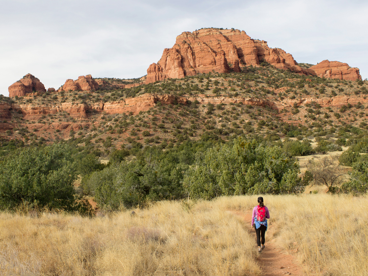 The Bear Mountain Hiking Trail starts across the street from its trailhead parking lot. A quarter-mile ahead, Bear Mountain’s hulking form fills the horizon. The approach is an easy stoll. The trail cuts across a flat, grassy plain, lumbering in and out of a few sandy, rain-carved washes.
 At the base of the the mountain, the trail takes on a more ferocious character. The next quarter-mile switchbacks up a steep rocky slope, to a sandstone rim, midway up the mesa.
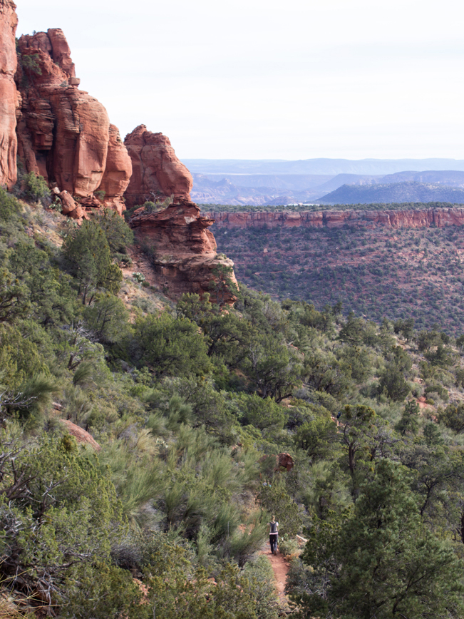 Atop the rim, the path curves around a number of huge hoodoos, then veers left. This area is popular with rock climbers. And it’s common to see them tooling around on the cliffs. The Bear Mountain Hiking Trail then plods along the rim for 1/3-mile, before clawing its way upwards once again.
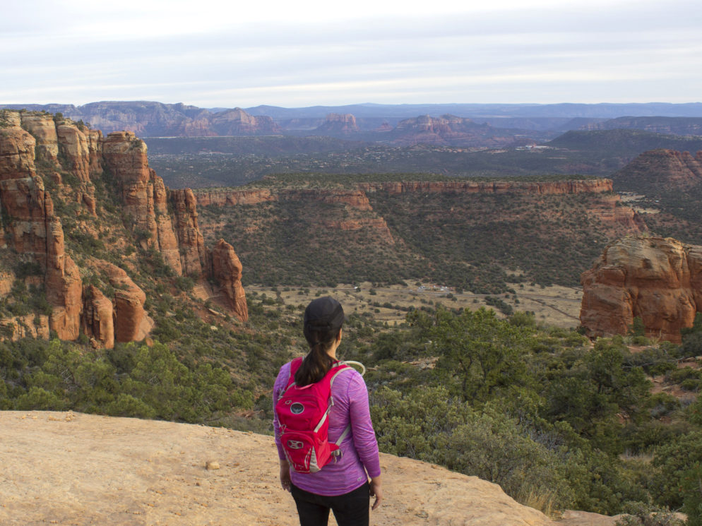
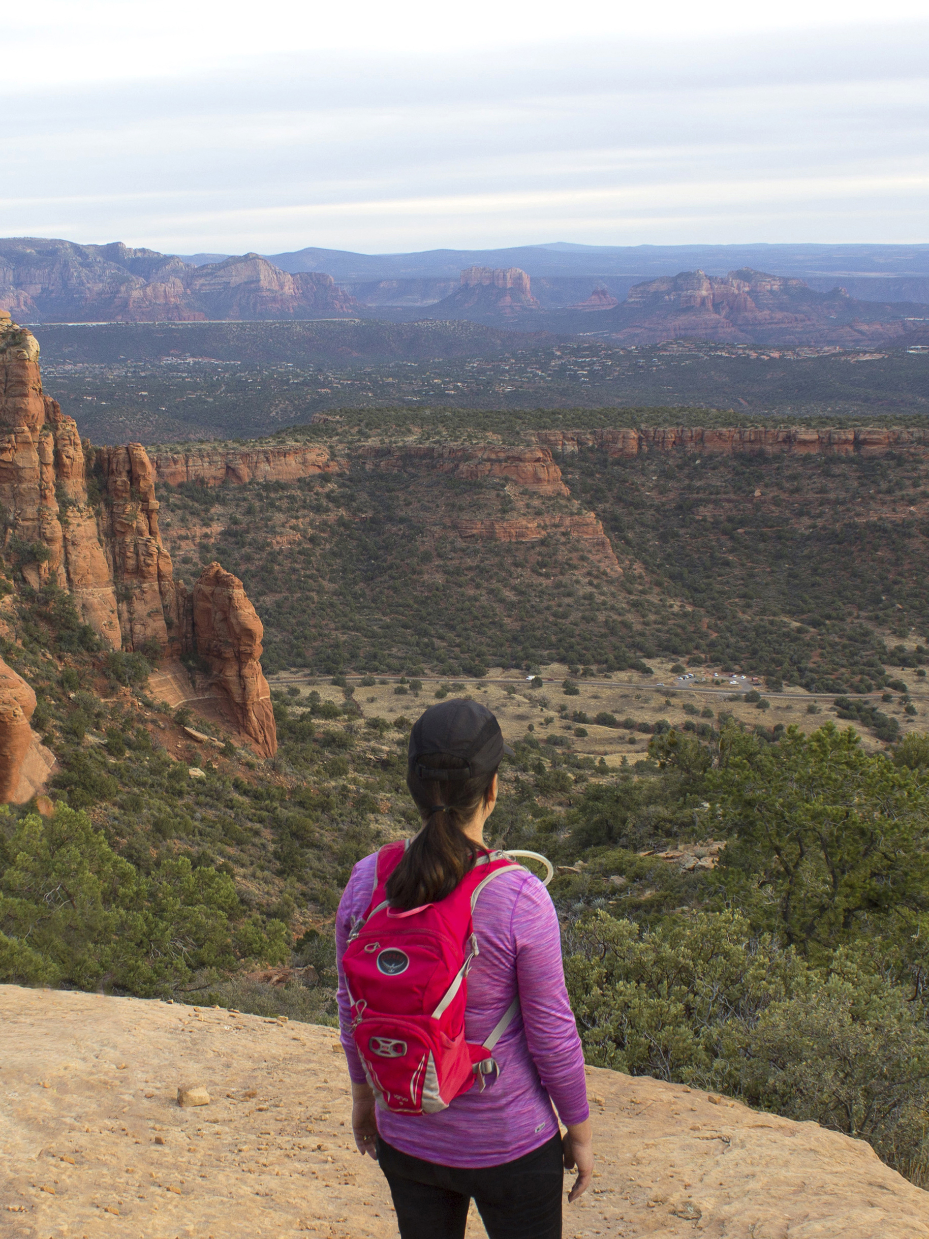 For the next quarter-mile, the trail shreds the mountain on a series of steep switchbacks, rock scrambles and short chutes. These reach the top of the mesa and a short side canyon. Looking backwards, there are jaw-dropping views south over Doe Mountain and the red rocks of Sedona.
 The Bear Mountain Hiking Trail now ambles north for 3/4-miles – crossing a high plateau. Lush Manzanita fields line this moderately steep section.
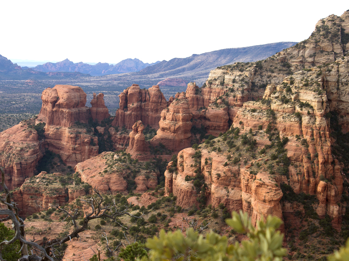 A couple of narrow passes serve up phenomenal north-south views, over wildly plunging, hoodoo filled canyons.
 At the end of the plateau, the upper portion of Bear Mountain becomes visible. The trail dips down, crosses a narrow pass, and starts another savage climb.
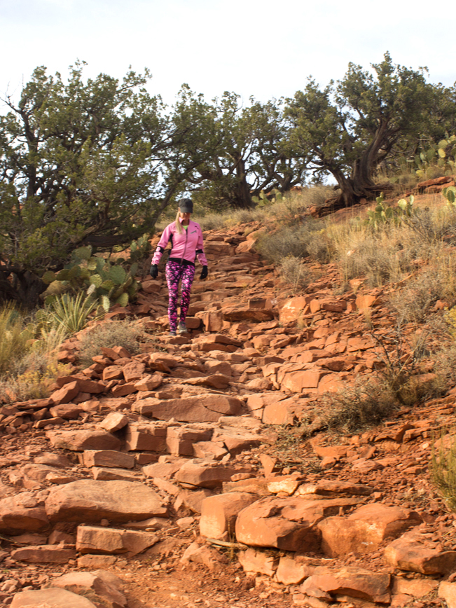
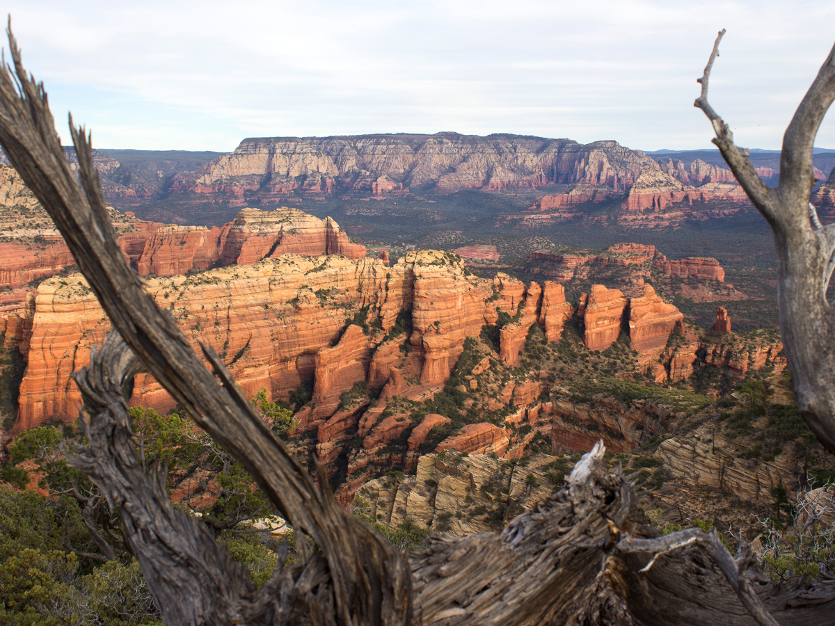 The last leg of the hike definitely keeps the heart pumping! The trail ascends a topsy-turvey “sidewalk” of wide sedimentary stones, layered one atop another. It reaches a false peak and then continues on to the summit. The views at the top of Bear Mountain are amazing! Humphreys Peak is visible to the north. And, to the south, Sedona’s colorful spires and mesas fill the horizon. Take a well-deserved break. And then return the way you came.
Total Nerdery Bear Mountain is named for its bear shaped peak.
Resources Click here to download a trail map.
Directions From the intersection of Routes 89A and 179, take 89A west 3.2 miles to Dry Creek Road. Turn right on Dry Creek Road (which becomes Boynton Pass Road). At 2.9 miles, turn left at the first T-intersection, to remain on Boynton Pass Road. Continue another 1.6 miles to a second T-intersection, and turn left again to remain on Boynton Pass Road / FR 152C. Drive 1.2 miles to the shared Bear and Doe Mountain trailhead parking area on the left. Cross the street to the access the Bear Mountain Trail.
Leave a Reply