


★★★★☆ Difficult / Cave Creek
This short, steep hike ascends a craggy slate trail & pays off with epic north valley views! Tucked behind Cave Creek’s western-style town, the Black Mountain Hiking Trail is one of the valley’s best butt-kicking hikes. This trail gets less crowds than central Phoenix’s Piestewa or Echo Canyon hiking trails. But is an equal match for a sweat-inducing workout with excellent views.
TRAILHEADs: North Schoolhouse road, cave creek • DIFFICULTY: difficult • DISTANCE: 1.25 MILEs (2.5 miles RT) • APPROX. TIME: 2.5-3.5 HOURS • ELEVATION GAIN: 1,165 FEET (83 STORIES) • APPROX. CALORIES BURNED: 425-475 RT • BEST TIME OF YEAR: October-april • PETS: YES (note: trail is steep and rocky) • KID FRIENDLY: no • FACILITIES: None • FEES: none
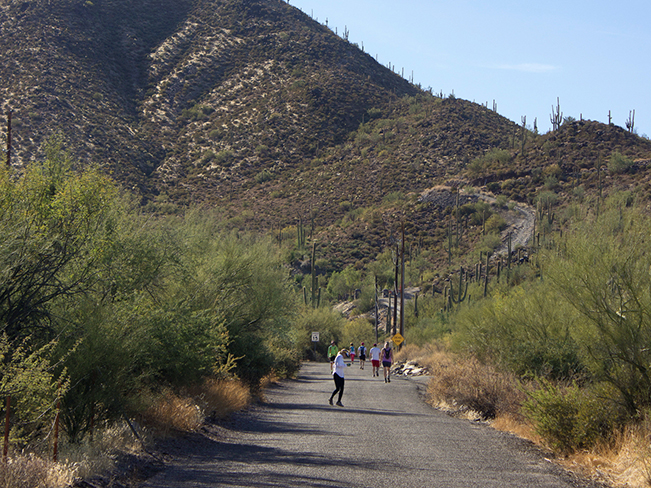 If you’ve visited Cave Creek, you’ve most likely noticed the tall mountain plopped on the southern edge of town. What most visitors and Harley riders (hanging out at the local saloons) may not know is that Black Mountain is home to one of the valley’s best workout trails! From the parking lot, an easy quarter-mile jaunt up the road leads to the trailhead.
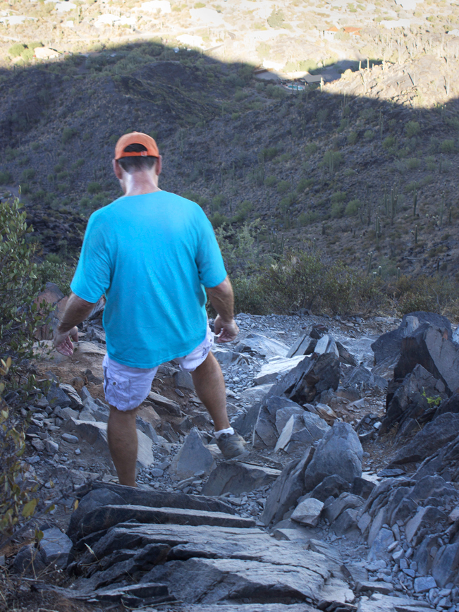 From the get go, the Black Mountain Hiking Trail is pretty dang steep and rocky. Slate forms the base of this rugged path. And the rocks get increasingly jagged and pronounced as the hike ascends. Expect high stepping and a solid heart-rate!
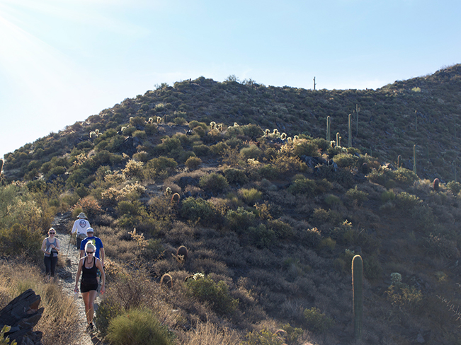 Keep on trucking to reach a short reprieve. After three-quarters of a mile, the trail reaches a short saddle with fantastic views over Cave Creek. From here, the path turns moderate and less rocky for a stretch, as it ascends the mountain’s upper slope.
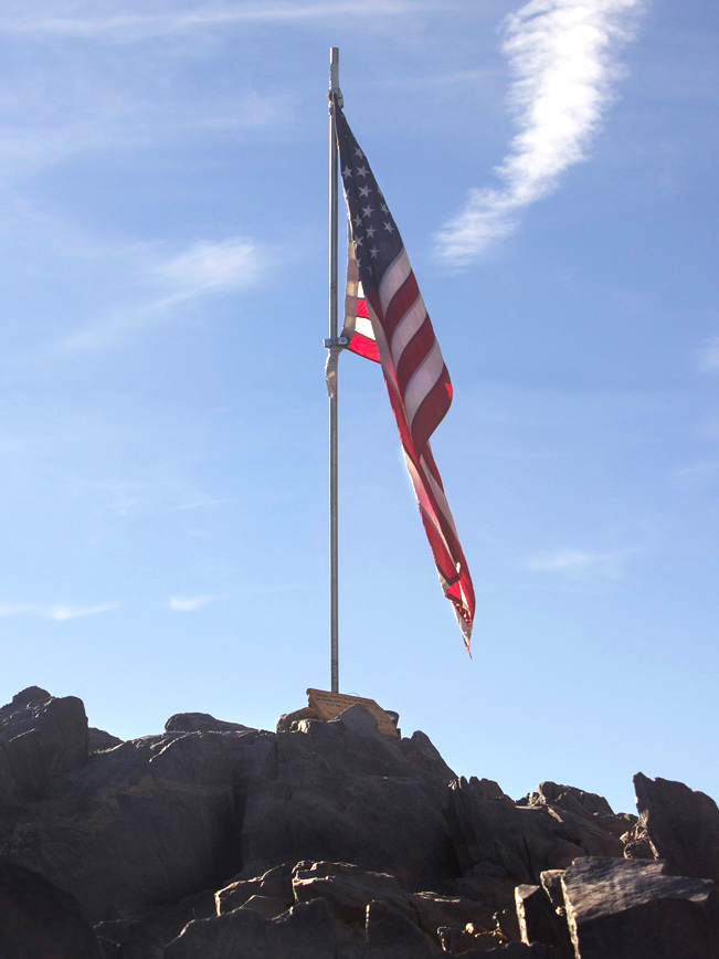 A quarter mile more and the the Black Mountain Hiking Trail reaches its peak. An American Flag marks the top.
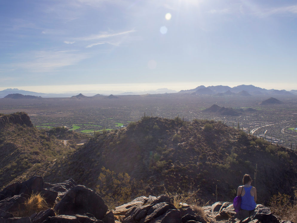
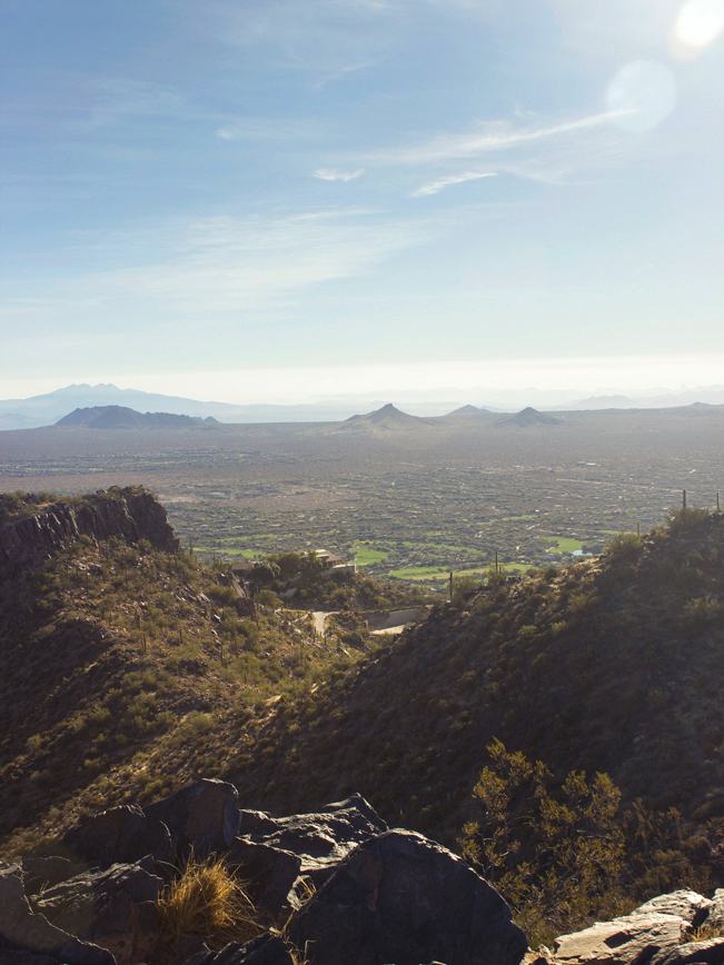 360° views are a choice reward for the climb. To the east and southeast are views of Four Peaks and the McDowells. While Piestewa, Camelback and even the Superstition’s Weavers Needle are visible to the south.
Total nerdery
Black Mountain is named for the black hue created by its rocky slate surface.
Directions From the intersection of 101 and Scottsdale Road (in north Scottsdale), head north on Scottsdale Road (which turns into Tom Darlington) for 12 miles. At the T-intersection of Tom Darlington and Cave Creek Road, turn left / west onto Cave Creek, and continue 1.4 miles. At the stop sign, turn left / south onto North Schoolhouse Road. Parking for the trail is a quarter mile further on both sides of Military Road.
8 Responses to Black Mountain Hiking Trail
I love the views of your picture on top of the Black Mountain. I always wanted to hike in there but i’m still a beginner and the hike in the Black mountain is difficult. I will probably go in there some other time. Thanks for sharing this post.
Thanks Annika. So glad you like the shots. This one is a toughy! But, thankfully, it’s also pretty short. Hope you get there when you’re ready.
Great pics and description, can’t wait for the challenge. Thank you!
It’s a good one! But will be hot in Summer. Early am is best.
Is this mountain tougher than hiking on Camelback Mountain? Thanks.
Black Mountain is very slightly easier than Camelback Mountain’s Echo Canyon Hiking Trail. Its elevation gain is 1,165″ vs. Echo Canyon’ 1,200′.
And the trail is a consistent ascent on slate and earth vs. Echo Canyon’s mix of Granite face, boulder and earth. Both are great workout trails.
I’m glad I did it, and yeah , it was tough! Footing on the way down especially, is precarious. I would not recommend this hike unless you are in shape. The views however were worth it! I’m glad I did it, but I probably won’t do it again🤷♀️
Definitely a tough one! And being in shape is a plus. Glad you did it.