Rim Lakes Vista Hiking Trail


★★☆☆☆ Easy / Payson Area:
Strolling along this gently winding rim trail is like being plopped inside a scenic viewfinder (with no quarters required)! With flashback-worthy views spanning endlessly from trail to horizon, the Rim Lakes Vista Hiking Trail is a smaller cousin of the Grand Canyon Rim Trail. Skirting a ridiculously scenic stretch of Arizona’s 200-mile-long Mogollon Rim.
TRAILHEAD: Mogollon Campground off of FOREST ROAD 300, MOGOLLON RIM • DIFFICULTY: EASY • DISTANCE: 3.5 MILES (7 miles rt) • APPROX. TIME: 3-4 HOURS • ELEVATION GAIN: MINIMAL • APPROX. CALORIES BURNED: 900-1,050 • BEST TIME OF YEAR: APRIL – OCT. • PETS: YES • KID FRIENDLY: yes • FACILITIES: YES (at campground) • FEES: None
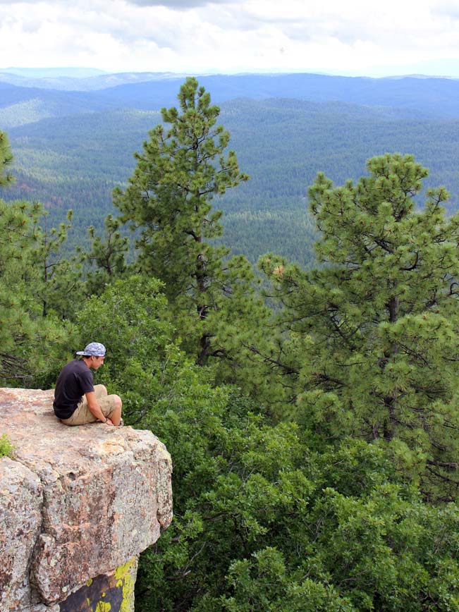
 Indeed, every curve in the easy Rim Lakes Vista Hiking Trail floods the senses with incredible hundred-mile views of deep canyon walls and pristine mountain ranges stretching out from beneath the edge of the Mogollon rim. Starting at the western end of the trail (accessed via the Mogollon Campground), the first mile is universally accessible: paved and dotted by three jaw-droppingly gorgeous overlooks (ideal for taking postcard-perfect selfies). With available parking at each overlook, expect to encounter “drive-through” visitors, hopping in and out of their cars to quickly take in the scenery, before zooming off to the next.
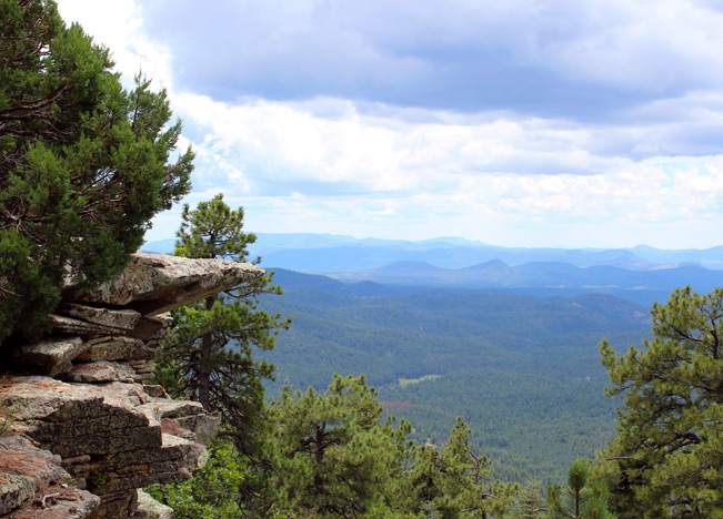
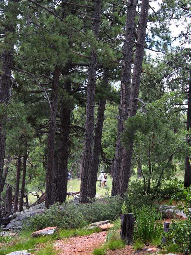 After this highly popular first mile the Rim Lakes Vista Hiking trail sheds its pavement, and becomes much more tranquil. Here you’ll encounter craggy canyon top stone outcroppings, lovely mountain flowers, hawks soaring overhead, occasional mountain bikers, and views that refuse to give up.
 There are trailheads at both the Mogollon Campground (at its western end) and the Rim Lakes Parking area (on its eastern end).
Total Nerdery
The Mogollon Rim extends across central Arizona from Sedona to the border of New Mexico. 1-17 slices right through it near Sedona. The Mogollon Rim is the second most lightening struck area in the world, so skidaddle if there are dark clouds and thunder!
Resources
Click here to download a trail map
Directions From the intersection of 89A and 260 (in Payson), take 260 east for 30 miles to Forest Road 300 / Rim Road (located on the left side of the road – directly across from the Mogollon Rim Visitor Information Center). Turn left / north on FR 300 and drive 7 miles to the Mogollon Rim Camp Ground, where the trailhead for the Rim Lakes Vista Hiking Trail begins.
- Dayhike, Easy, Family Friendly, Mogollon Rim, Overlook, Payson, Pet Friendly, Views
- July 18, 2015
4 Responses to Rim Lakes Vista Hiking Trail
Is the Rim Lakes Vista trail passable at this time of year. 02/04 2021
It may have snow on it. But the trail is very level, easy and should be passable.
Hello Lisa, on this one….which trails have you been taking to make that 7 miles Loop…or a bit longer? Love your website! thanks, udi
Hi Udi. So glad you like the site. I hope I understand your question correctly. If you hike the Rim Lakes Vista Trail from its start to end, and then back, it adds up to 7 miles in total.