Bear Jaw and Abineau Hiking Trail Loop


★★★★☆ Moderate / Flagstaff Area:
When Summer’s heat starts blasting, hiking in shorts & T-shirts through banks of snow on this Flagstaff loop trail is (yup . . . ) cool! Chilling in the shadows of Mount Humphreys, the upper levels of the Bear Jaw and Abineau Hiking Trail Loop often sustains crisp patches of snow through late June. Even post thaw, the trail’s cool mountain air and beautiful Pine and Aspen-lined pathways are like incredibly welcome Summer AC.
TRAILHEAD: Forest Road 9123Ja, Flagstaff, AZ • DIFFICULTY: moderate • DISTANCE: 6.8 MILE loop • APPROX. TIME: 4-5 HOURS • starting elevation: 8,550 • ELEVATION GAIN: 1,960 FEET (140 STORIES) • APPROX. CALORIES BURNED: 1,020-1,160 • BEST TIME OF YEAR: May – Nov. • PETS: YES please • KID FRIENDLY: YES (10 and over) • FACILITIES: none • FEES: none
 Situated on the northern slopes of Flagstaff’s San Francisco Peaks, the combined Bear Jaw, Pipeline and Abineau Trails form a crisply refreshing loop that takes hikers over beautiful Pine and Aspen-lined slopes, and provides awesome northern views of Sunset Crater, the Grand Canyon and beyond. Although the forest roads to the trailhead are well-graded and simple to navigate, (take it from a low clearance Prius driver) a high-clearance vehicle makes driving them a kinder experience (I won’t tell you about my fender mishap).
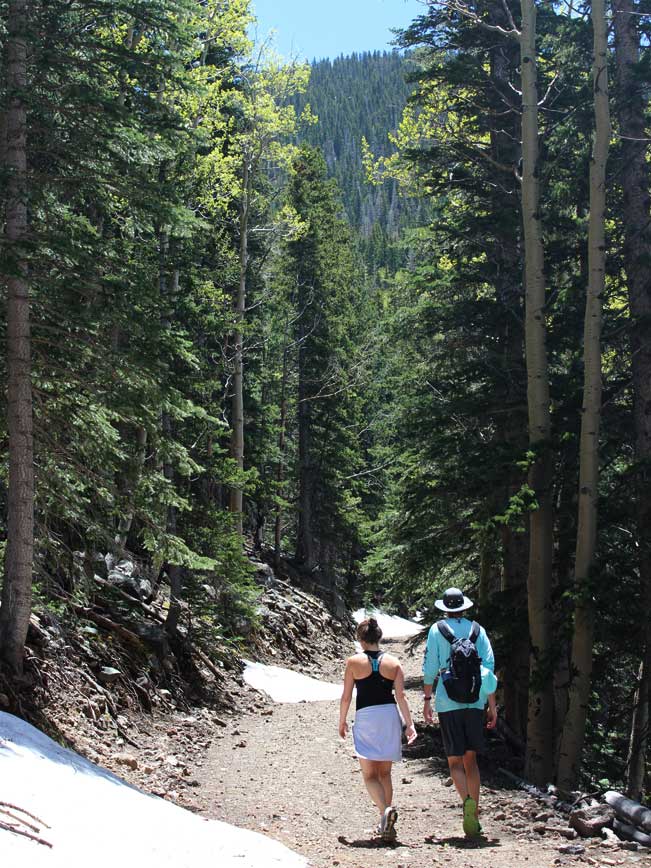
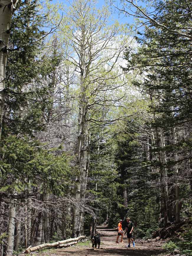
 From the incredibly scenic trailhead parking lot a brief, 0.8 mile, access trail meanders languidly across a soft grassy field to the start of both the Bear Jaw and Abineau Hiking Trails. The combined loop can be hiked in either direction (or each trail can be hiked independently as an out and back). For the loop I recommend starting with the 2.5 mile Bear Jaw Trail – since it is a little less steep than the Abineau, and very easy to follow.
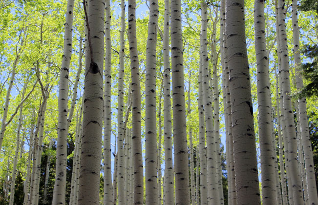 The Bear Jaw’s first mile is way easy, rambling along wide paths, through luxuriously dappled groves of tall Aspens, and with glimpses of the deep green and white slopes of Mount Humphreys (still snow capped in June) peeking between branches. As the trail reaches and ascends Bear Canyon (chock-a-block full of white trunk trees stretching towards the sun) its angle increases as it switchbacks up the slope.
 At the top of Bear Canyon the Bear Jaw ends, spilling out onto the wide, old, Pipeline Road. This well marked, and almost completely flat, upper-mountain passage connects a number of trails. For the loop, turn right to access the Abineau. Hiking Pipeline Road is a pleasant break. As a bonus, in Spring and early Summer, its surrounding trees shield the Winter snow, leaving frigid banks along the road to play in. As the trail gently curves forward, the backdrop of Mount Humphreys gets increasingly magnificent.
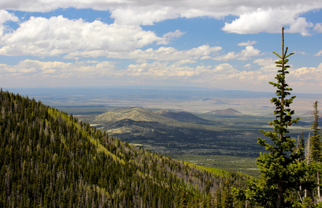
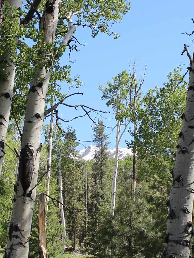
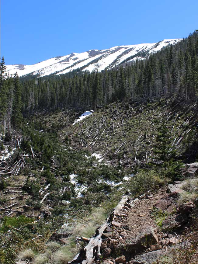 After 1.4 miles, the Pipeline Road ends smack dab in front of Mount Humphreys’ northernmost slope, and at the top of a long ravine. Here there are hundred-mile views over Arizona’s northern plateau, the Grand Canyon and Sunset Crater. The 2.35 mile Abineau Trail connects here, criss-crossing the ravine numerous times as it descends steeply. The upper portions of the Abineau are narrow and rugged, with a loose rocky surface and a few snow-downed trees to navigate around. In Spring and early Summer, bits of the trail sometimes remain covered with patches of snow. Stick to lower edge of the ravine bank (closest to Mt. Humphreys) and the trail steadfastly appears between these minor obstacles.
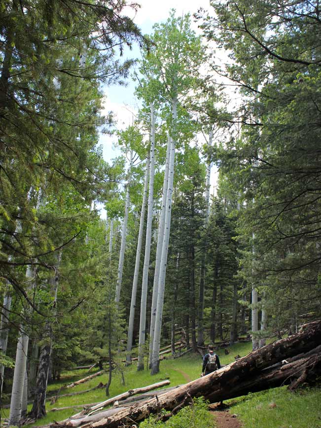
After about a mile the ravine’s impressive trail of winter exposure abates and the landscape regains a pacifist stride. In these lower sections, smoother surfaces are surrounded by gratefully upright trees. The joint trailhead for the Bear Jaw and Abineau Hiking Trail Loop is just a little further on, followed by the easy hike along the access trail back to the parking lot.
Total Nerdery The Pipeline (or Abineau Canyon) Road was built in 1950, with pipes laid below the surface to carry spring water down the mountain. It was abandoned after a failed attempt to tap a particular spring, and is now only used for hiking (Yay for us!).
Resources Click here to download a trail map
Directions From the intersection of US-89 and I-40 (in Flagstaff), drive 12.6 miles northeast on US 89 to Forest Road 545 (directly across from the Sunset Crater Turnoff). Turn left / west on FR 522 and drive 0.65 miles to the T-intersection of FR 420 (on the left) and 552 (on the right). Turn right on FR 522 and continue for 1.2 miles to FR 418. Turn right / north on FR 118 and drive a little over 7 miles to Forest Road 9123J. Turn left / south on Forest Road 9123Ja for 1.2 miles to the trailhead for the Bear Jaw and Abineau Hiking Trail Loop.
- Dayhike, Flagstaff, Moderate, Mountains, Northern Arizona, Pet Friendly, San Francisco Mountains, Views
- June 13, 2015
Leave a Reply