


★★★★☆ Moderate / Flagstaff Area:
Black “sand” and killer views of the Painted Desert rock this exotic hike. Looping around an ancient volcanic cinder cone, the little-known but highly recommended Strawberry Hiking Trail crosses hills of granular black lava, frozen volcanic formations and stunning fields of flowers tucked in between.
TRAILHEAD: Forest Road 779, North of Flagstaff • DIFFICULTY: MODERATE • DISTANCE: 2.2 MILE LOOP • APPROX. TIME: 1.5 – 2 HOURS • ELEVATION GAIN: 250′ (ABOUT 18 STORIES) • APPROX. CALORIES BURNED: 330-375 • BEST TIME OF YEAR: MARCH -october • PETS: YES • KID FRIENDLY: Yes. 10 AND OVER • FACILITIES: no • FEES: none
 Rising from the edge of Arizona’s Painted Desert, a string of tall volcanic mounds, seem to guard entry to the plain. Strawberry Crater is one of the smaller of these ancient cinder cones – being just a fifth as tall as its well-known and tourist-filled neighbor, Sunset Crater.
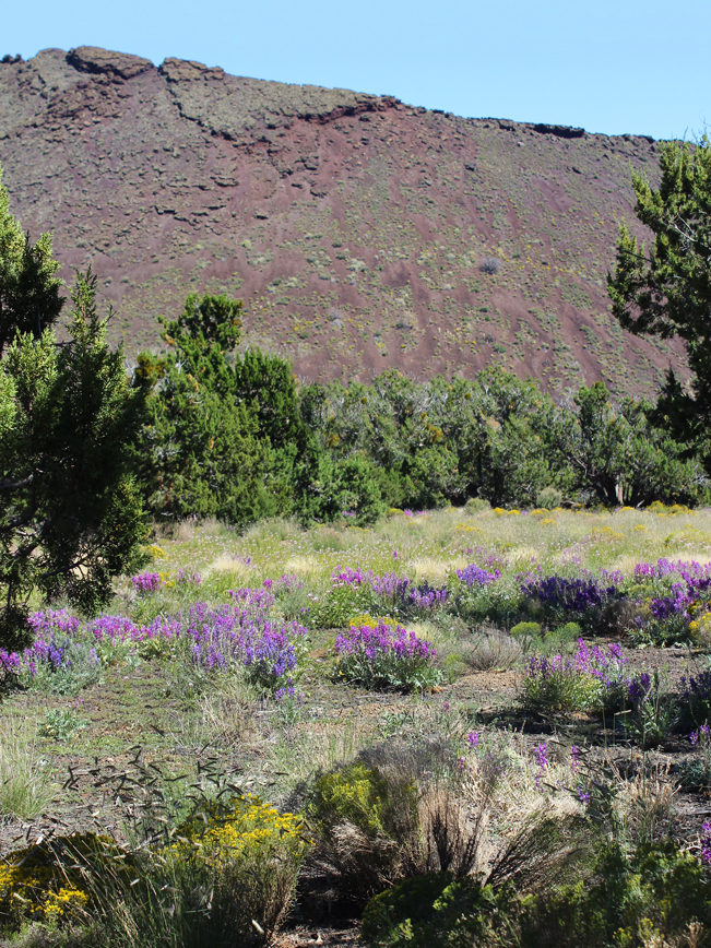
 It’s hard to do justice to the unique beauty of this sparse area and the intimacy of the Strawberry Crater Trail. Fields of wildflowers surround the Crater, Spring through Fall. The views of the Painted Desert are breathtaking. And there are no crowds to contend with.
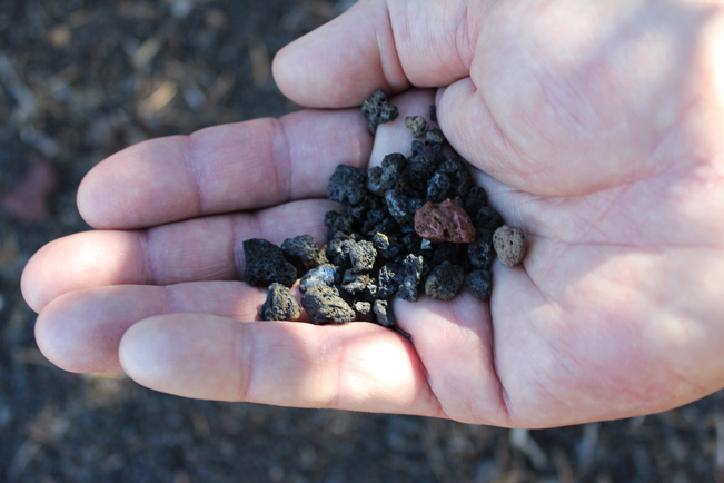 As the trail ascends the side of Strawberry Crater, the surface is surprising. It rapidly morphs from firm soil to deep, loose granules of black and red lava. This makes this part of the hike feel like walking up (and then down) a huge sand dune.
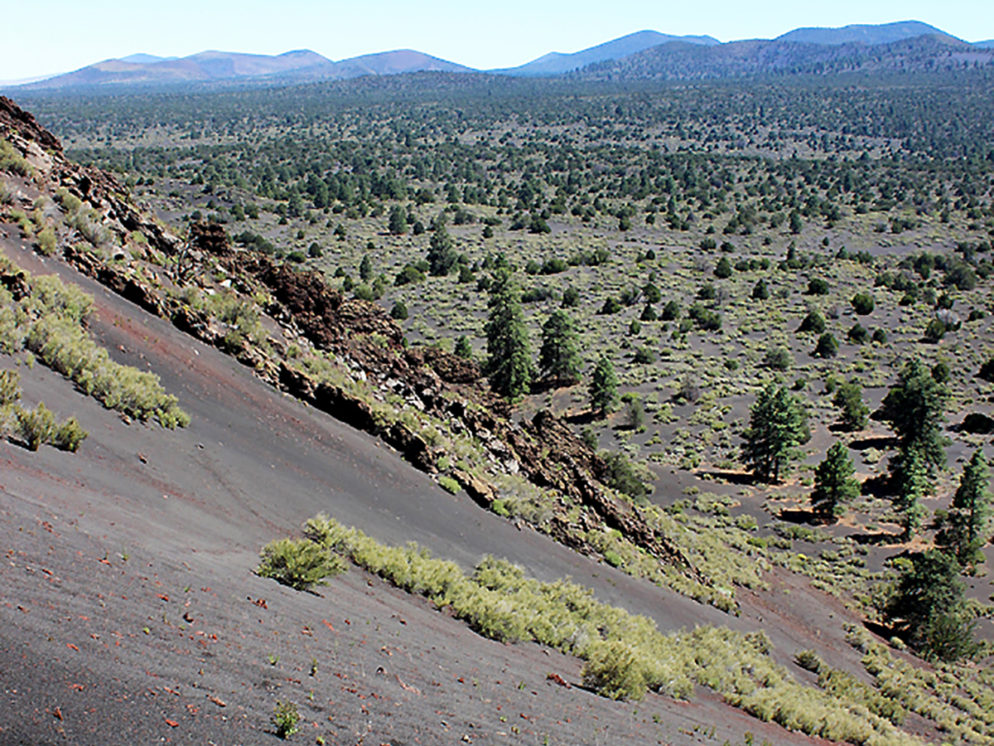
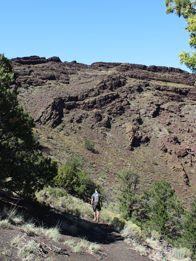 Continuing around the loop, the trail crosses a high point and then winds downward through a bizarre landscape of volcanic formations. Incredible views of the plains stretch out in the distance.
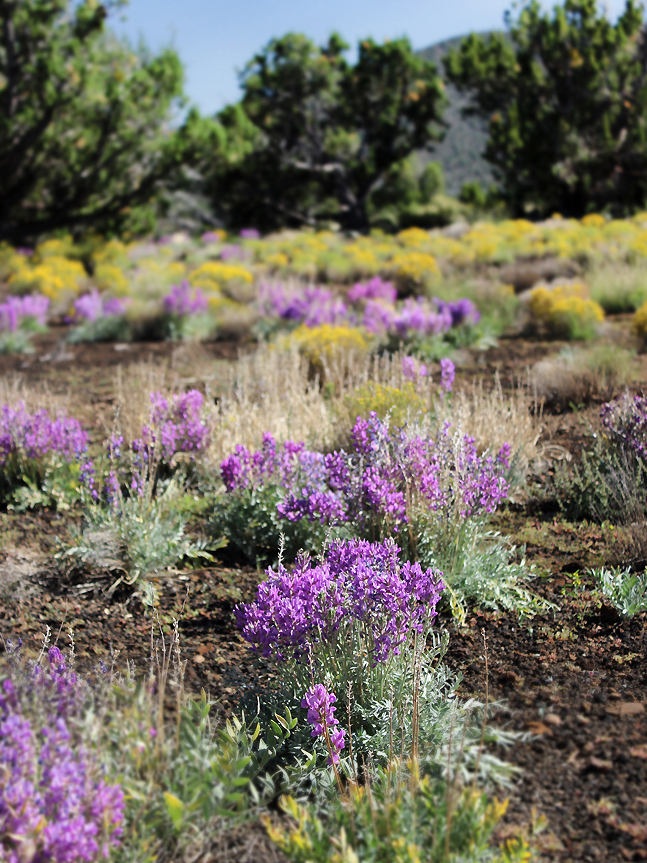 Fields of stunning yellow and purple wildflowers mark the return, as the trail completes its loop around Strawberry Crater. Enjoy them on the short trek back to the trailhead.
Total Nerdery
Strawberry Crater was named for its red toned lava surface and Strawberry-esque shape.
Resources
Click here to download a trail map.
Directions
From I-40 (in North Flagstaff) take exit 201 to US 89 North. Continue north on US 89 for 15.65 miles to Forest Road 546 and turn right / east. Take FR 546 for 3.55 miles to FR 779 and continue for 2.2 miles to the Strawberry Crater Trailhead. Although the forest roads are in pretty good shape, a high clearance vehicle is recommended.
Leave a Reply