


★★★★☆ Moderate / Phoenix Area
Fantabulous 360° views await at the top of this lofty peak! Tucked into a beautiful McDowell Mountain valley, the Sunrise Hiking Trail gets less traffic than it’s northern sister-trails. And the radical views at the top make the trek up totally worthwhile.
TRAILHEAD: 12101 N. 145th Way, scottsdale • DIFFICULTY: MODERATE • DISTANCE: 2 MILES (4 RT) • APPROX. TIME: 2 – 2.5 HOURS RT • ELEVATION GAIN: 1,100 FEET (79 STORIES) • APPROX. CALORIES BURNED: 600-680 RT • BEST TIME OF YEAR: OCT. – APRIL • PETS: YES • KID FRIENDLY: NO • FACILITIES: none • FEES: None
 Sitting on the southern tip of the McDowell Mountain Preserve, the Sunrise Hiking Trail kicks of from an intimate Scottsdale neighborhood. Within a few yards, the homes are quickly replaced by a gorgeous mountain valley.
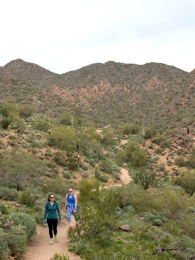
 The trail climbs steadily along the side of a granite strewn hill. Looking backwards, views of Red Mountain and the Superstitions become increasingly fine.
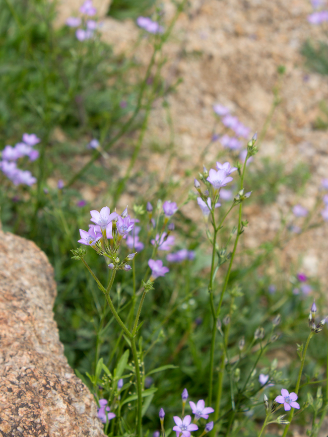 In Spring, the trail is lined by colorful wildflowers, including: Blue Dick (true name), Lupine, Mexican Poppy, and others.
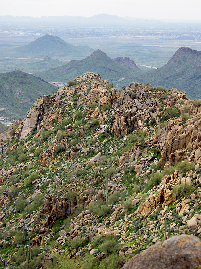 Dramatic walls of eroded granite line the upper portions of the Sunrise Hiking Trail. Just past the one mile mark, a scenic saddle opens onto hyper-long views of Phoenix.
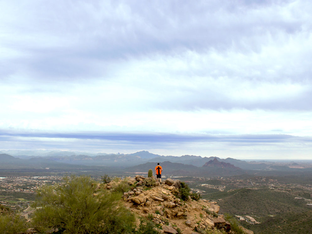
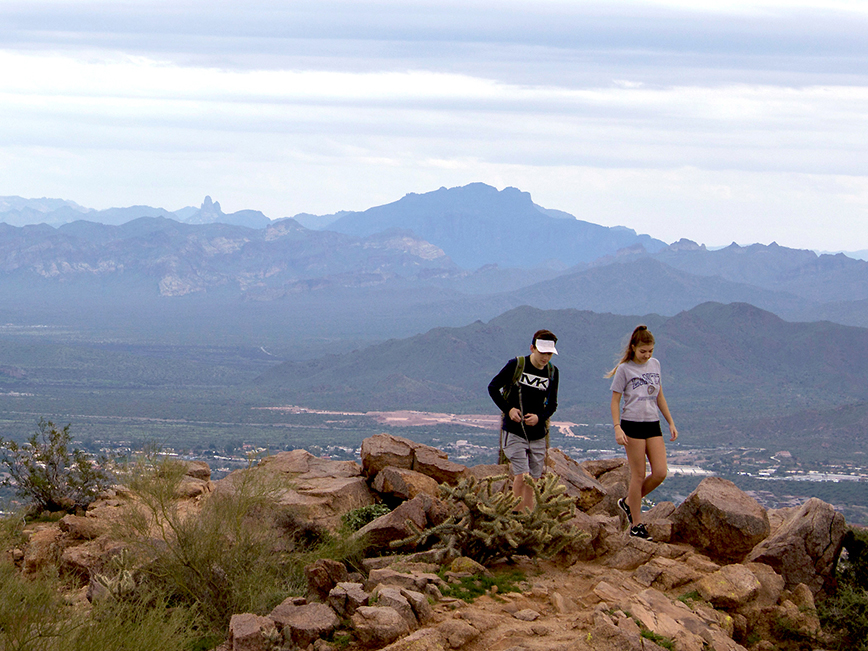 At 1.8 miles, a spur trail switchbacks up to Sunrise Peak. And wow is it worth it! Incredible views unfurl in every direction, including a stunning southward view of Weavers Needle and the Superstitions.
If you’re looking for a longer hike, the Sunrise Hiking Trail continues another 2 miles down the backside of the mountain. There, it comes to its ends at a juncture with Lost Dog Wash Hiking Trail.
Total Nerdery
At 3.069′, Sunrise Peak is the shortest of the McDowell Sonoran Preserve six peaks. East End Peak is the highest at 4,059′.
Resources
Click here to download a trail map.
Directions
From the intersection of AZ 101 and Shea Boulevard (in Scottsdale) turn east onto Shea Blvd. and drive six miles to 136th Avenue. Turn right/north onto 136th Ave. and continue a short distance to Via Linda Road. Turn right/east onto Via Linda and drive 1.35 miles to the Sunrise Peak Trailhead on the left side of the road.
Leave a Reply