Tom’s Thumb Hiking Trail, Northeast


★★★★★ Moderate to Difficult / Phoenix Area:
Tom’s Thumb Hiking Trail (from the northeast entrance) is my “happy hike”. Of the many, many trails in the Phoenix metropolitan area, there is no other that is makes my heart sing every time I take it! From the crazy-fun drive getting to the trailhead, to the monolithic curved boulders that make you feel about as big as an ant, to the amazingly expansive vistas particular to the McDowell Sonoran Preserve, this hike ranks as one of my most favorite.
Trailhead: 23015 N 128th St, Scottsdale • Difficulty: Moderate to Difficult with steep incline • Distance: 2.15 miles (4.3 miles RT) • Approx. Time: 2–3 hours • Elevation Gain: 1,420 feet (140 stories) • Approx. Calories Burned: 650-750 RT • Best Time of Year: Nov.–Apr. • Pets: Yes • Kid friendly: Yes for 12 and up • Facilities: Yes (but no water) • fees: none
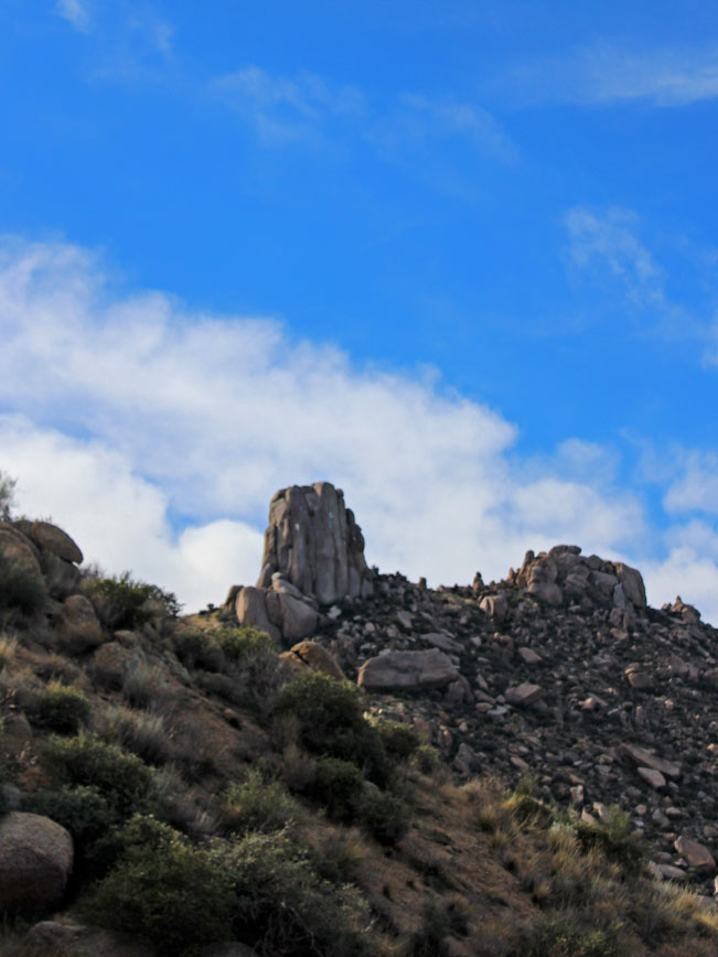
Tom’s Thumb itself is humongous rock formation on the north end of the McDowell Mountain Preserve. It is visible from almost anywhere in North Phoenix, Scottsdale or Fountain Hills. And once you recognize this “boulder on steroids” you almost have to smile whenever it comes into view. The hike itself is just lovely! The trail is made up of smooth gravel (no ankle twisting rocks here) and is tucked amongst such sensuously curved boulders and outlandish rock formations that you almost feel like a miniature peep show client in their midst. Tom’s Thumb Hiking Trail is fairly steep. But its smooth surface combined with the incredible terrain make hiking it pure pleasure.
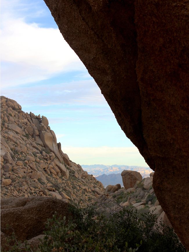
About a mile into the Tom’s Thumb Hiking Trail you reach the first summit, which offers expansive views of the North Valley, a sprinkling of custom homes (that make you wonder what those folks did for a living), and also of Tom’s Thumb. After a bit the trail winds around the top of this summit, heads down a short valley and then back up to the short jaunt out to the boulder it is named for. Every step offers breathtaking views – which shift from the North Valley to the South and West, revealing sun-drenched vistas of the McDowell Mountain’s nearby sister peaks as well as the Four Peaks range and even the distant Superstitions. Tom’s Thumb Hiking Trail is a popular. But there is ample parking and enough space that it rarely feels crowded. And there are really no words for its beauty at sunrise or sunset.

Total Nerdery
Tom’s Thumb is 140 feet (or about 11 stories) high, and solid granite. Rock climber’s have nicknamed it “The Dork”.
Resources
Click here to download a map of the trail.
Directions From AZ-101 (in Phoenix) take Exit 36/Pima Road and Princess Drive and head north. Continue north on Pima Road for 6 miles to Happy Valley Road. Turn right/east on Happy Valley Road (which becomes East 118 Street) and drive 4.3 miles to East Ranch Gate Road. Turn right/east on East Ranch Gate road and drive 1.2 miles to North 128 Street. Turn right/south onto North 128 Street and continue 1.4 miles to the trailhead parking lot.
- Boulders, Dayhike, North Phoenix, Scottsdale, Views
- February 3, 2015
4 Responses to Tom’s Thumb Hiking Trail, Northeast
Just did this hike 3 days ago. My feet still hurt. One of the steepest/most consistent uphill hikes I have done, but super beautiful vistas. Especially liked the view overlooking the fountain at Fountain Hills.
Hope your feet feel better! Love the views on this trail too!
Hi Lisa, we did this hike last weekend and loved it. You might not remember this, but we are the couple you gave a ride to this spring when we got lost in the Prescott National Forest near the Spruce Mountain trail. We saved your business card for this website and have been finding great trails on it ever since! (Other favorites are Sunrise Mountain and the Go John loop.) Thanks for everything.
Yay! So happy that you are out and about, and finding lots of good hikes. There are so many to choose from.