


★★★★☆ Mostly Easy / Prescott
Explore rolling Granite Dells, hidden coves and a waterfall on this stunning loop hike. The Watson Lake Loop Trails circle Prescott’s largest lake on a series of mile-long sections. Each portion surprises with a totally unique character.
TRAILHEAD: Hillsdale ROAD, prescott • DIFFICULTY: easy (Moderate in spots) • DISTANCE: 4.8 MILE Loop • APPROX. TIME: 2.5-3.5 HOURS RT • ELEVATION GAIN: 162 FEET (12 STORIES) • APPROX. CALORIES BURNED: 624-720 • BEST TIME OF YEAR: September – June • PETS: YES WITH LEASHES • KID FRIENDLY: 10 AND UP • FACILITIES: YES • FEES: $3 day parking
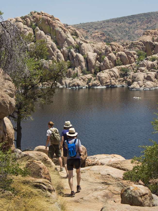 The wonderfully varied Watson Lake Loop Trails can be kicked off from a number of trailheads. And each sports a totally different character! Our favorite starting trail is the North Shore, for its granite surface, long views and hidden treasures. This slightly moderate, 1-mile long leg, meanders over the rolling Granite Dells that define Watson Lake’s unique beauty.
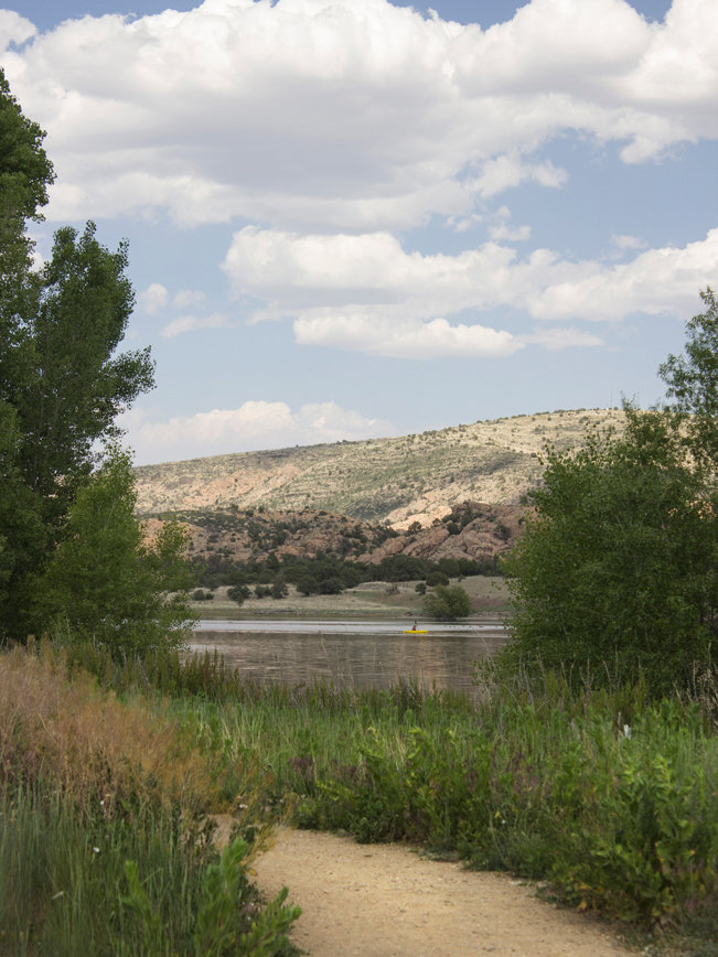
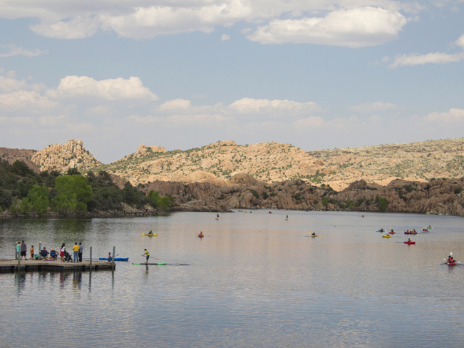
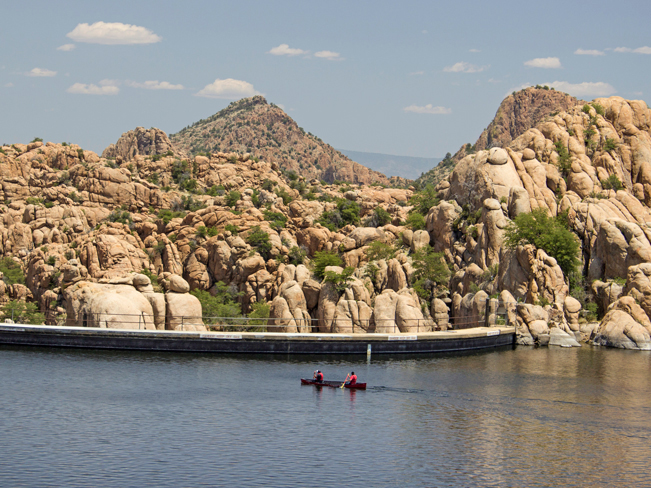 After a half-mile on the North Shore Hiking trail, fantastic views of the Watson Lake dam appear. From the trail, it’s fun to watch kayakers approach and paddle the rim.
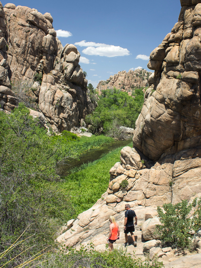
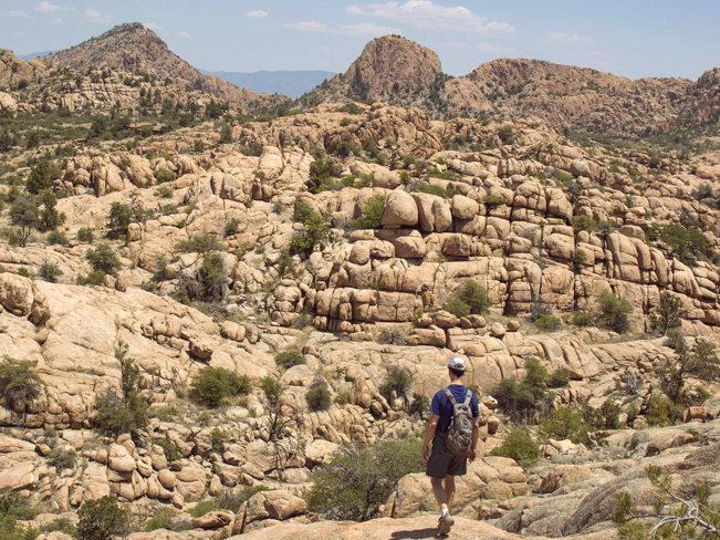 Passing the dam, the hike leads to a seemingly endless stretch of eroded Granite Dells. These immense formations seem otherworldly – with their oversized bulbous shapes and bizarre layering. Kids of all ages will have a blast hopping around this part of the trail!
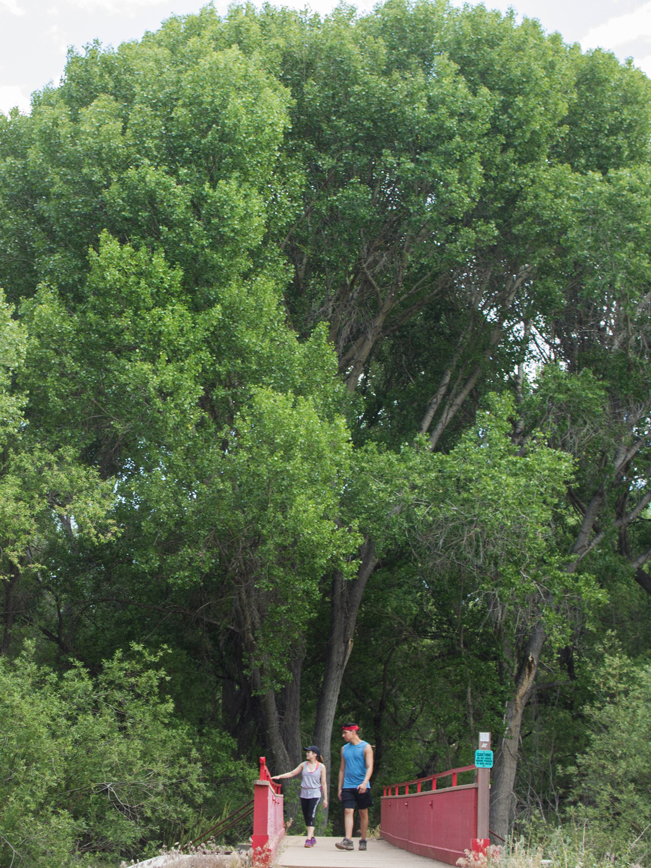
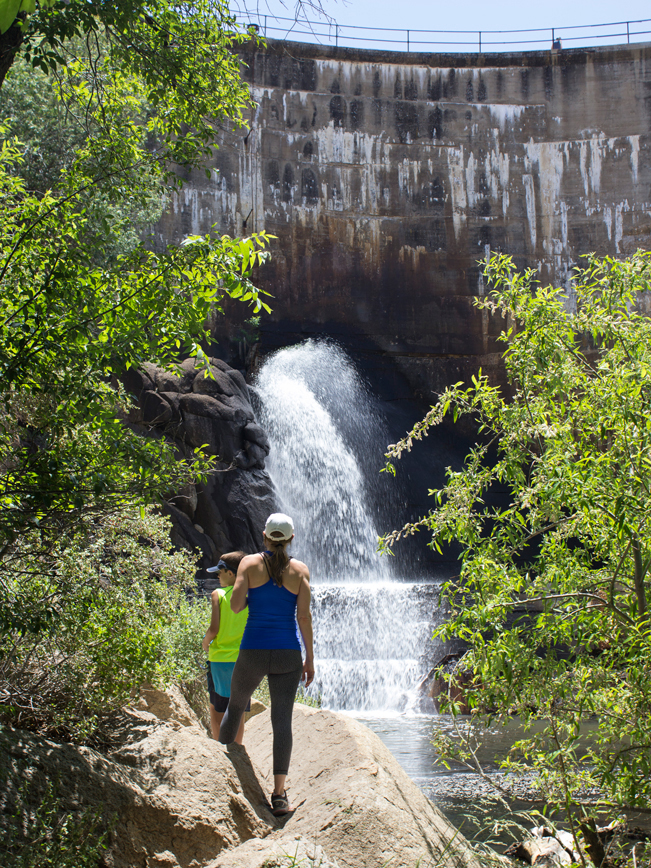 After a moderate descent, the North Shore Hiking Trail curves around to reveal one of the coolest features of the hike. Suddenly, the air is moist and cattails spring from a marsh! Crossing a small bridge, a short side trail leads to the back of the dam. Here a relief waterfall gushes out, spritzing the air.
 Exiting this lush area, the trail becomes the moderate, Over the Hill Hiking Trail. This section ascends back onto the Dells and meanders in and around them for the next mile.
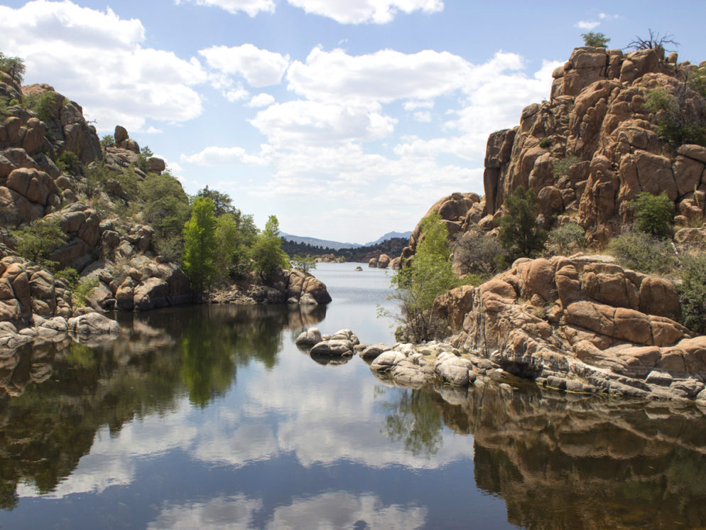
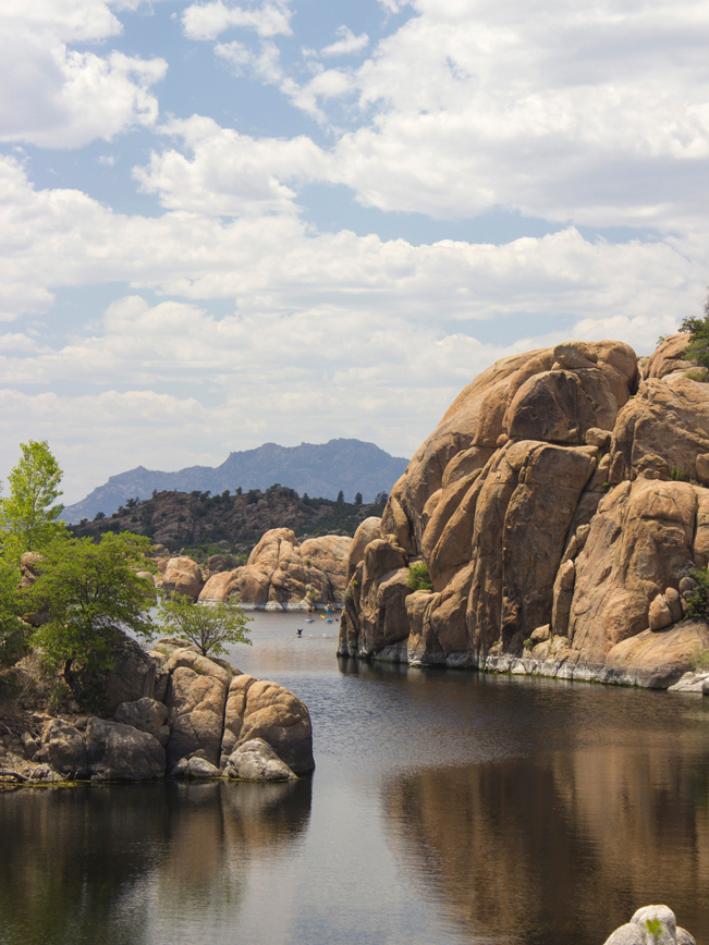 One particularly beautiful spot is Secret Cove, a large inlet with views out onto the lake. Here reflections of sky and stone, beneath the distant silhouette of Granite Mountain, just beg for social media posting.
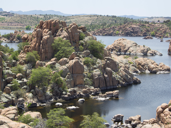 The path now becomes the Lakeshore Hiking Trail. True to its name, breathtaking views of the lake, its shores and the wacky rock formations that jut from the water, roll out from various high points.
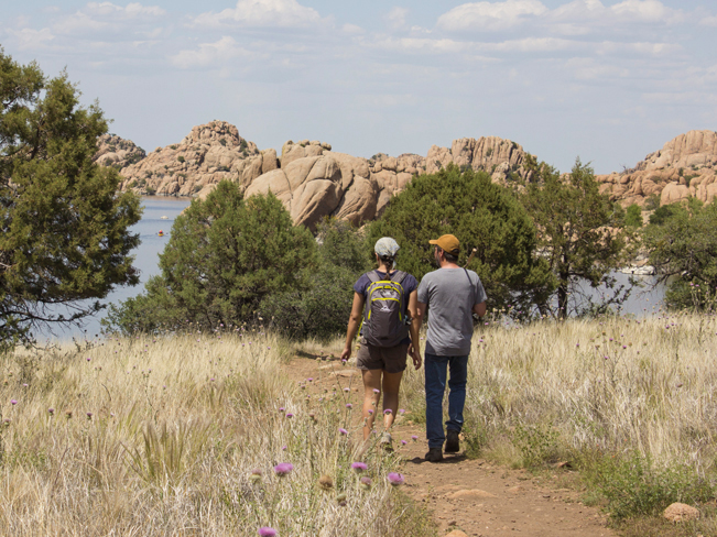 As the trail exits the Dells, the path opens onto wide fields. In Spring and Summer these are filled with colorful thistle and wildflowers.
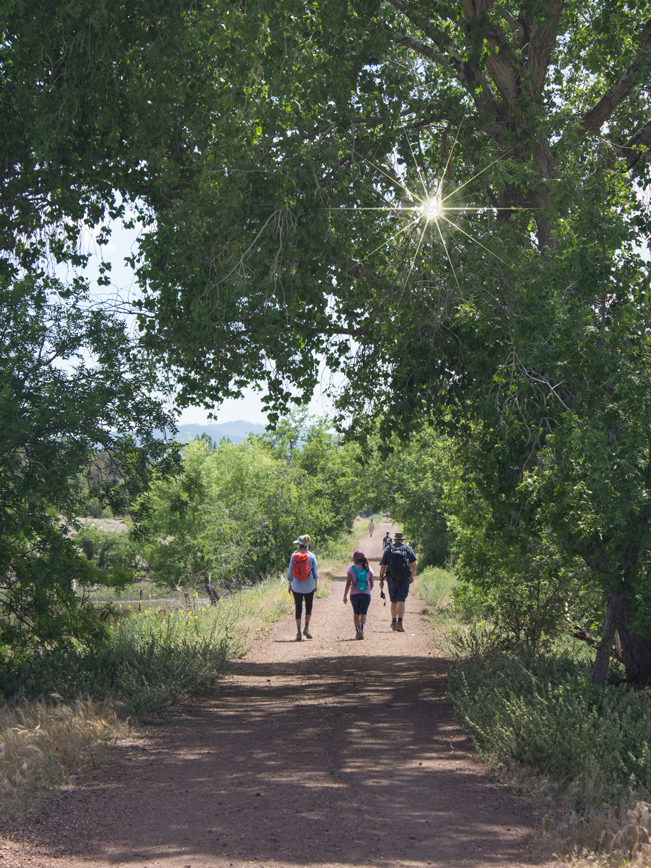 A half-mile further on, the hike merges onto Prescott’s renowned Peavine Trail. This wonderfully wide, flat pathway was constructed atop a 19th-century railroad track. It’s a local favorite for evening strolls and family bike rides.
 A right turn onto the Discovery Trail leads around the base of Watson Lake. Huge Cottonwood trees shade this section. And the temperature is refreshingly cool beneath the trees.
 The Discovery Trail now curves northwards around the lake. Delicate wildflowers line the wide even path in this section.
 At the boat dock, the trail becomes the Watson Lake Trail. This 1-mile leg continues north, eventually reentering the Dells. Jaw dropping views of the lake roll out from the Watson Overlook. A quarter mile further and the hike reaches it’s original starting point – at the North Shore Hiking Trail.
The Watson Lake Loop Trails can be started from the Peavine, Discovery, Watson Lake or North Shore Trails. Wherever you opt to get going, you won’t be disappointed!
Total Nerdery
Watson Lake was created in 1900 when the Chino Valley Irrigation District built a dam on Granite Creek. It’s sister lake is Willow Lake, sporting its own lovely loop trail.
Resources
Click here to download a trail map.
Directions From the intersection of 1-17 and AZ 69 (in Cordes Junction), take exit 263 onto AZ 69 north, towards Prescott. Drive 20.2 miles to Fain Road. Turn right / north onto Fain Road (which becomes AZ 89A) and continue 13.5 miles to the T-Intersection with AZ 89. Turn left / south onto AZ 89 and drive 3.5 miles to the traffic circle. From the circle merge onto Watson Lake Park Road. After entering the park, turn left onto Hillsdale Road and park at the recreation area. The North Shore Hiking Trailhead is a short ways further on the left side of the road, beside the boat dock.
4 Responses to Watson Lake Loop Trails
Link to the trail map no longer works. The City site does not appear to include a map of the Watson Lake Dells Trail.
Thanks for letting me know Jim! I’ll look for another link.
City of Prescott map: http://www.prescott-az.gov/wp-content/uploads/2016/12/watsonloop_10Oct19.pdf
Thank you for the updated link! Much appreciated.