


★★★★☆ Moderate / Southern Arizona:
A mountain top grotto and trailside hoodoos are a blast to explore on this Chiricahua National Monument hike! Kids will love playing hide and seek between the wacky rock formations sprinkled over the first mile. And adults and kids alike will enjoy making this a totally downhill trek, by snagging the park’s free shuttle from the Visitor Center to sky-high Echo Canyon trailhead.
TRAILHEAD: BONITA CANYON DRIVE, WILLCOX, AZ • DIFFICULTY: MODERATE • DISTANCE: 4.2 MILES 1-WAY USING THE FREE SHUTTLE (OR 8.4 MILES RT) • APPROX. TIME: 2.5-3.5 HOURS (1-WAY HIKE) • ELEVATION GAIN: -1050 FEET (-75 STORIES) • APPROX. CALORIES BURNED: 545-630 • BEST TIME OF YEAR: MARCH-OCTOBER • PETS: NO • KID FRIENDLY: very (first mile) • FACILITIES: YES • FEES: None
 Chiricahua National Monument, in southeastern Arizona, is known for its gazillion towering hoodoos. From the area’s cool 6780′ Echo Canyon Trailhead, the hike down the mountain passes through some of the best of these crazy formations. Hikers can either park at this trailhead, or catch a free 9:00 am shuttle from the Visitor Center. The second option makes for a mostly easy downhill trek back to your car at the shuttle parking lot. Pretty sweet!
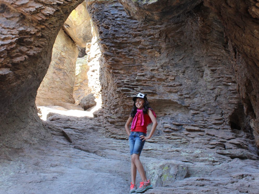
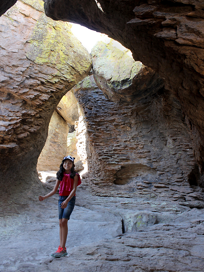 For kids especially, the most grin-inducing feature of this hike is the Grotto, a playground of interconnected arches, etched out of the rock by time, wind and weather. The 1/2-mile mini-trek to get there, along the hoodoo-flanked Echo Canyon trail section is full-out family fun.
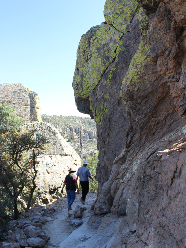
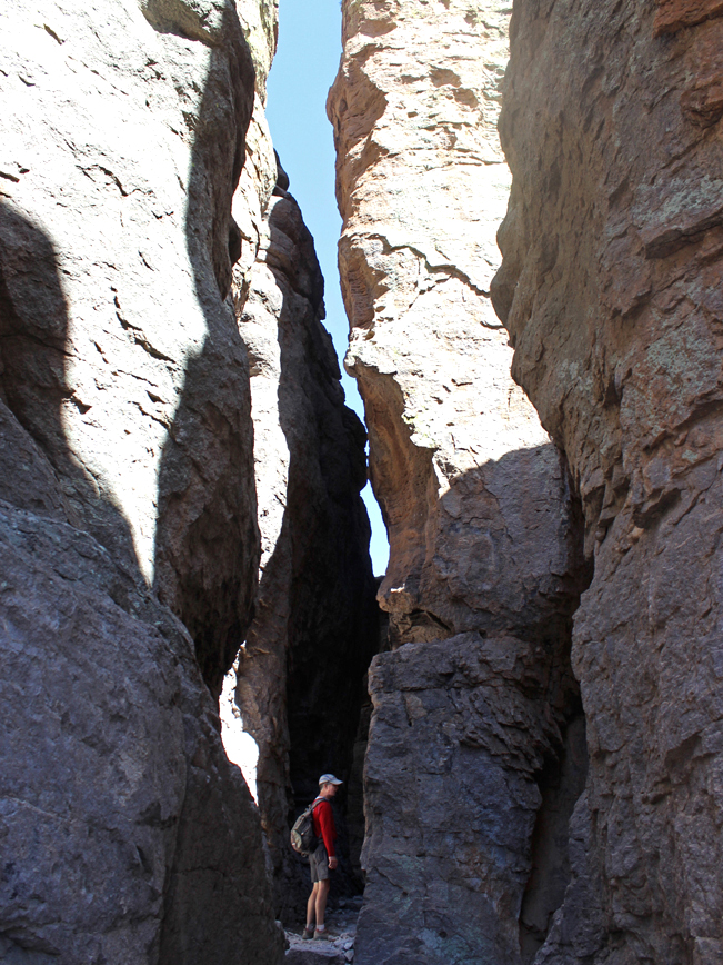 The remaining hike down the mountain follows one long trail, broken up into separately named sections (see downloadable map below). The 1.6-mile Echo Canyon section squeezes through a radically tall outcropping just past the Grotto.
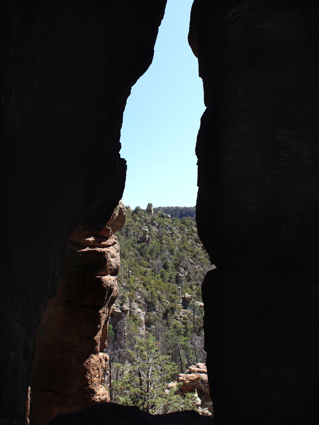 Spindly windows peek out between these monoliths onto layer upon layer of towering spires. Continuing the descent, an area called Echo Park (although we couldn’t get one) is circled by a virtual hoodoo army.
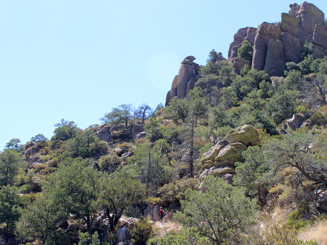 On the 1.1-mile Upper Rhyolite section, which continues the descent on a series of switchbacks, the stone walls retreat, and epic views open onto the surrounding hills and valleys, encrusted with massive towers.
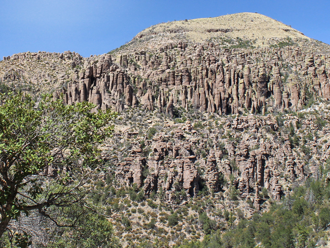 For the last leg, the mostly flat 1.5-mile Lower Ryholite section leads back to the Visitor Center. In every direction the mountains are laden with a gazillion stone hoodoos.
Note: The Grotto hike can also be done as a 9.5 mile loop around Chiricahua National Park that passes through the prized hoodoo cluster, Heart of the Rocks (see downloadable map below). This option heads uphill from Upper Rhyolite, on the Sarah Deming, Big Balanced Rock, Mushroom Rock and Ed Riggs trail sections.
Total Nerdery
Chiricahua’s wacky hoodoos are the remains of the hot lava, spit from a powerful volcano over 27 million years ago. Cracking and erosion have worn them into their crazy shapes. Native Apaches called them “Standing up Rocks.”
Resources
Click here to download a trail map.
Click here for Chiricahua hiking shuttle information.
Directions From the intersection of I-10 and I-19 (in Tucson) head southeast on I-10 for 76.82 miles to exit 336 / AZ-186. Continue for 3.4 miles on AZ-186 (called Haskell as it passes through Willcox) and then turn right / east on Maley / AZ-186. Continue for 34.33 miles. AZ-186 becomes Bonita Canyon Drive as it enters the park. The Visitor Center is located 2.5 miles into the park on the right side of the road.
Leave a Reply