Horton Creek Hiking Trail


★★★☆☆ Easy / Payson Area:
Like Mother Nature’s “water cooler”, Horton Spring gushes cold, crystal-clear water and chilly air year-round. The easy Horton Creek Hiking Trail follows the banks of beautiful, spring-fed Horton Creek (to its fresh water source). It is a touch of bliss – especially in the midst of Arizona’s hot Summers.
TRAILHEAD: Upper Tonto Creek Campground, Payson, AZ • DIFFICULTY: Easy (MODERATE for last mile) • DISTANCE: 3.5 MILEs (7 miles rt) • APPROX. TIME: 3.5-4.5 HOURS • ELEVATION GAIN: 1,060 FEET (76 STORIES) • APPROX. CALORIES BURNED: 900-1,050 • BEST TIME OF YEAR: MArch – NOV. • PETS: absolutely • KID FRIENDLY: YES • FACILITIES: yes (at campground) • FEES: NONE
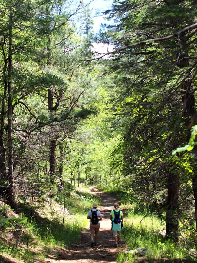 Starting near the base of the Mogollon Rim, at the Upper Tonto Creek campground, the Horton Creek Hiking Trail ascends gently northwards towards the rim, under the shade of ancient trees. The relaxing babble of water flowing over rocks, and bouncing down small waterfalls accompanies the hike from the start.
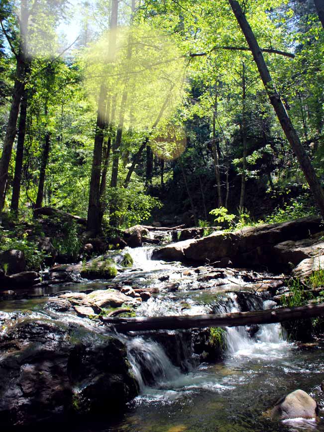 As the trail advances, Horton Creek pops in and out of view alongside the path. There are plentiful spots to sit and relax in the shade if desired, or to get your feet wet and splash around in one of the many mini-falls dotting the creek.
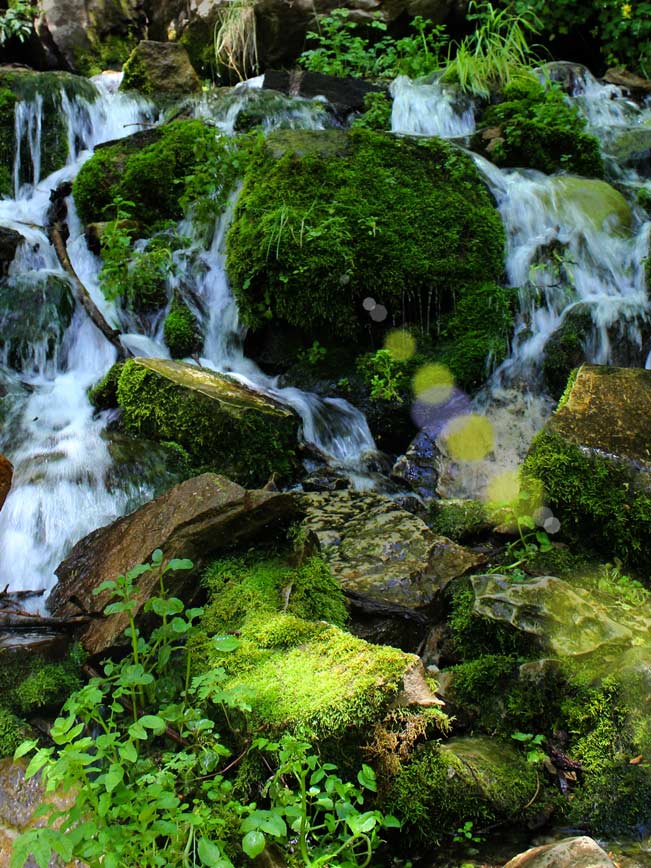
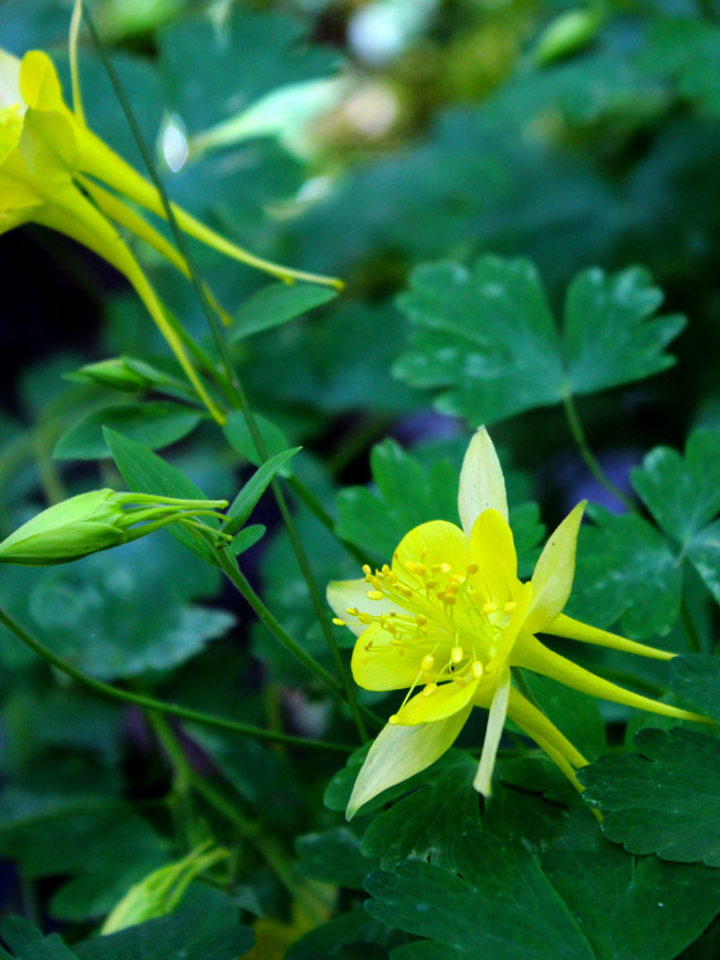
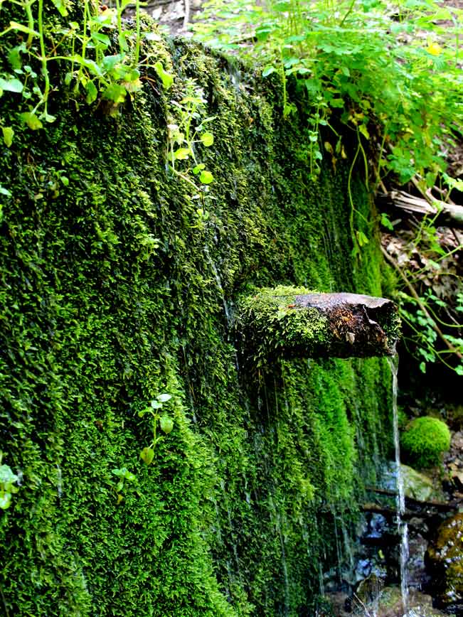 After a couple of miles, the trail steepens slightly, as it winds towards the top. Here tall pines take over the scenery, and the path arcs away from the creek for a short distance. Horton Creek Hiking Trail ends at the Highline Trail. Turn right turn on the Highline, and walk few yards to reach Horton Spring. From seemingly out of nowhere, and above a cascade of moss covered rocks, buckets of icy water gush from this underground spring. A little bit further along, a second, equally lovely spring can be found – housing lush flowers (throughout the Spring and Summer) and a pipe gurgling with fresh spring water.
This hike can be done as an out-and-back. Or can be done as a slightly longer, eight-mile loop, by continuing for two miles right / east on the steeper Highline Trail then turning right / south for 2.5 miles on the moderate Derrick Trail (which also ends at the Upper Tonto Creek Campground).
 Total Nerdery
Zane Grey, renowned American Western author, hiked and hunted along Horton Creek in the early 1900s. I wonder if he bagged the great great great grandparents of the many deer we saw along the trail.
Resources
Click here to download a trail map
Directions From the intersection of 87A and 260 (in Payson), take 260 east for 16 miles to Forest Road 289 (at signs for Kohl’s Ranch). Turn left / north towards the Tonto Creek Fish Hatchery. Continue one mile to the Horton Creek and Derrick trailhead parking lot on the left / west side. To trailhead for the Horton Creek Hiking trail is located across the road, in the campground. The entrance is a few yards in on the left.
- Central Arizona, Creek, Dayhike, Family Friendly, Mogollon Rim, Payson, Pet Friendly, Spring, Waterfall
- June 20, 2015
16 Responses to Horton Creek Hiking Trail
A friend and myself are planning on hiking the Horton Creek trail Wednesday, 6/30/18. Since a lot of the parks are closed down, will we still be able to do this hike.
Hi Diana, Here is a link to the mogollon forest area closed, as of May 23rd. https://bit.ly/2IMSHuP. From the map it appears that Horton Creek is included in the closures. However, I would recommend contacting the Ranger District at (928) 477-2255 to be sure. So far, I have not seen any information on when the restrictions will be lifted. Good luck!
The Horton Creek trail is closed even to day hikers, and given the nature of human stupidity (by which I mean the USDA Forest Service) there is no telling when it will re-open. I wouldn’t count on hiking it this Summer, if I were you.
Thank you R. Thomas. Once the extreme fire hazards have passed, the Forest Service will re-open these areas. But, you’re right. It may not be until later in the year. Let’s all hope for some good monsoons this year!
So it’s closed right now in August??
Hi Michelle, The Horton Spring Trail is open again, now that the Monsoons have relieved the high risk of fires.
In the 1960s we camped in the Tonto Creek campground which started near Kohl’s Ranch and ended near the confluence with Horton Creek. There used to be a sink hole into which all or most of the water from Horton disappeared. In the late summers, Horton was almost always dry from the confluence up to this sink hole. I was a child then and have not been back to the area since 1978 when I hiked the Creek as a newlywed. I don’t remember how far upstream from the confluence it was. No posts mention this sink hole. Does anyone still remember it? Is it still there?
I am not aware of it Lynnell. But I’ll keep my eyes open next time I visit.
We just hiked yesterday and we were puzzled by this. The creek flowed really nicely until that point and just disappeared. We though that there is some kind of underground cave system where water goes – it never resurfaces all the way to confluence with Tonto. Thanks
Not really a sink hole, but a hole in the rocks. I cast a fly once in that hole. Terrible cast, line and fly flopped in the middle of the hole. A trout grabbed the fly. Great memories.
[…] Horton Creek Trail – this 3.5 mile trail is great because you can access water without even completing the hike! Rated as easy, it’s moderate the last mile. No fees, restrooms at nearby campground. […]
Yes. It”s nice that you can do as little or as much as you’d like to enjoy this trail.
Do I need any kind od a pass in order tol hike her 9/24/21?
There are no passes required for Horton Creek Trail.
I’d like to take my group of 14 year old girl hockey players on this hike but starting below the fish hatchery along the Highline and dropping down at the Horton Creek trail. We’d leave a car at the bottom to retrieve the vehicles above. Any info on the length of this hike as I can’t find references to this route. Thanks. Bob
I wasn’t able to find an exact mileage for this section of the Highline Trail. But I estimate that it would add another 3 miles to the hike. (Smart plan to leave a vehicle at the start of the Horton Trail, to avoid having to hike back up to the hatchery.)