With its mountain location and climate, the Flagstaff area is a hiker’s utopia – Spring through Fall. Flagstaff area hiking trails in the San Francisco Peaks (Arizona’s highest range) lead to wildflower filled meadows, immense fern gullies, glistening aspen groves, pine filled expanses, and impressive summits. Easy hikes wind across foothills. While ambitious trails conquer high peaks – including Mount Humphreys, Arizona’s tallest. Thunderstorms roll in quickly in Summer. So come weather prepared. In winter many trails close due to seasonal snow. Mileage noted below, is one way.
Scroll down to explore Flagstaff hikes by difficulty. Click hike names for full details.
Easy Flagstaff Area Hikes
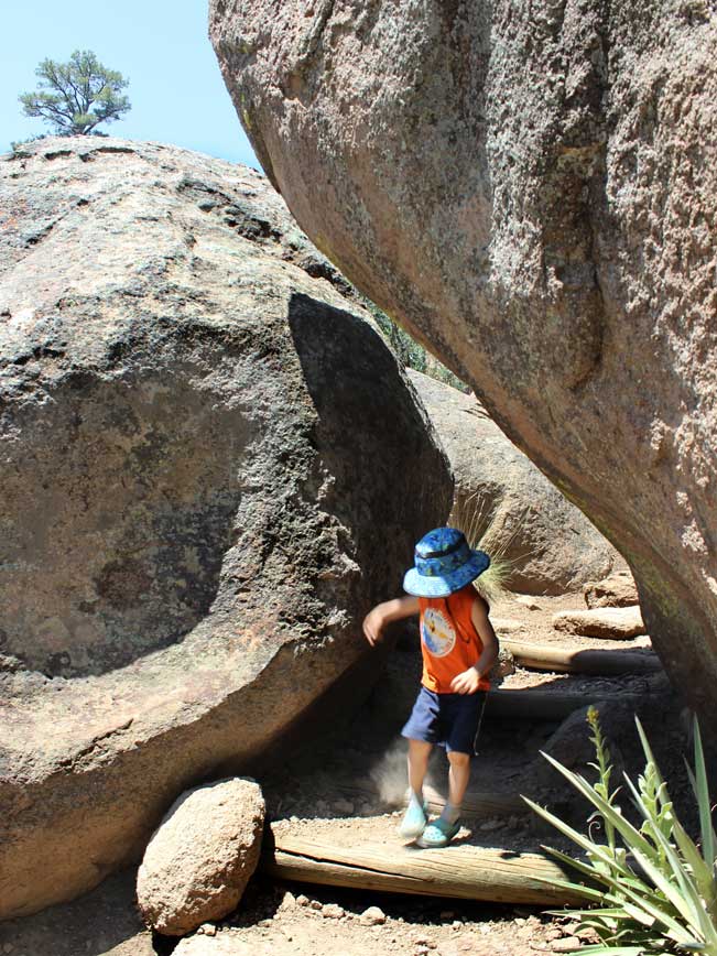 ★★★★☆ Fatmans Loop Hiking Trail / San Francisco Mountains / 2.5 mile loop
Oversized rock-formations and fun-filled nooks-and-crannies beg to be explored. Have a blast scooching between the immense boulders of Fatmans Pass or climbing into large recesses on trailside boulders.
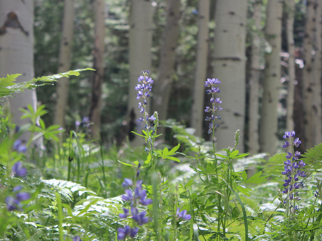 ★★★★☆ Kachina Hiking Trail / San Francisco Mountains / 5.4 miles
An almost overwhelmingly beautiful hike. Spring and Summer fill huge trailside meadows with fragrant wildflowers or ferns. While Aspens shimmer in Fall.
 ★★★★☆ Lava River Tube Trail / North of Flagstaff / 1 mile
Headlamps required – on this naturally refrigerated hike through a short underground tunnel. Turn off the lights for an extra thrill.
 ★★★★★ Red Mountain Hiking Trail / North of Flagstaff / 1.5 miles
The maze of colossal Cinder Cones at the end of this trail is amazing (hee hee). Thousands of these unusual formations make hikers feel like ants, in a sprawling city of hyper-high anthills. Let the exploring begin!
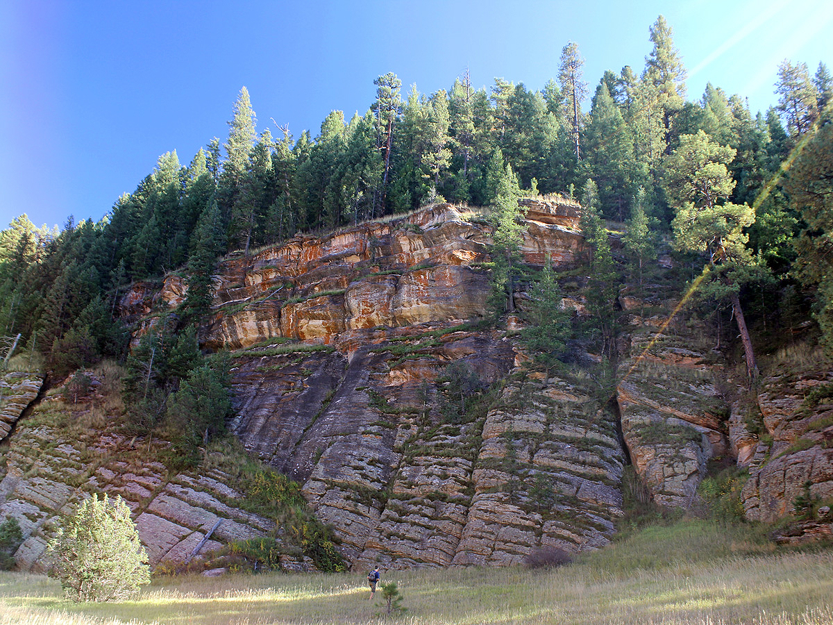 ★★★☆☆ Sandys Canyon Hiking Trail to Walnut Canyon / South of Flagstaff / 2.7 miles
“Twisted” cliffs, punctuated with small caves, make this hike seem a bit surreal. Following a level canyon, this trail leads to Fisher Point where a Dali-esqe cliff looms, gnarled and frozen.
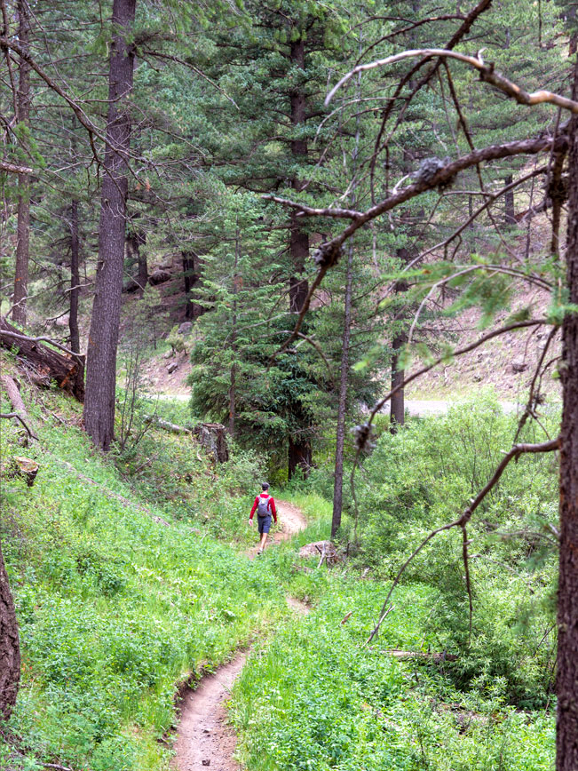 ★★★★☆ Schultz Creek Hiking Trail / Flagstaff / 4.25 miles
This shady trail follows the curvilinear banks of beautiful Schultz Creek, at the base of Dry Lakes Hills. Summer wildflowers line the path in a patchwork of green, gold, purple and red.
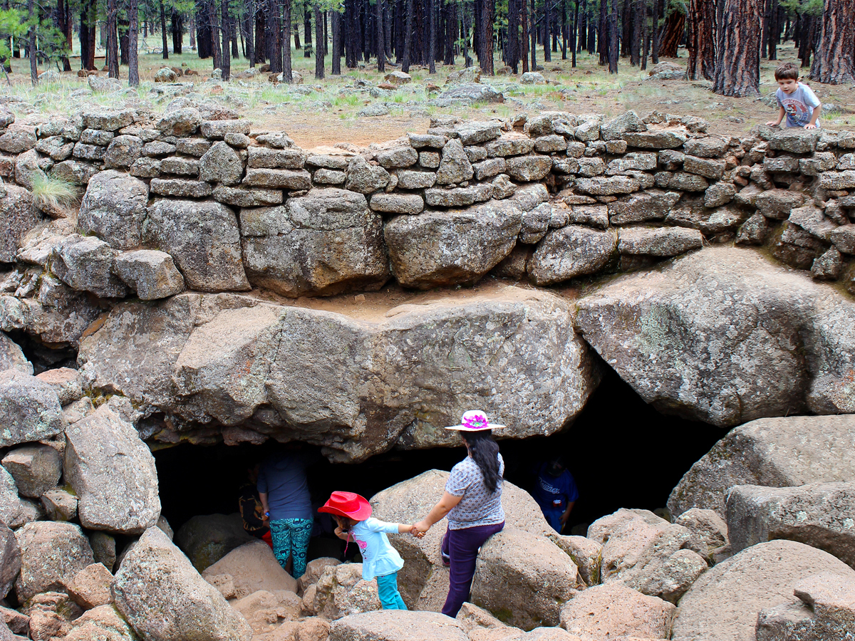
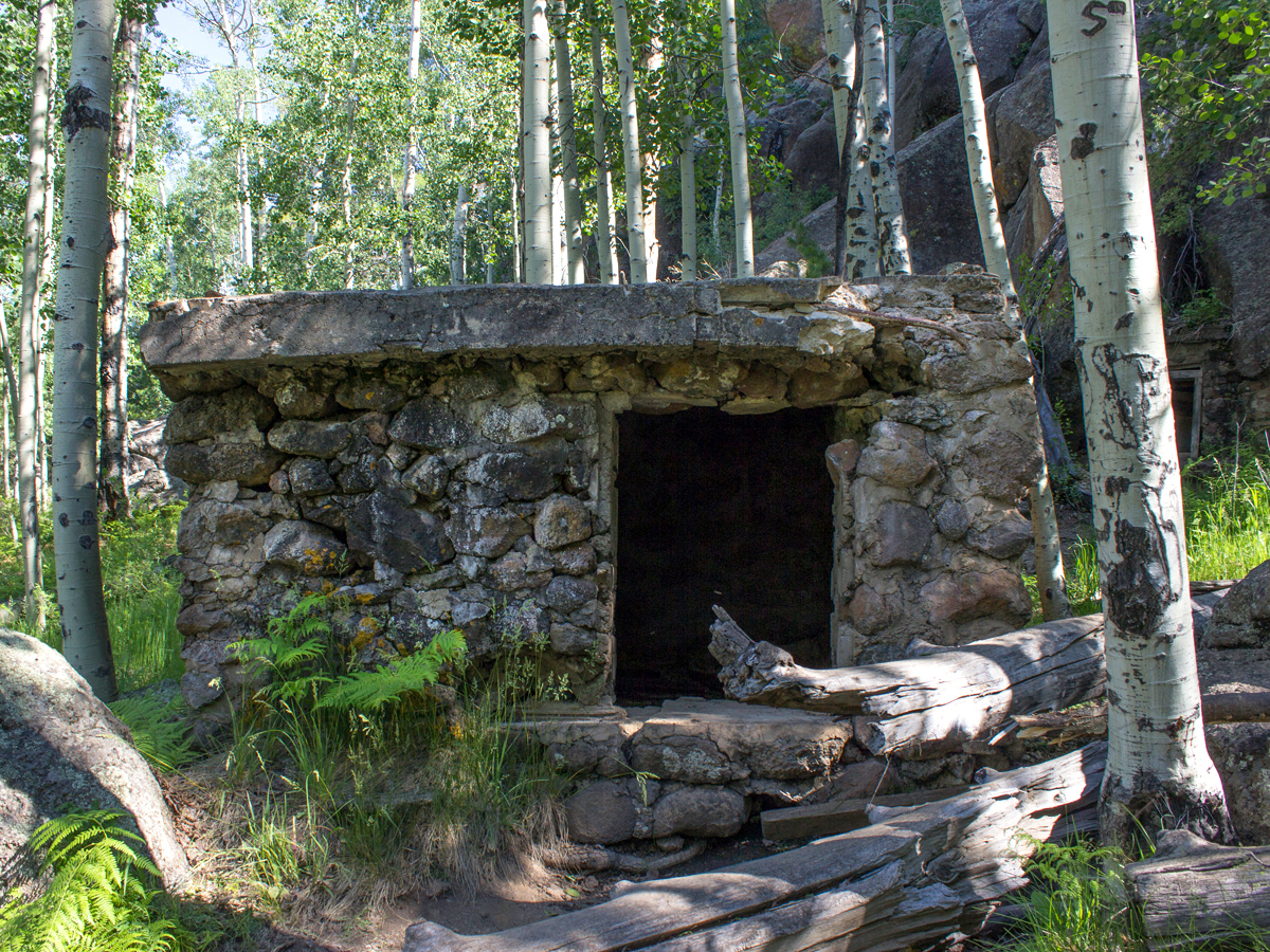 ★★★☆☆ Veit Springs Hiking Loop Trail / Flagstaff Area / 1.7 mile loop
This short little alpine hike is loaded with history and is a blast to explore. It passes Native American pictographs, early pioneer structures and a babbling spring.
Moderate Flagstaff Area Hikes
 ★★★★☆ Bear Jaw & Abineau Hiking Trail Loop / San Francisco Mountains / 6.8 mile loop
Just chillin’ in the shadow of Mount Humphreys, the upper tier of the Bear Jaw and Abineau Hiking Trail Loop sustains crisp patches of snow through late June. Even post thaw, the trail’s cool mountain air refreshes.
 ★★★★☆ Brookbank Hiking Trail / San Francisco Mountains / 3.7 miles
Ascend treelined slopes to a stunning inner meadow, on one of the Dry Lakes Hills area’s steepest trails. Pretty views over Flagstaff and Mount Elden blend with a patchwork of char left over from the 2019 Museum Fire.
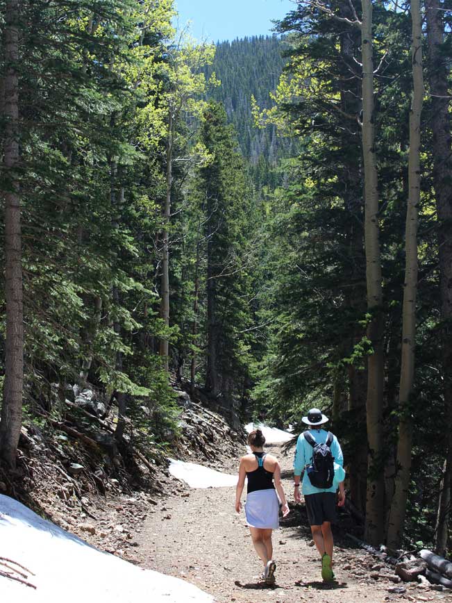
 ★★★★★ Inner Basin Hiking Trail / San Francisco Mountains / 3.9 miles
Stunningly beautiful, this trail is extra-ordinary. It’s filled with summer sunflowers, fairytale-esque groves of shimmering Aspens and a high-mountain meadow (where elk graze beside high-altitude runners in training).
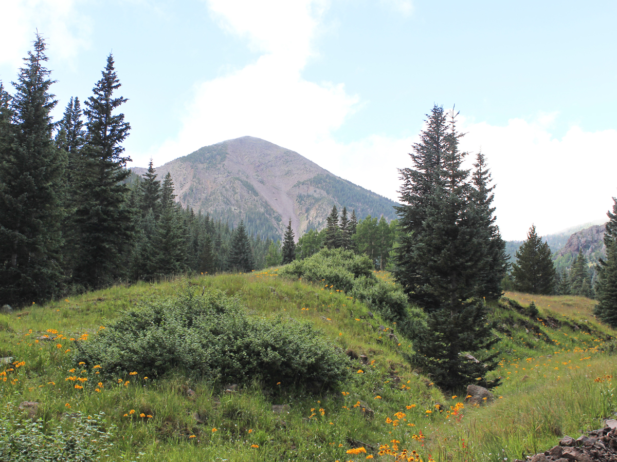
 ★★★★☆ Kendrick Hiking Trail / North of Flagstaff / 4.6 miles
This trail offers lots of elevation gain with very little pain! The trail’s hyper-long switchbacks allow a gentle climb to an impressively high summit, ending in “Wowza!” views.
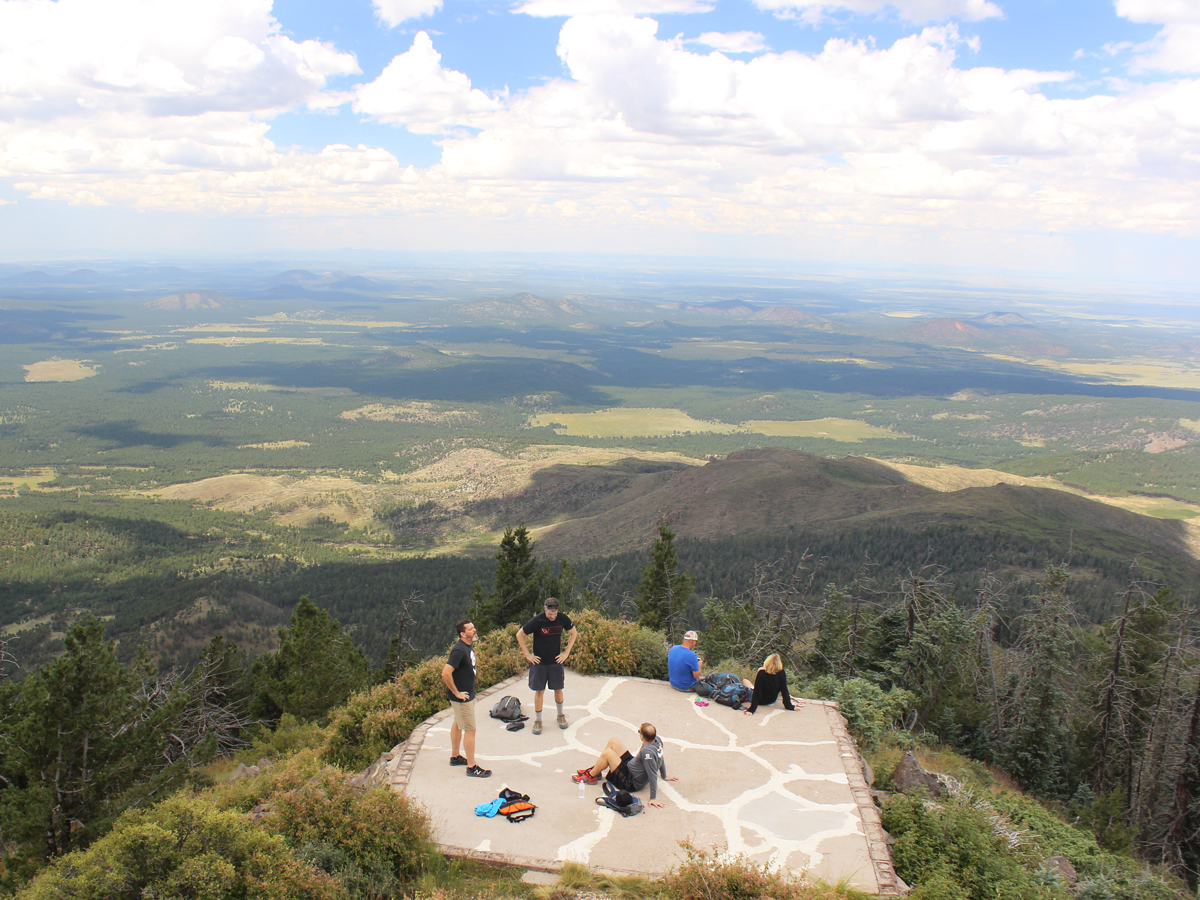
 ★★★★★ O’Leary Peak Hiking Trail / North of Flagstaff / 4.85 miles
Epic views of Sunset Crater earn this hike favorite status. Just 20 miles north of Flagstaff, it follows a primitive road to the top of a huge lava dome.
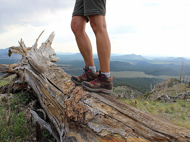 ★★★★★ Pumpkin Hiking Trail / North of Flagstaff / 4.8 miles
This back-door trail to Kendrick Peak crosses devastatingly beautiful hills. Fallen tree trunks, from a 2000 fire, line the trail like giant pick-up-sticks – offering a creepy-cool glimpse into the beauty of natural regeneration.
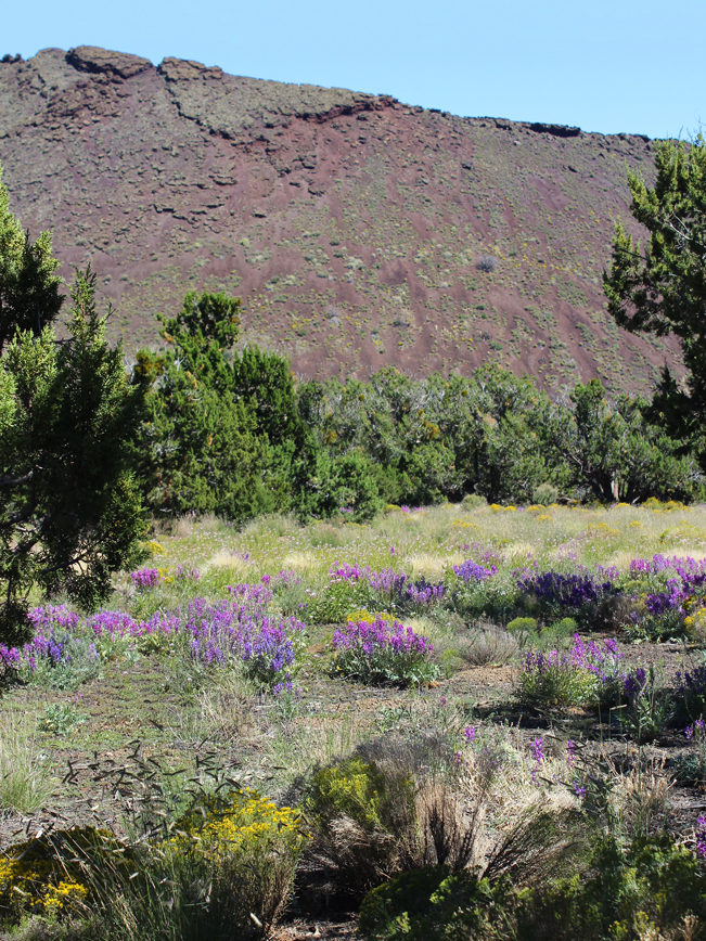 ★★★★☆ Strawberry Crater Hiking Trail Loop / North of Flagstaff / 2.2 mile loop
Black “sand” and killer views of the Painted Desert rock this exotic hike. Looping around an ancient volcanic cinder cone, this little-known trail crosses hills of granular black lava, frozen volcanic formations and stunning fields of flowers tucked in between.
Difficult Flagstaff Area Hikes
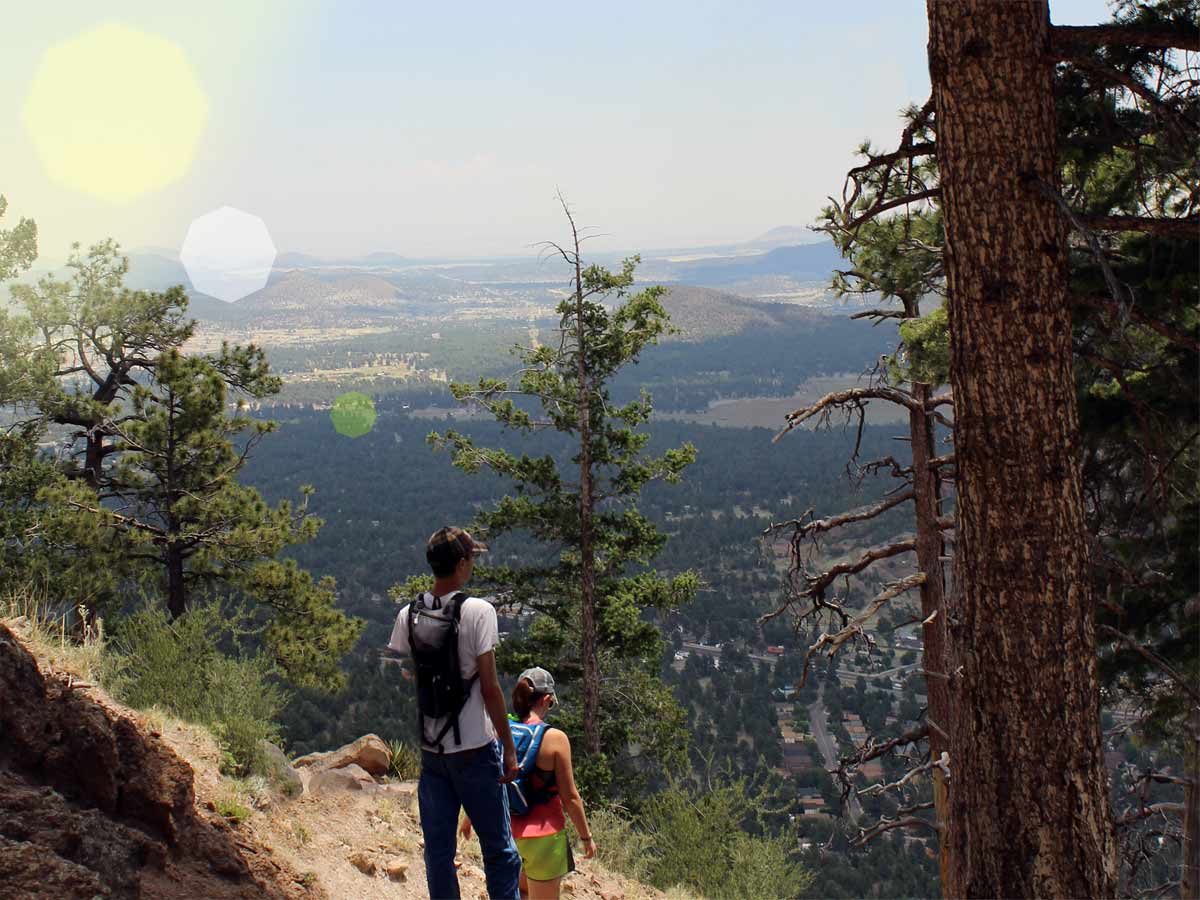 ★★★☆☆ Elden Lookout Hiking Trail / San Francisco Mountains / 3 miles
This cardio lovers dream hike makes a heart-pumping ascent up a series of tight, Ponderosa lined, switchbacks. The soaring views from the summit lookout tower make hikers feel like the King or Queen of the mountain.