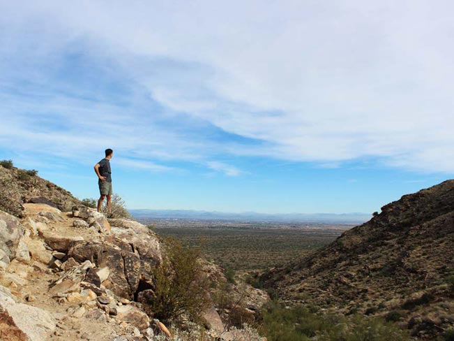
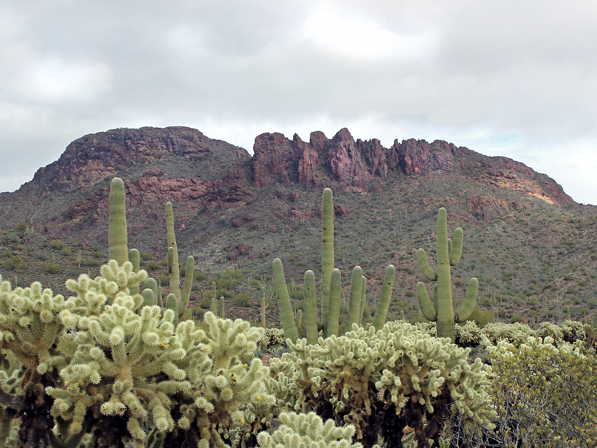
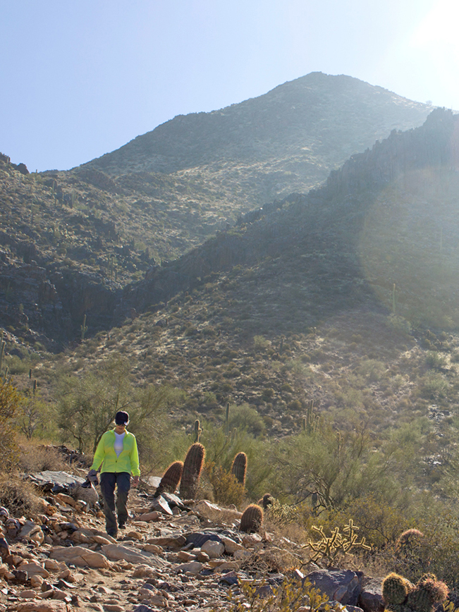
Surrounded by awe-inducing mountains, Phoenix is a hiker’s paradise …
(well … except in Summer, when the heat drives most sane hikers north). Hundreds of excellent Phoenix area hiking trails wind through the city and its surrounding ranges. To the east, the dramatic Superstition, San Tan and Usery Ranges offer ruggedly stunning hikes, replete with hoodoos, cliff views and caves. In the west, the Estrella and White Tank Mountains house undulating trails with minimal traffic. North of the city are the gorgeous McDowell Mountain, Spur Cross, Cave Creek and Sonoran Desert Preserves. While to the south, South Mountain is chock-a-block full of trails with hidden features and epic city views. Mileage noted below, is one way.
Scroll down to explore Phoenix Area hikes by region. Click hike names for full details.
Central Phoenix Area Hikes
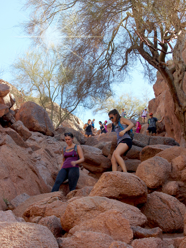
 ★★★★★ Cholla Hiking Trail, Camelback Mountain / Difficult / 1.5 miles
This challenging eastern approach climbs Phoenix’s defining mountain. Slightly longer than the Echo Canyon trail, it starts modestly, but ultimately morphs into a vertigo-inducing, narrow ridgeline, rock scramble at the top.
 ★★★★★ Echo Canyon Hiking Trail, Camelback Mountain / Difficult / 1.2 miles
Phoenix’s defining city hike! This immensely popular trail is short, but high up there on the challenge scale. Included are a steep rock scramble, boulder covered paths, and spectacular city views.
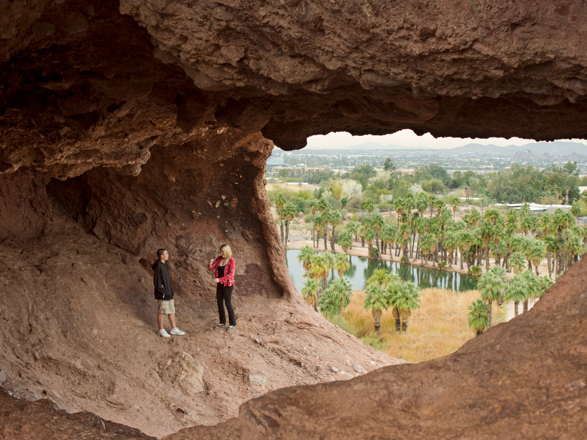 ★★☆☆☆ Hole in the Rock Hiking Trail Loop, Papago Park/ Easy / 0.31 miles
A super-short hike to a huge hole, in a huge rock, is perfect family fun! At just over a quarter mile long, this loop trail is both easy and surprisingly scenic.
 ★★☆☆☆ North Mountain National Hiking Trail / Moderate / 0.72 miles
From sunrise to sunset, this short, central city hike rocks! This urban trail offers a good workout, with locals hiking, running and pushing strollers up and down the paved pathway. At sunset, city views shimmer below.
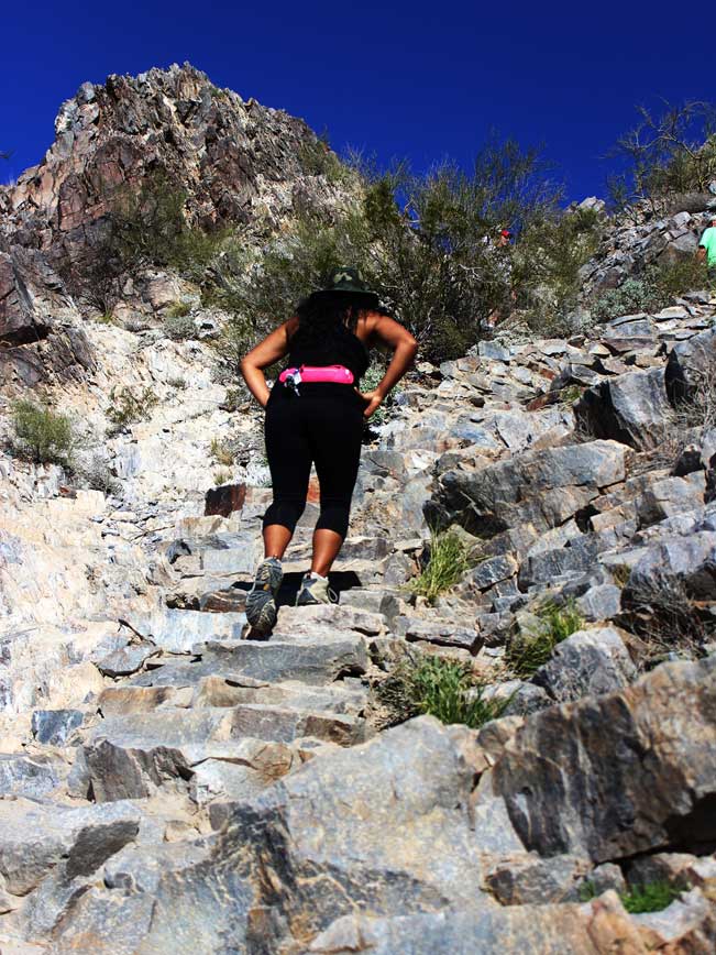 ★★★★☆ Piestewa Peak Summit Hiking Trail / Difficult / 1.2 miles
This urban “Stairway to Heaven” is a most popular city hike. Its central location, sweat inducing “stone steps”, and 360° views make it a go-to trail. At night, lights from hiker’s headlamps bounce up and down the slope.
East Phoenix Area Hikes
 ★★★☆☆ Ballantine Hiking Trail / Moderate / N. of Fountain Hills / 3.4 miles
Huge, upright boulders and a “sometimes” stream grace this NE Phoenix trail. Kicking off beside busy Beeline Highway, this trail curves into the mountains, leading to unexpected tranquility & tons of cool rock formations.
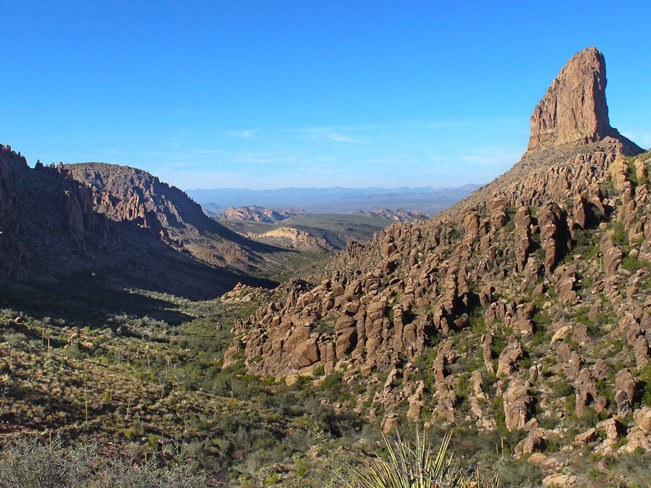
 ★★★★★ Black Mesa Hiking Loop / Moderate / Superstition Mountains / 10.41 mile loop
Weavers Needle plays hide and seek on this long, languid, stunningly beautiful loop, formed by the Dutchman’s, Black Mesa and Second Water trails. Enjoy pretty creek crossings and ethereal views.
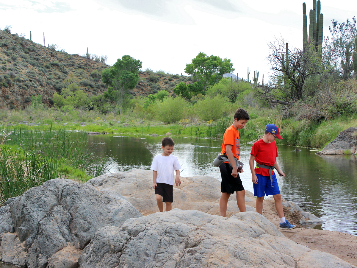
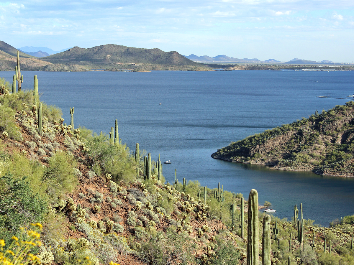
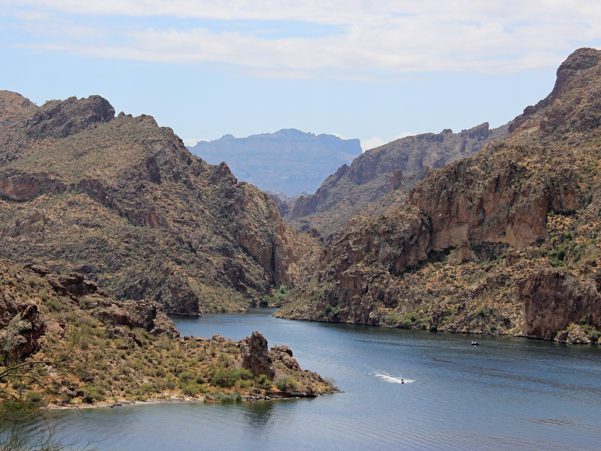 ★★★★★ Butcher Jones Hiking Trail / Moderate / Saguaro Lake / 2.5 miles
Skirting Saguaro Lake, a stunningly beautiful desert gem, this trail crosses a sandy beach, intimate reed lined coves and high pinnacles with breathtaking views.
 ★★★☆☆ Hieroglyphics Hiking Trail / Easy / Superstition Mountains / 1.2 miles
Ancient hieroglyphics and pools of blue water sit before endless vistas, at the end of this short hike. Ascending to the cradle of a vast canyon, this trail leads to one of the Superstition Mountain’s most uniquely beautiful spots.
 ★★★☆☆ Pass Mountain Hiking Trail Loop / Moderate / Usery Park / 7.5 miles
Choice views, varied terrain and a high traverse make this trail totally worthy! Scrunched between the Superstition & Mazatzal Ranges, this sweet 7.5-mile loop offers excellent views as it circles Usery Park’s main peak.
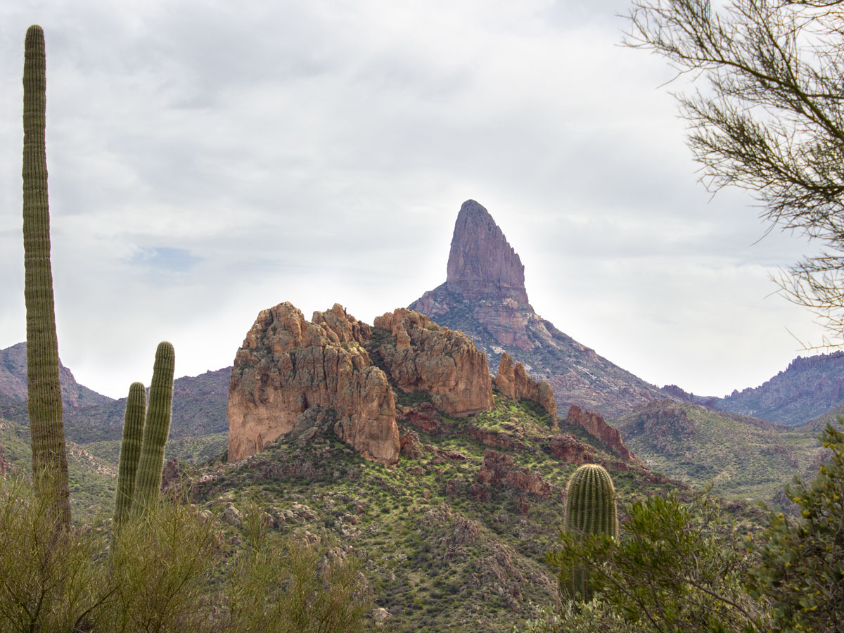
 ★★★★★ Peralta Hiking Trail to Freemont Saddle / Moderate / Superstition Mountains / 2.45 miles
A stone skyscraper, taller than the Chrysler Building, is the star of this ruggedly beautiful trail. Slicing diagonally across the Superstitions, this trail crosses a deep valley, ascending to Instagram-worthy views Weavers Needle.
 ★★★☆☆ Picketpost Hiking Trail / Difficult / Superior / 2.5 miles
If butt-kicking scrambles up rocky ravines are your thing, this hike is for you! A deceptively easy approach quickly morphs into a rugged scramble. The payoff is some of the best 360° views around!
 ★★★★☆ San Tan Hiking Trail Loop / Easy / San Tan Regional Park / 7.5 mile loop
Spectacular Southwestern scenery goes on for miles on this level loop hike! Circling the desert floor, between the Malpais and Goldmine Mountains, this mostly-flat trail offers big views, but requires minimal up & down hiking.
 ★★★★★ Siphon Draw Hiking Trail to Flatiron Mesa / Difficult / Superstition Mountains / 3 miles
Breathtaking views, from the bow of this immense “granite ship,” reward hikers for the butt-kicking scramble up. Nestled into a deep canyon, this hike starts with a deceptively easy preamble to a steep climb.
 ★★★★☆ Treasure Loop Trail / Moderate / Superstition Mountains / 2.4 miles
This short, family-friendly loop winds around the huge rock formations at the base of the Superstition Mountains. Ginormous boulders the top are a blast to explore.
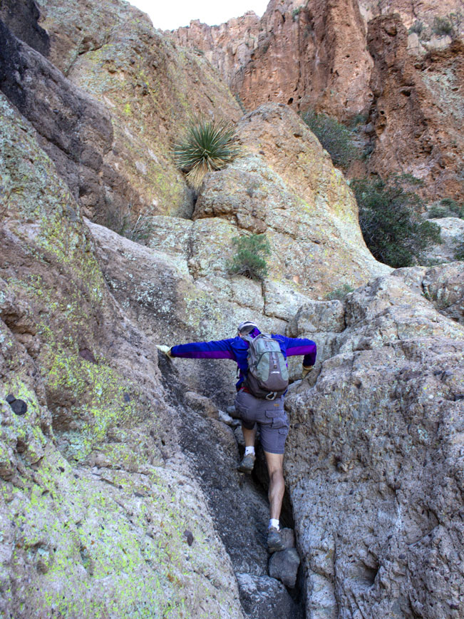
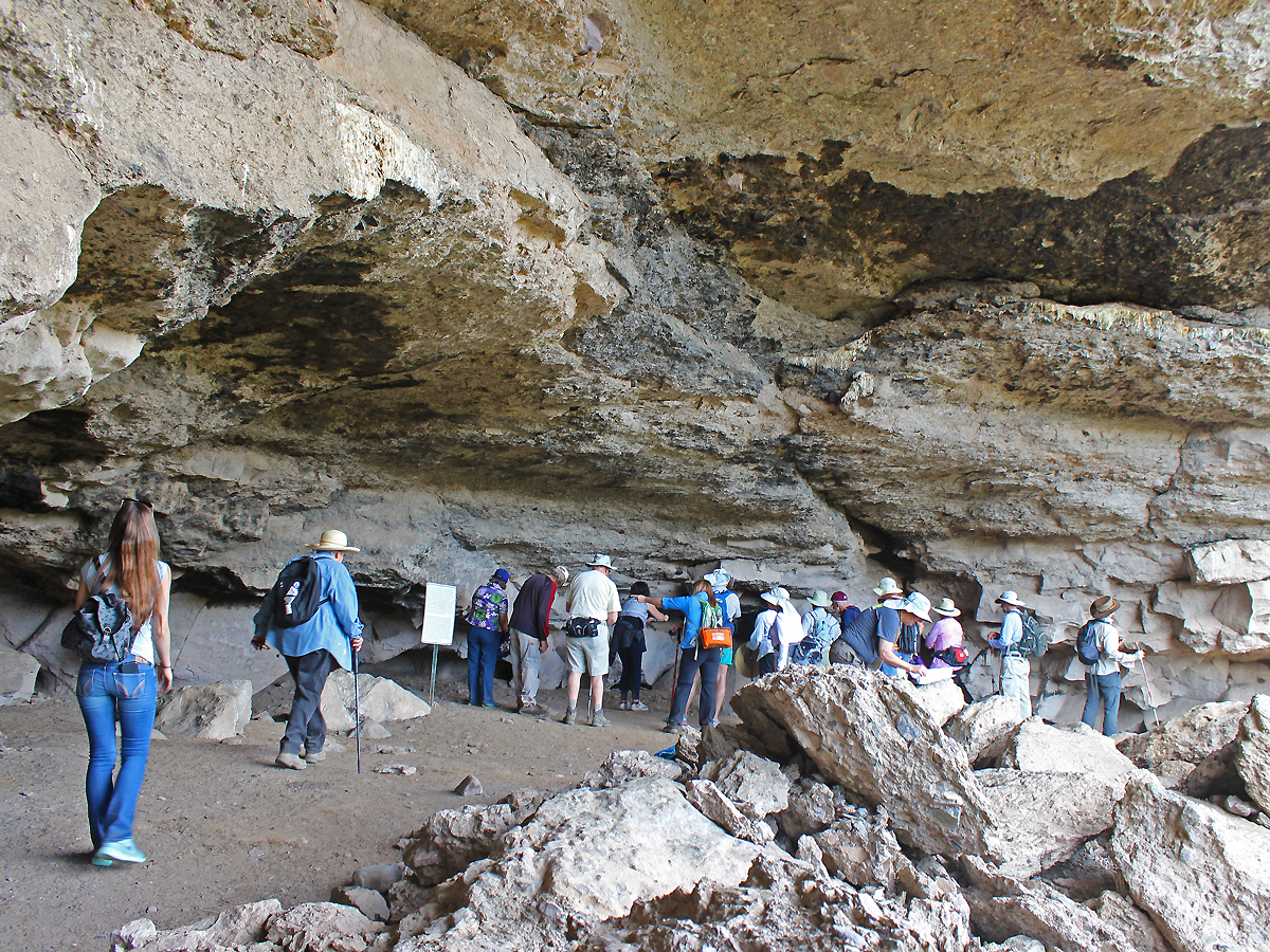
 ★★★★☆ Wave Cave Hiking Trail / Moderate / Superstition Mountains / 1.75 miles
Cowabunga! “Surf” a huge stone wave tucked into the side of the Superstition Mountains. This short trail leads to a gapping cavern, rimmed with an oversized wave-like formation.
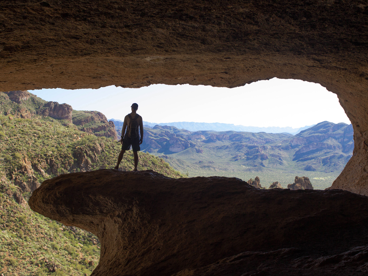
 ★★★☆☆ Wind Cave Hiking Trail / Moderate / Usery Park / 1.5 miles
A sky-high cave rests atop neon-greens cliffs at the top of this desert trail. Lichen encrusted cliffs are pockmarked with mini-caves on the way up to this cliff-top veranda.
West Phoenix Area Hikes
 ★★★★☆ Goat Camp Hiking Trail / Difficult / White Tank Mountains / 6.3 miles
Mashing up long easy sections and short steep hills, this trail winds deep into the gorgeous White Tank Mountains and leads to outstanding West Valley views.
 ★★★☆☆ Mesquite Canyon Hiking Trail / Moderate / White Tank Mountains / 5 miles
This lovely rambling trail, offers lots of solitude and awesome west valley views. Expect to pass an occasional horseback riders also out enjoying the tranquil beauty of this trail.
 ★☆☆☆☆ Rainbow Valley and Toothaker Hiking Trail Loop / Easy / Estrella Mountains / 6.2 mile loop
Winding through a series of interconnected valleys, this loop is “nice & easy.” Wide, mildly inclined paths span long desert stretches, sandy arroyos and hillside rambles. Distant views of the White Tanks frame the horizon.
 ★★★★☆ Waterfall Hiking Trail / Easy / White Tank Mountains / 0.9 miles
Abundant Native American hieroglyphics and a hidden waterfall are just two of the awesome, squeal-inducing features of this easy, educational trail. At less than one mile long, it’s a perfect family hike.
North Phoenix Area Hikes
 ★★★★☆ Bell Pass Hiking Trail / Difficult / McDowell Sonoran Preserve / 4.7 miles
This beautiful trail ascends a pass between the McDowell Mountains two highest peaks. Instagram-worthy views abound on both sides of the mountains.
 ★★★★☆ Black Mountain Hiking Trail / Difficult / Cave Creek / 1.25 mile
This short, butt-kicking hike ascends a craggy slate trail and pays off with epic north valley views! It’s a solid alternative to crowded Piestewa Peak or Echo Canyon trails.
 ★★★☆☆ Cave Creek Cave Hike / Easy / Cave Creek / 1 mile
Hey History Buffs, the unique Cave Creek Cave hike is taylor made for you! Guided hikes lead to the historically significant cave that the creek and town were named for.
 ★★★☆☆ Dixie Mountain Hiking Loop / Moderate / Phoenix Sonoran Preserve / 4.2 mile loop
Pretty views, an owl’s nest and a rusted out car are fun features of this neighborhood hike, where suburbs are replaced by pretty, rolling desert hills.
 ★★★☆☆ Elephant Mountain Hiking Trail Loop / Difficult / Spur Cross Recreational Area / 5.4 mile loop
Get your hiking “Om” on – on this tranquil trail. Just a stones throw from Cave Creek’s rowdy saloon-style cafes, this quiet loop trail winds through a pristine conservation area full of tall buttes and deep arroyos.
 ★★★☆☆ Gateway Hiking Trail Loop / Moderate / McDowell Mountains / 4.5 mile loop
Hikers flock to this McDowell Mtn. foothill loop, like kids to an ice cream truck. It offers a perfect location, length and scenery, as well as opening onto many of the preserve’s other fantastic trails.
 ★★★★☆ Go John Hiking Trail Loop / Moderate / Cave Creek Regional Park / 5.8 mile loop
Unobstructed views and blissful tranquility are hidden just north of Phoenix. This trail, in the rolling hills of Cave Creek Regional Park, turns its back on the suburbs, and offers undulating hills, long views and hypnotic tranquility.
 ★★★★☆ Jewel of the Creek & Dragonfly Hiking Trail Loop / Easy / Jewel of the Creek Preserve / 2 mile loop
Dragonflies by a pond, wood-plank creek crossings and a kid-sized cave are some of the fun features on this easy, hike around the lush green banks of Cave Creek.
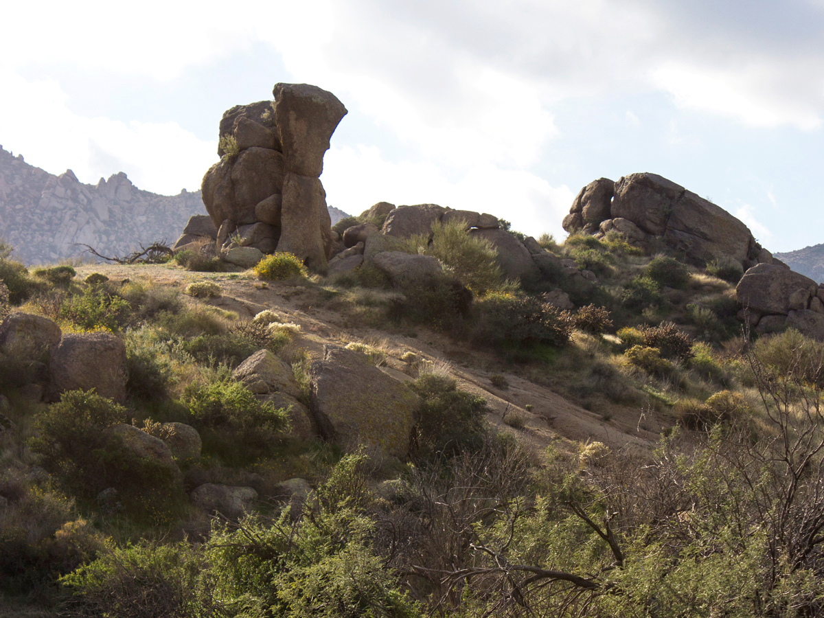 ★★★★☆ Marcus Landslide Hiking Trail / Easy / McDowell Mountain Preserve / 1.85 miles
Easy, but dramatically beautiful… this hike’s otherworldly rock formations and intriguing geology are custom-made for a mellow day of outdoor exploring!
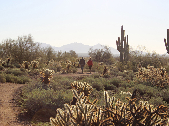 ★★★☆☆ Ocotillo, Apache Wash, Sidewinder Loop / Easy / North Phoenix / 1.95 miles
Escape Phoenix’s northern ‘burbs on this family-friendly loop hike. A blend of three short, easy sections of Phoenix Sonoran Preserve trails. Bonus, may include morning and evening hot air balloons sightings during cooler months.
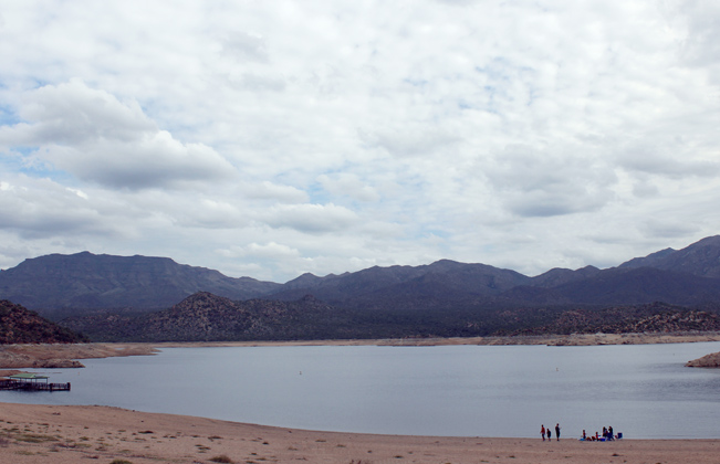 ★★☆☆☆ Palo Verde Hiking Trail / Moderate / Bartlett Lake / 3.8 miles
For a perfect day at the lake, picnicking, sunbathing and hiking this lakeside trail can’t be beat. Enjoy the trail’s ample water views, gentle hills, abundant bird life and lush Springtime flowers.
 ★★★★☆ Pinnacle Peak Hiking Trail / Moderate / North Scottsdale / 1.75 miles
If a hiking trail can be “posh” this is the trail! Rising above a sea of emerald golf courses, this tony hike features curvilinear boulders, well manicured paths and lavish views.
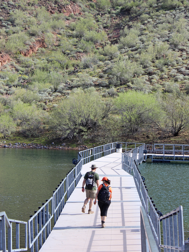 ★★★★☆ Pipeline Canyon Hiking Trail / Easy to Moderate / Lake Pleasant / 2 miles
A floating bridge crosses crystal clear water, in one of Lake Pleasant’s intimate coves. Rambling along quiet hillsides, this hike leads to a special location where wild burros and ducks are seen regularly.
 ★★★☆☆ Quartz Hiking Trail Loop / Moderate / Cave Creek Recreational Area / 4 mile loop
Glittering white quartz is scattered like oversized breadcrumbs over and around this trail. As a bonus, a jaw-droppingly large outcropping is a radically fun feature.
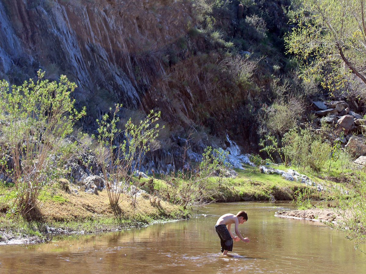 ★★★☆☆ Rock Springs Spur Trail to Aqua Fria River Crossing / Moderate / Black Canyon City / 1.4 miles
Wade in a gentle creek, or relax on a wide stone beach, outside Black Canyon City. This trail leads to a bend in the refreshingly cool Aqua Fria River, perfect for splashing in or across.
 ★★★☆☆ Sears Kay Ruins Hiking Trail Loop / Moderate / Cave Creek / 1.1 mile loop
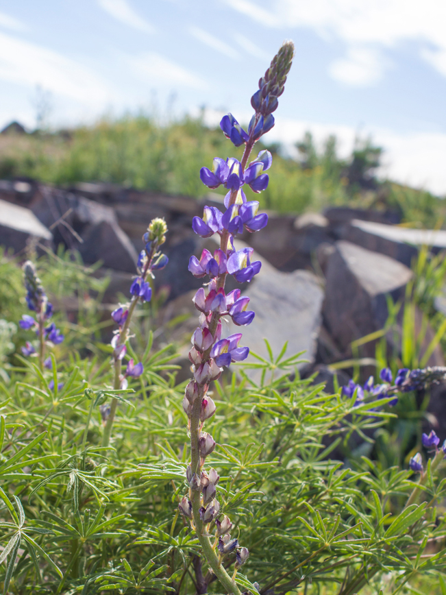
Ancient Hohokum ruins, and long Bartlett Lake views, grace the top of a windswept bluff on this short loop hike. Expect lots of pretty wildflowers in spring.
 ★★★☆☆ Sidewinder, Ridgeback, Ocotillo Hiking Trail Loop / Moderate / Phoenix Sonoran Preserve / 4.56 mile loop
Nab a quick escape from Phoenix’s northern ‘burbs on this pretty combo trail loop. Bonus! Elongated 360° views, plus the likelihood of hot air balloons floating nearby.
 ★★★★☆ Sunrise Hiking Trail to Sunrise Peak / Moderate / McDowell Mountain Preserve / 2 miles
Fantabulous 360° views await at the top of this lofty peak! Tucked into a gorgeous McDowell Mountain valley, this trail is less trafficked than its northern sister-hikes.
 ★★★★☆ Thompson Peak Hiking Trail / Difficult / McDowell Mountains / 5 miles
A grinding slog, up a patchwork road, leads to one of the areas highest peaks. Situated in the less populous, east side of the range, this trail makes a relentless climb to outstanding 360° views!
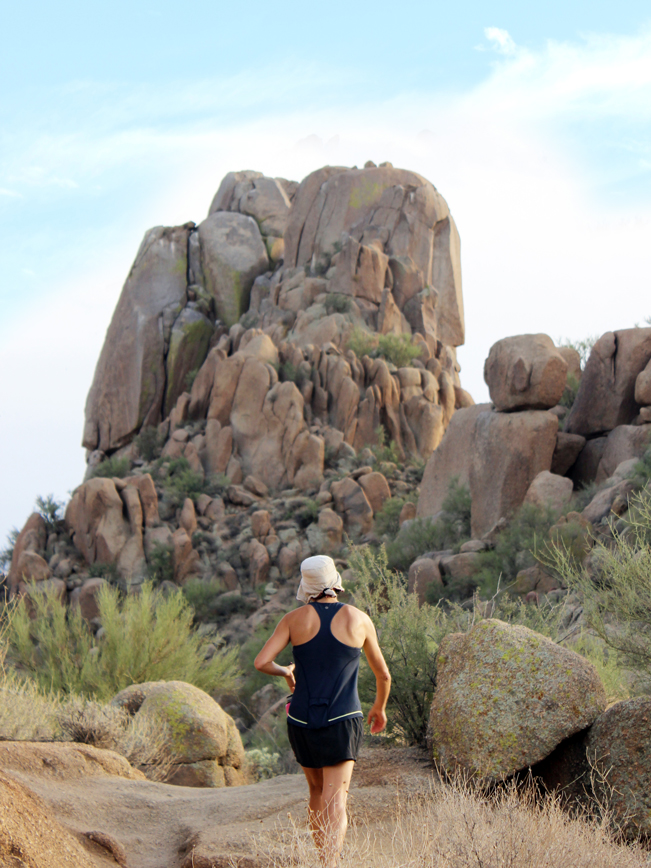
 ★★★★★ Tom’s Thumb Hiking Trail, Northeast / Moderate to Difficult / McDowell Mountains / 2.15 miles
This gorgeous hike, to a 14-story stone tower, is lined with monolithic, curvilinear boulders and amazing hundred-mile views. Its sensuous beauty astounds.
 ★★★★☆ Vulture Peak Hiking Trail / Moderate / Wickenburg / 2 miles
Get spoiled with amazingly unspoiled views from a high saddle! Less than 1-hour NW of Phoenix, this hike ascends to a narrow break between jagged cliffs and endless views of pristine desert.
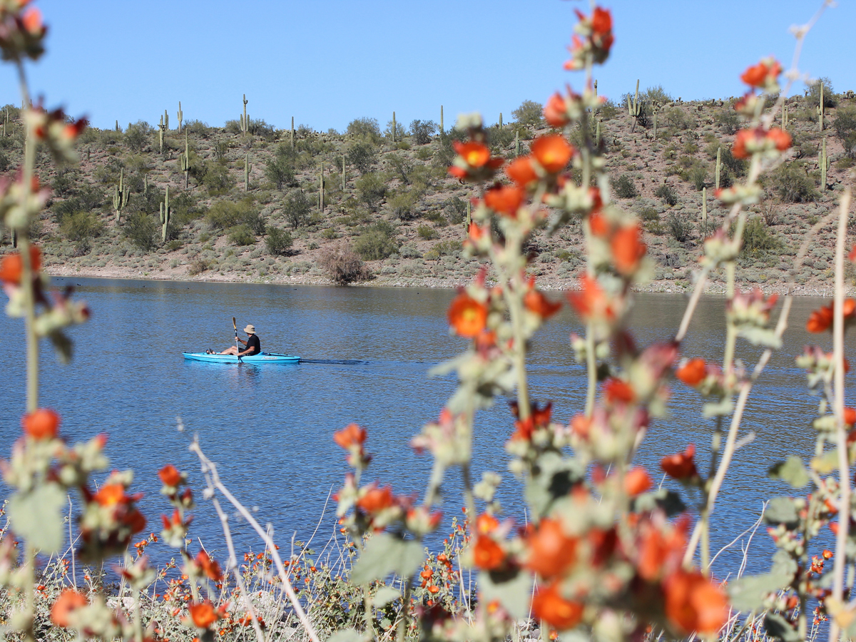 ★★★☆☆ Wild Burro Hiking Trail / Easy / Lake Pleasant / 2 miles
Enjoy a scenic stroll around Lake Pleasant’s intimate, blue coves. This hike teems with Spring wildflowers & views of boats frolicking on the water year round. The possibility of a wild burro sighting is high!
 ★★★★☆ Windgate Pass Hiking Trail / Moderate / N. Scottsdale / 4.5 miles
With long views & great mix of moderate & easy sections, this trail is anything but boring! It first climbs to gorgeous Inspiration Point, with excellent views over the N. Scottsdale, then continues to Windgate Pass.
 ★★★★☆ Yavapai Point Hiking Trail / Moderate / Lake Pleasant / 1.5 miles
Soak in epic water views and lakefront breezes at the top of this trail. Watching the sailboats waft across the lake, it’s easy to forget that Phoenix is only a few miles away.
South Phoenix Area Hikes
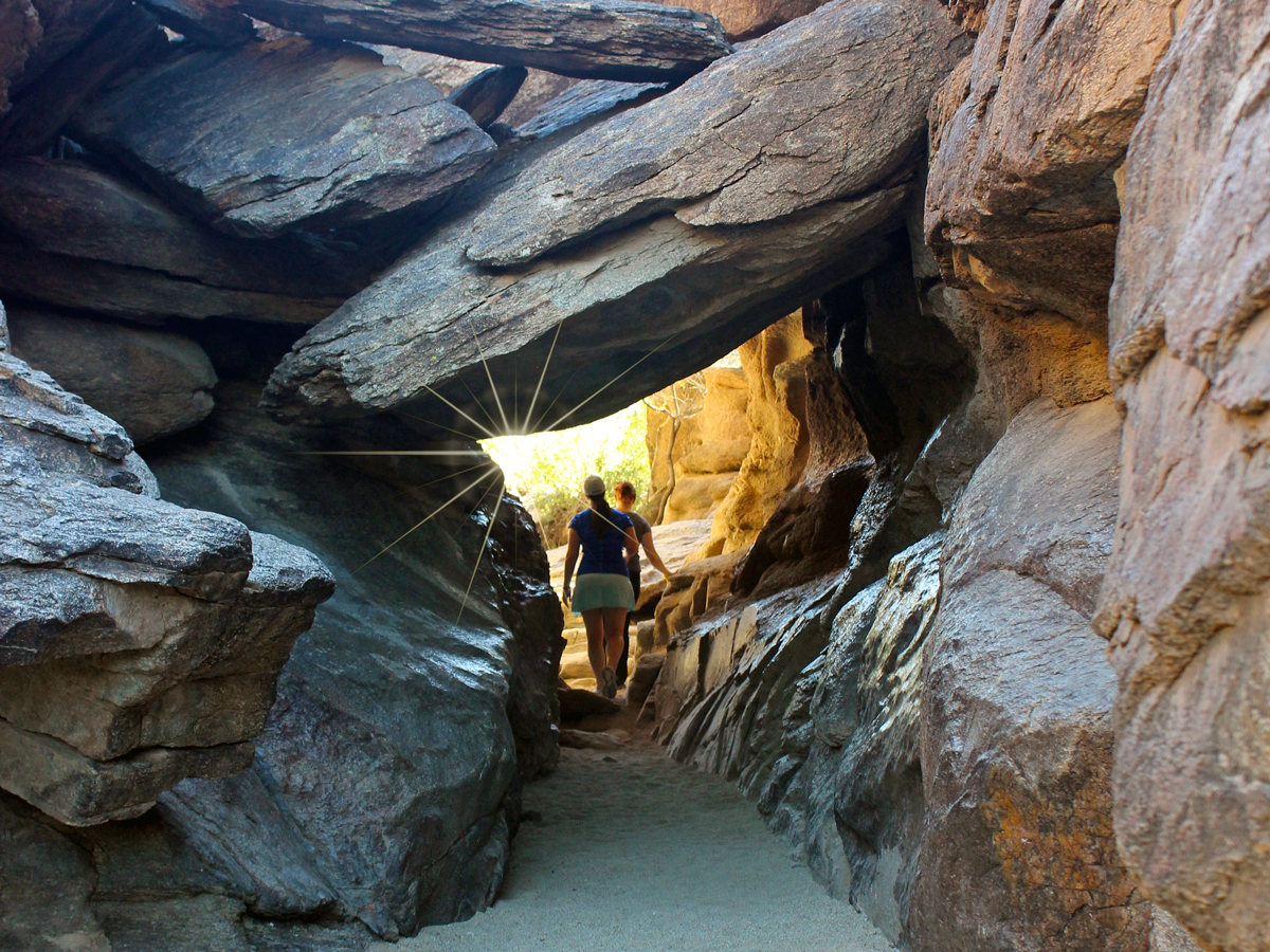 ★★★★☆ Hidden Valley via Mormon Hiking Trail / Moderate / South Mountain / 1.95 miles
Hidden Valley’s mini-slot canyon and long stone tunnel are hyper-fun to explore! Accessible via the Mormon Hiking Trail, these secluded wonders have hikers squishing through, climbing over or walking under them.
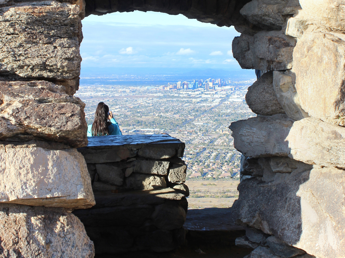 ★★★☆☆ Holbert Hiking Trail to Dobbins Lookout / Moderate / South Mountain / 2.55 miles
Hands down, the best views of the Phoenix skyline are from Dobbins Lookout, at the top of this beautiful trail. Here arched windows frame “Wizard of Oz” like views.
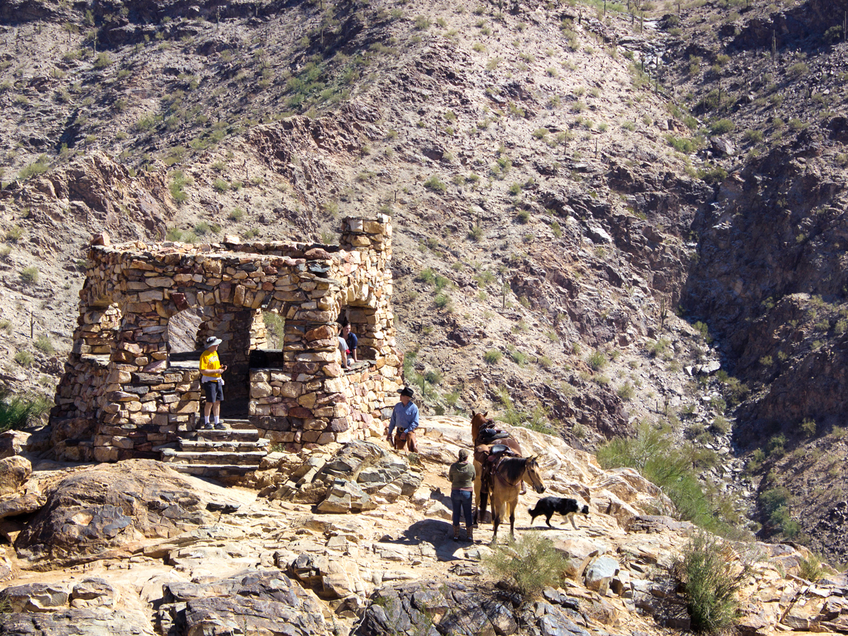 ★★★☆☆ Kiwanis Hiking Trail to Telegraph Lookout / Easy / South Mountain / 1.25 miles
Meandering up a pretty valley this hike is family-perfect! Near the top, Telegraph Pass Lookout offers awesome north & south valley views.
Leave a Reply