People fly around the globe to experience the awe-inspiring majesty of the Grand Canyon. Trails, both in the National Parks and other sections of the canyon, range from easy, flat rim hikes to challenging descents (followed by their strenuous uphill returns). The canyon is best hiked during spring or fall. In winter it is blanketed in snow and ice. And summer brings temperatures as high as 120 degrees at the base. The areas surrounding the canyon are also full of beautifully dramatic hikes, worth taking the time to explore. Mileage noted below, is one way.
Scroll down to explore both Grand Canyon and Grand Canyon area hikes. Click hike names for full details.
Easy Grand Canyon Hikes
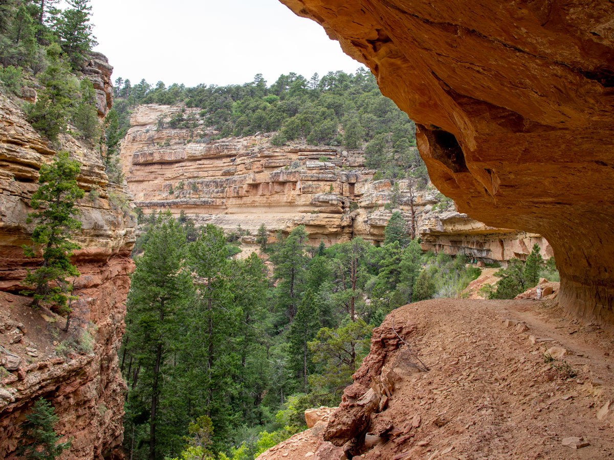 ★★★★☆ Cliff Springs Hiking Trail / Grand Canyon North Rim / Easy / 0.75 miles
See ancient ruins, upside down plants and a dripping spring on this pretty hike. The trail gently descends an intimate ravine at the top of the canyon. Along the way a number of natural treasures are revealed … one-by-one.
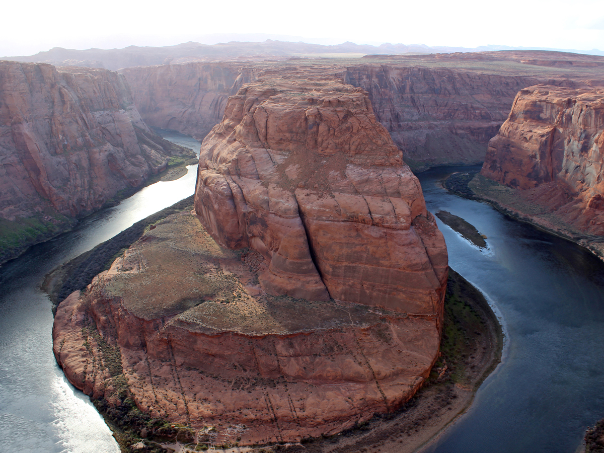 ★★★★☆ Horseshoe Bend Hiking Trail / Page / Easy / 0.75 miles
Enormous cliffs tower over the Colorado River, as it makes a hairpin turn around Horseshoe Bend. This short, blustery hike leads to Lookout Point, where views from a 1000′ high, heart-palpitating rim boggle the mind!
 ★★★☆☆ Widforss Hiking Trail / North Rim / Easy / 4.8 miles
Insanely good views are a prime feature on this easy, shaded trail! Following the rim of The Transept Canyon, you’ll find endless canyon views, stunning rock formations and seasonal wildflowers.
Difficult Grand Canyon Hikes
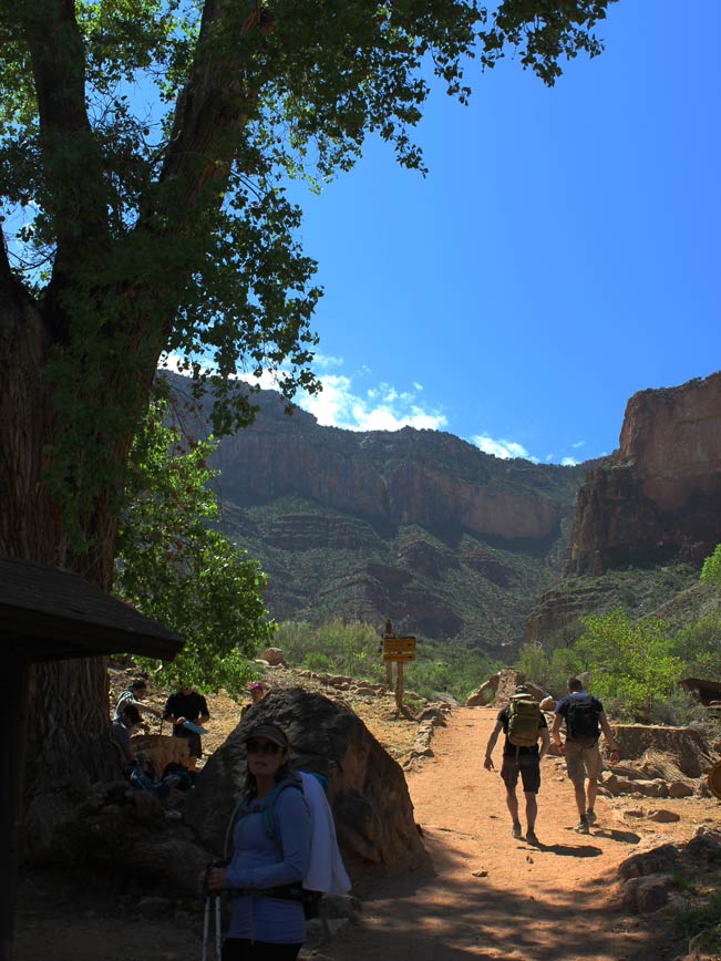 ★★★★★ Bright Angel Hiking Trail to Indian Gardens / South Rim / Difficult / 4.5 miles
This quintessential Grand Canyon’s hike descends 4.5-miles to a lush green oasis. Indian Gardens, on the canyon’s middle plateau, features a babbling brook and leafy trees perfect for resting and recuperating under.
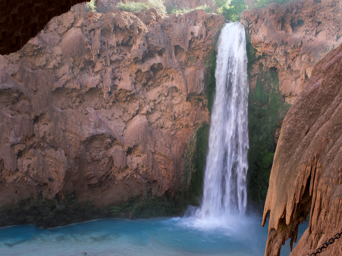
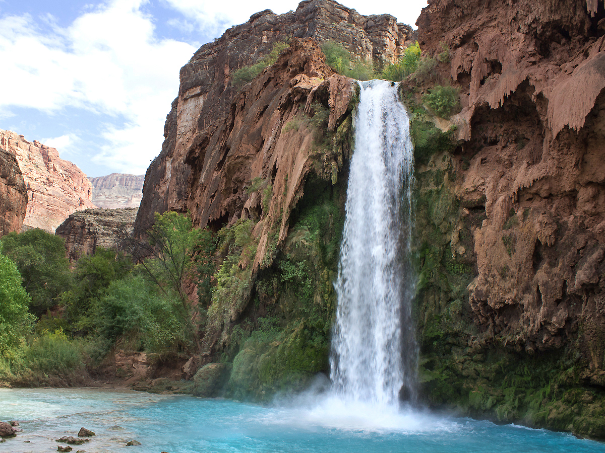 ★★★★★ Havasu Falls Hiking Trail / Difficult then easy / 10 miles
Turquoise blue water and a 100′ waterfall make Havasu Falls one of Arizona’s most spectacular places. This trail descends a remote canyon to a magical land of icy blue water, roaring falls, and 1,000′ canyon walls.
 ★★★★★ Havasu Falls Hiking Trail to Mooney & Beaver Falls and Colorado River / Difficult then Moderate / 8 miles
Continuing 8 miles past Havasu Falls this canyon trail reaches Mooney & Beaver Falls. Finally the trail, creek and canyon end at the mighty Colorado River.
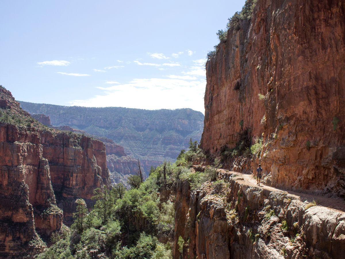 ★★★★★ North Kaibab Hiking Trail to Roaring Springs / North Rim / Difficult / 4.7 miles
The N. Kaibab’s first five miles provide one of the most awe-inspiring day hikes into the Grand Canyon! The trail passes stunning overlooks, a stone tunnel, dizzying ridge and waterfall on the steep descent to Roaring Springs.
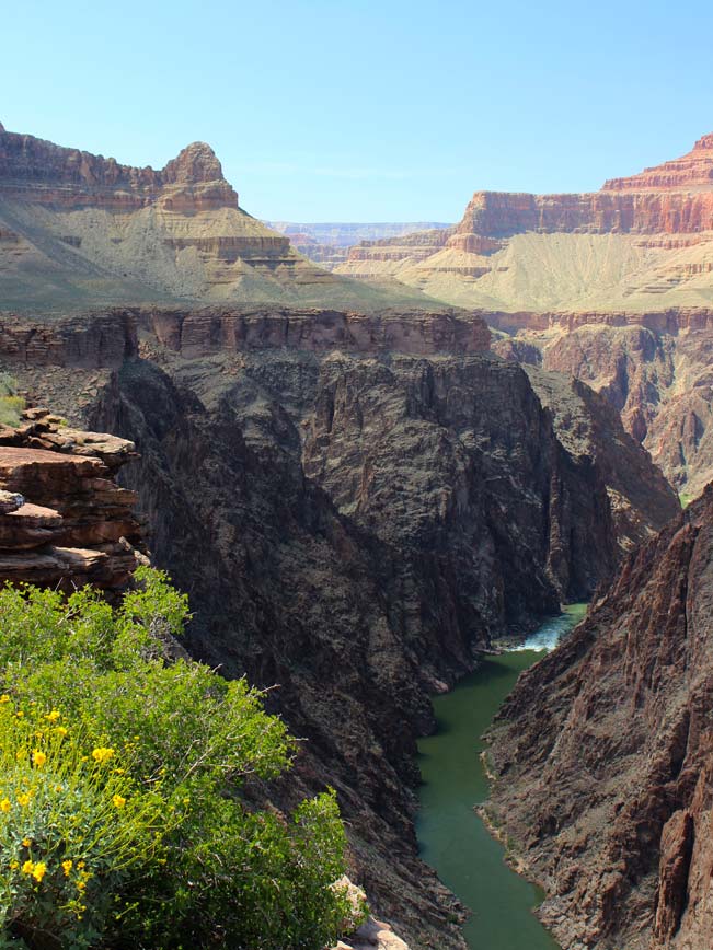 ★★★★★ Plateau Point Hiking Trail / South Rim / Easy (following Bright Angel descent) / 1.5 miles
Seeing the Colorado River roaring 1,300′ below this stone overlook, is utterly amazing! Enveloped in towering views of technicolor cliffs, this spur trail from Indian Gardens is bucket-list worthy.
Easy Grand Canyon Area Hikes
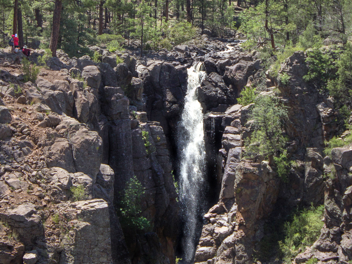 ★★★★☆ Sycamore Rim Hiking Trail Loop / Easy / 1 to 4 mile sections or 11 mile loop
Each snippet of this trail is stunningly beautiful! With five trailheads to pick from, it’s a breeze to hike just 1 or 2-miles, or the full 11-mile loop. Either way there are jaw-droppingly good views, seasonal falls and wildflowers.
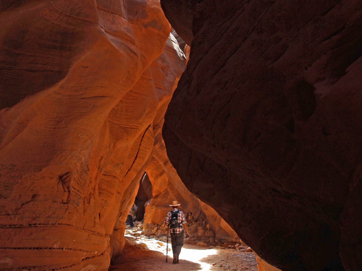 ★★★★★ Wire Pass to Buckskin Gulch Hiking Trails / E. of Kanab, Utah / Easy / 1.75 – 13.5 miles
One of the longest, deepest, and most stunning, slot canyons in the world, can be accessed by hiking Wire Pass to Buckskin Gulch. Both trails sit just north of the Arizona border and are beyond-words beautiful!
Moderate Grand Canyon Area Hikes
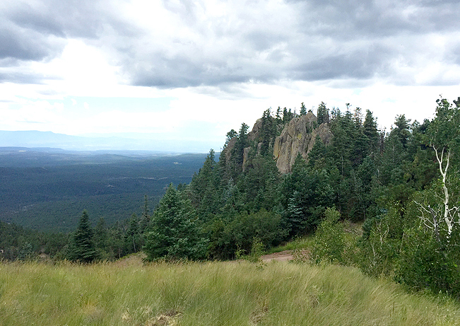 ★★★☆☆ Bill Williams Hiking Trail / Williams / Moderate / 3.85 miles
On the outskirts of the charming western town, Williams, this hike up the namesake mountain, has surprisingly varied terrain. It gradually transforms from arid to lush (with ferns & moss) as it ascends. Summit views are expansive.
Leave a Reply