Bordering central Arizona’s dramatic Mogollon Rim, hikes in the Payson area (as well as Pine, Strawberry and Heber-Overgaard) are surprisingly lush. Trails in this temperate region ascend pine filled slopes, hop-scotch babbling streams and reveal cold, clear springs and hidden waterfalls. Atop the dramatic Mogollon rim, intimate lakes are plentiful and astounding views stretch for hundreds-of-miles, from rim to horizon. Mileage noted below, is one way.
Scroll down to explore Payson area hikes by difficulty. Click hike names for full details.
Easy Payson Area Hikes
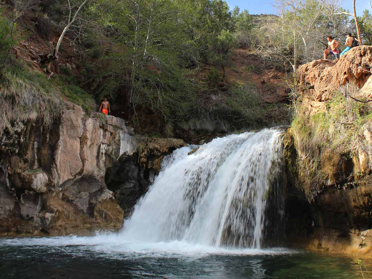 ★★★☆☆ Fossil Creek, Waterfall Hiking Trail / East of Camp Verde / 1.2 miles
Blink your eyes (on this crazy short hike) and you’ll have arrived in paradise! A gushing waterfall and turquoise blue pools at the end of this trail are feasts for the senses. Frolicking in these deliciously icy waters is incredible.
 ★★★☆☆ Horton Creek Hiking Trail / East of Payson / 3.5 miles
Like Mother Nature’s “water cooler”, Horton Spring gushes cold, crystal-clear water and chilly air year-round. This trail follows Horton Creek to its fresh water source. A touch of bliss during Arizona’s hot Summers.
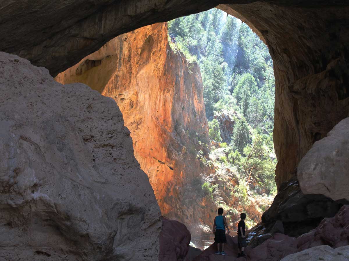 ★★★★☆ Pine & Gowan Hiking Trail Loop, Tonto Natural Bridge / South of Pine / 0.92 mile loop
Shiver and squeal, as ice cold droplets fall from the 14-story-high natural bridge overhead! This short loop hike mashes-up an exhilarating blend of desert, creek, cave and waterfall fun.
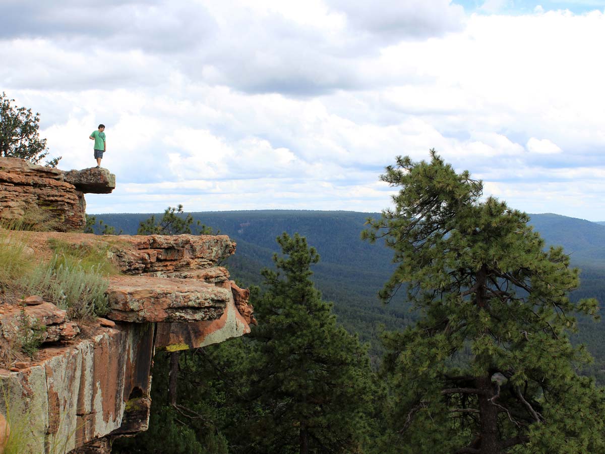 ★★☆☆☆ Rim Lakes Vista Hiking Trail / Mogollon Rim / 3.5 miles
You might wonder if you’ve been plopped inside an gigantic viewfinder on this incredibly scenic, easy rim trail. Flashback-worthy views span for hundreds of miles – from rim to horizon.
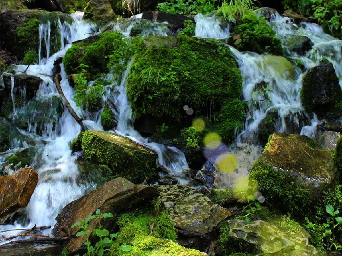
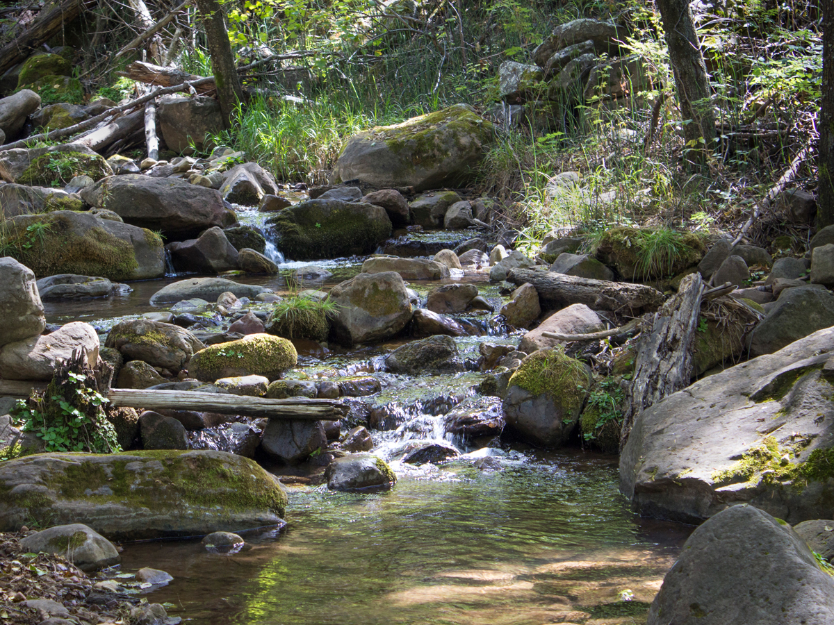
 ★★★☆☆ See Spring Hiking Trail / Christopher Creek / 1.5 miles
Explore a babbling creek and gushing springs on this shady, family-friendly hike. The trail criss-crosses lush Christopher Creek and leads to a series of cascading springs on the base of the Mogollon Rim.
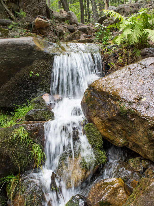
 ★★★★★ Water Wheel Hiking Trail / Easy / North of Payson / 1.6 miles
This short hike ends at a gushing cascade and icy swimming hole. Along its rustic river pathway, it passes dramatic waterfalls and deep gorges.
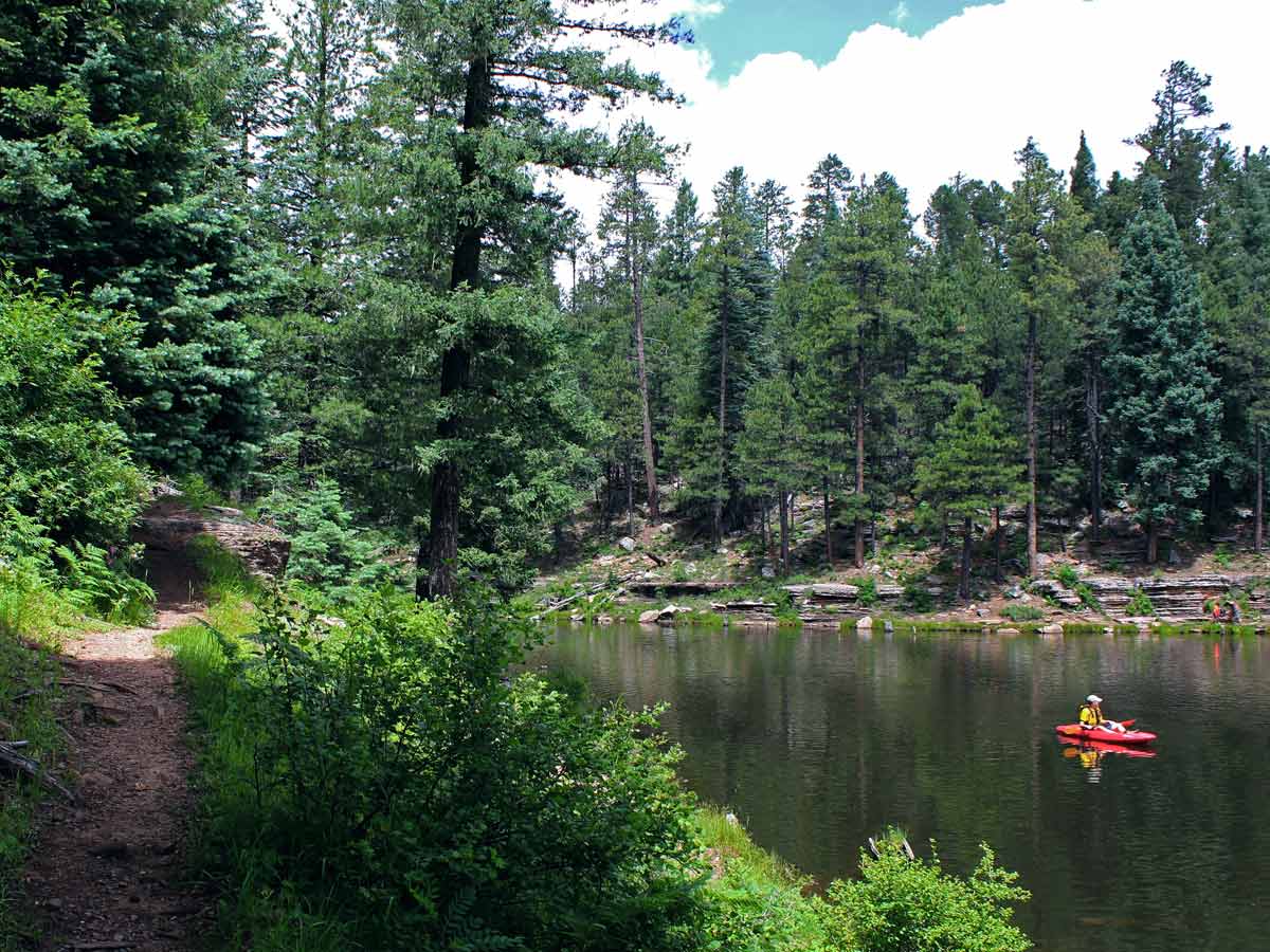 ★★★☆☆ Woods Canyon Lake Hiking Trail Loop / Mogollon Rim / 3.7 mile loop
Traverse a bog on a log. Skip stones. And walk under an eagle’s nest on this peaceful lakeside trail. With no motorboats allowed, you’ll hear only the muffled sounds of fishermen, kayakers and folks out having fun.
Moderate Payson Area Hikes
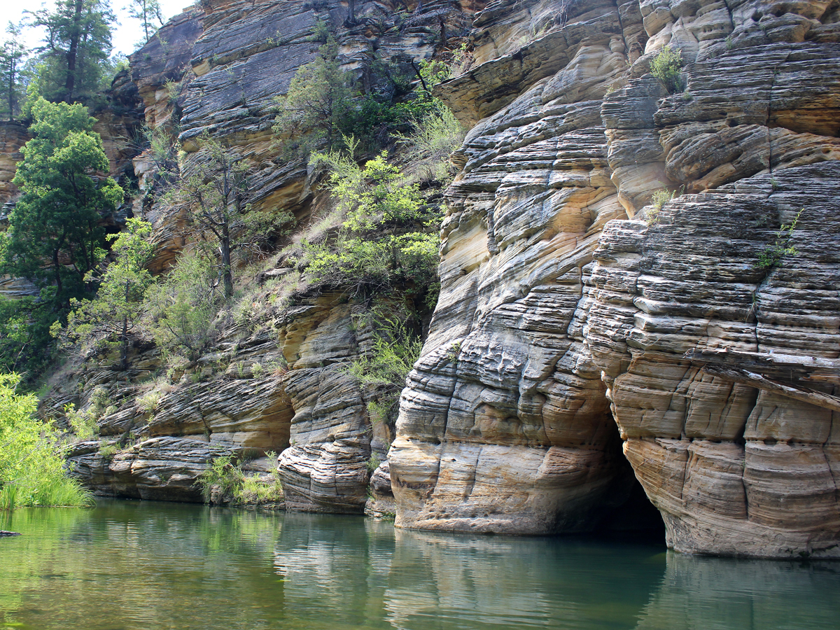 ★★★☆☆ Maxwell Hiking Trail / North of Strawberry / 0.7 miles
A string of crisp, clear swimming holes dot the creek at the base of West Clear Creek Canyon. Starting from the rim, a short, steep descent leads to a pristine canyon base.
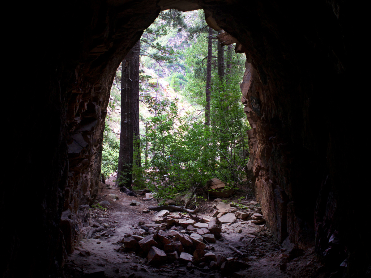 ★★★☆☆ Railroad Hiking Trail / East of Strawberry / 1.5 miles
Explore an abandoned railroad tunnel at the end of this short Mogollon Rim Hike. This trail works its way down and around a moderately steep ravine – to a shady stone tunnel with sweet rim views!
 ★★★☆☆ See Canyon Hiking Trail / Christopher Creek / 3.5 miles
Creeks, cool forests and Mogollon Rim views are just a few of the perks on this pretty hike. This trail can be hiked bottom to top, or top to bottom. Either way, it’s is loaded with many of the Rim’s best features.
Difficult Payson Area Hikes
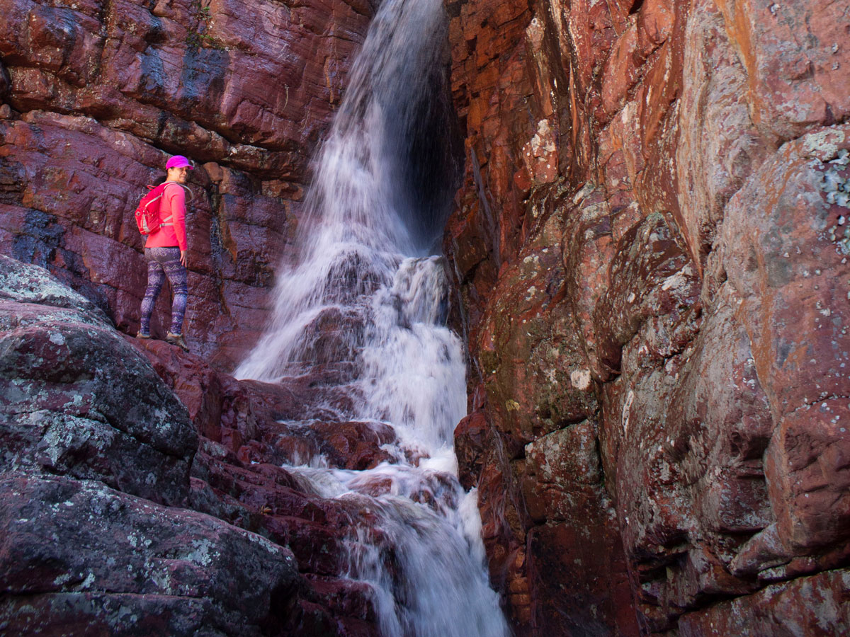 ★★★★★Barnhardt Hiking Trail / South of Payson / 6 miles
Spring waterfalls are the sweet reward for this trek up a gorgeous Mazatzal Mountain valley. While elongated views make it a bucket list worthy hike year round.