Red Mountain Hiking Trail


★★★★★ Easy / Flagstaff Area:
Hiking through this maze of colossal cones is kind of amazing (sorry). But it really is! Surrounded by cliffs and thousands of sky-high Cinder Cones, the Red Mountain Hiking Trail makes one feel a bit like an ant in a sprawling city of hyper-tall anthills. And kids will have so much fun climbing and playing on these oversized formations that they many not want to leave.
TRAILHEAD: Highway 180, North of Flagstaff • DIFFICULTY: EASY • DISTANCE: 1.5 MILES (3 MILES RT) • APPROX. TIME: 1.5-2.5 HOURS RT • ELEVATION GAIN: minimal • APPROX. CALORIES BURNED: 390-450 • BEST TIME OF YEAR: APRIL – NOVEMBER • PETS: YES • KID FRIENDLY: Yes Please! • FACILITIES: none • FEES: NONE
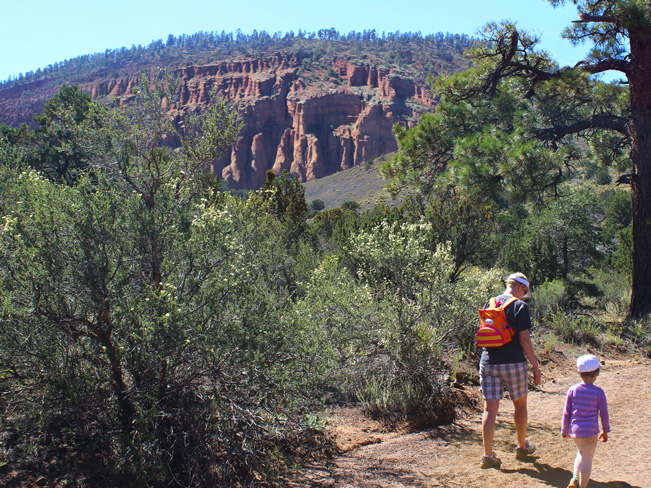
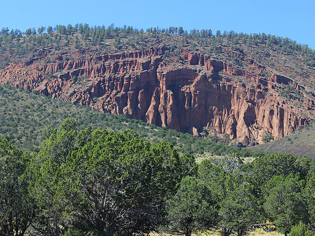 For an entertaining, diminutive experience (that is great for hikers of every age), the Red Mountain Hiking Trail through northern Arizona’s unique Cinder Cone canyon, is a must. This unusual destination is visible right from the trailhead. A mile-and-a-half away, an immense puckered wall, made up of thousands of ancient volcanic Cinder Cones, juts into the side of Red Mountain.

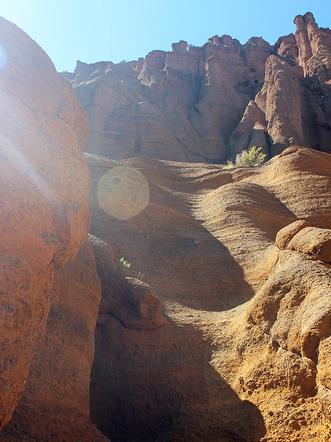
 The hike is an easy one: flat and wide, flanked by Pinion and Juniper. In one section the trail enters, and meanders along, a soft sandy arroyo, before exiting at a trail post a few yards further on. Nearing the canyon, the Cinder Cones appear almost mind-boggelingly large in scale.
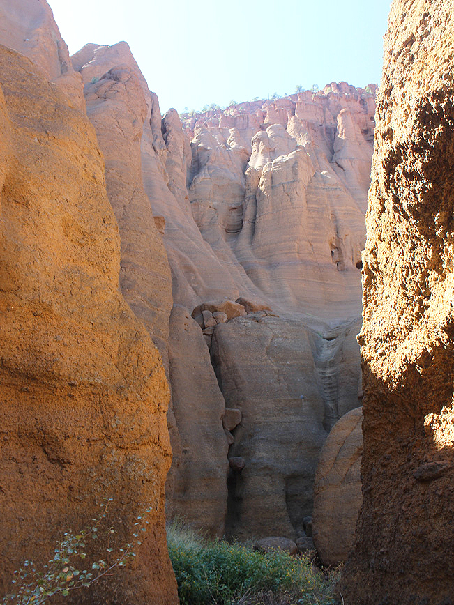
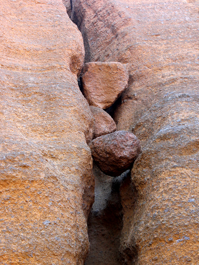
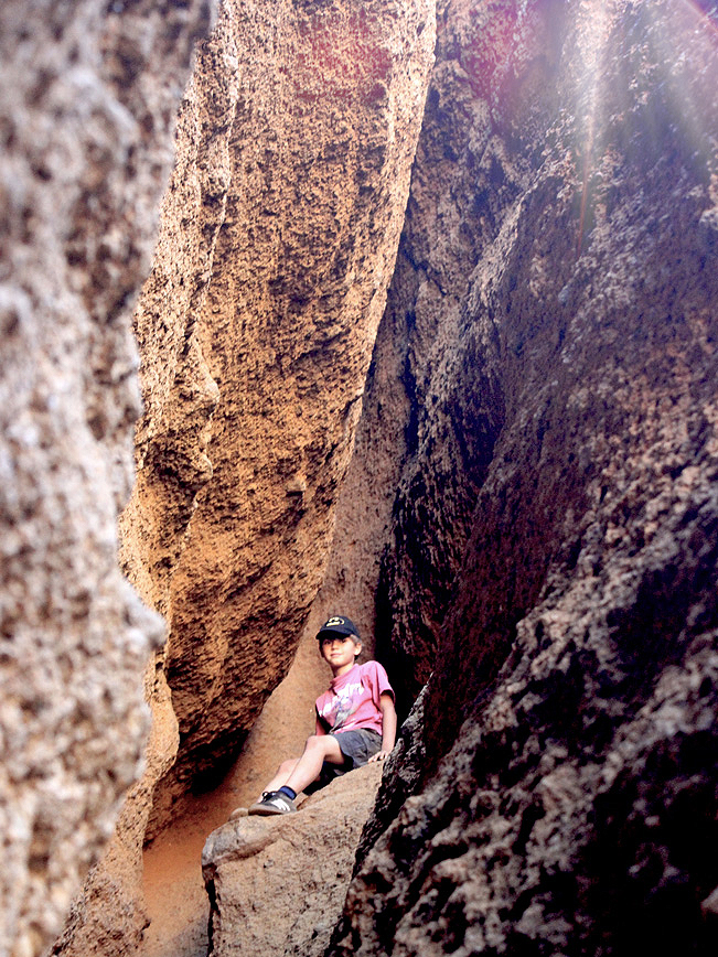 At the foot of the canyon, a small ladder climbs to the base. An alternate route is to hike up a small hill, between two black lava cliffs (handy if you have a dog with you). At the base, tiers of crinkled cliffs and soaring spires loom just ahead. Hiking between these vertical formations on the Red Mountain Hiking Trail is extraordinary! This dense conglomeration of Cinder Cones forms a vast maze of curvilinear slopes, tucked-in valleys, small slot canyons, and suspended boulders. Exploring each section is a mini-adventure of its own.
 Resources
Click here to download a trail map.
Click here to for Forest Service Hike description.
Total Nerdery
Red Mountain’s Cinder Cones were formed by lava erupting from volcanic vents almost 3/4 million years ago. After being blown into the air, the lava broke apart, solidified, and fell into these conical mounds. Red Mountain’s highest cone is over 1000-feet high.
Directions From Highway 180 in Flagstaff, head north for 25 miles, to Milepost 247. Turn left/west at Milepost 247 onto the short unpaved access road for the area (there are well marked signs on Highway 180). The trailhead for the Red Mountain Hiking Trail is at the end of this access road, one-quarter-mile in.
- Cinder Cone, Cliffs, Dayhike, Easy, Family Friendly, Flagstaff, Northern Arizona, Red Rocks, Rock Formation, Short
- October 7, 2015
2 Responses to Red Mountain Hiking Trail
This was such an amazing hike! We would have never known about it if it wasn’t for your blog. Thanks!
So glad you were able to both find and enjoy it. It’s a great hike with kids!