Bill Williams Hiking Trail


★★★☆☆ Moderate / Grand Canyon Area:
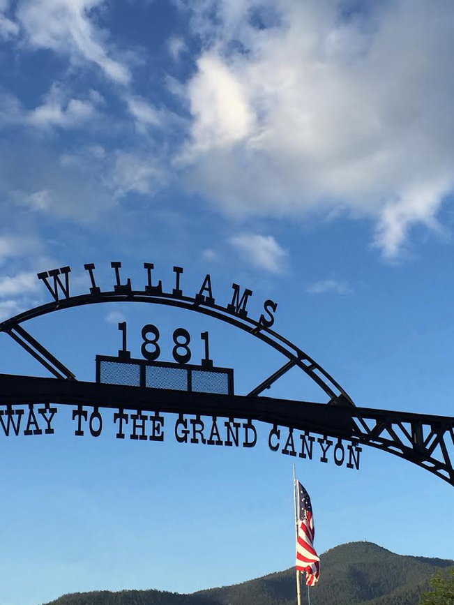
Visible behind Williams’ charming historic sign, Bill Williams Mountain harbors a surprisingly fun and varied summit trail. As it ascends, the Bill Williams Hiking Trail gradually transforms from a somewhat arid hike into a lush one, lined with ferns, moss and Aspens. At the summit the views back over Williams (with its many fun restaurants and bars) are a wonderful payoff. Post-hike drinks and dinner are waiting in this lively small town!
TRAILHEAD: Williams Ranger Station, End of South Clover Road, Williams • DIFFICULTY: MODERATE • DISTANCE: 3.85 MILEs (7.7 Miles RT) • APPROX. TIME: 4.5-5.5 HOURS • ELEVATION GAIN: 2,400 FEET (171 STORIES) • APPROX. CALORIES BURNED: 1,200-1,360 • BEST TIME OF YEAR: April-Oct. • PETS: YES • KID FRIENDLY: No • FACILITIES: Yes (no water) • FEES: None
 Like a western chameleon, the Bill Williams Hiking Trail caught me by surprise in its transformation. The beginning of this hike is fairly dry – with a moderately steep, dusty and rocky trail lined with Ponderosa Pines. It remains this way for the first mile or so. And, although the trail is pleasant, this first section doesn’t really offer a lot to write home about.
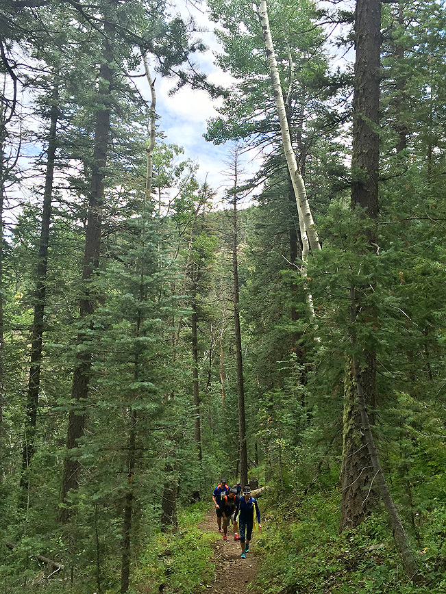 After the first mile, however, the trail begins to transform. As it gradually steepens, and ascends a series of lengthy switchbacks, the landscape becomes increasing lush. Here dense shade shelters an earthy trail, lined with moss, ferns and strands of Aspens. The sounds of civilization fall away. And birds and wildflowers make themselves apparent.
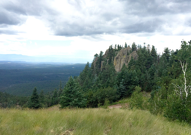 At approximately 3.5 miles in, the Bill Williams Hiking Trail crosses Forest Road 111 (the cheaters way to the summit). It then opens up onto a lovely field with views over a huge rock outcropping and out over Williams.
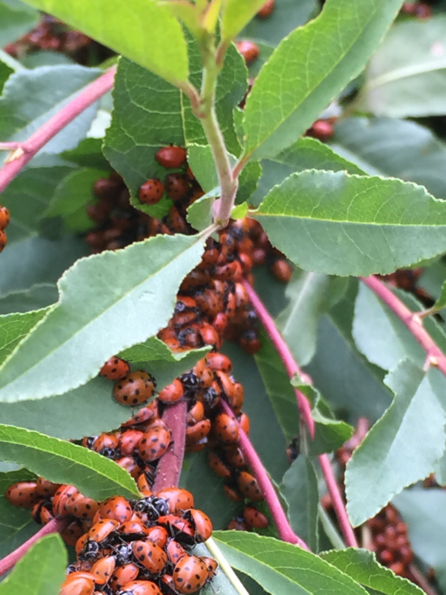
To reach the mountain’s summit, continue hiking along FR 111 for another half mile. There are a number of satellite towers at the peak, and phenomenal 360 degree views of the area. This is a great place to stop and take a quick break. As an added bonus, during mid-to-late summer thousands of migratory ladybugs are often encountered taking a breather on the plants at the peak.
 After your hike, Williams is a fun and lively small town to explore. There are many good restaurants and watering holes to replenish yourself. And it is fun to listen to the tourists from every country who stop here on their way to and from the Grand Canyon.
Total Nerdery
“Old Bill” Williams (for whom the town and mountain are named) was an area Mountain Man, Explorer, Guide and Trapper in the early 1800s. A sculpture of him sits in Bill Williams Monument Park in (you guessed it) Williams.
Click here to download a trail map.
Directions From I-40 (outside Williams) take exit 161/ Country Club Drive / Bus Route 40. Turn east, towards Williams and continue 0.3 miles to Frontage Road (on the right). Take Frontage Road for 0.7 miles to South Clover Road (on the left). Take South Clover Road for 0.2 miles. Veer left at the fork to reach the Bill Williams Hiking Trail parking area.
- Dayhike, Mountains, Northern Arizona, Pine
- August 29, 2015
2 Responses to Bill Williams Hiking Trail
Hi Lisa, This trail looks awesome…especially with the ladybugs! I’m putting it on my list the next time we are up near Williams. I just sent you an invitation to the event on 9/23; I hope you can make it!
It is a fun uphill hike. Hope you enjoy it! And thanks for the invite.