Devil’s Bridge Hiking Trail


★★★★★ Moderate / Sedona Area:
Ka’ching! It’s not often that a hike reaches a scenic jackpot with so little effort. At only two miles in length, the Devil’s Bridge Hiking Trail does just that! Its wide, gently tiered, Juniper-lined pathway leads to one of Sedona’s most prized formations: a 50′ high, natural sandstone arch. Incredible, miles-long views from the top of this monolith are a bonus payoff.
TRAILHEAD: intersection of dry creek and Forest road 152, sedona • DIFFICULTY: MODERATE • DISTANCE: 2.05 MILES (4.10 MILES RT) • APPROX. TIME: 2-3 HOURS • ELEVATION GAIN: 400 FEET (28 STORIES) • APPROX. CALORIES BURNED: 470-540 RT • BEST TIME OF YEAR: sept. – may • PETS: yes • KID FRIENDLY: 10 and up • FACILITIES: YES, BUT NO WATER • Fees: RED ROCK ($5 DAILY, $15 WEEKLY, $20 ANNUAL) OR NATIONAL PARK PASS ($85 ANNUAL) REQUIRED
 The Devil’s Bridge Hiking Trail meanders through a scenic Sedona valley. It kicks off from either the Dry Creek Trailhead. Or, for those with well-equipped, high-clearance vehicles, from the Devils Bridge Trailhead, located 1.25 miles further along deeply-rutted, FR 152. It is described here from the more-accessible Dry Creek Trailhead.
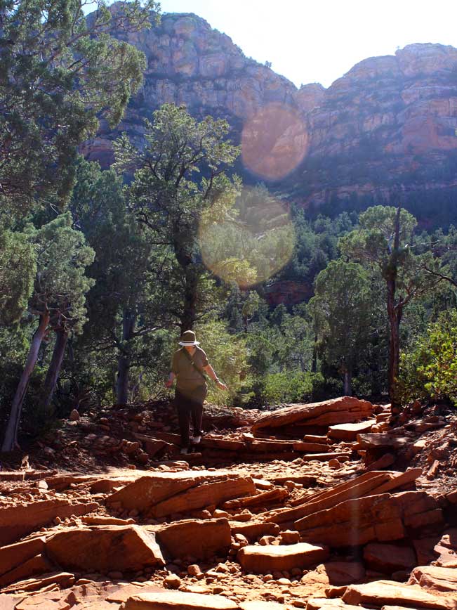
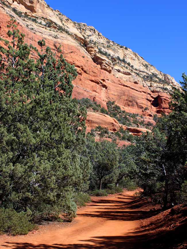 The first mile and a quarter of the Devil’s Bridge hike follows primitive FR 152. This gently undulating, seldom-driven, bumpy dirt road is lined with fragrant Juniper and Pine. After 1.25 miles the actual Devil’s Bridge Hiking Trail veers off to the right. Its soft, sandy pathway is intermittently shaded and tiered with natural stone steps. The trail skims red-rock cliffs and serves up long views as it rises. At the 2.05-mile mark the path butts up against the base of Devil’s Bridge Arch, which soars overhead.
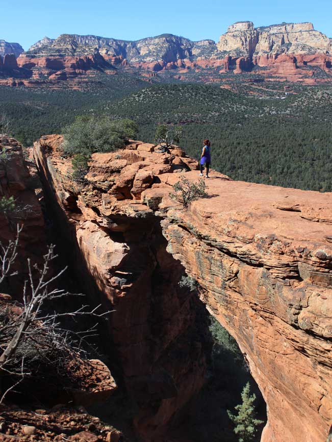
 The short ascent to the top of the arch is the steepest part of the hike. This section climbs a number of narrow “stairs” along one end of the arch. The hike’s jackpot is at the top. Here, a sandstone mesa overlooks the top of Devil’s bridge and serves up expansive valley views. A sharp U-turn, a little further on, provides access to the top of the bridge. Sashay across… carefully. It’s a long way down! Then turnaround to head back to the trailhead.
Total Nerdery At 50 feet (about 3.5 stories) high, Devil’s Bridge is the highest natural arch in Sedona. Vultee Arch is a shorter area sibling.
Resources Click here to download a trail map
Directions:
Free Sedona Shuttle – From the intersection of 89A and 179, turn left/west on 89A and continue for 1.5 miles to Posse Ground Road. Turn right/north and drive 0.5 miles to the Posse Grounds Park and Ride. Shuttle 11 departs every 50 minutes, Thursday – Sunday, from 7:00 am – 3:50 pm.
Trailhead – (Note: The Trailhead lot fills quickly, making the Shuttle a good alternative.) From the intersection of I-17 and AZ-170 (I-17 exit 298) turn north on AZ-179, towards Sedona. Drive 14.5 miles on AZ-179 to the intersection of AZ-89A. Turn left/west on AZ-89A and drive 3.1 miles to Dry Creek Road. Turn right/north on Dry Creek Road and continue approximately 2.5 miles to the trailhead parking lot on the right side of the Road.
- Arch, Dayhike, Moderate, Rock Formation, Sedona, Short, Views
- March 14, 2015
Leave a Reply