Kendrick Mountain Hiking Trail


★★★★☆ Moderate / Flagstaff Area:
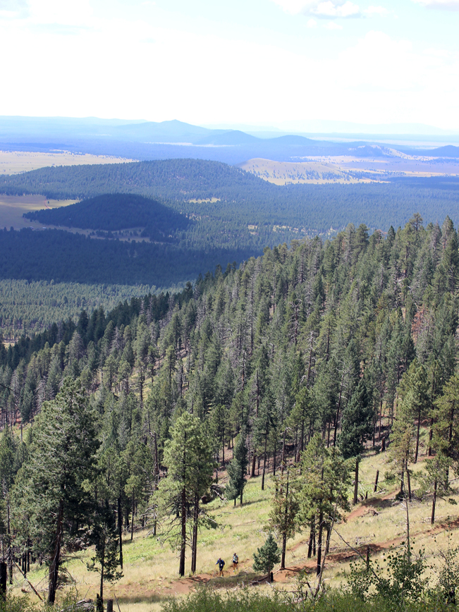
For lots of elevation gain with very little pain – the Kendrick Mountain Hiking Trail is one of Arizona’s best! The trail’s extremely gentle incline, to an impressively high summit, zigzags along some of the most hyper-long switchbacks I’ve ever encountered – making it a breeze to hike. And the views from the top? “Wowza!” A hundred miles in every direction. Grand Canyon? Check. Humphreys? Check. You’ll feel like the king or queen of the world from this mountain pinnacle.
TRAILHEAD: Forest Road 171, west of Flagstaff • DIFFICULTY: MODERATE • DISTANCE: 4.6 MILES (9.2 miles RT) • APPROX. TIME: 4.5-5.5 HOURS • ELEVATION GAIN: 2,640 FEET (189 STORIES) • APPROX. CALORIES BURNED: 1,380-1,560 • BEST TIME OF YEAR: APRIL-OCT. • PETS: YES • KID FRIENDLY: 10 and over • FACILITIES: YES (NO WATER) • FEES: NONE
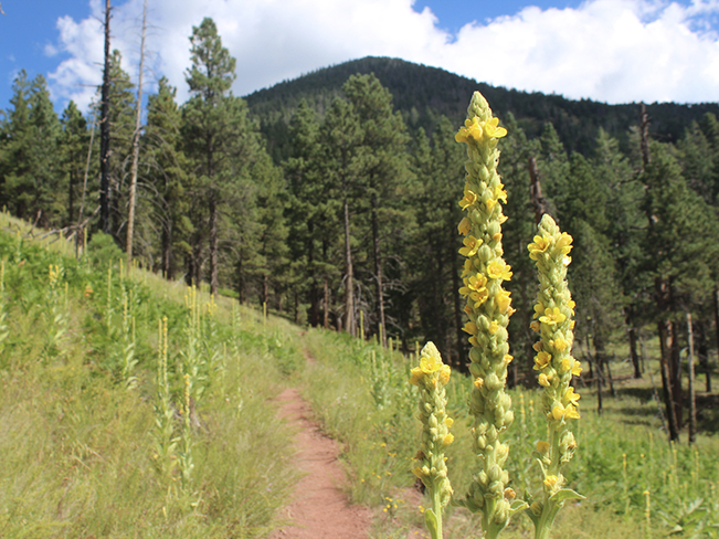
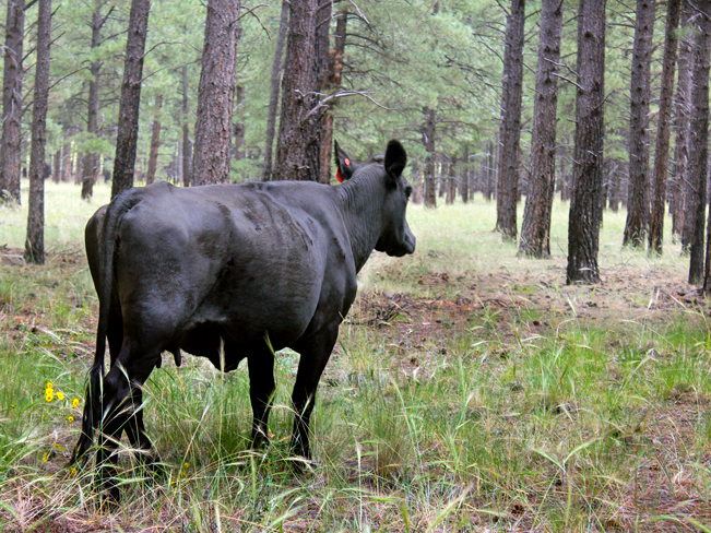
Although, the Kendrick Mountain hiking trail starts off like many other mountain hikes – along a wide, gently inclined path leading from the trailhead to the mountain base – it differs in that it maintains this mild ascent just about the entire way to the summit! Meandering through pine groves, and tall yellow flower filled meadows (and under the watchful gaze of the numerous local cows – grazing between trees) the first leg of the Kendrick Mountain Hiking Trail is lovely, with a long straight path. In the distance, the top of Kendrick Mountain peeks out sporadically between treetops.
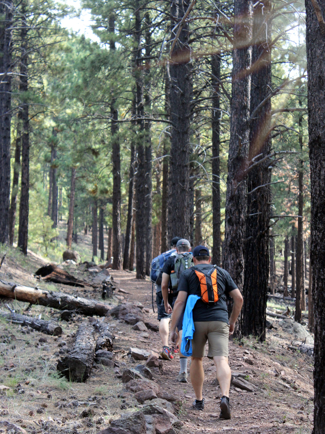
 As the trail gently advances toward the mountain, it’s just about impossible to ID just where it finally hooks up with Kendrick Mountain and begins to ascend its slope. Moving along epic-length switchbacks, the Kendrick Mountain Hiking Trail loyally retains this wide and gently inclined path. No steep narrow trail here. Nor stepmaster-like tiers to climb. In fact, the ease of the ascent makes each gorgeous, and increasingly long view along the hike into a pleasant surprise. “Wow. How did we get this high already?”
 As the trail gently gains elevation Aspens begin to mingle with the pines. And the watchtower at the peak starts popping in and out of view. Just prior to the summit, the Kendrick Mountain Hiking Trail opens up onto a quaint meadow housing a tiny historic, one-room, log cabin. Here it flattens to cross the meadow. Then, for the final brief leg to the top, takes on the only slightly steep and tiered section of the trail.
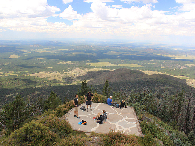
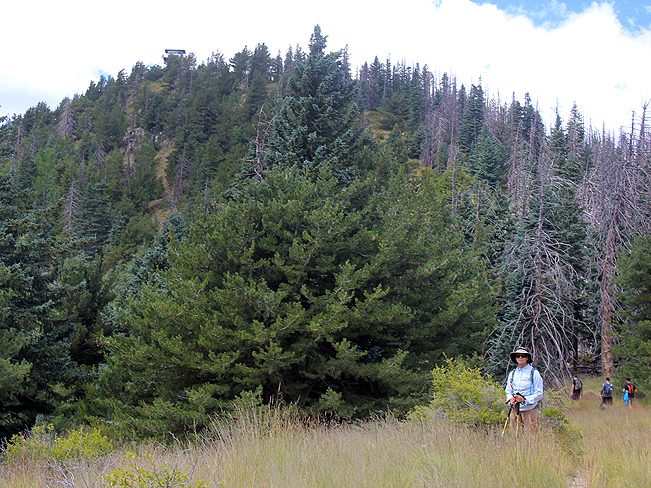 At the summit, if the gate is open to the volunteer manned watchtower, feel free to climb up and say “Hi” to the hosts. They know the area well and often enjoy pointing out the seemingly endless peaks visible from their mountain top roost. Just beyond the watchtower there’s an overlook, offering mind-blowing 360-degree views of the surrounding area. Humphreys stands tall to the east, while the rim of the Grand Canyon shimmers to the north. It’s fantastic to sit back and soak in the incredible vistas before beginning the trek back down the Kendrick Mountain Hiking Trail.
If desired, it’s possible to connect with either the Pumpkin or Bull Basin Hiking Trails from the Peak. These trails ascend and descend Kendrick mountain as well, from trailheads located a little over one mile from the Kendrick Mountain Hiking Trail’s starting point.
Total Nerdery
The fire lookout tower, on the summit of Kendrick Mountain, is one of 50 fire lookout towers located throughout Arizona.
Resources
Click here to download a trail map.
Directions
From Highway 180 in Flagstaff, head north/west for nine miles, to Forest Road 245 (located just past milepost 230 – on the left). Continue for 3 miles on FR 245 to the T-intersection with FR 171. Turn right on FR 171 and drive an three more miles to the trailhead for the Kendrick Mountain Hiking Trail.
- Dayhike, Flagstaff, Moderate, Mountains, Overlook, Views, Watchtower
- September 12, 2015
2 Responses to Kendrick Mountain Hiking Trail
I gotta try this trail. We get out of Atlanta every May and stay in Sedona for a couple of weeks.
I hate Atlanta.
Ha. I’m sure that Atlanta has its attributes. We did love the Kendrick Trail. A nice, long, steady climb. Never too steep. With incredible views at the top.