Pinnacle Peak Hiking Trail


★★★★☆ Moderate / Phoenix Area:
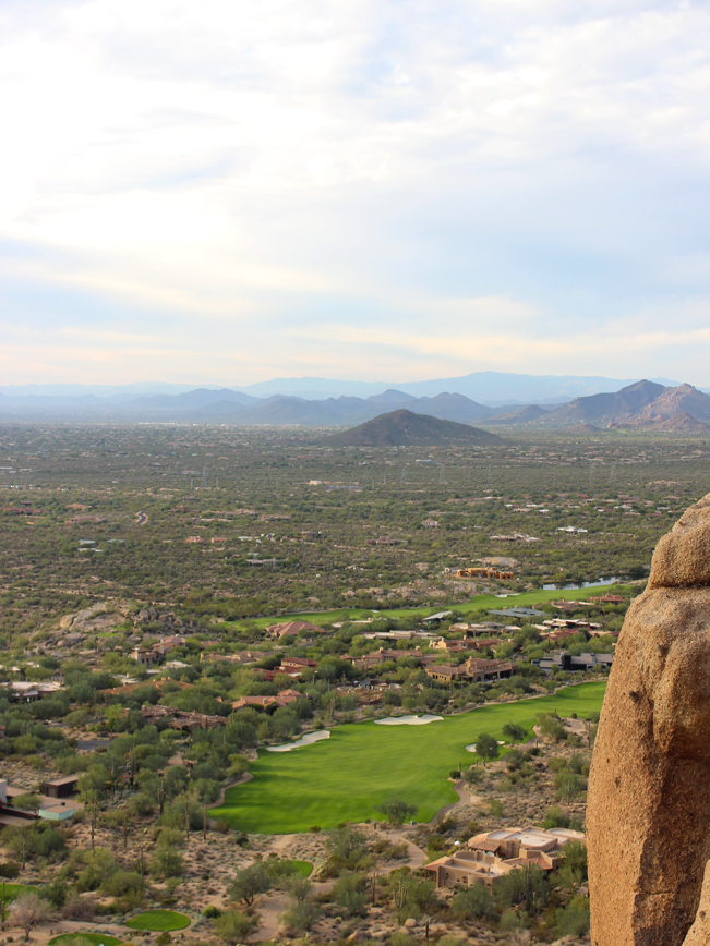
Looking for a “posh” hiking trail? You got it! Rising from a sea of emerald-green golf courses, the Pinnacle Peak Hiking Trail resides in the midst of North Scottsdale’s toniest neighborhoods. Winding between oversized, and perfectly curvilinear boulders, this trail is as well designed and manicured as the surrounding communities. And the views from its sky-high summit? 360 degrees and lavish!
TRAILHEAD: 26802 N. 102nd Way, Scottsdale • DIFFICULTY: moderate • DISTANCE: 1.75 MILES (3.5 rt) • APPROX. TIME: 2 – 3 HOURS • ELEVATION GAIN: 842 FEET (60 STORIES) • APPROX. CALORIES BURNED: 525-600 rt • BEST TIME OF YEAR: oct. – april • PETS: no! • KID FRIENDLY: 10 and older • FACILITIES: YES • FEES: none
 The scenic drive to Pinnacle Peak Hiking Trail passes luxurious multi-million-dollar estates. On the mountain summit, breathtaking rock formations create an elegant backdrop to this upscale residential area. In keeping with its high-end neighbors, the Pinnacle Peak Hiking Trail is substantially worthwhile!
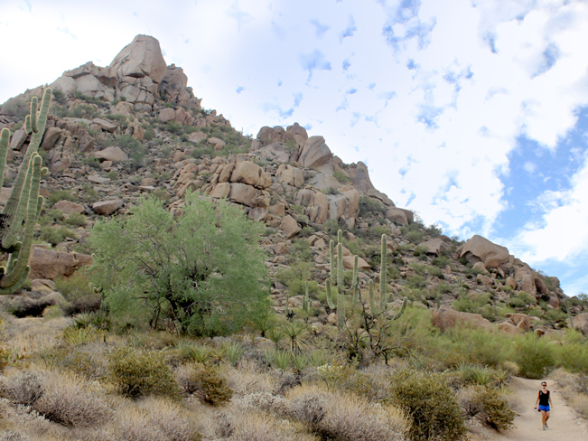
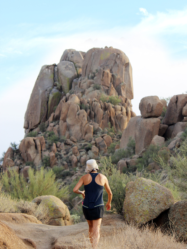
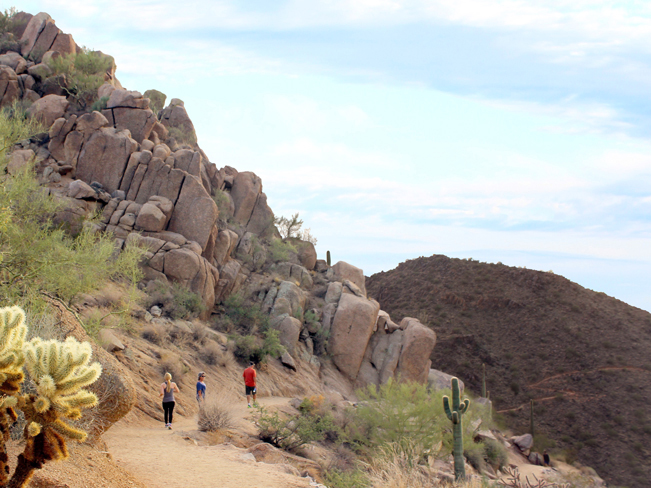
 Kicking off from an artfully designed Southwestern style trailhead – replete with shaded pagoda, stone-faced information casita, and fully-plumbed amenities – the Pinnacle Peak Hiking Trail impresses from the get-go. The mountain’s majestic summit cliffs make a commanding presence over its granite strewn slopes. A wide, well-groomed trail winds upwards between huge sculptural boulders. Views of stately homes and undulating golf courses glisten below. And elegantly landscaped rest areas, showcasing prime vistas, punctuate this moderately steep trail.
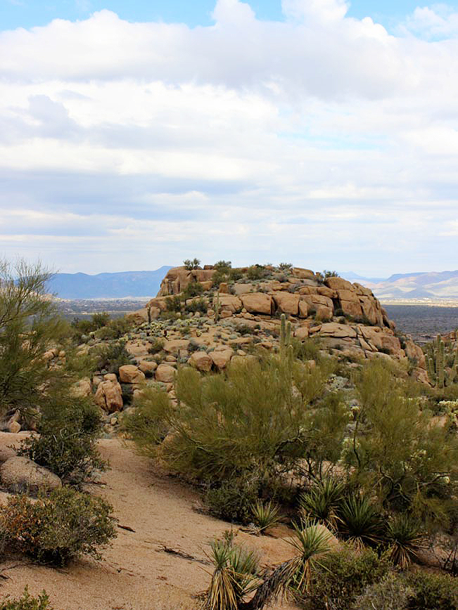
 After completing the climb to the base of Pinnacle Peak’s summit cliffs, the pathway gently curves around to the back of the mountain. Here, it descends for a half-mile to the middle of a neighboring slope. From this point the trail zig-zags along this mountainside before making a final descent to its end (in a valley of luxury homes). Turn around here for the scenic hike back to the trailhead, with its shaded rest area and cool running water.
Total Nerdery
Panoramic views of the Desert Highlands, Estancia, Troon and Four Seasons Resort golf courses are visible from atop Pinnacle Peak Hiking Trail – all beautifully framed by the distant McDowell, Mazatzal and Bradshaw Mountain Ranges. Rock climbers score an even better view from atop Pinnacle Peak’s summit cliff.
Resources
Click here to download a trail map
Directions From the intersection of AZ 101 and North Pima Road (in North Scottsdale) turn north onto North Pima Road and continue for 5.5 miles to Happy Valley Road. Turn right / east onto Happy Valley Road, and drive 1.95 miles to Alma School Road. Turn left / north onto Alma School Road and continue one mile to 102nd Way (on the left side of Alma School Road). There will be a small sign for Pinnacle Peak Park. Continue for one-half mile on 102nd Way to the Pinnacle Peak Hiking Trail Parking lot (on the left side of the road, just before a gated driveway).
- Boulders, Dayhike, Moderate, Phoenix Area, Scottsdale, Views
- October 30, 2015
Leave a Reply