Hunter Hiking Trail to Picacho Peak


★★★★★ Difficult / North of Tucson:
Exhilaration! Steep scrambles, climbing cables and wooden planks are all included on this adrenaline-inducing hike. Not for the faint-of heart, or anyone prone to vertigo, the Hunter Hiking Trail to Picacho Peak is a short, but intrepidly-steep-in-spots, climb to the apex of this mountain’s soaring rock face. The 360 degree views from the top, and well-deserved satisfaction in getting there, make this hike supremely worthwhile.
TRAILHEAD: 15520 Picacho Peak Rd, Picacho • DIFFICULTY: difficult • DISTANCE: 2 MILES (4 MILES RT) • APPROX. TIME: 2.5-3.5 HOURS • ELEVATION GAIN: 1,785 FEET (128 STORIES) • APPROX. CALORIES BURNED: 680-760 RT • BEST TIME OF YEAR: OCT. – APRIL • PETS: to first saddle only • KID FRIENDLY: 12 plus only • FACILITIES: YES • FEES: $7 Day use (or annual arizona state Park Pass)
 Anyone who has made the drive from Phoenix to Tucson has surely been entranced by the soaring rock-face of Picacho Peak. The vertical cliffs of this ancient mountain are noticeable from miles away, and make for a must-do hiking destination! The Hunter Hiking Trail to Picacho Peak is a short trail, containing some of the best rock scrambles (replete with handrails and cables) in all of Arizona.
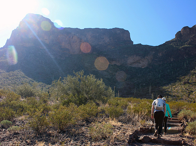
 The Hunter Hiking Trail begins its ascent on a series of switchbacks up the northern side of the Picacho Peak. These switchbacks climb to the base of the tall rock cliffs, that are clearly visible from the trailhead. From here, the trail moves along the base of these cliffs, on a mild incline, as it works its way towards a high mountain saddle.
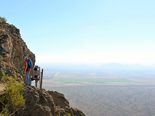
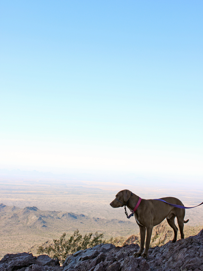 The saddle itself is a fantastic destination, offering expansive views, both north and south, for hundreds of miles across open desert. Many people choose to hike to this point on the Hunter Hiking Trail to Picacho Peak, before they turn around and head back to the trailhead.
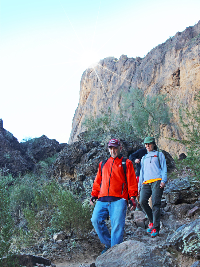
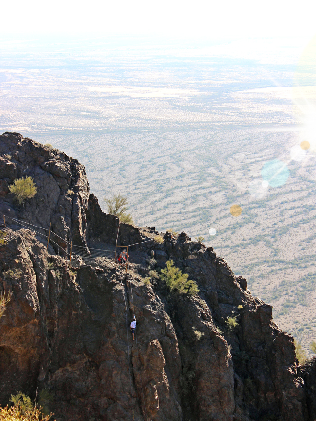
 For those who opt to continue to the peak, this is where the fun begins! The next leg of the trail entails a long descent down a cable lined rock face. This scramble ends at the base of the cliffs on the backside of Picacho Peak. It is easily four-times longer than the wide scramble on Camelback Mountain’s Echo Canyon Trail, in Phoenix.
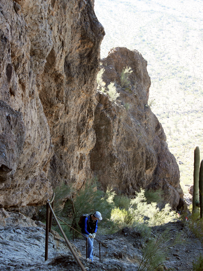
 Once around the backside of the mountain, the Hunter Hiking Trail to Picacho Peak again ascends along the base of the cliffs. There are a number of steep drop offs, and a second short cabled ascent, before the trail enters a small alcove between cliffs. At the end of this alcove there is another brief, but almost vertical, cable lined ascent to the top of a mountain ridge. Happily, the rough texture of the rock face offers plenty of footholds for the climb.
 The remainder of the trail is fairly steep. A wooden plank crosses a short drop off along the rim. After this, the trail crosses back onto interior ground and makes its final, switchbacked ascent to the peak.
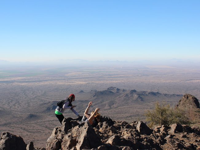 The views from the top of Picacho Peak are glorious! Spanning hundreds of miles in every direction. This is a perfect spot to take a well deserved break, replenish yourself with a snack, and revel in this amazing location. For the hike back to the trailhead, you can choose to return the way you came, on the Hunter Hiking Trail to Picacho Peak, or make a longer (eight mile total length) loop back to the trailhead on the Sunset Vista Trail. This trail intersects the Hunter Trail at the base of the mountain’s southern cliffs (see downloadable map below).
Total Nerdery
The poles and cables on Hunter Hiking Trail to Picacho Peak were originally set into the rocks in 1932. At that time the trail was used to maintain a 40-foot high, air traffic beacon on the summit.
Resources
Click here to download a trail map.
Directions From the intersection of I-10 and I-8 (in Casa Grande), take I-10 Southeast for 20.7 miles to exit 219 / Picacho Peak Road. Turn right / west on Picacho Peak road and continue for 0.28 miles to the park entrance. The trailhead for the Hunter Hiking Trail to Picacho Peak is located approximately 1.5 miles further into the park, at the top of the Barrett Loop (see downloadable trail map).
- Cables, Canyon, Cliffs, Dayhike, Rock Scrambles, Short, Steep, Views
- January 9, 2016
2 Responses to Hunter Hiking Trail to Picacho Peak
Yeah I just did this hike and it is amazing!!!!!!! I am not in good shape in fact I am fat, so this took me about 5 hours round trip. It is awesome and amazing. Great confidence building tool. I brought 2 bottles of water and 2 bottles of vitamin water and I drank them all. Make sure you eat a snack before you do it or your energy will burn out before you finish. This hike will challenge people of all ages, especially those who do not like to get sweaty.
If you like adventure you will love this trail. If you like cable TV this may not be for you. FYI if the temperature is above 80 degrees you may want to consider doing this when it is cool.
Definitely good for confidence building – with it’s cables, ramps and narrow passes! Congratulations on sticking with the trail. Deserves a good “Whoo Hoo” at the top. 🙂