


★★★★★ Difficult / Payson Area
Spring waterfalls are the sweet reward for this trek up a gorgeous Mazatzal Mountain valley. While the Barnhardt Hiking Trail’s elongated views make it a bucket list worthy hike year round.
TRAILHEAD: Forest Road 419, SOUTH OF PAYsON • DIFFICULTY: difficult • DISTANCE: 2.5 miles to main fall (5 miles RT), or 6 MILES full trail (12 miles RT) • APPROX. TIME: 7 – 8.5 HOURS rt • STARTING ELEVATION: 4,185′ • ELEVATION GAIN: 1,823′ • APPROX. CALORIES BURNED: 1,800-2,040 rt • BEST TIME OF YEAR: MARCH- Oct. • PETS: YES • KID FRIENDLY: NO • FACILITIES: NONE • FEES: None
 The Barnhardt Hiking Trail kicks off west of the Beeline Highway, about 12 miles south of Payson. After a quick jaunt through desert scrub, the trail starts a long, straight ascent up the side of rugged Barnhardt Canyon. A blend of steep walls and rocky, chevron patterned slopes line the mountainsides.
 In Spring, the sound of rushing water accompanies the hike. Snowmelt, from the higher elevations, cascades down the slopes. And a seasonal stream courses through the valley.
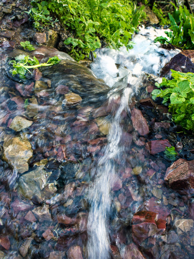 In February and March, random rivulets race across the muddy trail.
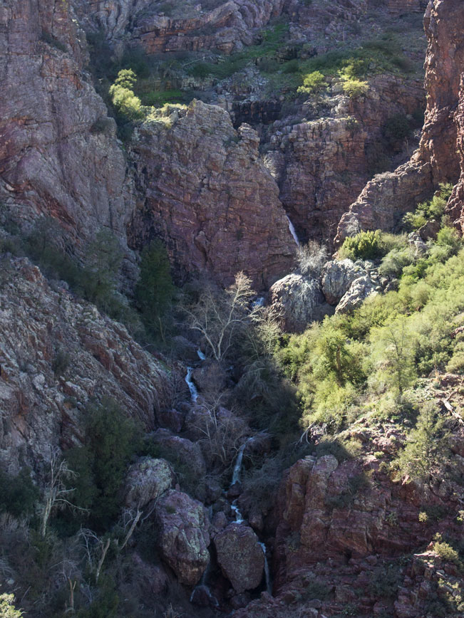
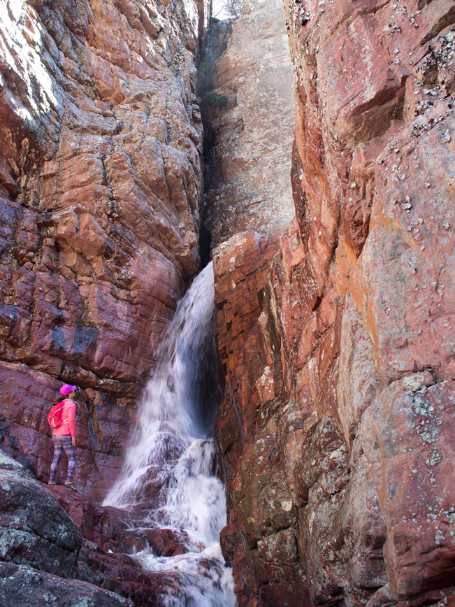
 At 1.5 miles, the trail makes a sharp turn into an upper canyon. A series of steep switchbacks climb to the base of a high ridge, where numerous Spring waterfalls spill over the rocky cliffs.
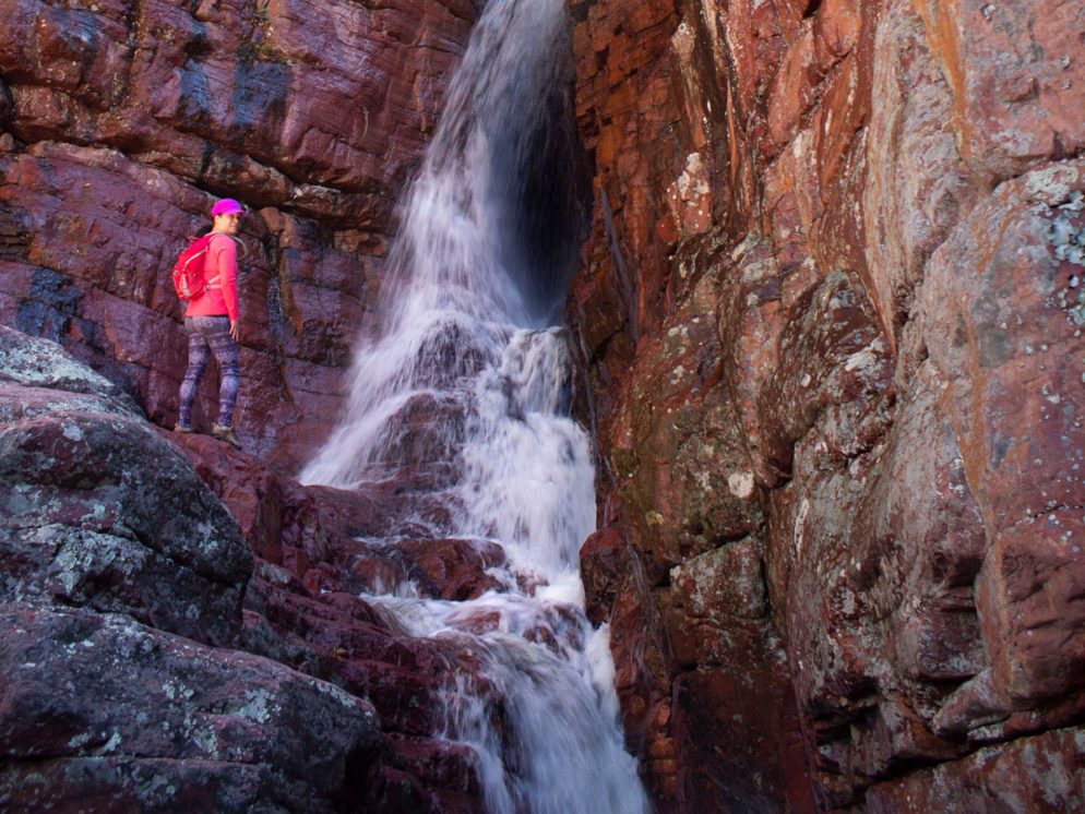
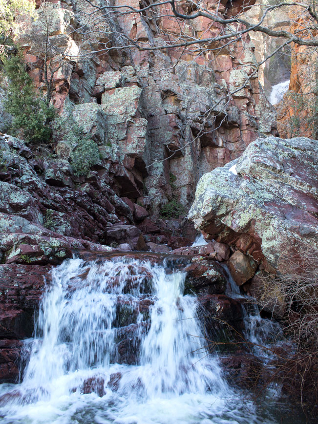
 At 2.5 miles, a shallow box canyon shelters the hike’s main feature. A stunning twenty-foot high waterfall crashes over the canyon wall.
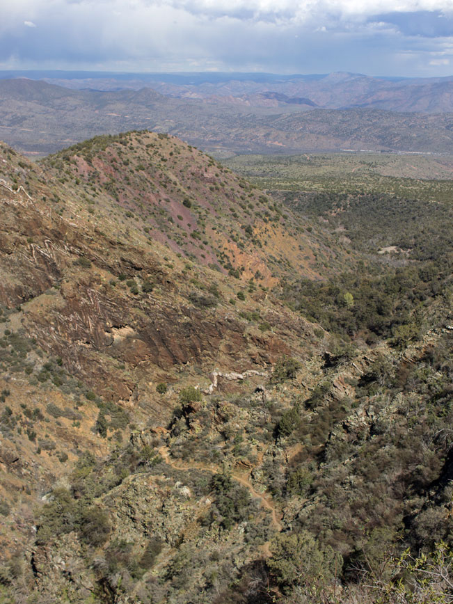
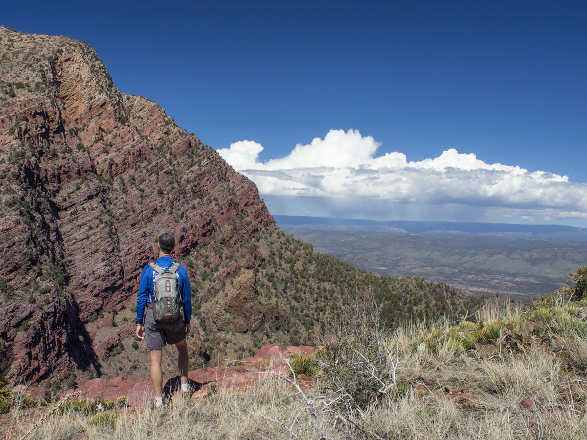 From here, the Barnhardt Hiking trail mostly levels out. It curves around the top of a high mesa, serving up excellent views of the valley below. The trail then meanders up and over the high, open peaks to its end at the Mazatzal Divide Trail. Turn around here to head back to the trailhead.
Total Nerdery The Barnhardt Hiking Trail passes through the Mazatzal Wilderness, a 252,000 acre protected area. Mazatzal is thought to mean “land of the deer.”
Resources Click here to download a trail map
Click here for info on the Matzatzal Wilderness Area
Directions From Payson, go south on State Route 87 (the Beeline Highway) for 12 miles to Forest Road 419 (look for the trailhead sign on the right). Turn right onto FR 419 and continue 5.1 miles to the trailhead.
Leave a Reply