


★★★★☆ Moderate / Flagstaff Area
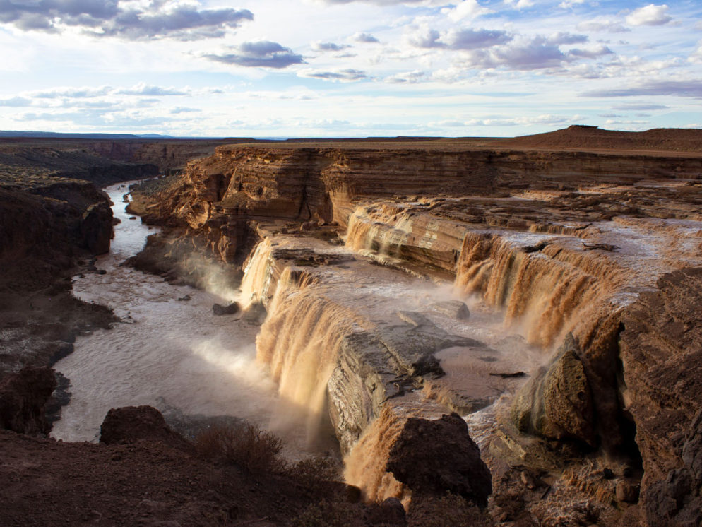
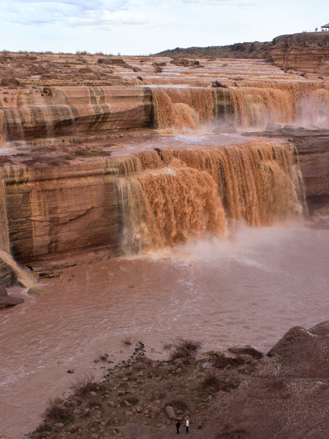
A short, rocky hike leads to the base of a thundering, chocolate colored, waterfall. Grand Falls is a one of Arizona’s most incredible natural wonders. At 185′ tall, it is 18′ higher than Niagra Falls. During spring snowmelt, or after heavy monsoons, its roaring cascades are impressive to experience.
TRAILHEAD: Route 70, Navajo Nation • DIFFICULTY: moderate • DISTANCE: 0.3 MILES (0.6 miles RT) • APPROX. TIME: 0.5 HOURS rt • ELEVATION GAIN: -180′ • APPROX. CALORIES BURNED: 90 – 100 rt • BEST TIME OF YEAR: March-April, July-August • PETS: YES • KID FRIENDLY: Yes • FACILITIES: YES. no water • FEES: None
 NOTE: This sacred Navajo land trail, is currently closed to the public due to overuse and littering. Please respect this decision until otherwise noted.
The muddy brown waters crashing over the tiered cliffs of Grand (or Chocolate) Falls, are amazing to see during spring snow melts or after heavy monsoons. The short, unofficial trail to the base of the falls, winds down the cliffs directly across from the falls.
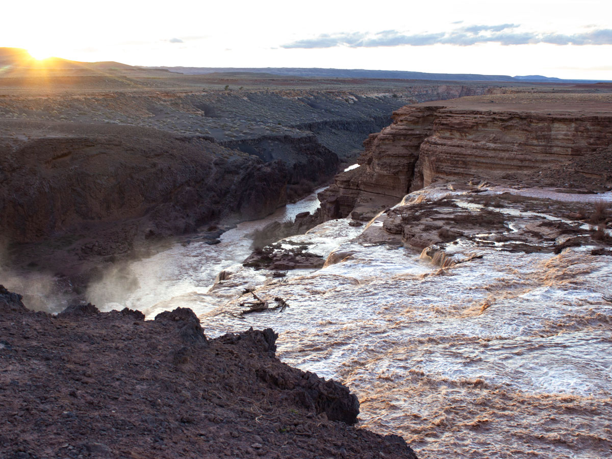
 From the parking area, the walk along the canyon rim serves up impressive views of the falls and the Little Colorado River below.
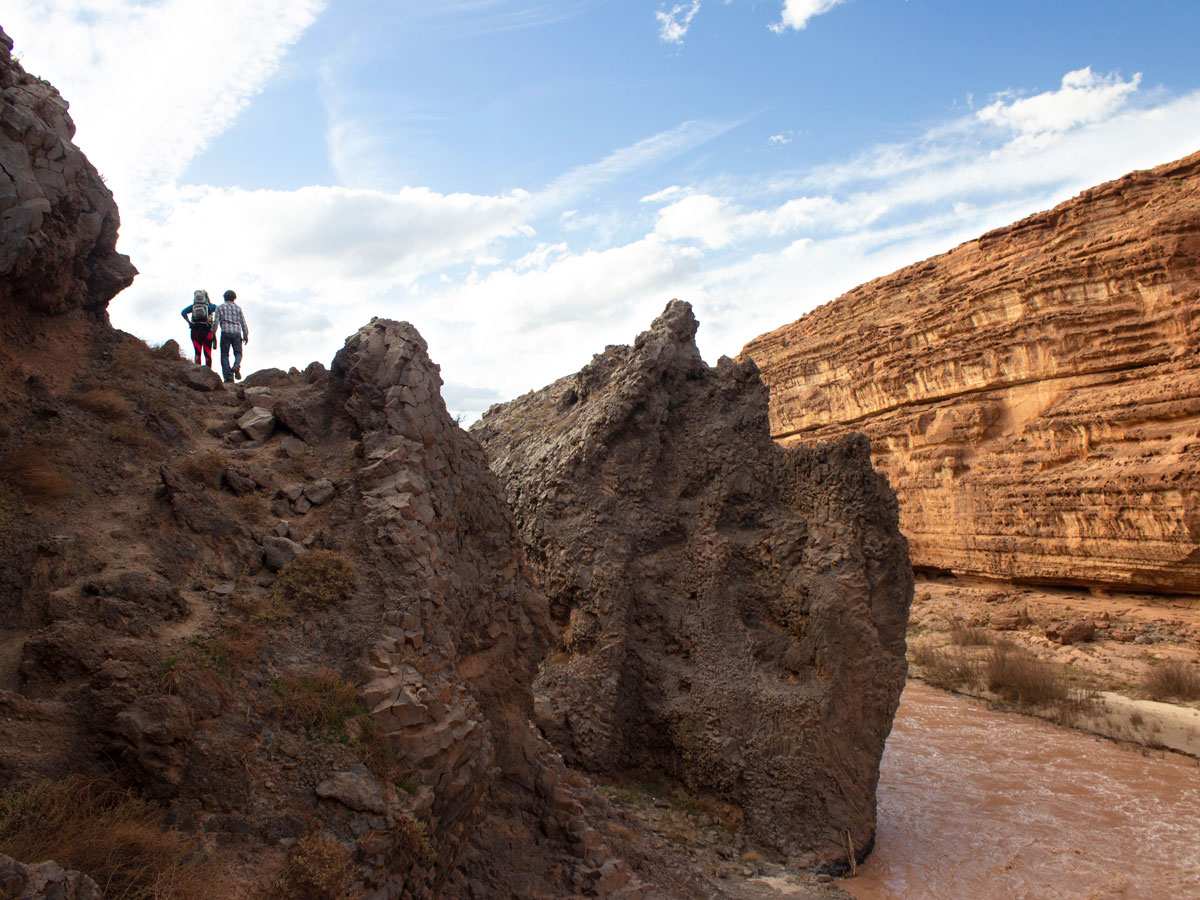 A well-worn, sandy walkway heads out from the rim, just across from the far edge of the falls. This path switchbacks down the rocky cliff face and descends to the sticky, mud riverbank below.
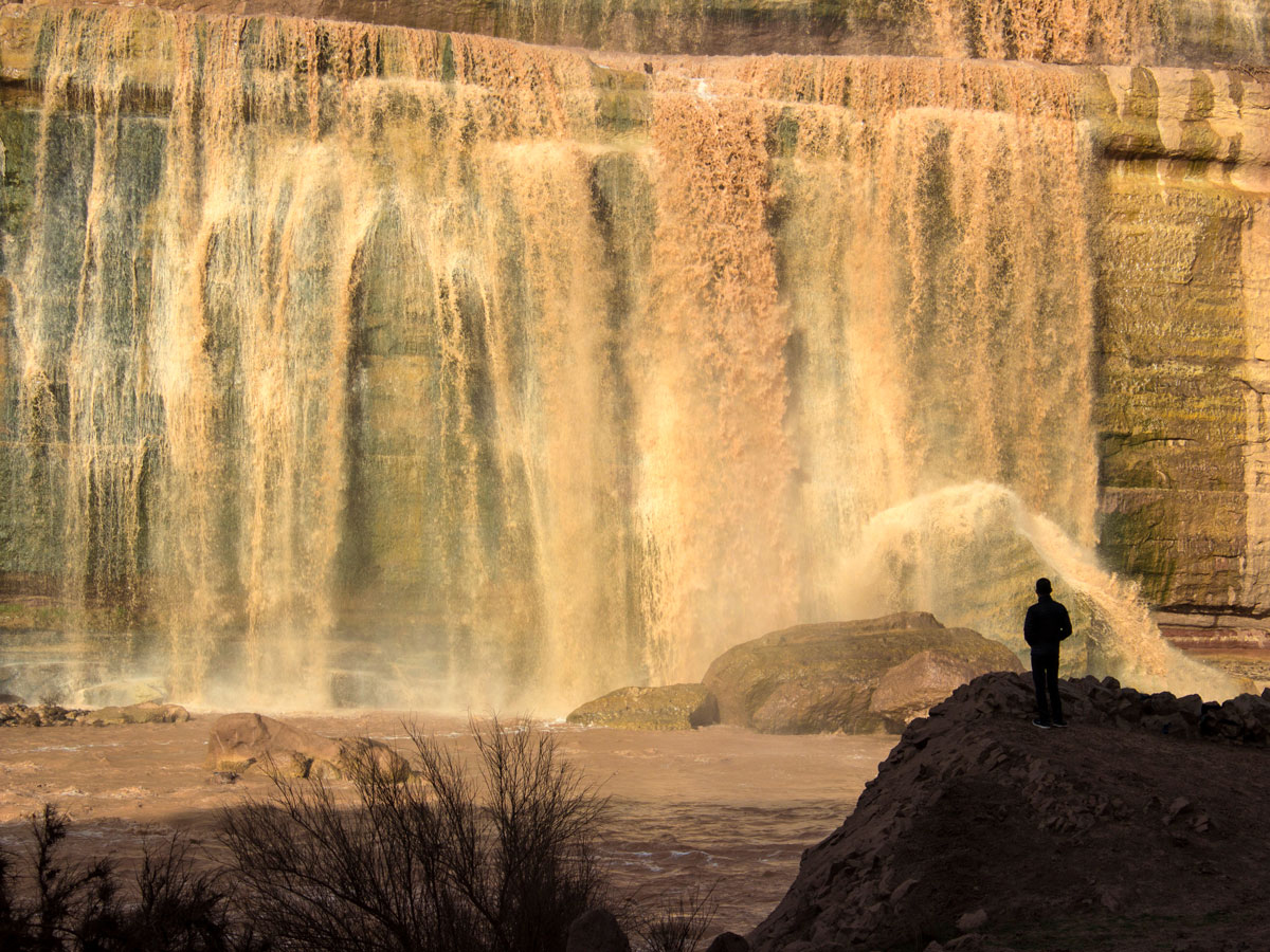 The roar from the riverbank is deafening when the falls are flowing heavily. And the high cliff walls have the capacity to make anyone feel tiny.
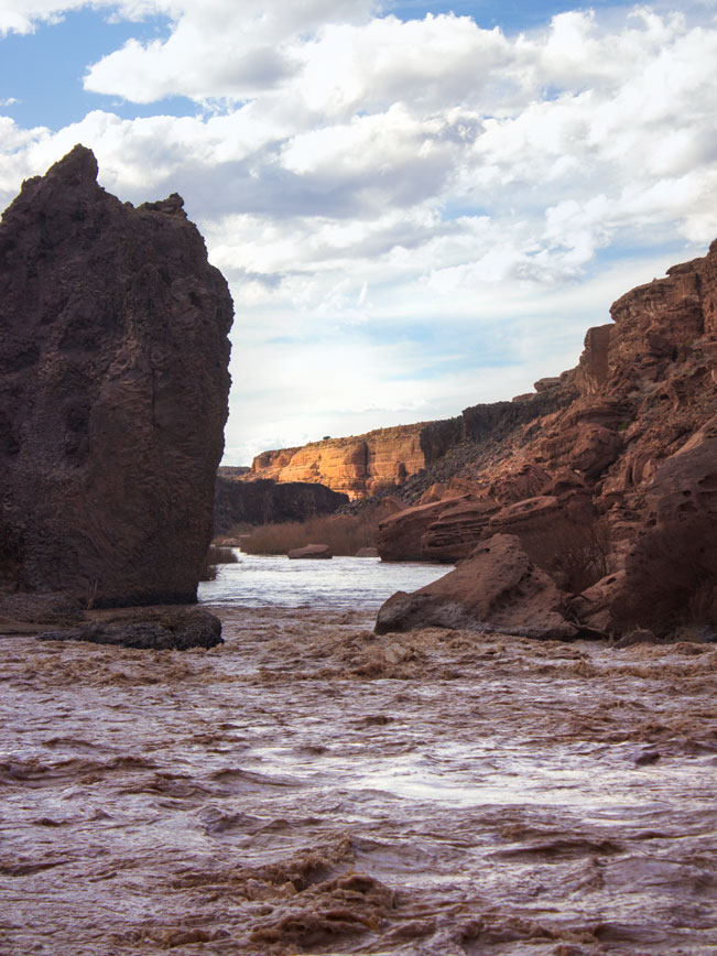 To the left, the river’s brown waves course towards the Colorado River between high canyon walls.
Total Nerdery Grand Falls is located on the Tribal lands. Please be respectful and follow closure notifications and guidance. Click here for a link to their site.
Directions From the intersection I-17 and I-40 (in Flagstaff) take I-40 east for 15.75 miles to the Townsend-Winona Road exit. Turn left /north onto Townsend-Winona Road and continue for 2.2 miles to Route 419 / Leupp Road. Turn right /north and drive 13 miles to Route 70. Turn left (this is a well-graded dirt and gravel road) and continue for 9.5 miles to Grand Falls.
2 Responses to Grand Falls Hiking Trail
We got here a few years ago! and we really had a great adventure. It’s really challenging but worth it. Thank you for bringing me back to this place through your experience.
It is a beautiful and unique spot. The Navajo Nation has decided to protect it moving forwards. So it will not be as available to visitors.