


★★★★☆ Moderate / Flagstaff Area
One of the steeper trails in Dry Lakes Hills, this hike ascends the slopes to a stunning inner meadow. Tall trees, forested washes and pretty views over Flagstaff and Mount Elden define the Brookbank Hiking Trail. Unfortunately, the Museum Fire burned much of the area in 2019, leaving behind a patchwork of charred and living forest.
TRAILHEAD: Forest Road 557 (East Mount Elden Lookout Road), Flagstaff • DIFFICULTY: Moderate • DISTANCE: 3.7 Miles (7.4 Miles rt) • APPROX. TIME: 4-5 HOURs RT • Starting Elevation: 7,568 • ELEVATION GAIN: 1,200 FEET (85 STORIES) • APPROX. CALORIES BURNED: 550-630 • BEST TIME OF YEAR: April-October • PETS: yes • KID FRIENDLY: No • FACILITIES: None • FEES: none
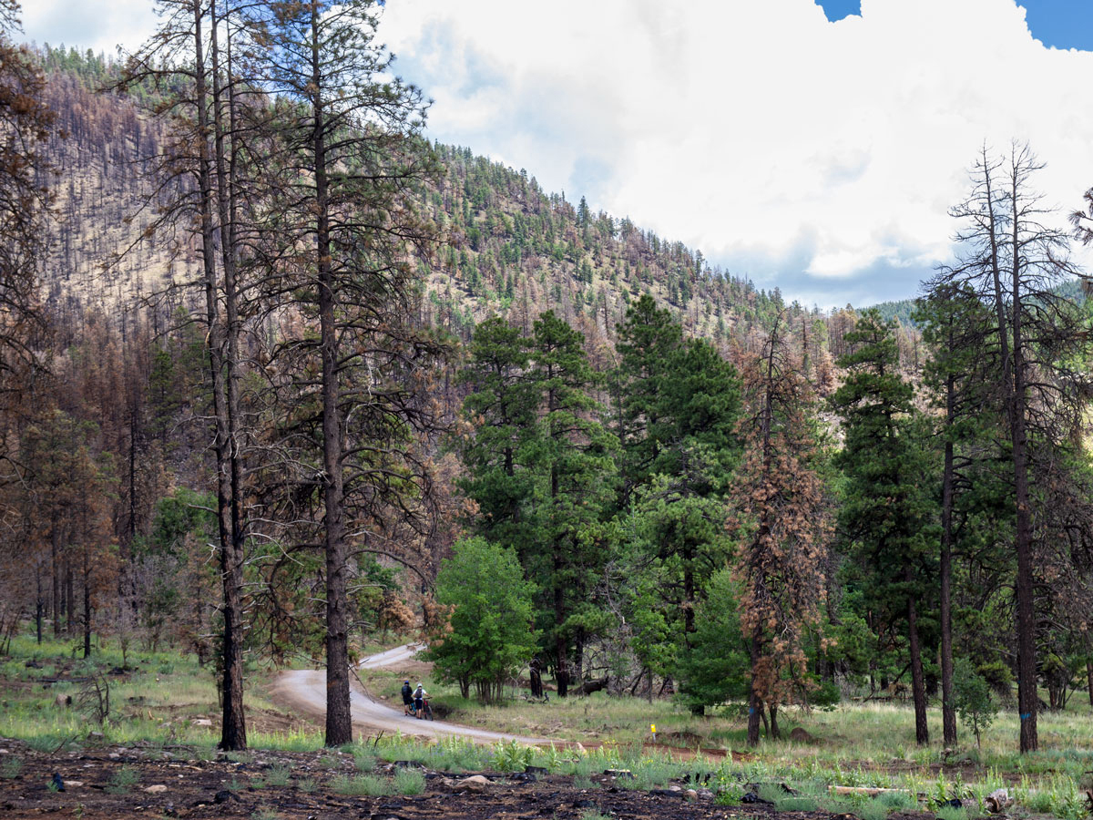 The first 1/4-mile of the Brookbank Hiking Trail moves alongside the western edge of scenic East Mount Elden Lookout Road. A mix of healthy and fire damaged trees give testament to the 2019 Museum Fire, which consumed much of the area. This road is popular with mountain bikers. So expect to see a few whizzing by.
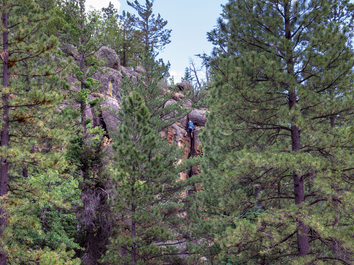 A dramatic granite ridge, on the east side of the road is a popular climbing destination. Look closely and you just might see a few climbers navigating the crevices.
 After a quarter mile, the Brookbank Hiking Trail veers sharply left and heads straight into the hills. The climb starts here, with the next mile ascending a number of long, moderate switchbacks up an eastern slope of Dry Lake Hills.
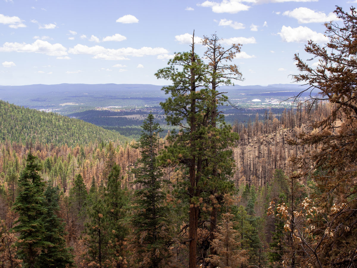 Lovely views span out over Flagstaff as the trail gains elevation. The white roof of NAU’s Skydome stadium is clearly visible in the distance.
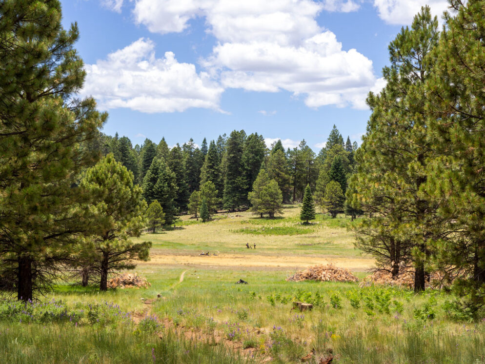
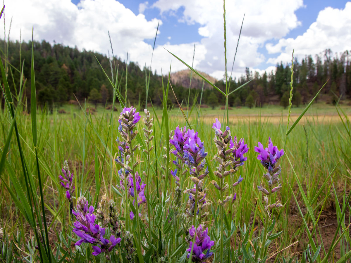 One and a half miles into the hike, the Brookbank Hiking Trail ascends a small hill and then suddenly opens onto stunningly beautiful Dry Lakes Meadow. Vibrant purple Lupine and red Indian Paintbrush flowers intermingle with bright green grass during spring and summer. The tops of the San Francisco Peaks rise in the distance. And a small water tank, on far side of the meadow, is fun to explore.
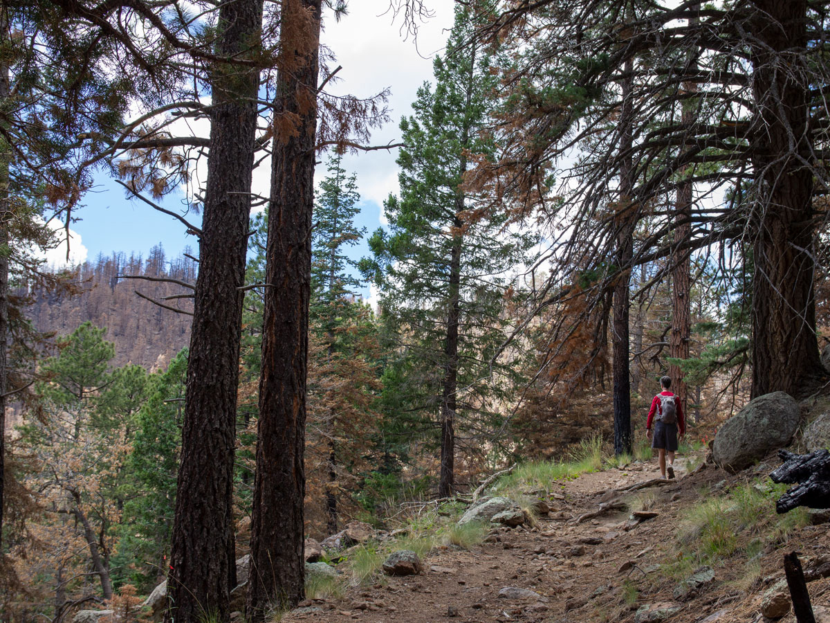
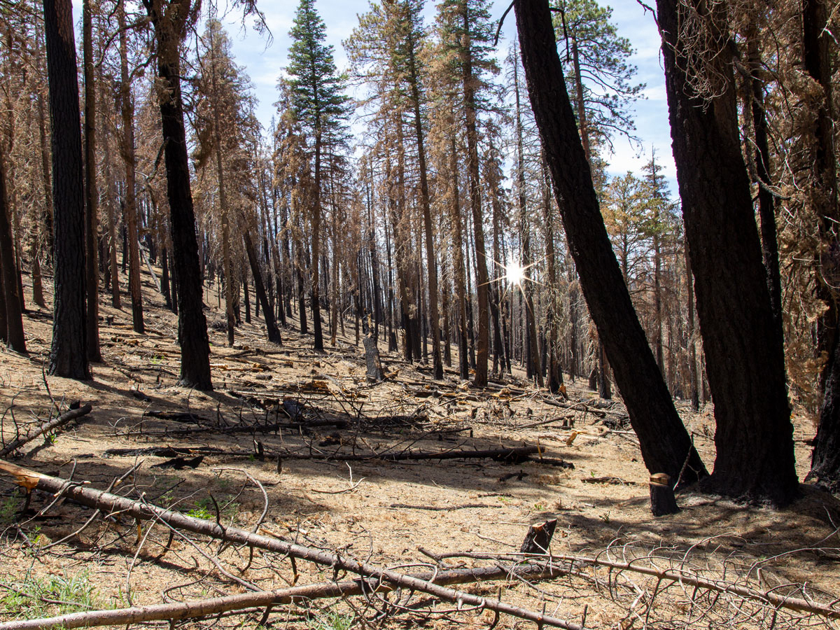 The path makes a sharp right turn, halfway around the meadow’s northern edge. From here, it curves back into the mountains and continues climbing. The trail circles an inner hill, then skirts the edge of an east facing valley. Evidence of the fire abounds in this section, with marred and fallen trees everywhere. At last, the Brookbank Hiking Trail ends at the intersection of the Sunset Trail. Turn around here to head back to the trailhead. Or turn left on the Sunset Trail, Schultz Creek Trail and then Rocky Ridge Trail to form a rewarding 11-mile loop hike.
Total Nerdery The Museum Fire burned almost 2,000 acres in July, 2019. It was accidentally sparked during a forest thinning operation. Fire damage safety concerns kept the Brookbank Hiking Trail closed for over a year.
Resources Click here to download a trail map
Directions From the intersection of I-180 and North Humphreys Street (in Flagstaff), turn north onto North Humphreys Street and drive 0.60 miles to West Columbus Avenue. Turn left onto West Columbus Avenue (which becomes US-180 West/ North Fort Valley Road) and continue 2.65 miles to North Schultz Pass Road. Turn right onto North Schultz Pass Road and drive 0.5 miles to FR 557 / East Mount Elden Lookout Road. Take East Mount Elden Lookout Road for about 3 miles to the Brookbank trailhead.
One Response to Brookbank Hiking Trail
I enjoyed reading your blog. You really had a great adventure. I hope i can also explore this place in the future. I love hiking!