


★★★★★ Difficult / Phoenix
Hike to Camelback’s breathtaking summit on this challenging trail up the mountain’s eastern slope. The Cholla Hiking Trail differs greatly from Camelback’s western Echo Canyon Trail ascent. An extra 0.3 mile length lends some ease to the beginning of this popular central Phoenix hike. But the Cholla Trail ultimately morphs into a vertigo-inducing, rock scramble along a narrow ridgeline.
TRAILHEAD: 5150 North Invergordon Road, Paradise Valley (Opens at sunrise. Closes at sunset) • DIFFICULTY: Difficult • DISTANCE: 1.5 Miles (3.0 Miles rt) • APPROX. TIME: 1.5-2.5 HOURs RT • Starting Elevation: 1,469 • ELEVATION GAIN: 1,420 (100 Stories) • APPROX. CALORIES BURNED: 510-570 • BEST TIME OF YEAR: September- May • PETS: No • KID FRIENDLY: no • FACILITIES: yes • FEES: None
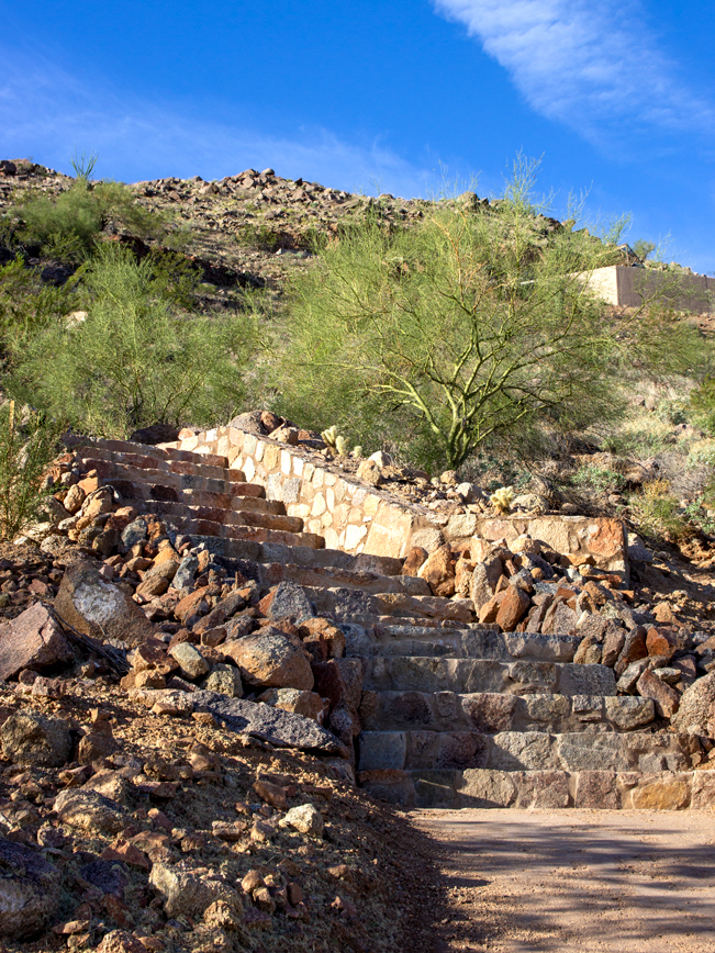 Camelback Mountain’s Cholla Hiking Trail reopened in Fall 2022 after a 2.5-year renovation. The much improved city trailhead sports N. Invergordon Road access, seventy roadside parking spaces, ride-sharing drop off points, plumbed restrooms and a number of stone stairways on the trail’s lower portions. The hike starts on a paved access trail, then dirt pathway, which meander behind swanky Paradise Valley homes. Stone steps then que the start of the switch back ascent up Camelback’s lower foothills.
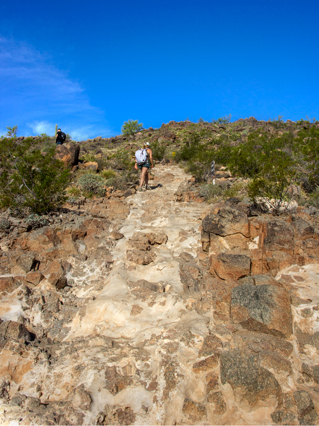 The first mile of the Cholla Hiking Trail is a consistently moderate climb. The pathway alternates between dirt and rock and wide stone sections. Tree cover isn’t a thing on this hike. So come prepared for full sun exposure – meaning plenty of water and sunscreen.
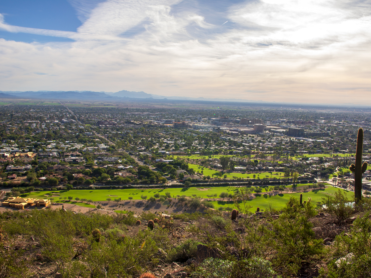 As the trail rises, wide views spread out over The Phoenician Resort, with the valley’s southern mountains in the distance.
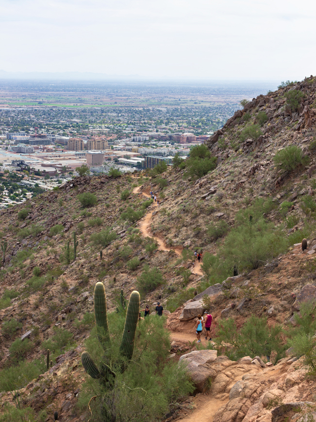 About 0.75 miles into the hike, the trail curves onto north side of Camelback Mountain. Here, it hugs the hillside, offering intermittent shade during parts of the day.
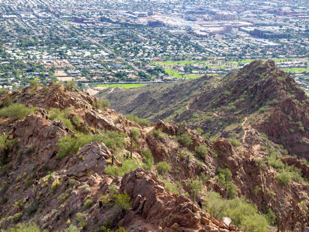
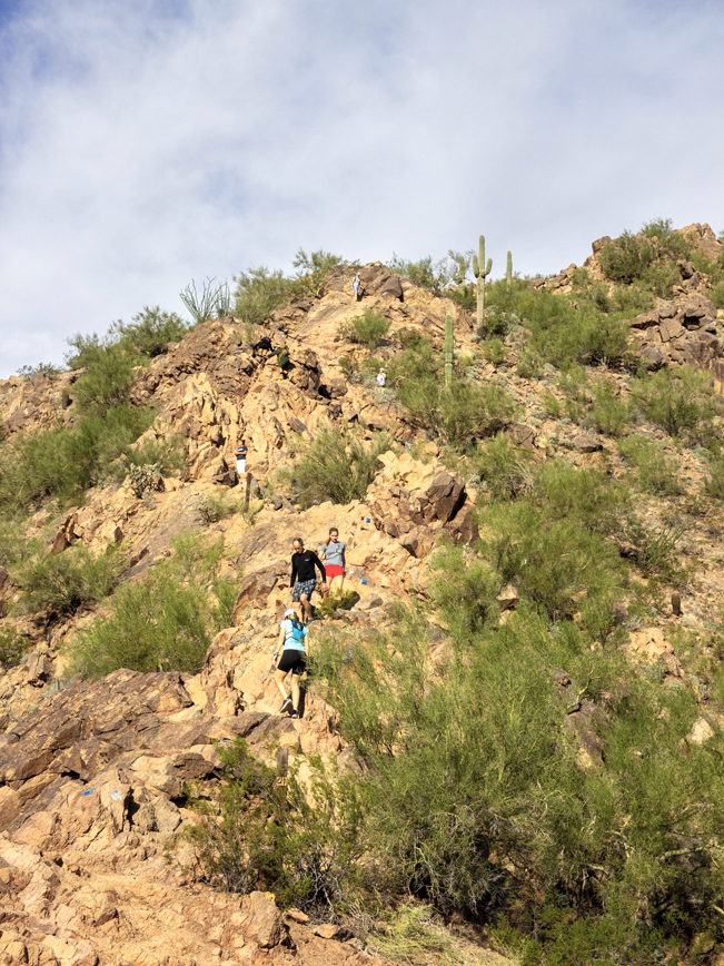 After passing an open saddle that serves up long north-south views, the Cholla Hiking Trail changes gears. A steep, 50° rock scramble kicks off the final half-mile climb to the summit. From here on out, the trail clings to the top of a narrow rocky ridge.
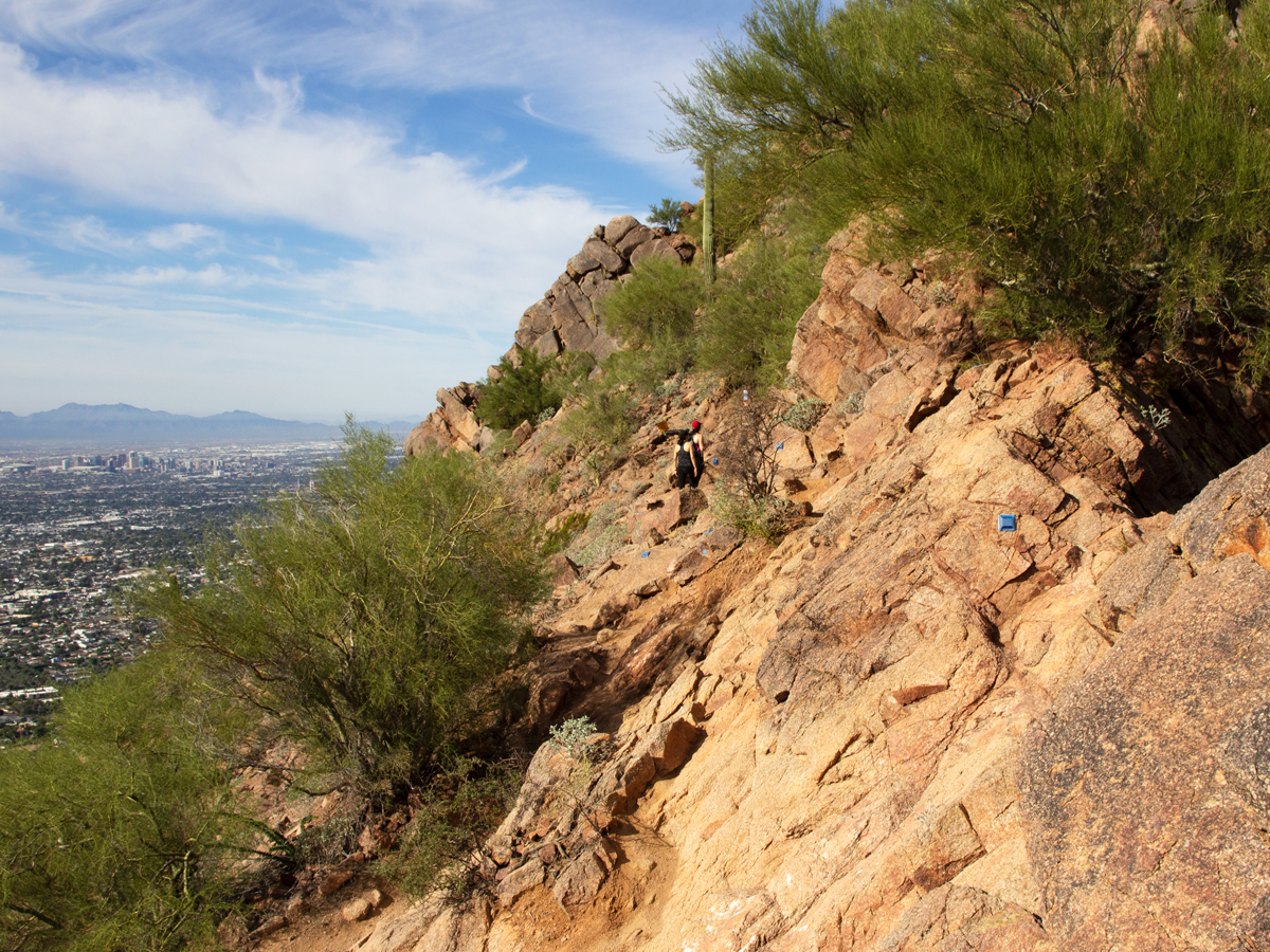 The path moves back and forth across the ridgeline. Sometimes on naturally worn “steps,” and always with steep drop offs on either side. Even for those not typically prone to vertigo, the upper part of the trail can feel a little precarious.
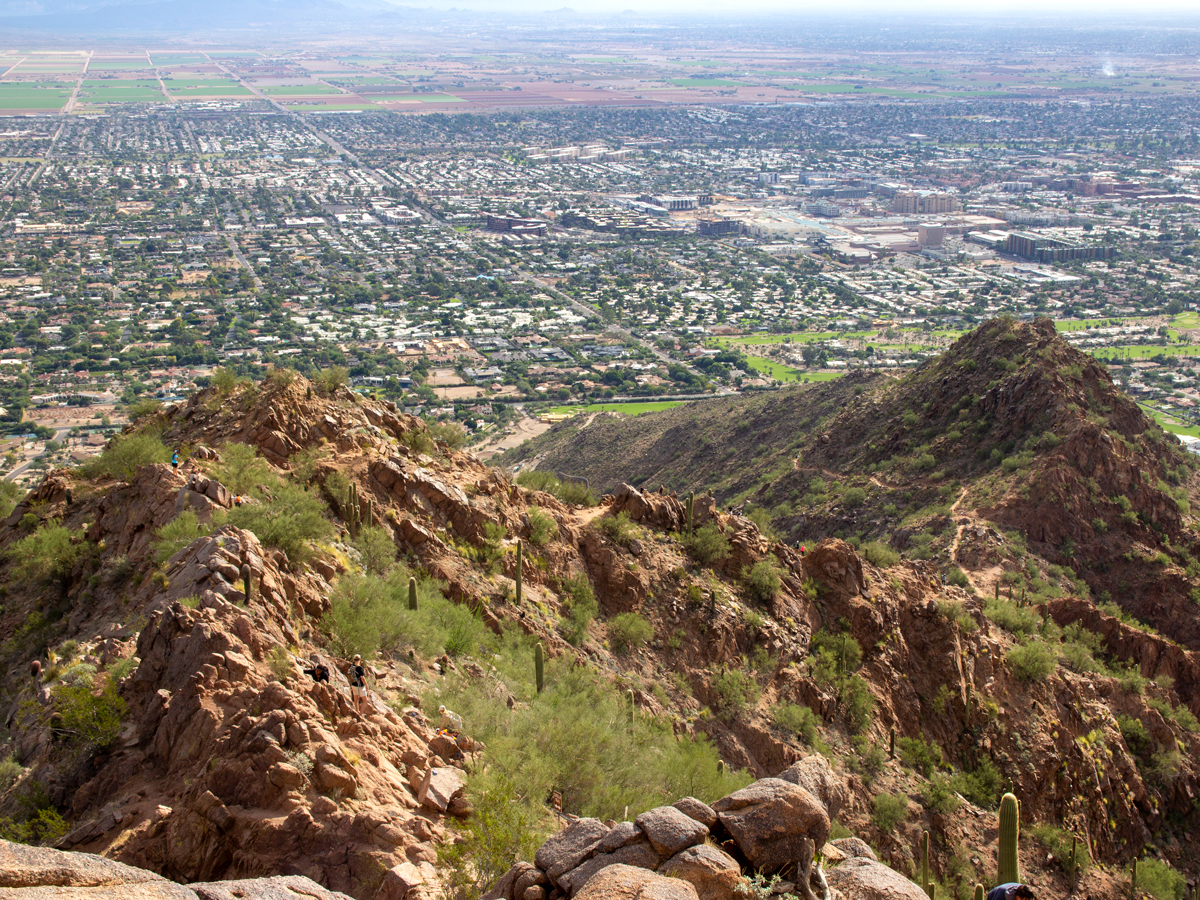 Stick with it and you soon arrive at the summit. The views from Camelback’s peak are fantastic. They spread out in every direction, with huge valley homes appearing miniature more than 1,400 feet below. Head back the way you came. Or, alternatively, head down the Echo Canyon Hiking Trail and grab a taxi back to the Cholla Trailhead. For an extreme challenge, hike down the Echo Canyon Hiking Trail then back up and over the mountain once again.
Total Nerdery At 2,704′ high, Camelback is the highest mountain in the Phoenix Valley. It’s named for its silhouette, which resembles a seated camel when viewed from the north or south.
Resources Click here to download a trail map.
Directions From the Intersection of Camelback and North Invergordon Roads (in Phoenix), turn north onto North Invergordon Road. Continue for 0.65 miles, until you see signs for the trailhead and the roadside parking spots. Parking is along the west side of the road.
Leave a Reply