


★★★☆☆ Easy / Sedona
This short, easy hike meanders through the base of an iconic red rock canyon. Its pine shaded path, flanked by soaring sandstone cliffs, makes the Fay Canyon Hiking Trail A-OK for hikers of all ages.
TRAILHEAD: Boyton Canyon Road, Sedona • DIFFICULTY: Easy • DISTANCE: 1.2 Mile (2.4 Miles rt) • APPROX. TIME: 1-1.5 HOURs RT • Starting Elevation: 4592 • ELEVATION GAIN: 390′ (28 Stories) • APPROX. CALORIES BURNED: 312-360 • BEST TIME OF YEAR: Year round • PETS: yes • KID FRIENDLY: Yes • FACILITIES: yes (No water) • FEES: $6 Red Rock Day use Pas (or $85 Annual National Parks Pass)
Fay Canyon Trail
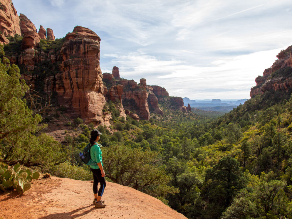
 Grab the family and go, on this easy red rock canyon stroll. The Fay Canyon Hiking Trail starts across the street from the parking area, then heads straight into a scenic box canyon. Its shaded Pinyon Pine, Cyprus and Manzanita lined path meanders alongside a dry wash (which sometimes flows after rare heavy rains).
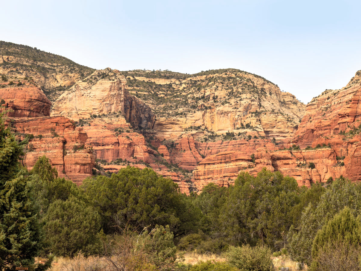
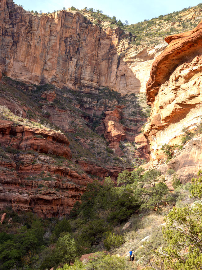
 Stunningly high, sandstone cliffs rise on either side of the trail. An erosion carved arch is visible to the right, a little over 1/2-mile into the hike.
 The Fay Canyon Hiking Trail officially ends by a signpost, 1.2-miles into the canyon. A steep, rocky, sandstone rise rests directly in front of the trail’s endpoint. For those willing to make the scramble, this short climb leads to amazingly beautiful backwards views over the canyon and all the way out to Cathedral and Bell Rocks.
 The far end of the box canyon is also visible from this juncture. But the trail does not continue further. Turnaround here to head back to the trailhead.
Fay Canyon Arch
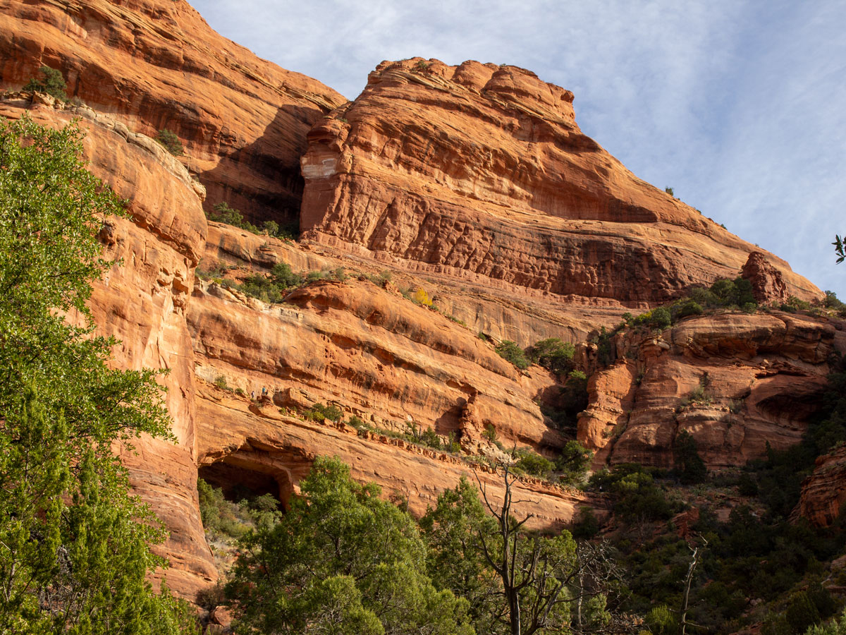
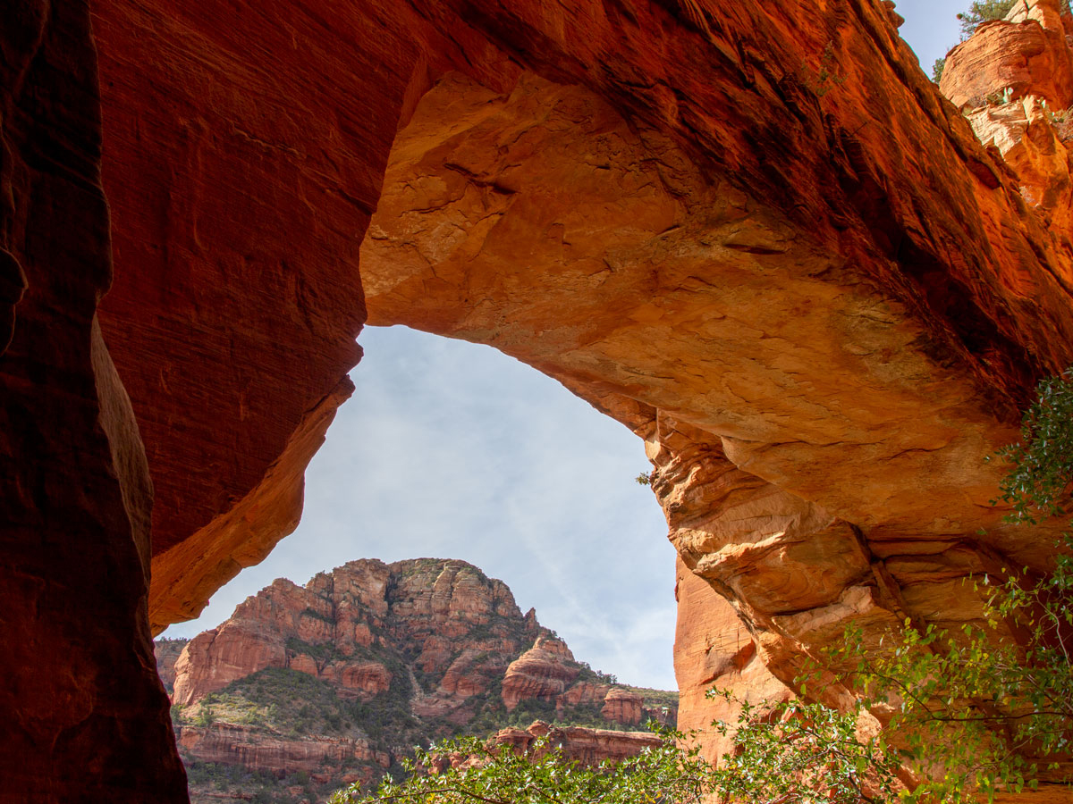 A large, erosion carved arch punctuates the canyon walls approximately 0.65 miles from the Fay Canyon Trailhead. The area surrounding the arch is designated wilderness. And, although it is legal to enter the area, all visitors are encouraged to be highly respectful, to follow all Leave No Trace Principles and to stay on the primitive, steep, narrow, rocky path that leads to the arch. The path starts on the far side of the wash, almost directly in front of the arch and is 0.33 miles each way.
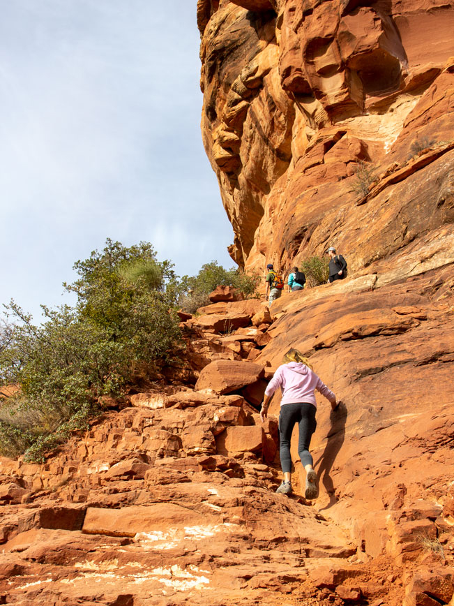
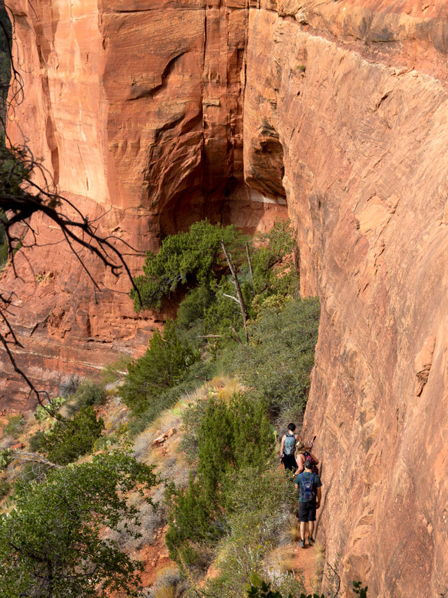 This natural formation is way larger than it appears from the canyon floor. Its curved underbelly sports a wonderful array of small eroded nooks and crannies. To the right, an extremely narrow, very steep path hugs the arch’s perfectly perpendicular side and leads to the top.
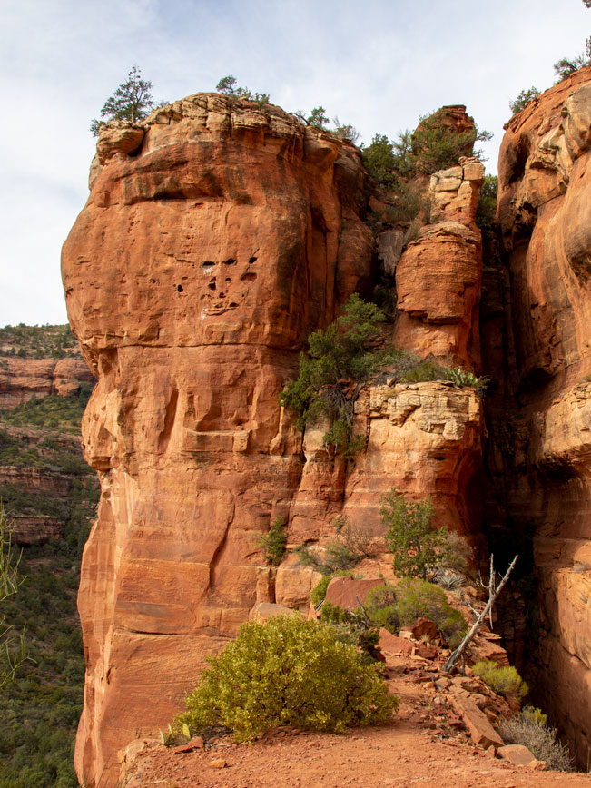 Here, a narrow, vertigo-inducing walkway traverses the arch’s ledge. And outstanding views spread out over the canyon.
Total Nerdery Fay Canyon was home to the Sinaguan people for many years. It provided ample protection, shelter and water. If anyone knows why it was named Fay Canyon, let me know. I couldn’t find information on this anywhere.
Resources Click here to download a trail map.
Directions From the intersection of 179 and 89A (in Sedona) turn left / south on 89A and drive 3.2 miles to Dry Creek Road. Turn right / north onto Dry Creek Road and continue 4.5 miles to the Boynton Canyon intersection. Turn left / north and drive approximately 1/2-mile to the Fay Canyon parking area on the left. The Fay Canyon Hiking Trailhead is across the street.
Leave a Reply