


★★★★☆ Easy / Phoenix Area
Easy, but dramatically beautiful… this hike is custom-made for a mellow day outdoors! The Marcus Landslide Hiking Trail’s wide, gentle pathway passes otherworldly rock formations and intriguing geology. It’s perfect for a day exploring with family, friends or novice hikers.
TRAILHEAD: 23015 N 128TH ST, SCOTTSDALE • DIFFICULTY: easy • DISTANCE: 1.85 MILES (3.7 miles RT) • APPROX. TIME: 2-3 HOURS rt • ELEVATION GAIN: 300 feet • APPROX. CALORIES BURNED: 480 – 550 rt • BEST TIME OF YEAR: NOV.–APR. • PETS: YES • KID FRIENDLY: Yes • FACILITIES: YES (BUT no water) • FEES: None
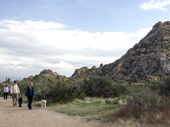 The Marcus Landslide Hiking Trail starts at the northern tip of the McDowell Mountains. Then it gently curves around the mountain’s eastern base. The contrast of open skies against boulder strewn slopes creates a dramatic landscape right from the beginning.
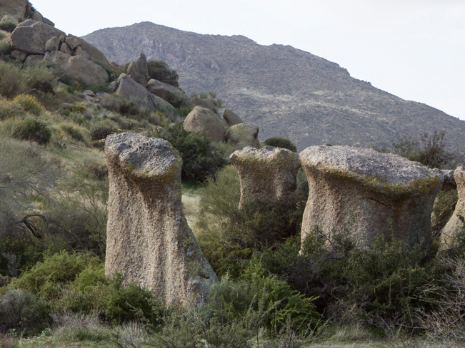 Interpretive signs explain the area’s bizarre geology with geeky, fun-filled facts. Included are the “hows and whys” of the numerous, massive granite “mushrooms” huddled beside the trail.
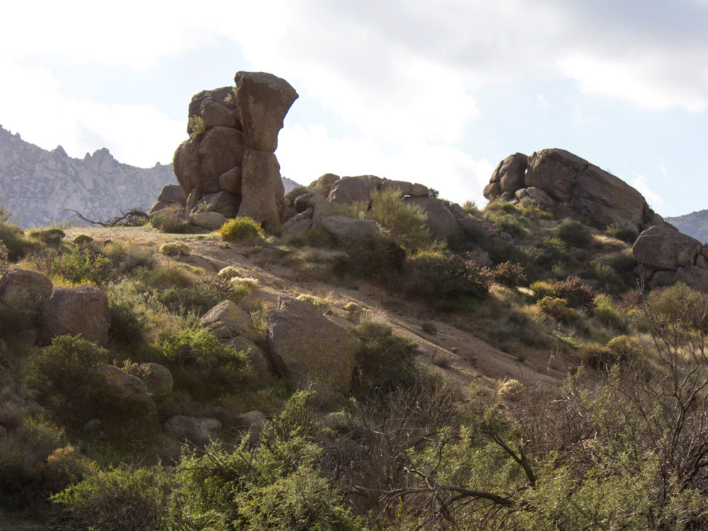
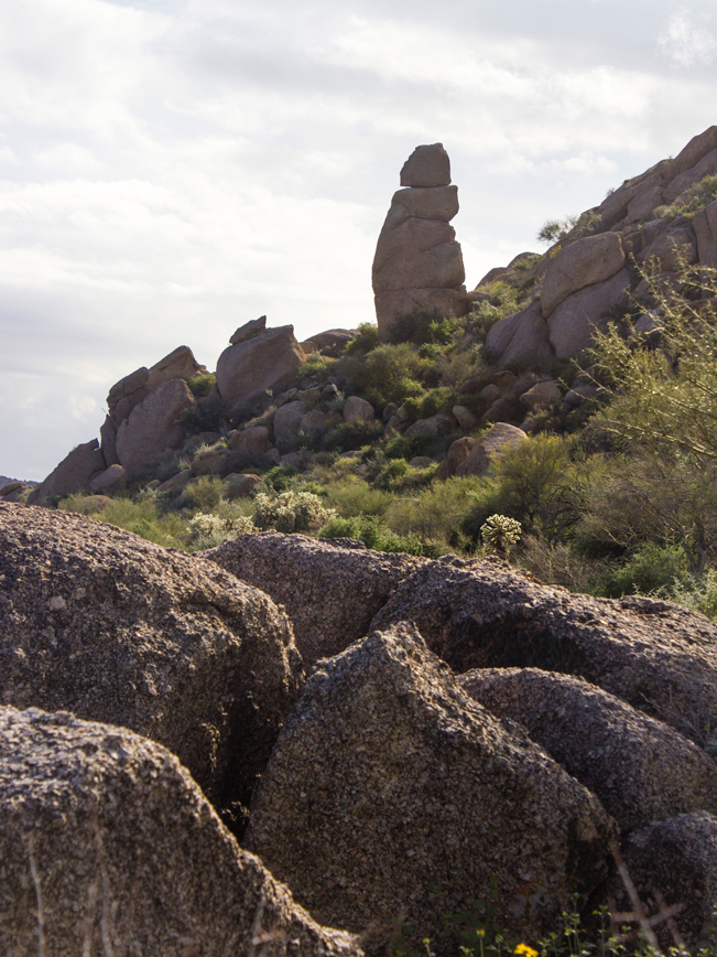 Millions of years of erosion have resulted in soaring, 50′ high, hoodoos. These precariously balanced, Jenga-like structures seem to defy gravity.
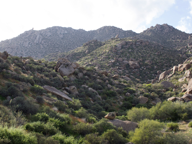 The Marcus Landslide area comes into view as the trail curves around the mountain. About 500,000 years ago, almost 30 billion pounds of rock and soil slid down the mountainside, at 40 miles-per-hour! Included in the rubble were ginormous boulders weighing more than 2 million pounds each.
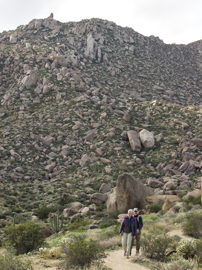 Near the trail’s end, a short, moderately steep loop, winds through part of the slide mass. Here, a gigantic boulder, called the Submarine, rests alongside the trail. Head back the way you came to reach the trailhead.
Total Nerdery
The Marcus Landslide was only discovered in 2002, by two college students (pretty smart!). It is the second largest known landslide ever to occur in Arizona.
Resources
Click here to download a map of the trail.
Directions From AZ-101 (in Phoenix) take Exit 36/Pima Road and Princess Drive and head north. Continue north on Pima Road for 6 miles to Happy Valley Road. Turn right/east on Happy Valley Road (which becomes East 118 Street) and drive 4.3 miles to East Ranch Gate Road. Turn right/east on East Ranch Gate road and drive 1.2 miles to North 128 Street. Then turn right/south onto North 128 Street and continue 1.4 miles to the trailhead parking lot.
Leave a Reply