


★★★★☆ Moderate / Sedona
Explore the top of a stunning red rock mesa on this short Sedona hike! The Doe Mountain Hiking Trail switchbacks up the side of an ancient butte to an easy-to-explore, football-field-sized platform. Circling the rim, awesome views of Sedona span for miles.
TRAILHEAD: Boynton PAss Road, SEDONA • DIFFICULTY: MODERATE • DISTANCE: 0.7 miles (1.4 RT) plus 1.3 mile around the mesa if desired • APPROX. TIME: 0.5-1.5 HOURS RT • ELEVATION GAIN: 430 FEET (31 STORIES) • APPROX. CALORIES BURNED: 275-315 RT • BEST TIME OF YEAR: YEAR ROUND • PETS: YES with leashes • KID FRIENDLY: 10 AND UP, WATCH THEM NEAR THE rim • FACILITIES: YES (BUT NO WATER) • FEES: $5 RED ROCK DAY PASS (OR $20 ANNUAL)
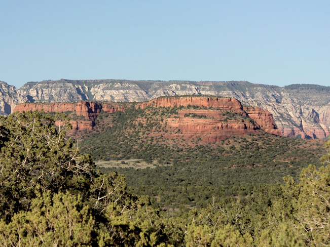 Northern Sedona’s Doe Mountain is a perfect sightseeing platform, courtesy of Mother Nature! This relatively short mesa offers crazy good views from the rim. And it’s wide flat top is a blast to explore.
 The trail up the side of the butte is a short, moderate climb on multiple switchbacks. Low growing Juniper and Ash trees offer intermittent shade along the way.
 At the top of the mesa, the Doe Mountain Hiking Trail comes to its official end. But in reality this is where the fun begins!
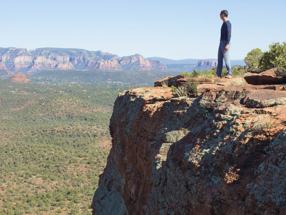
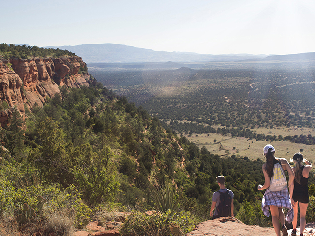
 From the trail’s end, it is easy to head in any direction to the reach the rim. And circling the edge of the mesa is a fantastic experience. Here incredible views of the Sedona red rocks spread far and wide. Tip: hang onto your hats at the top, as the wind often whips across this elevated platform.
Total Nerdery
Doe Mountain is considered one of the best places to watch the sunset in Sedona. Bring a fully charged flash light for the hike back down.
Resources
Click here to download a trail map.
Directions From the intersection of 179 and 89A (in Sedona) turn left / west onto 89A and drive 3.15 miles to Dry Creek Road. Turn Right / north onto Dry Creek Road (which become Boynton Pass Road) and continue 4.5 miles to the T intersection. Turn left / west and continue on Boynton Pass Road. The Doe Canyon Trailhead is located 1.5 miles further, on the left side of the road.
Leave a Reply