


★★★☆☆ Moderate / Prescott
Hike this shady Pine & Oak lined trail to the top of Spruce Mountain. The Groom Creek Hiking Trail meanders gently upwards to a high Watchtower. From the lookout, stunning 360° views of Granite Mountain, the Chino Valley and Prescott National Forest are a sweet reward. This trail’s consistent 3.5 mile ascent makes it a favorite training hike for those prepping for the Grand Canyon or Havasu Falls.
TRAILHEADs: senator hwy / FR 52, south of prescott • DIFFICULTY: moderate • DISTANCE: 9 MILE Loop • APPROX. TIME: 4.5-5.5 HOURS • ELEVATION GAIN: 1,375 FEET (98 STORIES) • APPROX. CALORIES BURNED: 1,350-1,530 RT • BEST TIME OF YEAR: year round • PETS: YES • KID FRIENDLY: no • FACILITIES: yes (no water) • FEES: none
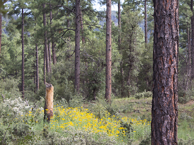
The Groom Creek Hiking Trail Loop offers up a well shaded trail, with notable views at the top. Meandering though a pristine forest of Pine and Oak, this hike makes a wide loop up and down Spruce Mountain. In Spring and Summer, expanses of yellow and white wildflowers lit upon by busy bees and chirping birds, fill the mountain base with activity.
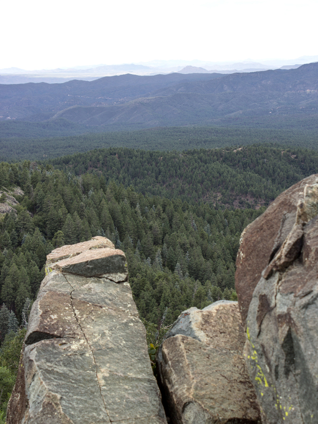
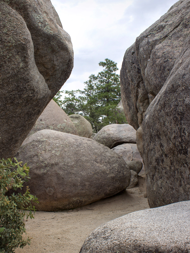 For the shortest route to the top, head left/clockwise from the trailhead. This leg is a scant 3.5 miles. Many people hike it both in & out for a shorter, 7-mile, trek. Heading this direction, be sure to stop and check out the huge outcropping of boulders about a quarter mile into the hike.
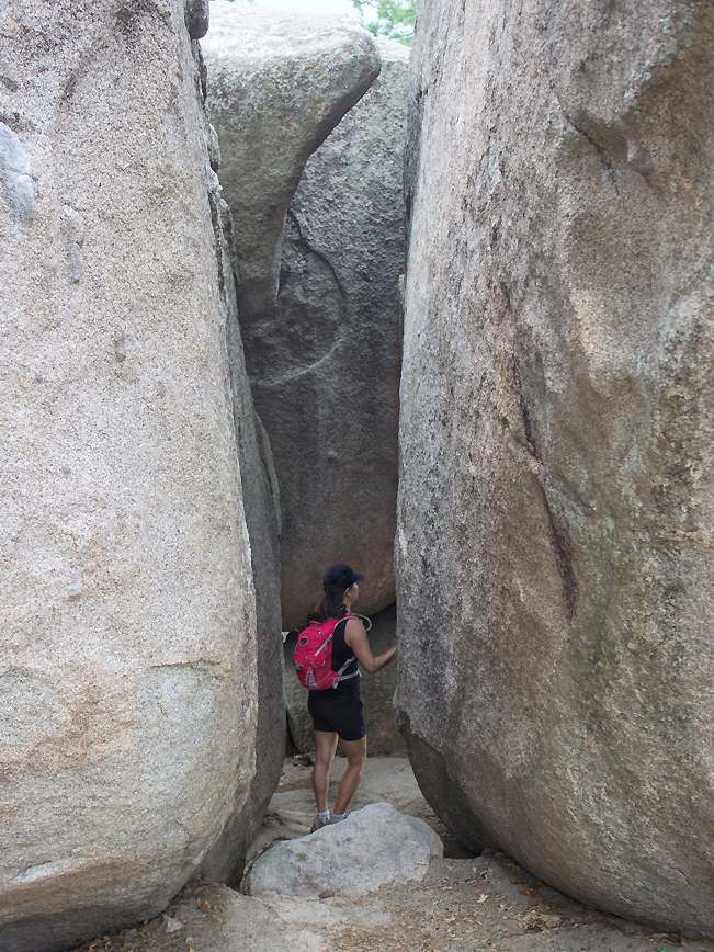 These ginormous stones, layered one atop another, create a fun maze of hidden pathways. Their nocks and crannies are a blast to explore. For families looking for a short adventure, this entertaining spot is an ideal turnaround point.
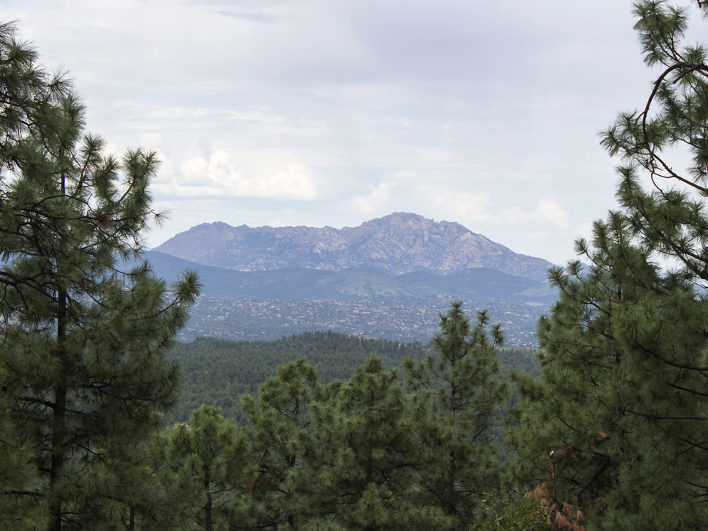
 The tall Ponderosas and wide strands of Oak that line the Groom Creek Hiking Trail keep it refreshingly shaded. The trade off is limited views during most of the hike. However, a nice expanse, with long views, opens up 1.5 miles into the hike.
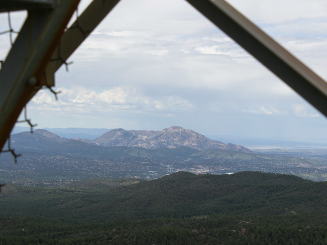 At the peak, a side-trail veers left and leads to a mountaintop watchtower. Here there are excellent 360° views of the Chino Valley, Prescott, Granite and Union Mountains and Willow and Watson Lakes.
 If the tower is occupied, the firefighter will often let you in, providing a glimpse of watchtower life. Heading down from this high roost, the trail crosses back over the Spruce Mountain Picnic area, replete with wooden picnic tables and vault toilet. Perfect for a well deserved break.
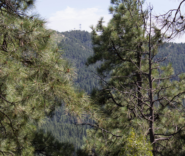 Continuing on, the Groom Creek hiking trail flattens out and follows the ridge for the next 1.5 miles. Looking across the treelined peeks you can pick out the Union Mountain Watchtower on the next mountain over.
 At 6 miles the trail intersects the Isabella Trail. Here it veers right and starts its slow, even descent. Wide strands of Gamble Oak line the path in some areas with a low-slung beauty. And a few openings in the trees reveal Thumb Butte, with Granite Mountain behind it.
The last 2 miles of the Groom Creek hiking trail are pleasantly sandy and mostly flat. Here flowers, birds and bees make a renewed appearance. Keeping company until the trailhead is reached once again.
Total Nerdery
The Groom Creek Hiking Trail is named for Colonel Bob Groom, who settled the area in 1862. Groom was the original surveyor for what is now the city of Prescott.
Resources
Click here to download a trail map.
Directions From the intersection of Gurley and Sheldon Streets (in Prescott) head west on Gurley for .65 miles to South Mount Vernon Avenue. Turn left/south onto Mount Vernon Ave. (which becomes Senator Hwy./Forest Road 52) and continue for 6.5 miles to the Groom Creek Trailhead on the left side of the road (just across the street from the Groom Creek Horse Campground).
Leave a Reply