


★★★☆☆ Moderate / Phoenix Area:
Wade in a gentle creek, or relax on a wide stone beach, outside Black Canyon City. Just a mile-and-a-half off the ever-bustling I-17 highway, the Black Canyon Trail splashes across a bend in the cool Aqua Fria River. Lucky for us, this scenic water crossing, at the foot of a tall canyon, is easily accessible via the short & sweet Rock Springs Spur Trail.
TRAILHEAD: South Warner Road, black canyon city • DIFFICULTY: MODERATE • DISTANCE: 1.4 MILEs (2.8 Miles RT) • APPROX. TIME: 1.5-2 HOURS • ELEVATION GAIN: 232 FEET (17 STORIES) • APPROX. CALORIES BURNED: 420-476 • BEST TIME OF YEAR: OCT. – APRIL • PETS: YES • KID FRIENDLY: yes • FACILITIES: YES (no water) • FEES: none
 When you feel like escaping Phoenix, but don’t want to go too far, the Rock Springs Spur Trail to Aqua Fria River, is a pretty sweet option. Tucked into the hills behind Black Canyon City, this short trail provides access to a southern portion of the 80-mile Black Canyon Trail. Which, in turn, soon hops across the Agua Fria River.
 Starting at the Black Canyon Trail parking lot, the Rock Springs Spur Trail heads west, quickly departing civilization and entering the beautifully rolling, saguaro-lined foothills of the Bradshaw Mountains. Stay straight, past a turnoff to the High Desert Trail. Then, after about 0.75 miles, veer left where the Rock Springs Spur Trail ends at a T-intersection with the Black Canyon Trail.
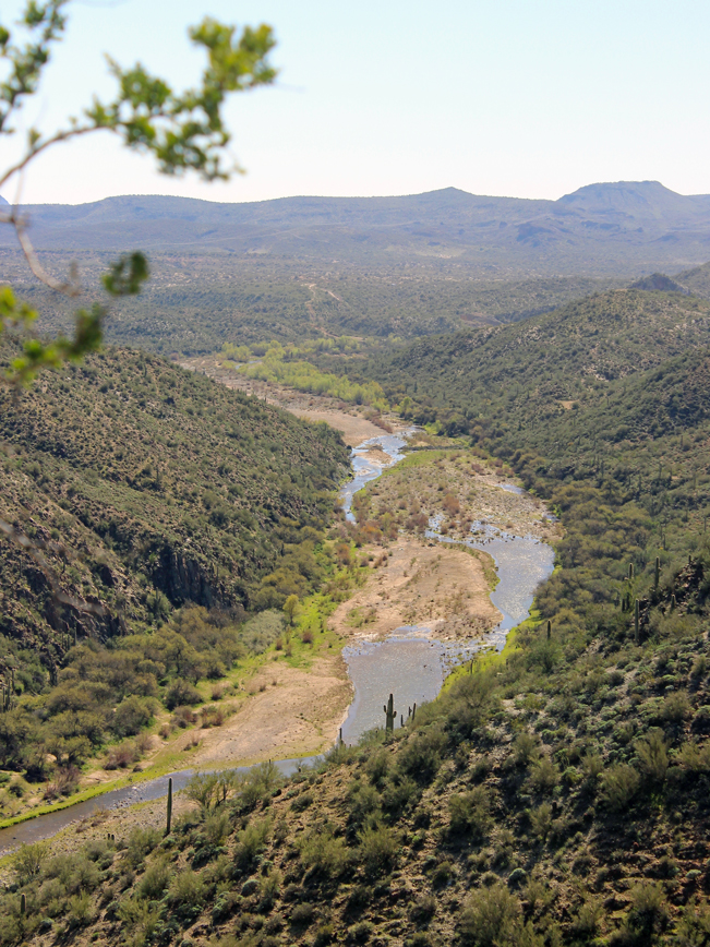
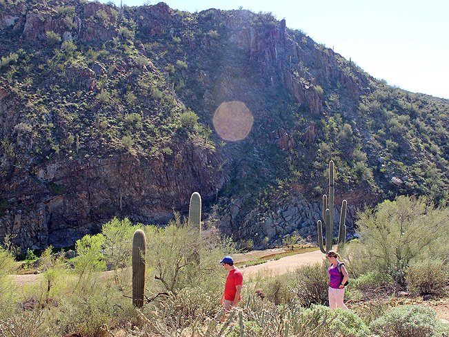 From here, the Black Canyon Trail, winds gently down a lovely canyon side. And views of the Cottonwood-lined Agua Fria River begin to peak in and out of view below. A number of short switchbacks make the final descent to the creek.
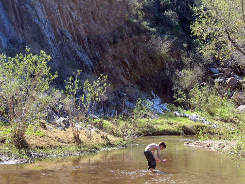
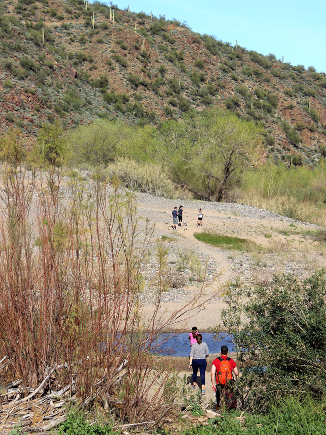 A wide sand and stone expanse, known as Horseshoe Bar, frames the river’s edge where it makes a tight U-turn around the high canyon walls.
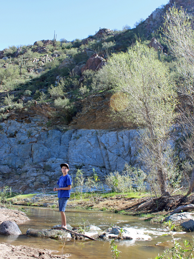 This is an awesome area to hang out. The Agua Fria’s cool water is refreshing, changing depth with the seasons. A few large Cottonwood Trees provide shade and are perfect to sit beneath and relax.
 If you’re feeling ambitious, and want to hike further, continue across the creek on the Black Canyon Trail. Once across the river, the BCT approaches, then makes a moderate climb up, the surrounding hills. Incredible views over the twisting Agua Fria spread out below after 2.5 miles of additional hiking.
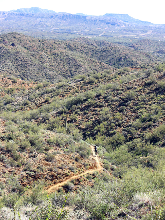 After 3.5 miles the BCT trail crests at a beautiful overlook, before heading south to New River. In total, the BCT stretches 80-miles, from Prescott (in the north) to New River (in the south). It is hyper-popular with mountain bikers, for its extreme length and perpetual curves.
Total Nerdery
The 120-mile long Aqua Fria (Cold Water) River starts north of Prescott, winds south through the Bradshaw Mountains, and reaches its final destination as a cool dip in Lake Pleasant.
Resources
Click here to download a trail map. The Rock Springs Spur Trail starts at the Black Canyon City Trailhead.
Directions: From I-17 (about 27 miles north of Phoenix) take exit 242 west / left, to Black Canyon City. Just after crossing over the highway, turn right / north onto Old Black Canyon Highway and drive 0.6 miles to South Warner Road. Turn left onto South Warner Road and continue approximately 0.5 miles to the Black Canyon City Trailhead parking lot on the right side of the road.
4 Responses to Rock Springs Spur Trail to Aqua Fria River Crossing
It’s actually a left off the highway, then right, then left onto South Warner
Thanks Leah. Those are the directions given. Just used west from I-17 instead of left. Hope you enjoyed the hike.
Searched today trying to find this, no luck. We followed the directions and no luck, plus we searched for it on All Trails and it does’t recognize the name. We did the high desert trail instead.
Argh! If you parked at the Black Canyon Trailhead off of Warner Road, you were SO close! Instead of turning right onto the High Desert Trail, continue straight on the Rock Springs Spur Trail (which All Trails only mentions on its 30 mile route from Black Canyon City). Then veer left where the Spur Trail ends at the Black Canyon Trail.