


★★★★☆ Difficult / Sedona:
The hike to Vultee Arch, a 50′ huge, red rock bridge, climbs up and over a high Oak Creek canyon. The arch is worthy both for its ginormous size and its tucked-in location, away from Sedona’s sometimes maddening crowds. Sterling Pass Hiking Trail is a little steeper and a little less accessible than most tourists go for. So, for those up for it, this hike offers a welcome respite in a spectacular Sedona location.
TRAILHEAD: AZ 170, Sedona, AZ • DIFFICULTY: difficult • DISTANCE: 2.4 MILES (4.8 MILES RT) • APPROX. TIME: 2.5-3 HOURS RT • ELEVATION GAIN: 1050 FEET (75 STORIES) • APPROX. CALORIES BURNED: 815-920 • BEST TIME OF YEAR: SEPT.-JUNE • PETS: YES • KID FRIENDLY: No • FACILITIES: None • FEES: RED ROCK ($5 DAILY, $15 WEEKLY, $20 ANNUAL) OR NATIONAL PARK PASS ($85 ANNUAL) REQUIRED
 Lesser known and definitely less crowded than the ever popular Devils Bridge, Vultee Arch is possibly the more impressive of these two sister formations. To get there, Sterling Pass Hiking Trail takes off from the banks Oak Creek and heads up, over and down a gorgeous red rock canyon.
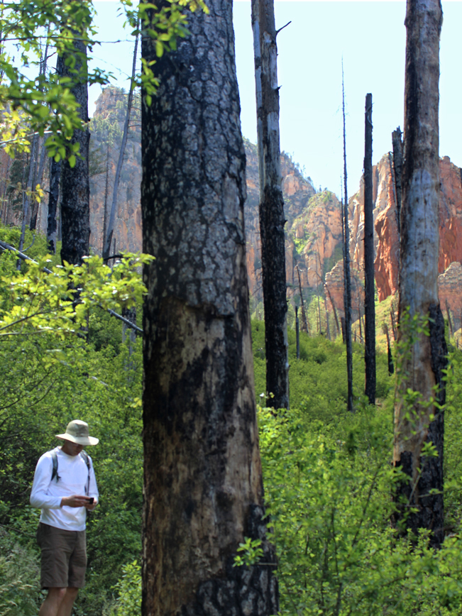
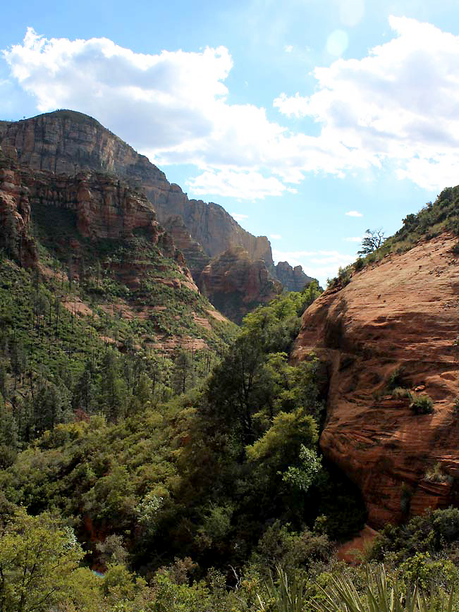
 After first meandering towards the canyon wall, under trees burned crisp by a long-ago forest fire, the hike begins a heart-pumping one-mile ascent up multiple switchbacks. Numerous stopping points open up onto stunning views of towering vermilion cliffs.
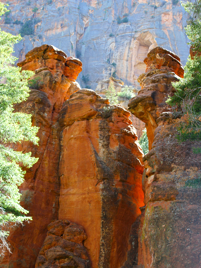
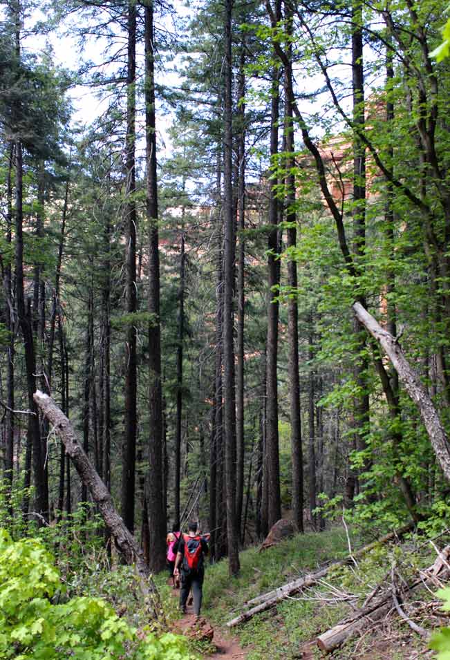 At the top of the canyon, the trail crosses Sterling Pass and starts a well deserved and very welcome, mile-long descent down the backside. Here glimpses of tall red rock cliffs peek out between the branches of stick-straight Ponderosa Pines.
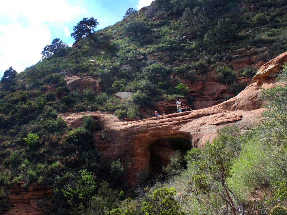
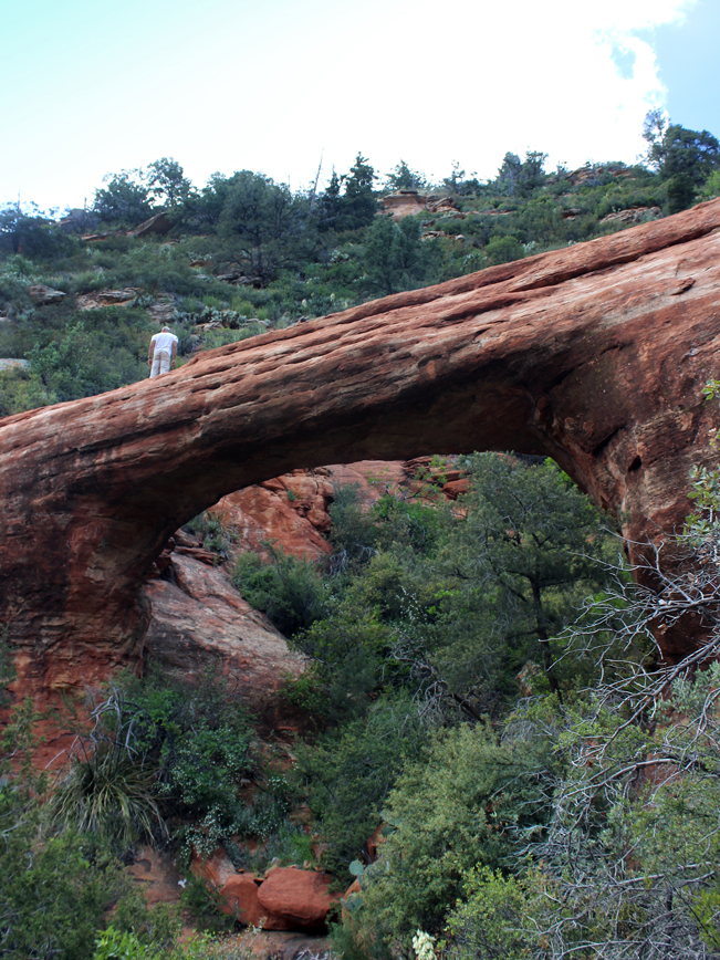 Approaching the base of the Canyon, the trees suddenly give way to reveal Vultee Arch, tucked into a hillside on the right. The path winds toward the arch where a small side trail leads to the top.
 The views from the arch are breathtaking, looking back towards the canyon you climbed down from and out towards the red rocks of Sedona. To return to the trailhead hike back the way you came. Yup. Up first. Followed by an exquisitely welcome down!
Total Nerdery
Vultee Arch was named for Sylvia and Gerard Vultee (an early aircraft designer), who died in 1938, when their aircraft crashed on a nearby canyon. There is a small plaque commemorating them by the arch. It’s also possible to reach Vultee Arch from the much easier Vultee Trail, whose trailhead is located 4.5 miles along the high clearance vehicle only, deeply rutted, Forest Road 152.
Resources
Click here to download a trail map.
Directions From the intersection of 179 and 89A (in Sedona) head north on 89A for 5.5 miles. The trailhead is located on the left / west side of the road, near mile marker 380 and just before the entrance to the Manzanita Campground. There is a small parking pull out alongside the road. Hint, if you get to Slide Rock Park, you’ve gone too far.
2 Responses to Sterling Pass Hiking Trail to Vultee Arch
Very cool pictures and great views! I might have to check this out on my next trip to Sedona; the crowds of Devil’s Bridge are, admittedly, a little much.
This hike is a really nice escape from Sedona’s crowds – being more a little more remote and challenging. Hope you get to take it. Curious to know what you think.