


★★★★☆ Difficult / Superior
If butt-kicking scrambles up rocky ravines are your thing, this hike is for you! The Picketpost Mountain Hiking Trail kicks off with a deceptively easy approach that quickly morphs into a rugged climb up a steep, narrow gorge. The payoff for bagging this solitary peak? A well-deserved sense of accomplishment and some of the best 360° views around!
TRAILHEAD: Forest Road 231, Superior • DIFFICULTY: difficult • DISTANCE: 2.5 miles (5 miles RT) • APPROX. TIME: 3.5 – 6 HOURS rt • STARTING ELEVATION: 2,382′ • ELEVATION GAIN: 2,115′ • APPROX. CALORIES BURNED: 850-950 rt • BEST TIME OF YEAR: Oct.- april. • PETS: no • KID FRIENDLY: NO • FACILITIES: yes (no water) • FEES: None
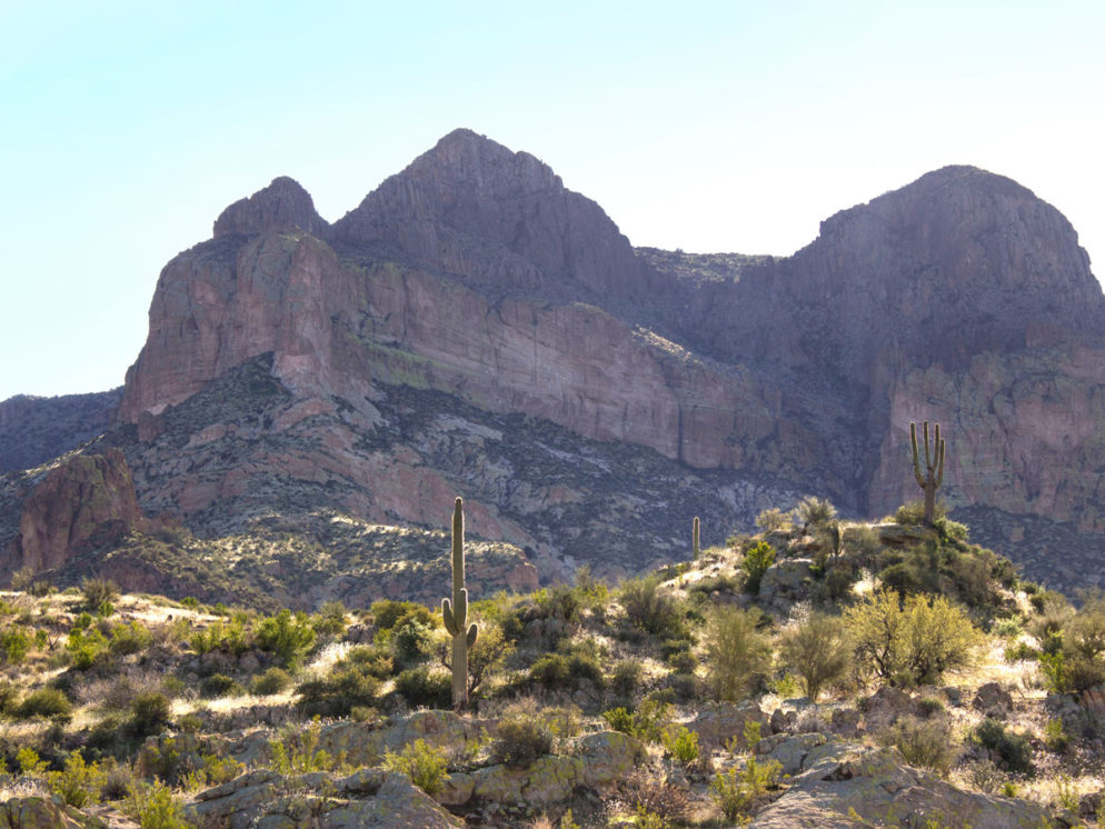
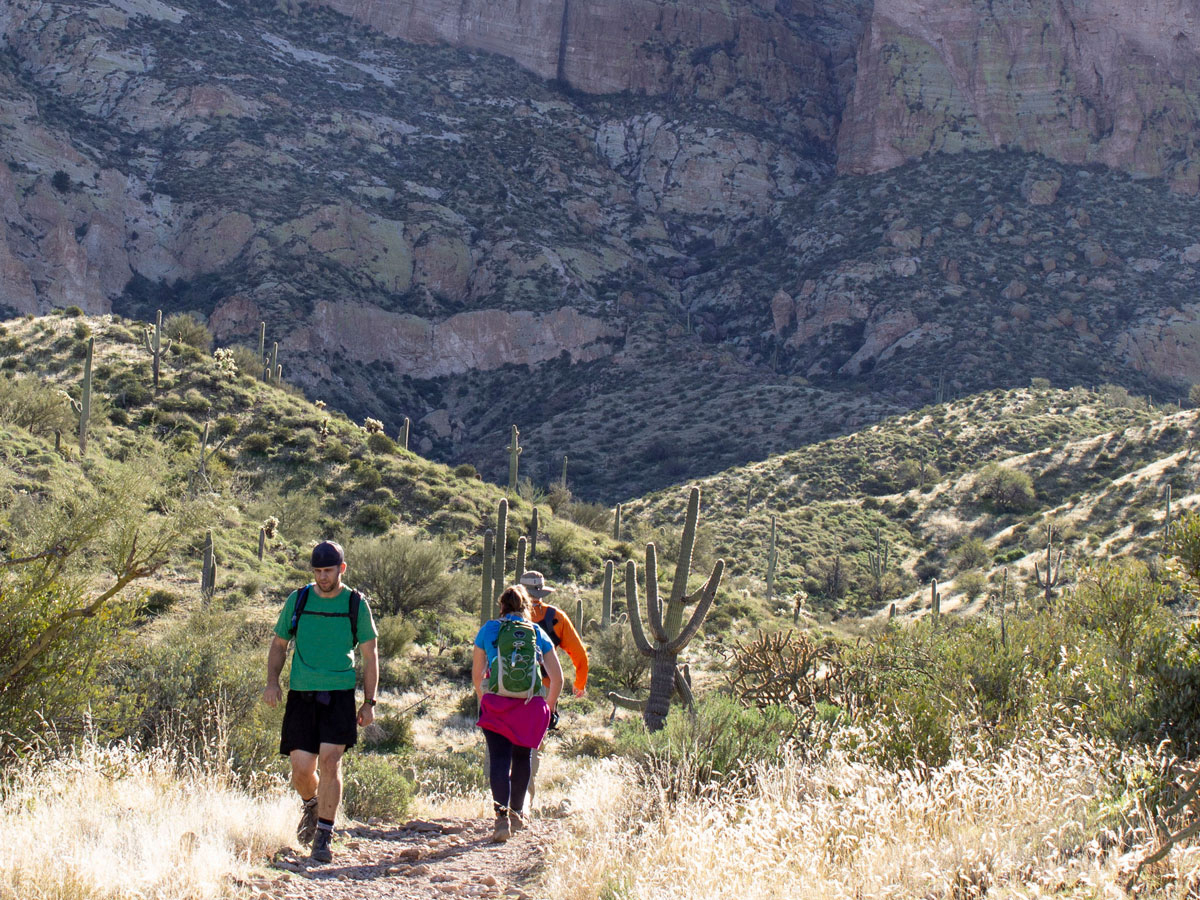 The Picketpost Trailhead, just west of Superior, provides access to both the Arizona and the Picketpost Hiking Trails. From the trailhead, turn right onto the AZT and hike about a quarter mile to Picketpost Trail’s well marked turnoff. From here, the path meanders lazily up and around the foothills for a little over a mile. It’s filled with pretty views of White Canyon Wilderness.
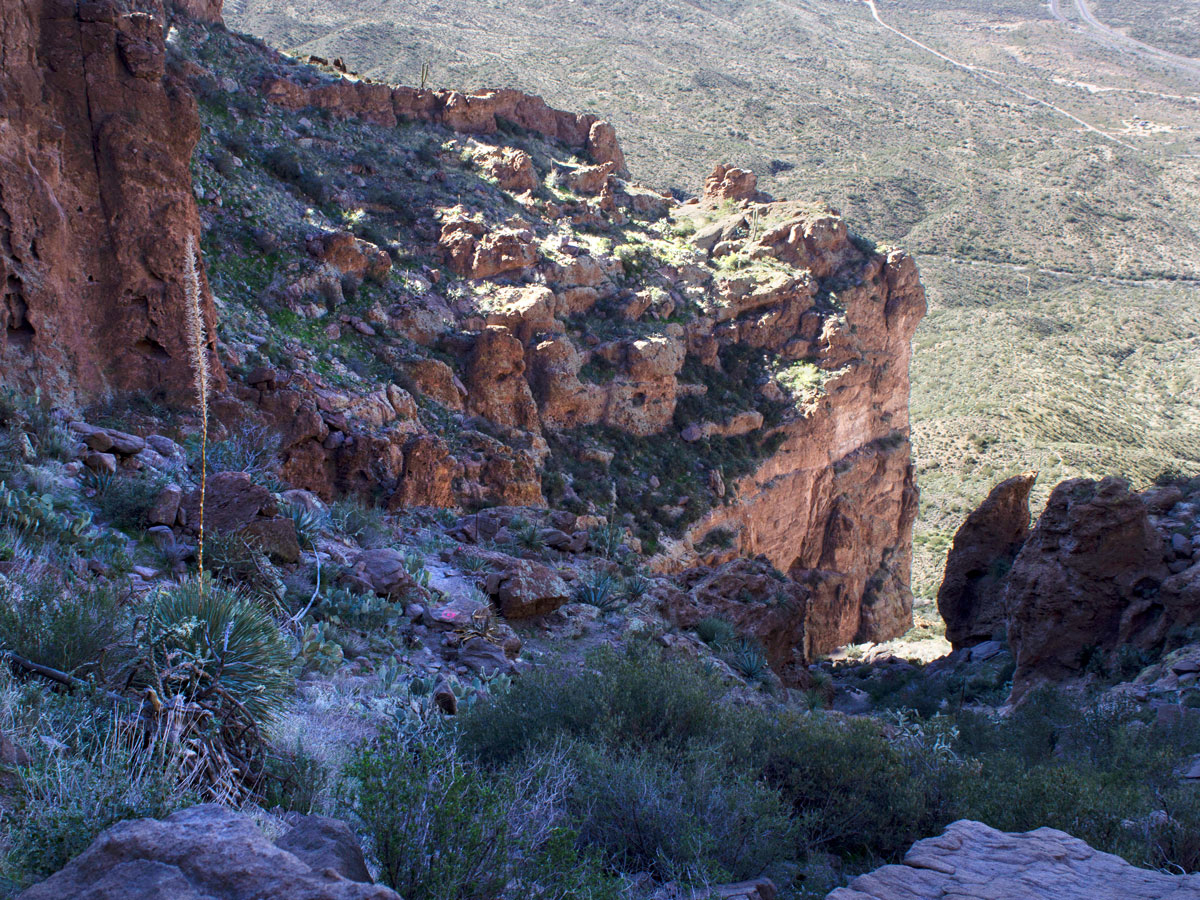
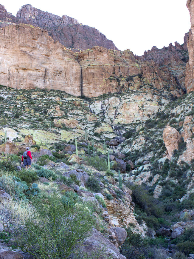 After about 1.5 miles, the trail veers sharply left and heads straight towards the mountain, steepening as it skims the edge of a deep wash. The first of many scrambles follows, up a wide, 50′ high rock face. From here, a loose rock path, marked by occasional cairns and spray painted dots, switchbacks up the mountainside. A few precarious ledges require steady footwork, as the trail approaches the narrow ravine that ultimately leads up Picketpost Mountain.
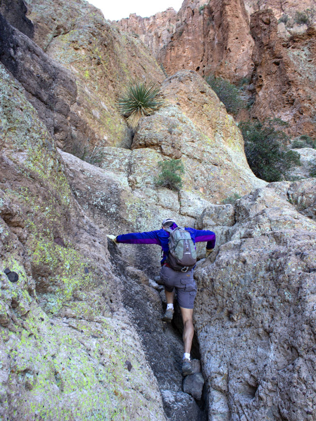 Making the steep 0.75 mile hike up this ravine is really a matter of “choosing your scramble”. There are multiple routes. One hugs the cliffs on the far side of the ravine. While another weaves through the middle. Any option is guaranteed to be steep and loaded with full-on rock scrambles.
 A wide stone basin cuts through the rocks about halfway up the ravine. It’s followed by more large boulders, narrow rocky chutes and tall scrambles.
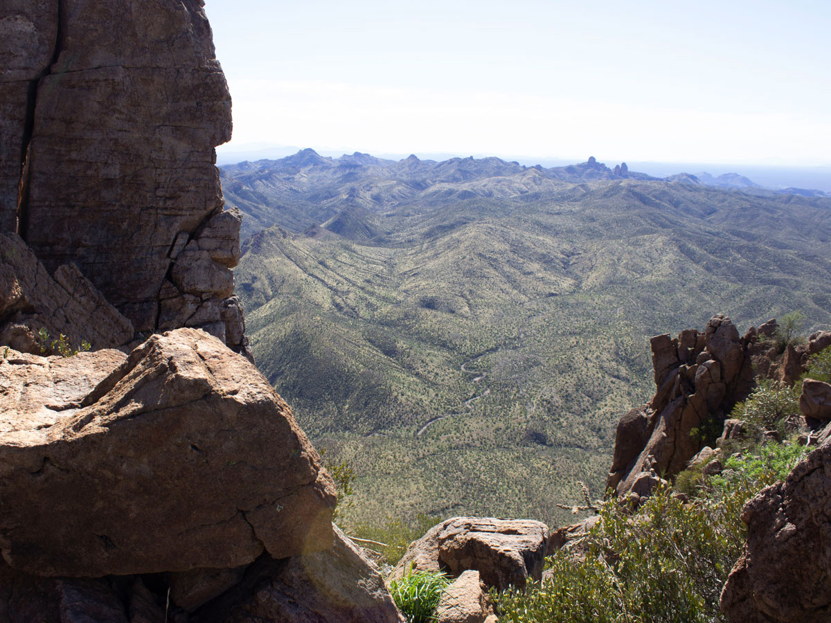
 After 2 miles, the trail reaches the top of the ravine. Backwards views spread out below and confirm the steepness of the ascent. From here, a well defined dirt path leaves the scrambles behind, and continues up the mountain.
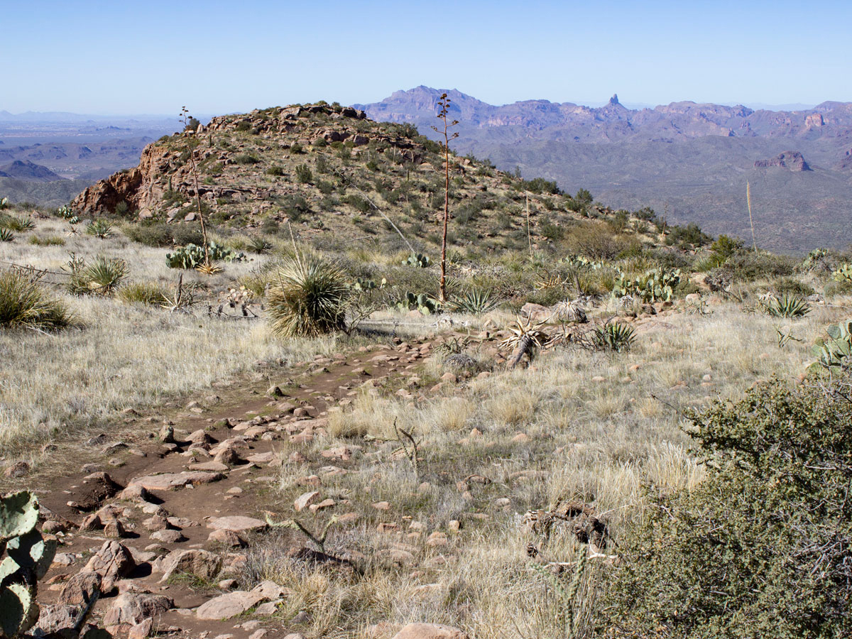
At the top of Picketpost Mountain, the trail flattens out and crosses to the other side. Lengthy views make Weavers Needle and Flatiron look toy-sized in the distance.
A final, short ridge, on the far side of the mesa, leads to Picketpost Mountain’s summit. Here 360 views abound! To the north are the Superstition Mountains and Four Peaks. In the east are Apache Leap and Pinal Peak. To the west are the San Tans and greater Phoenix valley. And to the south are stunning views of the White Canyon Wilderness. A mailbox, where hikers left notes, had marked the trail’s end until someone removed it in early 2020.
Turn around here for the steep, slippery descent back to the trailhead. Hiking poles are recommended for remaining upright on the loose rock path. And gloves are a plus for protecting your hands on the scrambles.
Total Nerdery Picketpost Mountain was named in 1870 by soldiers stationed at a military camp by its base. The mountain’s high walls worked like a picket post to help ward off attacks. The town of Superior grew out of this camp.
Resources Click here to download a trail map. Click here for more information on the White Canyon Wilderness.
Directions From the intersection of AZ 202 and US 60 (in Gilbert), take US 60 east towards Superior for 31 miles. Just after mile marker 221, at the sign for the Picketpost Trailhead, turn right onto FR 231. Turn left / east at the T intersection and continue for 0.7 miles to the right side turnoff to the trailhead parking lot.
Leave a Reply