


★★★☆☆ Difficult / Fountain Hills
A grinding slog, up a patchwork road, leads to one of the McDowell Mountains highest peaks. Climbing the less populous, east side of the range, the Thompson Peak Hiking Trail veers off Dixie Mine Trail to a relentless climb, followed by outstanding 360° views! azutopia.com
TRAILHEAD: 14425 East Golden EAgle Boulevard, fountain hills • DIFFICULTY: difficult • DISTANCE: 5 MILEs (including access trail) (10 miles rt) • APPROX. TIME: 5 – 6.5 HOURS rt • starting elevation: 2,100′ • ELEVATION GAIN: 1,882′ • APPROX. CALORIES BURNED: 630 – 715 • BEST TIME OF YEAR: OCT. – april • PETS: YES • KID FRIENDLY: no • FACILITIES: YES • FEES: $2 day use
Access via Dixie Mine Trail
 The Thompson Peak Hiking Trail is most easily accessed via Dixie Mine Hiking Trail (see map). To reach this trailhead, park at the lot just outside the Golden Eagle Private Community. A quick, half-mile walk through the neighborhood leads to the trailhead, and the box for depositing the required $2 Day Use Fee.
As soon as boots hit trail, the Dixie Mine Hiking Trail transforms into something wonderfully remote. Traversing a wide natural expanse, between the McDowell and Four Peak Mountain Ranges, it’s framed by gently rolling hills, tall saguaros and dramatic, granite topped crests.
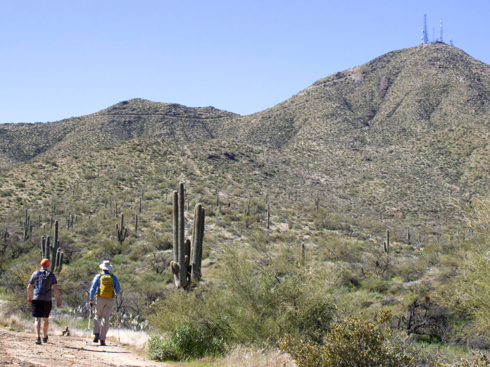
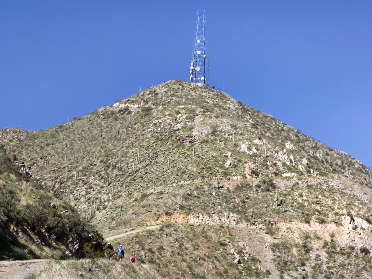
 Thompson Peak, with it’s high satellite towers, points skywards behind yellow-gold boulders. And long views over Four Peaks Wilderness spread out to the east.
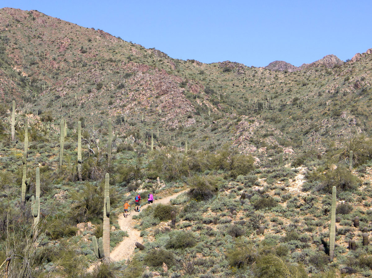
 After a pleasantly-rolling, 2-mile jaunt, the old Dixie Mine protrudes from a hillside. A T-intersection marks the start of the Thompson Peak Hiking Trail. Thompson veers to the left, while the Dixie Mountain Trail swings right.
Thompson Peak Hiking Trail
 The Thompson Peak Hiking Trail now heads straight towards the mountains. It follows a bumpy, rock and gravel service road. The first mile is an easy approach. Pretty arroyos and craggy foothills line the path. While the steep road, cutting straight up the slope, is visible directly ahead. Sparkling satellite towers mark the final destination.
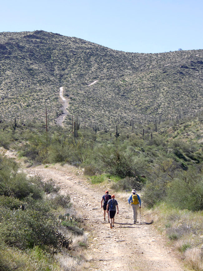
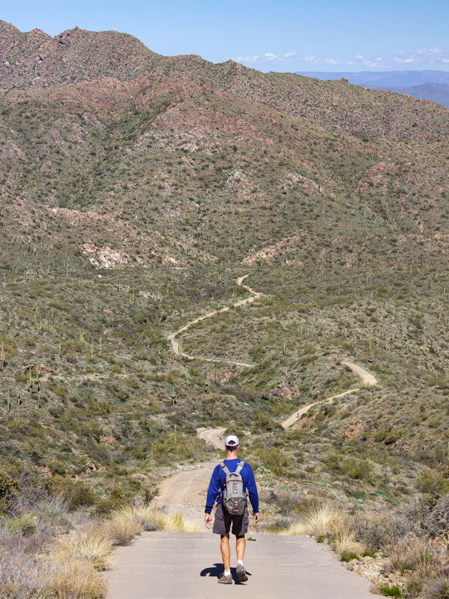 Now the climb starts in earnest! The next 3/4-mile is a grinding slog. It starts with a 30-35° climb up a loose rock and dirt hill, followed by an equally steep ascent up a patchwork cement road. There are no breaks in this section (making it hard to remember what perpendicular feels like).
 At last the trail levels out a bit, as it cuts across the side of the mountain. A couple of high passes serve up excellent views at the start and end of this 0.45-mile leg. Fountain Hills, Scottsdale, Phoenix, Camelback, Piestewa and even the White Tanks Mountains spread out below.
 Take a deep breath because the Thompson Peak Trail now kicks it up again for the final stretch. The hike’s last quarter-mile curves up and around the mountaintop at an even steeper angle! It’s a whopping 37° as the soaring satellite towers come into view. But oh it is worth it! At the top, amazing 360° views fan out in every direction. And birds glide on the breezes below the peak. Take a well deserved break and then head back the way you came.
Total Nerdery Although Thompson Peak may look like the highest peak in the McDowell Mountain Range, it is actually 52′ shorter than the highest peak, East End.
Resources Click here to download a trail map
Directions From the intersection of 101 and Shea Blvd. (in Scottsdale), head west on Shea Blvd. and drive 7.85 miles to N. Palisades Blvd. Turn left / north onto N. Palisades Blvd. and continue 1.55 miles to Sunridge Drive. Turn left / north onto Sunridge Dr. and drive 2.7 miles to East Golden Eagle Blvd. Turn left / west onto E. Golden Eagle Blvd. and drive 0.45 miles to the trailhead parking area, on the left side of the road.
One Response to Thompson Peak Hiking Trail
Great hike. It definitely requires one to watch your steps. As a result, it improves your balance especially for older individuals. Footnote: my wife lost her hearing aids(right side). If found please e-mail me.