


★★★★☆ Difficult / Phoenix Area
This beautiful trail ascends a pass between the McDowell Mountains two highest peaks. Instagram-worthy views of North Scottsdale define the front. While majestic views of Four Peaks fill the horizon on the back.
TRAILHEAD:18333 N. ThompsonPeak Pkwy., scottsdale • DIFFICULTY: difficult • DISTANCE: 4.7 MILES, including access trails (9.4 miles RT) • APPROX. TIME: 3.5–4.5 HOURS rt • starting elevation: 2,014 • ELEVATION GAIN: 1,184 • APPROX. CALORIES BURNED: 960 – 1,090 rt • BEST TIME OF YEAR: sept.-may • PETS: YES • KID FRIENDLY: no • FACILITIES: YES • FEES: None

The Bell Pass Hiking Trail kicks off 1.5 miles from the McDowell Sonoran Preserve’s bustling Gateway Trailhead (click here for a map). To reach it, take the easy Saguaro Trail 0.4 miles to moderate Gateway Loop Trail, then turn right. This busy loop serves up soaring views of the McDowell Mountain Range. After 1.5 miles, the Bell Pass Trailhead veers off to the right.
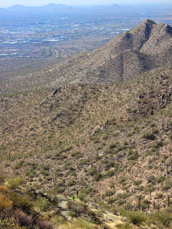
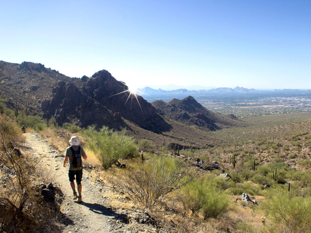
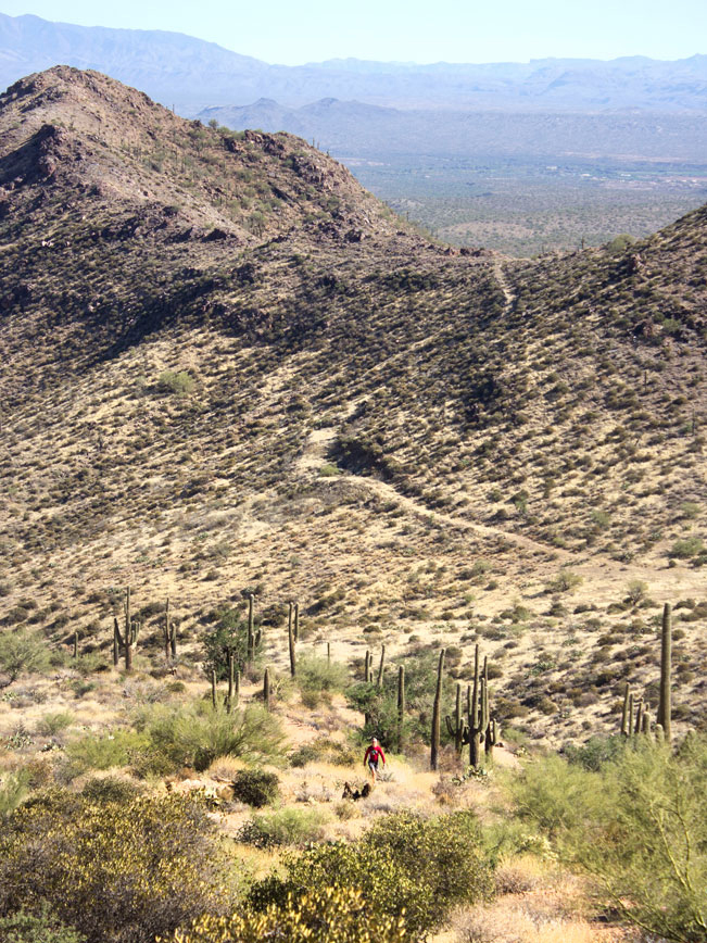
The next 1.25 miles make a moderate, switchbacked ascent up a pass between McDowell & Thompson Mountains. Looking backwards, pretty North Scottsdale views spread out below.
 The hardest part of the hike kicks in just a little further on. Here, a steep .25 mile section climbs straight up the pass.
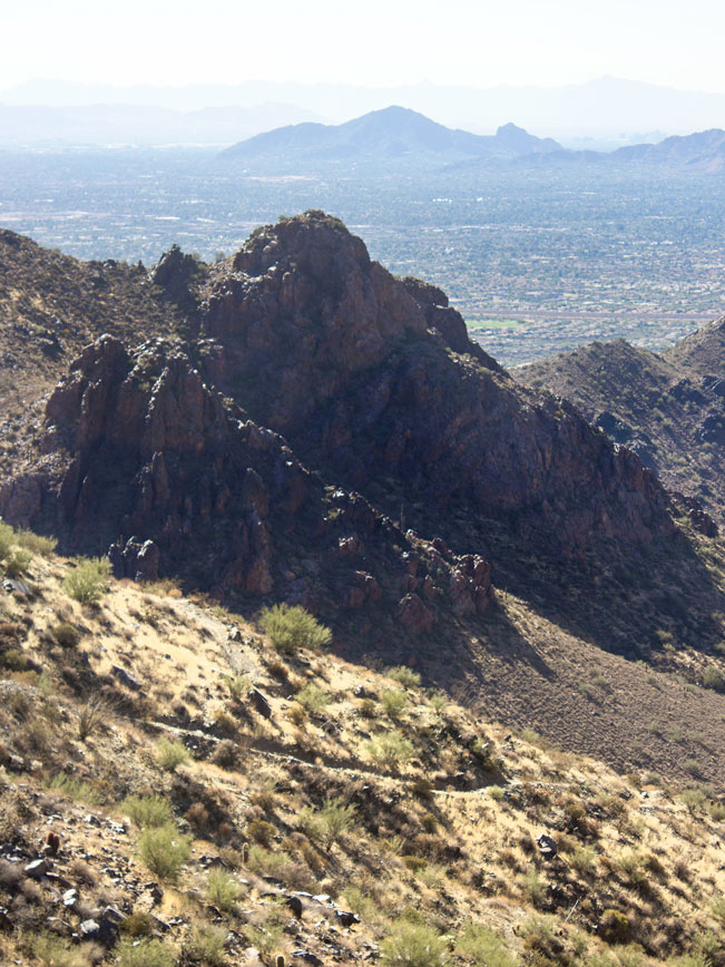
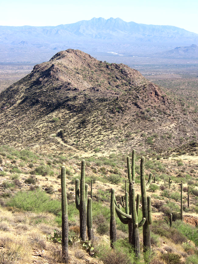 After 3.5 miles, the trail reaches the top of the pass. Ahead, majestic views of Four Peaks fill the horizon.
 The hike is mostly downhill from here to Bell Pass Hiking Trail’s end. After a steep descent the trail levels out a bit, curving left towards its end at Windgate Pass Hiking Trail. Turnaround here to head back on Bell Pass. Or, turn left on Windgate Pass for a 9.4 mile loop back to Gateway Trailhead.
Total Nerdery Bell Pass ascends between the two highest peaks in the McDowell Mountain Range. Thompson Peak is the second highest, at 3,969′. And McDowell Peak is the highest at 3,995′. There are no trails to the top of McDowell Peak.
Resources Click here to download a trail map
Directions From the intersection of AZ Loop 101 and Bell Road (in Scottsdale) turn east onto Bell Road. Continue for 1.66 miles on Bell Road to N. Thompson Peak Parkway. Turn left/north onto N. Thompson Peak Parkway and drive 0.5 mile to the entrance to the McDowell Sonoran Preserve Gateway Trailhead. It’s clearly marked on the right side of the road.
2 Responses to Bell Pass Hiking Trail
I keep asking where did this park gets it’s name?
I’ve looked for that information myself. But haven’t been able to find the answer. Let me know if you do.