


★★★★☆ Moderate / Scottsdale
With its long views, and great mix of moderate & easy sections, the Windgate Pass Hiking Trail is anything but boring! Kicking of from busy Gateway Trailhead in north Scottsdale’s McDowell Sonoran Preserve, this trail first climbs to gorgeous Inspiration Point. Here there are excellent views over the city. The trail then gently ascends to equally stunning Windgate Pass, on the far side of the preserve.
TRAILHEADs: GATEWAY TRAILHEAD,18333 N. Thompson Peak Pkwy., scottsdale • DIFFICULTY: Moderate • DISTANCE: 4.7 MILEs (9 miles rt) INCLUDING ACCESS TRAILS • APPROX. TIME: 3.5-4.5 HOURS • ELEVATION GAIN: 858 FEET (61 STORIES) • APPROX. CALORIES BURNED: 930-1,055 RT • BEST TIME OF YEAR: October-April • PETS: YES • KID FRIENDLY: No • FACILITIES: YES • FEES: none
Gateway Trailhead to Windgate
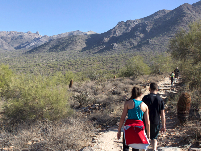 As an interior trail, the Windgate Pass Hiking Trail is only reachable by hiking one of six McDowell Sonoran Preserve access trails. The most popular access (described here) is via the Gateway Loop Trail, from Gateway Trailhead. From the Trailhead, the super-easy, half-mile Saguaro Trail leads to the Gateway Loop Trail. Turn left to reach the Windgate Trailhead, one mile around the loop. This leg is, by far, the busiest part of the hike! The Hyper-popular Gateway Trail is moderately steep, with great views of Tom’s Thumb hanging out in the distance.
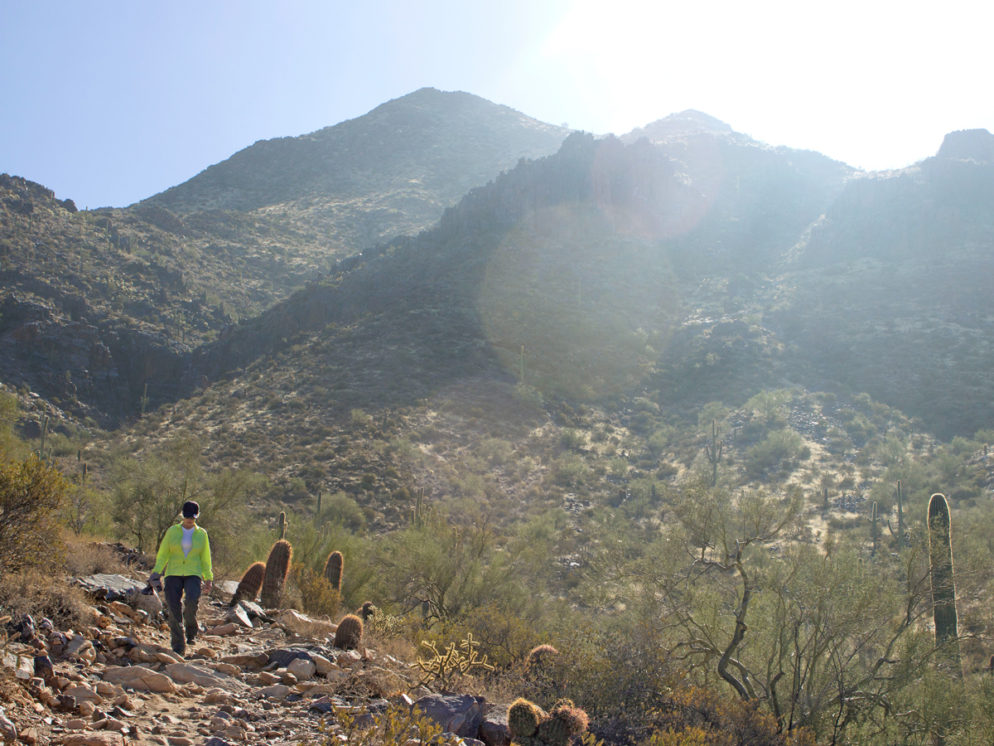
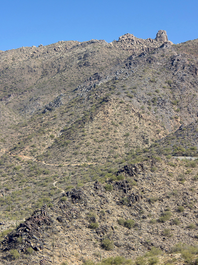
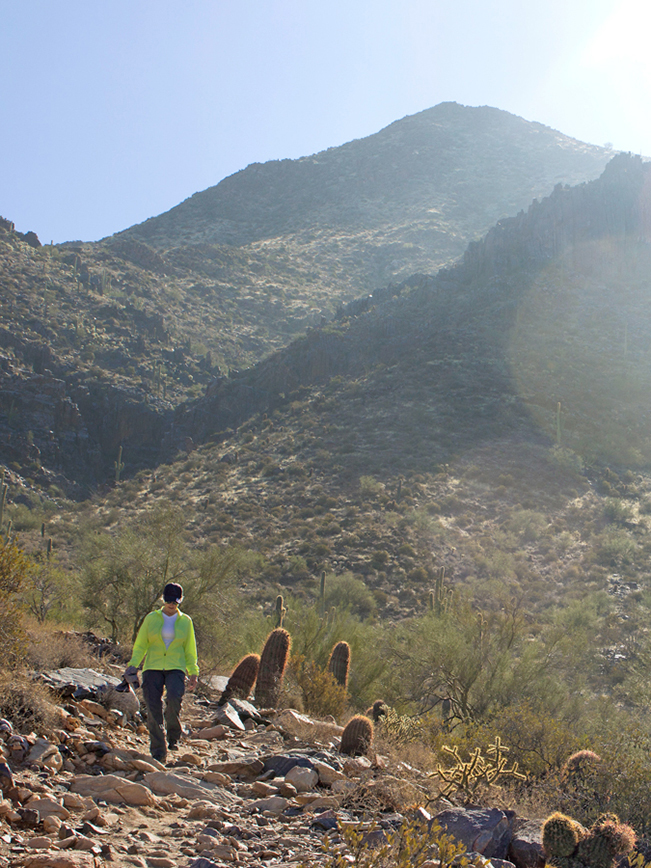 Once on the Windgate Hiking Trail, the crowds quickly disappear! The Windgate steepens slightly as it curves upwards between the mountains towards Inspiration point. Views of Toms Thumb are replaced by the rocky slopes of Drinkwater and McDowell Mountains.
Inspiration Point to Windgate Pass
 Less than 3-miles into the hike, the Windgate Pass Hiking Trail reaches Inspiration Point. This gorgeous lookout, complete with stone benches to rest on, sits at an impressive 2,714′ elevation. Lots of hikers make Inspiration their turnaround point for a quick 6-mile out and back.
 Looking back over the trail there are beautiful views of North Scottsdale. While, to the north, Toms Thumb is again visible, along with its namesake trail.
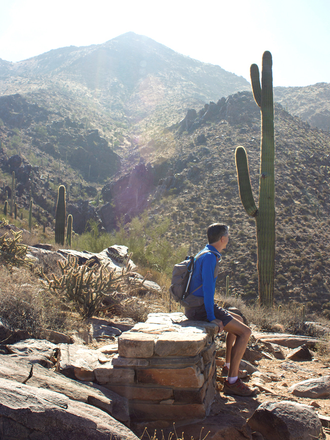
 For those looking for a longer hike, the trail continues past Inspiration Point to Windgate Pass. This one-mile long section is less steep than the first section of the trail. At 3,031′, Windgate Pass is the highest point of the hike. From here, there are epic views both west, over Scottsdale and the McDowell Mountains, and east, over Fountain Hills.
Windgate Pass to Bell Trail
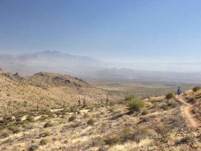 From Windgate Pass to the trail’s end, at the Bell Pass Hiking trail, the hike is now either flat or downhill. The mountains open up to wide eastward views of Fountain Hills, with Four Peaks far off on the horizon. Hikers can either turn around at Bell Pass Trail and head back the way they came. Or they can do a 9.7-mile loop by continuing on Bell Pass, to Gateway Loop, to Saguaro Trail. This route also returns to the Gateway Trailhead, and is only 0.4 miles longer than heading back on the Windgate Pass Trail. See the trail map at the link below for details.
Total Nerdery
At 30,500 acres the McDowell Sonoran Preserve is the largest Urban Park in the United States!
Resources
Click here to download a trail map.
Directions
From the intersection of AZ Loop 101 and Bell Road (in Scottsdale) turn east onto Bell Road. Continue for 1.66 miles on Bell Road to N. Thompson Peak Parkway. Turn left/north onto N. Thompson Peak Parkway and drive 0.5 mile to the entrance to the McDowell Sonoran Preserve Gateway Trailhead. It’s clearly marked on the right side of the road.
2 Responses to Windgate Pass Hiking Trail
The easiest access point for this trail is probably the Gateway Loop Trail. From the well-equipped and popular Gateway Trailhead, you’ll hike along the clockwise portion of Gateway Loop with a steady but moderate climb for about 1.6 miles. This is a crowded section that’s frequently used as part of a workout loop by mountain bikers, trail runners, chatty neighborhood residents and, based on one sighting I recently had, a unicyclist. Fortunately, you’ll lose the crowd at the approximately 1.6 mile mark, because their loop turns off to your right at an officially marked sign, while you will continue straight. It is at this point that the Windgate Pass Trail officially begins.
Thanks Barry.