


★★★★☆ Difficult / Phoenix Area
Mashing up long easy sections and short steep hills, the Goat Camp Hiking Trail winds deep into the gorgeous White Tank Mountains. Multiple peaks offer fantastic resting places and amazing 100-mile views! Spreading out below are Goat Camp Canyon and the farms just west of Phoenix. As a bonus, you’ll get lots of solitude on this anything-but-boring hike.
TRAILHEAD: 20304 W. WHITE TANK MOUNTAIN ROAD, WADDELL • DIFFICULTY: difficult (but only for Two miles of the trail) • DISTANCE: 6.3 MILES (12.4 RT) • APPROX. TIME: 6.5 – 7.5 HOURS rt • ELEVATION GAIN: 1,730 FEET (124 STORIES) • APPROX. CALORIES BURNED: 1,860 – 2,100 rt • BEST TIME OF YEAR: oct. – april • PETS: YES • KID FRIENDLY: no • FACILITIES: YES. Not at trailhead, but in park • FEES: $7 DAY OR $85 ANNUAL MARICOPA COUNTY PASS
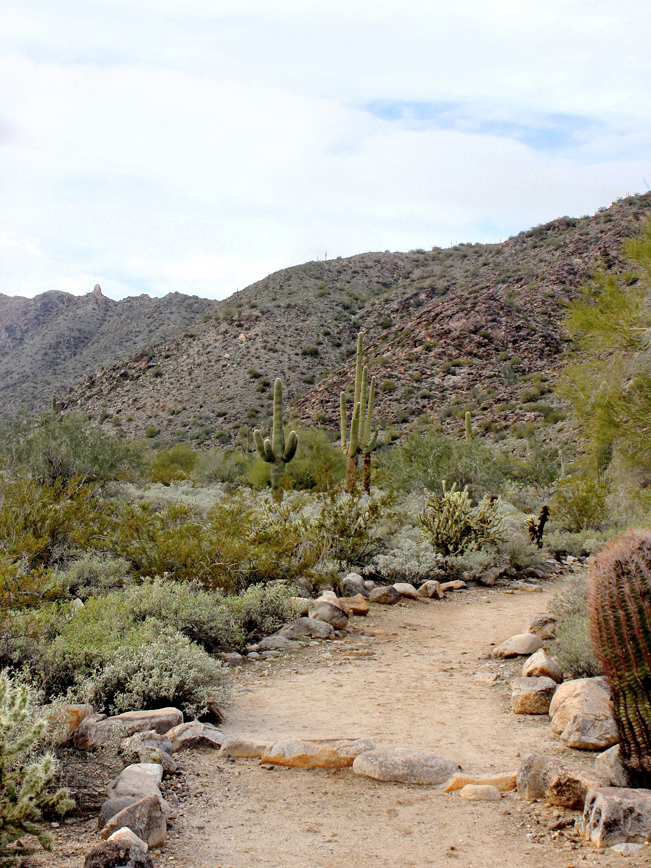 The first mile of the Goat Camp Hiking Trail is an easy stroll along a wide, sandy path. In the distance, a mountaintop butte marks a high point further up the trail.
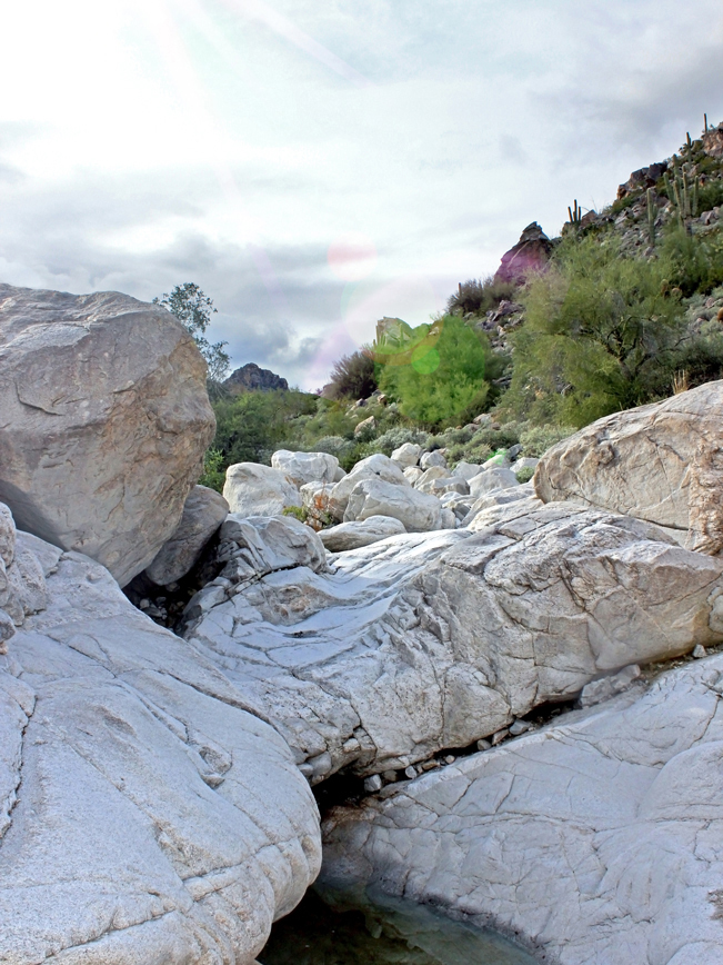 Beside the path, an arroyo, strewn with huge white boulders, cuts through the desert floor. Following Summer monsoons, pools of water line the mountain’s tanks – reflecting bleached rock and turquoise sky.
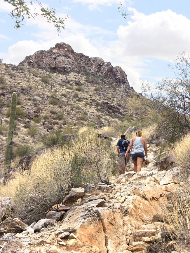 After this first easy mile, the Goat Camp Hiking Trail veers right and crosses the arroyo. From here, it begins a modest, then difficult, 1.5 mile climb up the mountainside. This is the most difficult part of the hike.
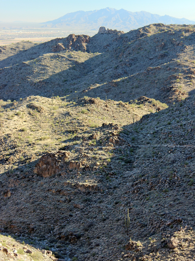
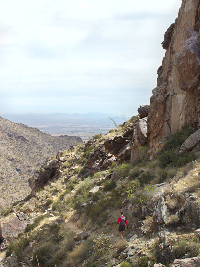 The trail becomes increasingly narrow, rocky and steep, as it switchbacks upwards towards the butte. At the crest, the rock face, that appeared so teeny from the trailhead, soars dramatically overhead. Forty foot drops define the arroyo’s path down the mountain. Looking backwards, long views over Goat Canyon and western Phoenix fill the horizon.
 Passing the sky-high rock formations at the crest, the Goat Camp Hiking Trail meanders modestly westward for the next half-mile. The trail then veers right again and begins another steep half-mile climb.
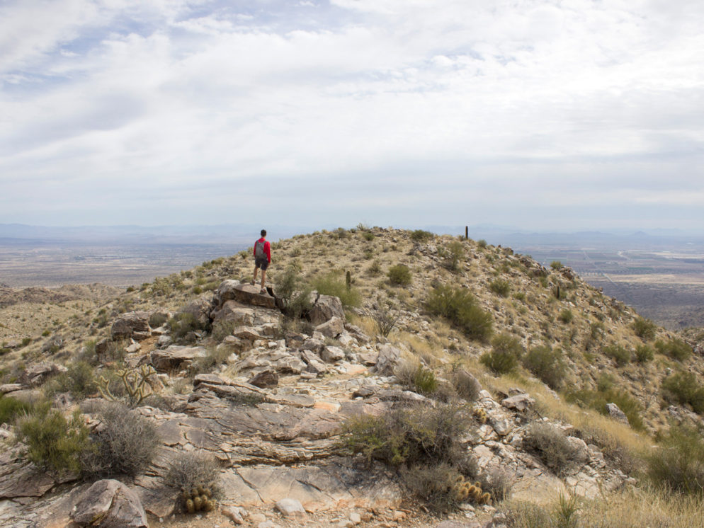
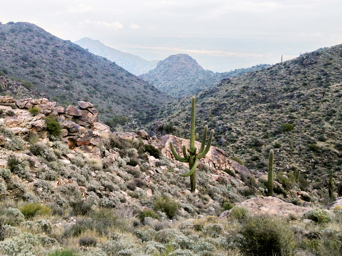
 A second stunning peak is reached 3.25-miles into the Goat Camp Hiking Trail. Beneath an exposed stone rim, vast expanses of Saguaro lead out to hundred-mile views of the Valley. This is a perfect place to take a breather, or to turn around for a shorter 7-mile round-trip hike.
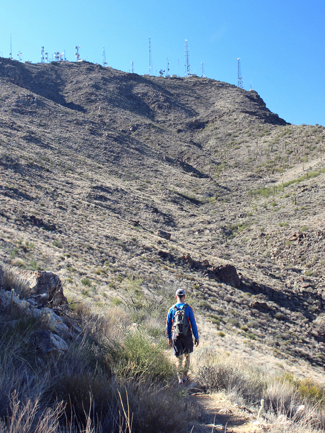 Continuing on, the Goat Camp Hiking Trail heads west once again. It approaches a row of Satellite towers adorning the top of the range. The remainder of the hike is mostly easy. Long stretches of trail wind gently around the range’s upper mountains. Outward views over the lower White Tanks, the Valley and the Estrella Mountains in the distance are beyond beautiful!
 Finally, the Goat Camp Hiking Trail comes to its end, at a juncture with the Mesquite Hiking Trail. Turn around here to head back to the trailhead. Or, alternatively, turn right onto the Mesquite, then Mule Deer, Hiking Trail to form a 14.7-mile loop hike.
Total Nerdery
The Goat Camp Hiking Trail passes near many of the highest peaks in the White Tank Mountains. This includes 3,141′ Radio Summit and 4,081 Barry Goldwater Peaks.
Resources
Click here to download a trail map.
Directions
(North Phoenix) From the northern intersection of I-17 and AZ-101, take AZ-101 west 13.5 miles to exit 9 / Olive Avenue. Turn right/west on Olive Avenue and continue 13.8 miles to the entrance to White Tank Mountain Regional Park. After entering the park, Take the second left onto North Black Canyon Drive. The trailhead is on the right.
(South Phoenix) From the southern intersection of I-17 and I-10, take I-10 west 18.4 miles to exit 124 / AZ-303. Drive 5.3 miles to exit 109 / Glendale Avenue. Turn left / west on Glendale Avenue and continue 0.5 miles to Cotton Lane. Turn right / north on Cotton Lane and drive 2 miles to Olive Avenue. Turn left / west on Olive Avenue and continue 4 miles to the entrance to White Tank Mountain Regional Park.After entering the park, Take the second left onto North Black Canyon Drive. The trailhead is on the right.
Leave a Reply