


★★★☆☆ Moderate / Yarnell
It’s hard not to shed a tear on this hike memorializing AZ’s 19 fallen Hotshots. Winding through beautiful Weaver Mountain and Yarnell Hill, the Granite Mountain Memorial Trail ends at the spot where these firefighters lost their battle with a wildfire. Here, crosses display each name. While plaques along the trail commemorate the lives of each hero.
TRAILHEAD: White Spar Hwy., Yarnell due to limited TRAILHEAD parking the HOTSHOT shuttle is recommended • DIFFICULTY: moderate • DISTANCE: 3.5 Miles (7 Miles Round Trip) • APPROX. TIME: 3.5-4.5 HOURS • ELEVATION GAIN: 1,200 FEET (86 STORIES) • APPROX. CALORIES BURNED: 1,050-1,190 RT • BEST TIME OF YEAR: oct. – may • PETS: YES • KID FRIENDLY: no • FACILITIES: yes (no water) • FEES: $5 recommended shuttle donation (cash only!)
 The Granite Mountain Hotshots Memorial Trail is an incredibly touching hike to make. It begins at a teeny, hillside park entrance, 3.5 miles from the spot where these firefighters lost their lives. Passing a large bronze memorial statue, the trail begins ascending Weaver Mountain, on a series of long switchbacks.
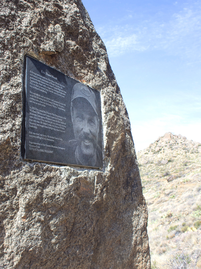 At 600-foot intervals, etched metal plaques, commemorate the lives of each firefighter. Set into the mountain’s large boulders, they bond firefighter and mountain together.
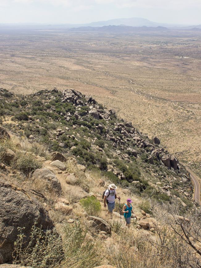
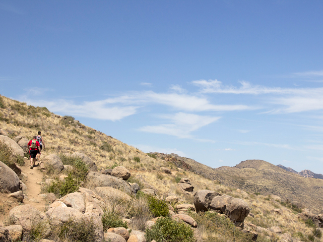
 As the trail climbs two-miles up the mountain, beautiful views over Wickenburg and Vulture Peak spread out below.
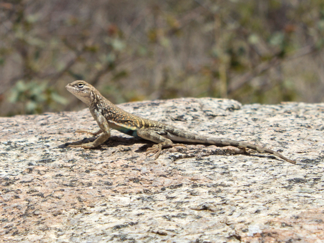 Lizards keep company all along the trail, peeking out between the rocks.
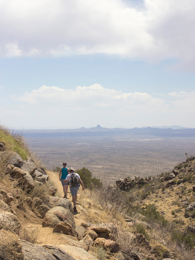
 After 2-miles, the Granite Mountain Hotshot Memorial Trail levels out. From here, it follows a ridgeline for the next mile.
 A shaded observation deck sits on the side of the Yarnell Hill 3-miles into the hike. Informative panels describe the Hotshot’s battle to contain the wildfire.
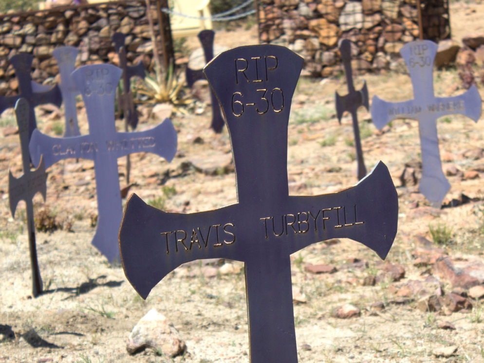
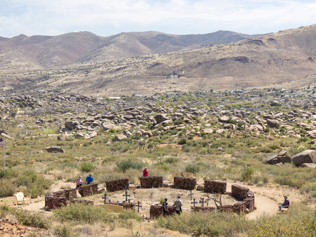
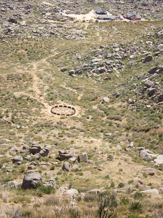 A ring of stone baskets, surrounding 19 metal crosses, is visible from the deck. It is deeply sobering to see how very close to civilization the Hotshots Fatality Site is.
 A Tribute Wall, hung with emblems and mementos from Firefighters and other well wishers, sits beside the Observation Deck.
Journey Hiking Trail
 From the Observation Deck, the half-mile long Journey Trail switchbacks down to the Fatality site, 400 feet below. For those wanting to pay their respects up close, this is a moving area to do so.
Turnaround at the Observation Deck or Fatality Site to return to the trailhead.
Total Nerdery The 19 Granite Mountain Hotshot firefighters lost their lives on June 30, 2013, while fighting to control the Yarnell Hill wildfire. A series of unexpected shifts in the wind trapped them, as they attempted to reach safety. Their tragic story was depicted in the movie “Only the Brave.”
Resources Click here to download a trail map
Directions From the intersection of I-17 and Carefree Hwy. / AZ-74 (in Phoenix) head west on AZ-74, towards Wickenburg, for 30.2 miles. Turn right / west onto US-60 and continue 9.6 miles to US-93. Head right / north on US-93 towards Congress and drive 5.5 miles to AZ-89 / White Spar Hwy. Turn right / north on AZ-89, towards Yarnell and continue for 0.6 miles to the Granite Hotshot Shuttle (beside Arrowhead Bar and Grill). NOTE: There are only 13 parking spots at the park entrance located 6.5 miles further along AZ-89. However, these fill quickly. So the shuttle is recommended.
4 Responses to Granite Mountain Hotshots Memorial Hiking Trail
Such an incredibly act of courage, unselfishness and bravery, these men gave their lives to save others….a truly heartbreaking story that I commend each and every firefighter who have served and are serving to this day….I thank God and ask him to continue to watch over them and keep them safe…I also Thank him for keeping my nephew safe throughout his service for the Mescalero Apache hotshot team!! The movie was surreal Thank you to all the firefighters who have risked their lives and lost their lives for our safty!! We take our lives for granted but do not give the firefighters much credit and appreciation for what they endure each time they leave their homes to fight fires for us….THANK YOU ALL!!
All I can add is “AMEN:!!!
I just recently watched the movie “Only the Brave”. The heartbreaking knowledge of knowing 19 firefighters were killed all at the same time during a job they didn’t think twice about doing for the safety of others weighs heavy on my mind and heart. I cannot imagine the pain and heartache of the families. I think about the guys alot. All I can say is I am so sorry. I wish all well and safe.
Agreed. These men were truly heroes.