


★★★★☆ Difficult / Sedona Area
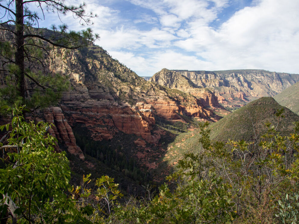
Tucked into a stunning canyon, this short hike leads to a gorgeous high plateau. The North Wilson Hiking Trail is the shorter, shadier route up Wilson Mountain – more quickly conquered than the mountain’s namesake trail. The canyon’s soaring vertical walls are jaw-droppingly beautiful. While the high plateau serves up seemingly endless hundred-mile views.
TRAILHEAD: 89A Road, Oak Creek • DIFFICULTY: Difficult • DISTANCE: 2.4 Mile (4.8 Miles rt) • APPROX. TIME: 2.5-3.5 HOURs RT • Starting Elevation: 4,564 • ELEVATION GAIN: 1,525 (109 Stories) • APPROX. CALORIES BURNED: 816-912 • BEST TIME OF YEAR: March-November • PETS: yes • KID FRIENDLY: no • FACILITIES: yes (No water) • FEES: $5 Day Use Red Rock Pass (or Annual National Parks Pass)
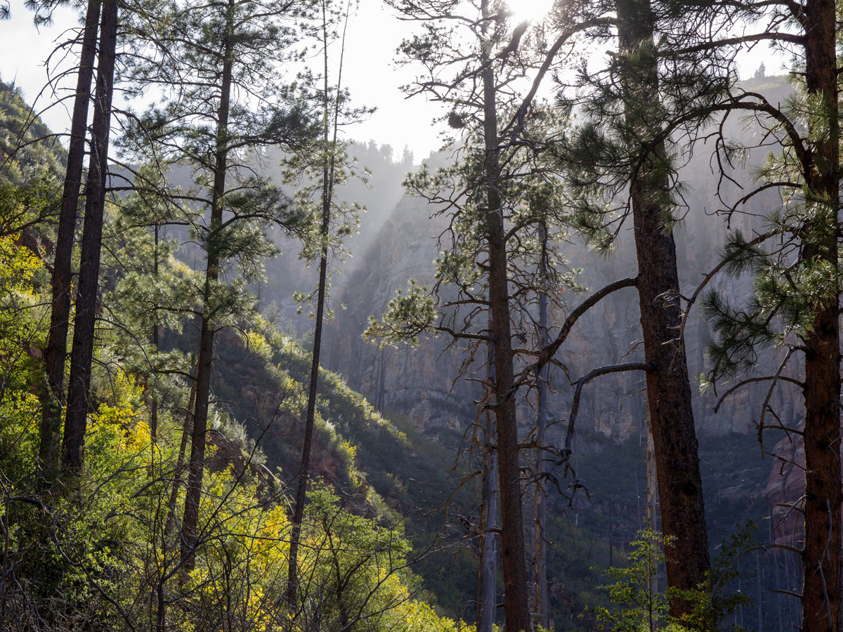
 Kicking off from the north end of Oak Creek’s beautiful Encinoso Picnic Area, the North Wilson Hiking Trail starts a moderate climb up the canyon foothills, as soon as boots hit trail. Here, the soft earthen pathway is pleasantly shaded by tall Ponderosas and Junipers.
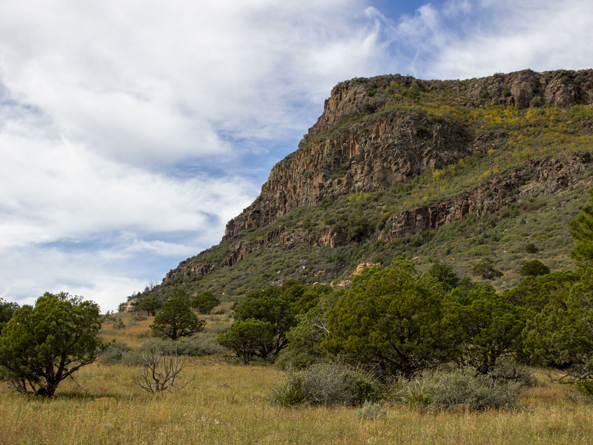
 After about 1/3-mile, the trees recede, replaced by shorter scrub and manzanita. The views of both the canyon above, and Oak Creek below, expand outwards, getting progressively prettier as the trail ascends the foothills.
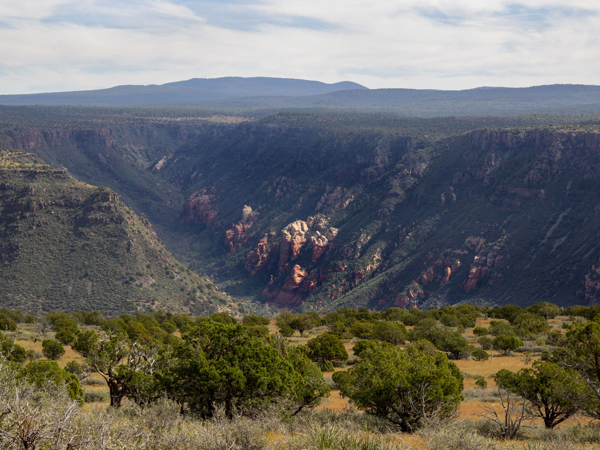
 At the 1.25-mile mark, the trail curves left, entering a narrow side canyon. Ponderosas take over once again here. With the soaring vertical cliffs of this inner canyon peeking out between their trunks.
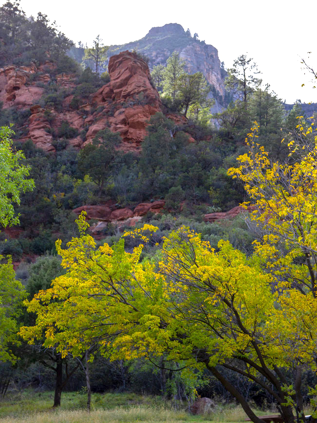
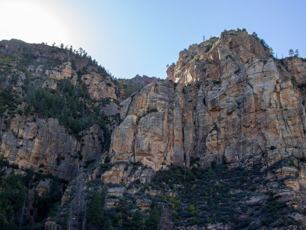 The North Wilson Hiking Trail steepens at this juncture. It ascends a number of tight, tiered switchbacks up the canyon side for the next 3/4-miles. The treelined path is a mix of earth, exposed roots and loose rock (which can be slippery on the way down! So poles are recommended). This is, by far, the most difficult part of the hike. It also offers some of the most exquisite views, as the steep canyon walls catch and reflect the sunlight.
 At the 2-mile mark, the trail steps onto a huge upper plateau and flattens out. The views here are lovely. Mount Humphreys and the San Francisco Peaks frame the horizon to the north. While Oak Creek Canyon’s upper plateaus and side canyons form layered swaths of color on the left.
 The upper reaches of Wilson Mountain rise above the plateau to the right. This easy section continues across the plain for 0.4-miles to North Wilson Hiking Trail’s end, at a T-intersection with the Wilson Mountain Hiking Trail. Turn around here and head back the way you came.
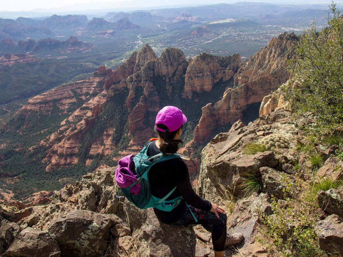 Or, for a longer hike, turn right onto the Wilson Mountain Hiking Trail and continue 1.5 miles to the top of Wilson Mountain and the stunning Sedona overlook.
Total Nerdery At 7,122′, Wilson Mountain is the highest peak in the Sedona area. The mountain was named after Richard Wilson, a bear hunter who was killed by a grizzly in 1885. There aren’t any grizzly left in Arizona.
Resources Click here to download a trail map.
Directions From this intersection of 179 and 89A (in Sedona) head north on 89A for 5 miles. The trailhead is located on the northern end of the Encinoso Picnic Area, which is about 3 miles north of Midgley Bridge, on 89A.
5 Responses to North Wilson Hiking Trail
Thank you so much for sharing. Contemplating to go out there on Wednesday early morning. What is the difference to do it your trek , or starting from midrifge (from the bridge trailhead? Thanks again , happy Saturday, udi katz btw, I wished you’d start an hiking club🙏I’d be the 1st to join
Thanks for your kind comments Udi! The Wilson Trail, which starts at Midgley Bridge is longer and lacks tree coverage. So it is much more exposed to the sun. The North Wilson Trail is more shaded – as it ascends a relatively narrow canyon. Both are good hikes. I hope this helps.
Hello Lisa, I have yet to do this hike, but planning on mid March. To do the entire route to the summit…..which way is shorter and/or easier? Staring at midgley or starting at encinoso picnic area -n Wilson tr? Thanks again, udi
Hi Udi. We haven’t done the hike from Midgley yet. But from what I understand, that hike is longer and more exposed to the sun than the hike form Encisosa Picnic Area. Hope that helps.
Tnx Lisa. Yesterday’s morning we’ve hiked up toms thumbs and continued to the lookout. A fantastic trek combo that never gets old. Ck us out at N Phoenix Laid Back hikers 40+. Your website and your hikes description are simply world class🙏😇👍, thank you for sharing, udi Katz