


★★★☆☆ Easy / Flagstaff
This short little alpine hike is loaded with history and is a blast to explore. In under 2 miles, the Veit Springs Trail passes Native American pictographs, early pioneer structures and a babbling spring. This perennial water source, which has drawn people to the area for ages, continues to make this a cool destination.
TRAILHEADs: Snowbowl road, flagstaff • DIFFICULTY: easy • DISTANCE: 1.7 MILE loop • APPROX. TIME: 2-2.5 HOURS • ELEVATION GAIN: 200 FEET (14 STORIES) • APPROX. CALORIES BURNED: 220 – 255 RT • BEST TIME OF YEAR: april – october • PETS: YES • KID FRIENDLY: yes • FACILITIES: none • FEES: none
 Nestled into the mountainside, just below Arizona Snowbowl, are a number of babbling springs which have drawn nomadic tribes and early settlers for centuries. The Veit Springs Hiking Trail follows an old, well shaded, jeep road towards these springs.
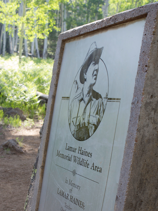 A quarter mile along the road, a trail splits off to the left. To hike the loop, you can either turn here, or hike straight along the road (see trail map link below). Either direction reaches the Lamar Haines Memorial Wildlife Area in three quarters of a mile. This historic area is clearly defined by a large plaque commemorating Haines, a popular Flagstaff conservationist.
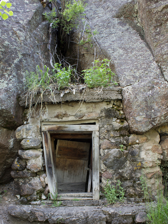
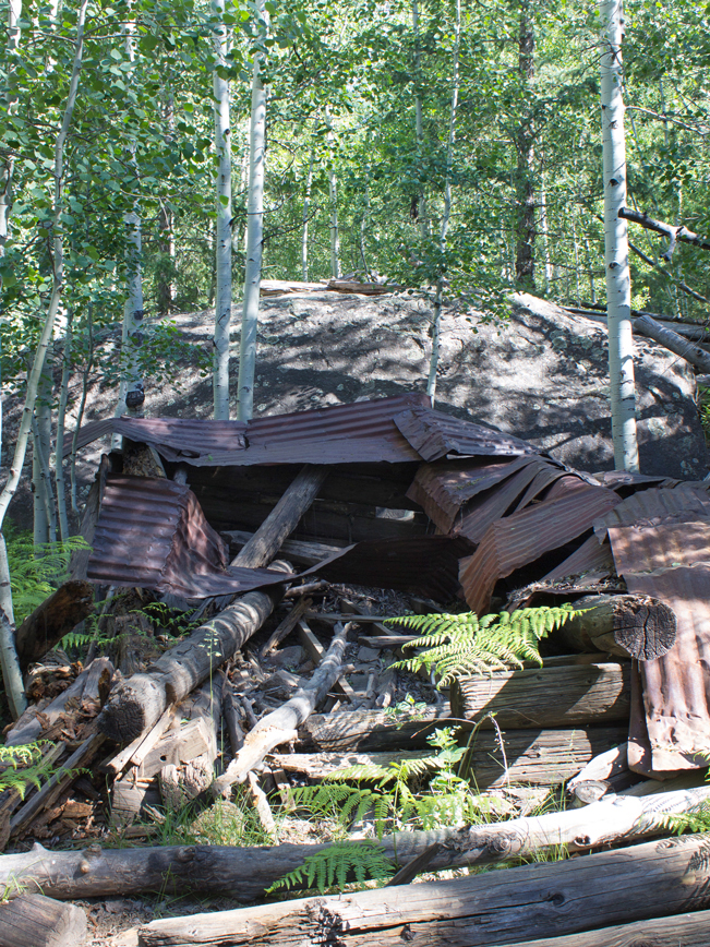 From the left side of the plaque a number of short trails fan out. These lead to the remnants of the 1920’s Jenks Family settlement and the area’s springs. Here Charles Ludwig Viet’s dilapidated cabin lies in ruins in front of a huge boulder.
 Past the cabin, a rustic stone structure shelters a bubbling, fresh water spring. And a few yards further on, a low open area reveals yet another spring fed bog.
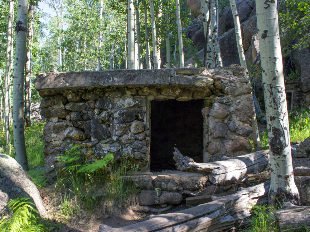
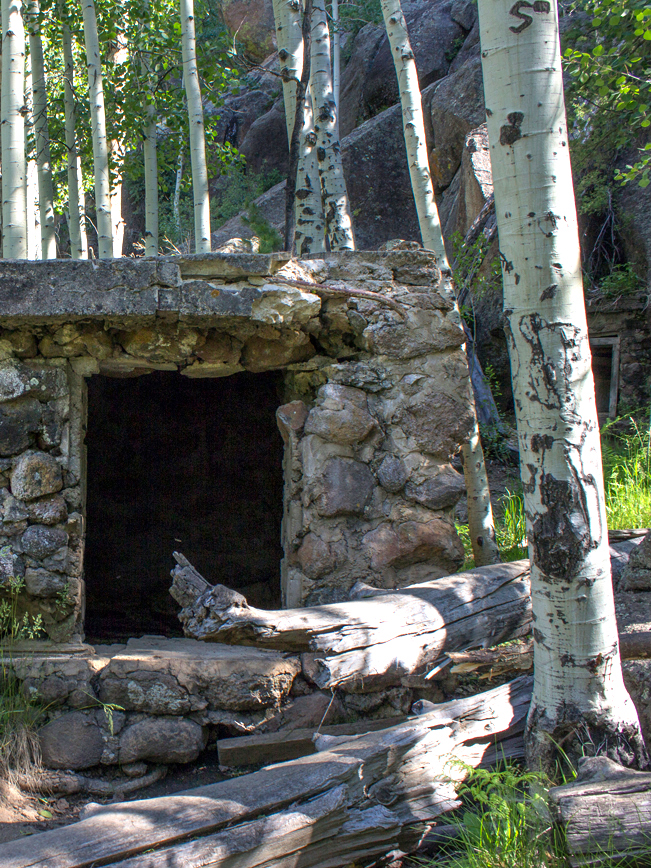
 To the right of the spring house, a second stone structure is built into a gap in the base of the surrounding basalt cliffs.
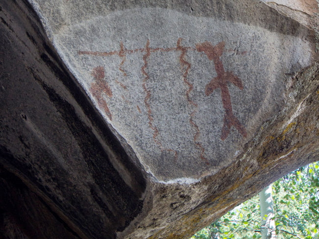 Exploring the cliff bases that line the area, a triangular cave is flanked by colorful Native American pictographs. The image appears to signal the value of water in the area hundreds of years ago. Follow either the road or trail to complete the loop and return to the trailhead.
Total Nerdery
The 160 acre Lamar Haines Wildlife Area originally became the property of Ludwig Veit in 1892, under the Homestead act. In 1928 it was purchased and settled by the Jenks Family. Then, in 1948, it was acquired by Arizona Game & Fish as a secure water source for area wildlife.
Resources
Click here to download a trail map.
Directions From the intersection of 180A and Snowbowl Road (in Flagstaff), turn north onto Snowbowl Road and drive 4.2 miles to a small turnout on the right side of the road. Near the trailhead a large sign shows the location of the trail’s historic features.
10 Responses to Veit Springs Hiking Trail Loop to Lamar Haines Area
is the Lamar Haines trail open right now to the public?…May 2 2020?
I have not heard otherwise. But you contact the ranger station at (928) 527-3600 for more information.
We’ve hiked this several times and were never able to encounter the old cabin sites. We found fellow hikers had the same experience. Definitely no babbling creeks in the area. We did pass the Lamar Haines Memorial marker along the trail, but it appears any vestiges of cabin structures have been removed.
Thank you for letting us know. Sometimes trails are changed after we write them up. A babbling spring, near the old stone structures, is the water source in the area. You are correct that it does not become a creek.
Cabin structures & babbling well/spring are still here. You just have to look for them! 9/14/21
Thanks for the update Darrow.
It’s a beautiful hike I’ve done many times. The most recent hike we did was this past week. All things listed do indeed exist. You just have to be willing to hike around and branch off the main trail to find it all. 🙂 It also requires some mild climbing up rocks and over downed trees. But it is a beautiful and fun hike!
So glad all of the elements are still there! This is a really nice hike.
As a living relative of Ludwig Veit, I have to tell the writer of the article that the cabin he shows is not the Jenks cabin. It is Charles Ludwig Veit and his wife Ruth Campbell Veit’s cabin. Yes it is still there and is falling apart.
Great Grandpa Veit at one time delivered water from the springs to people around Flagstaff when there was a shortage during the time he lived up there.
There was another cabin on the property which was moved down to I believe to a middle school in Flagstaff due to vandalism and was restored. It was being used as an outside class room.
Thank you so much for this information! We stand corrected. So wonderful that you have the stories from this bygone era. That is really cool.