


★★★☆☆ Moderate / Phoenix Area:
Unobstructed views and blissful tranquility on Phoenix’s northern border! Deceptively hidden behind the rolling hills of Cave Creek Regional Park, the Go John Hiking Trail tunes out its suburban neighbors, and replaces them with gently undulating hills, long views and hypnotic tranquility.
TRAILHEAD: 37900 N. Cave Creek Parkway, cave CREEK • DIFFICULTY: Moderate • DISTANCE: 5.8 MILE LOOP • APPROX. TIME: 3-4 HOURS • ELEVATION GAIN: 800 FEET (57 STORIES) • APPROX. CALORIES BURNED: 870- 986 • BEST TIME OF YEAR: OCT. – APRIL • PETS: yes • KID FRIENDLY: Not so much • FACILITIES: YES • FEES: $7 DAY USE (OR $85 ANNUAL MARICOPA PARKS PASS)
 So happy that, amidst Phoenix’s endless northern push, acres of billowy hills and curvy pathways have been preserved in Cave Creek Regional Park. It’s kinda’ amazing how totally removed from its suburban neighbors this expansive park feels – even after hiking over just one crest.
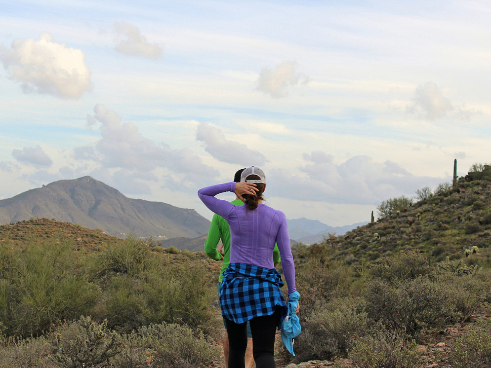
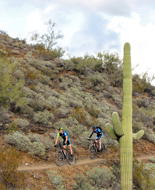 The Go John Hiking Trail Loop can be started heading straight (in front of the trail map) or right (from the side of the parking lot). Heading right, the trail makes a gentle ascent into the park. In this surprisingly uncrowded preserve, civilization is quickly replaced by natural serenity – with only an occasional hiker or mountain biker to intrerrupt. Shhhh. We’re quietly cheering.
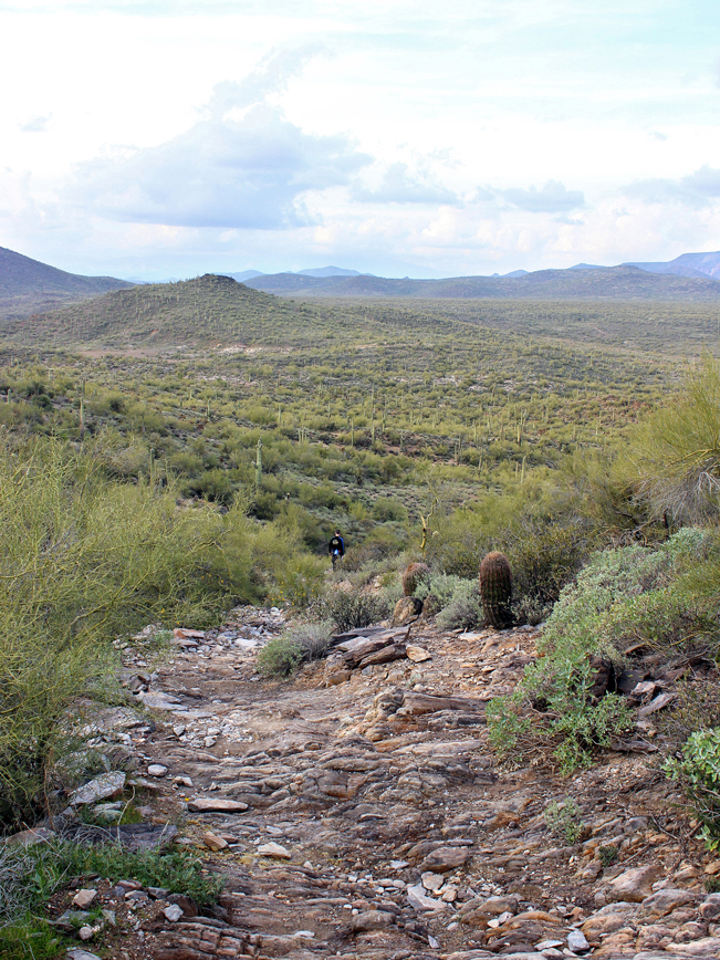 For the first mile, the Go John Hiking Trail winds up, down and around a series of gentle hills. It passes a juncture with the Quartz Trail and moves on. As the trail rounds the northern end of the park it mounts a tall ridge, and “wow” …. the views suddenly multiply – extending for miles over green and blue hills, framed by Elephant Mountain in the distance. Be careful of the exposed slate in this section.
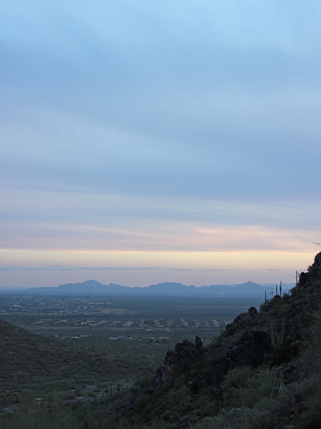
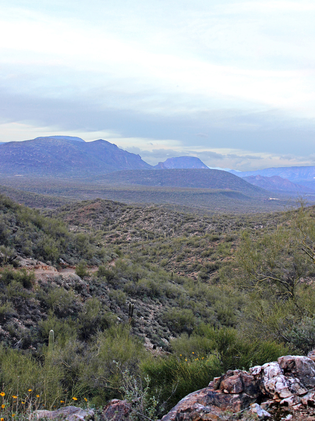 The trail continues its wide arc around the park, moving along the hillsides. Views continue to please, serving up hundred-year-old Saguros, sandy arroyos, and more. As the Go John Trail rounds its way back to the trail head, sweeping views south, over the northern suburbs, are backed by Piestewa and North Mountain in the distance.
Total Nerdery
What’s with the name? Apparently George O. John laid claim to mining in this area in the 1800’s. There is a mountain named after him as well. Who knew?
Resources
Click here to download a trail map.
Directions From the I-17 (north of Phoenix) take exit 223A/AZ-74 (Carefree Highway) and head east (towards the towns of Cave Creek and Carefree). Continue 6.9 miles to North 32 Street. Turn left/north on North 32 Street and drive 1.8 miles to the entrance of the Cave Creek Recreational Area. Once through the entrance continue approximately 0.75 miles on Cave Creek Park Road to Tonalite Drive. Turn left/north on Tonalite Drive for trailhead parking.
Leave a Reply