


★★★★☆ Moderate / Tucson
This stunning loop hike brims with Saguaro laden hills and valleys. Fusing together some of Saguaro National Park West’s most iconic hiking trails (Hugh Norris, Sendero Esperanza, Dobe Wash and Bajada Wash) this loop serves up a pretty Sonoran hillside ascent and descent, and flat, sandy, arroyo-lined valleys.
TRAILHEAD: Hohokam Rd., Tucson • DIFFICULTY: Moderate • DISTANCE: 6.6 Mile Loop • APPROX. TIME: 3.5-4.5 HOURs • Starting Elevation: 2,580 • ELEVATION GAIN: 1,168 (83 Stories) • APPROX. CALORIES BURNED: 990-1,125 • BEST TIME OF YEAR: September-April • PETS: No • KID FRIENDLY: no • FACILITIES: yes (at Red Hill visitor center) • FEES: $10 Daily Or $25 Weekly Saguaro National Parks Pass (or $80 Annual National Parks Pass)
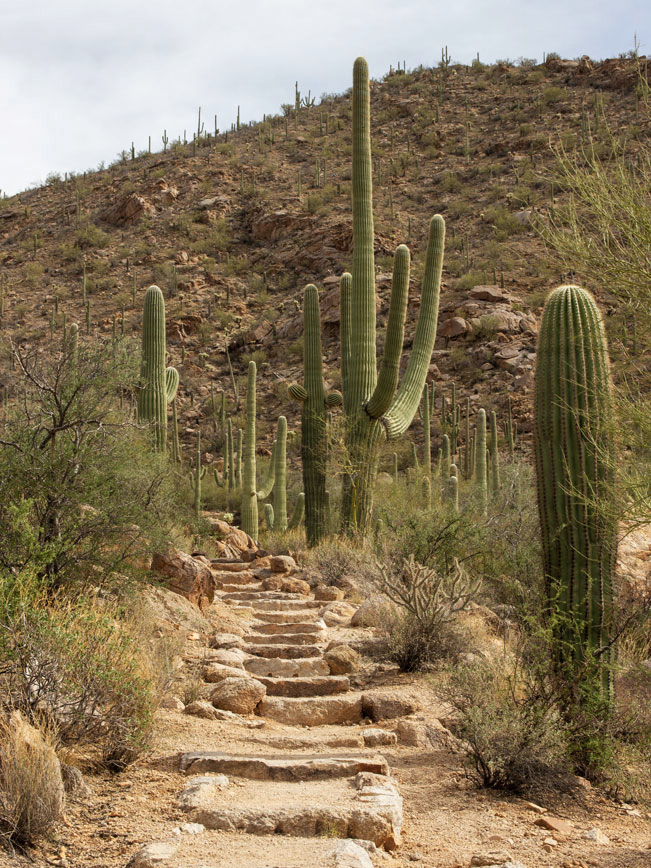
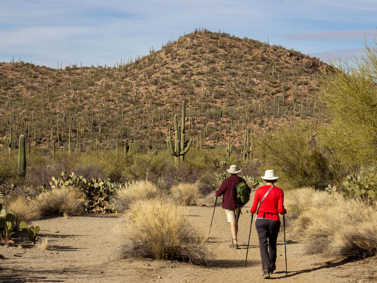
The Hugh Norris Big Loop Hiking Trails curve through the some of Saguaro National Park West’s prettiest and most varied terrain. This description heads counterclockwise, heading east on the Hugh Norris Trail off Hohokum Road. Kicking off from the trailhead, the first mile ascends a gorgeous Saguaro-lined ravine on hundreds of impeccably laid, and maintained, carved-stone steps. This is truly one of the prettiest trails we’ve had the pleasure of hiking!
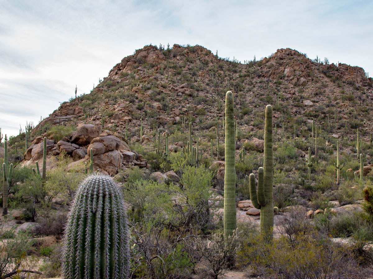
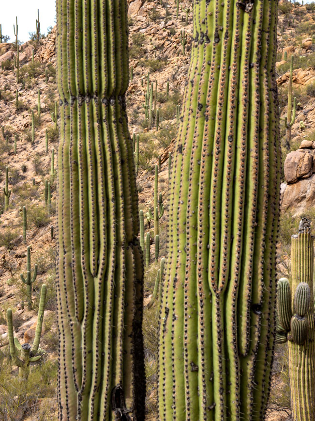 A forest of thick Saguaros blankets the hillsides of this entire ravine. Not only are these Sonoran giants stunning to look at, but they offer a glance into the vast array of shapes, heights and arms that make each one unique.
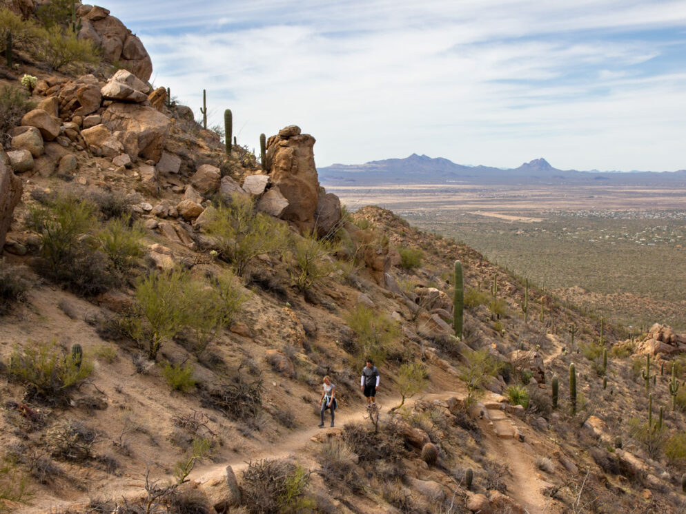
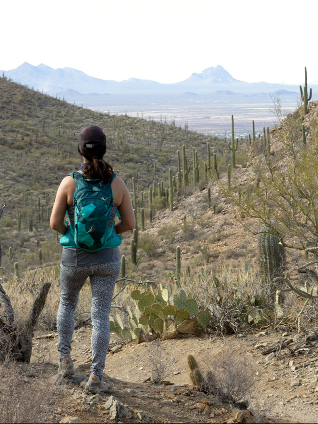
 After one mile, the Hugh Norris Trail reaches the top of the ravine and crosses to the other side of the mountain. Here it continues a moderate ascent along the boulder-strewn side of the Tucson Mountains. Looking backwards, beautiful views spread westwards over the agricultural fields of Avra Valley and the dramatic Roskruge Mountains. To the north, both Panther and Picacho Peaks are visible in the distance.
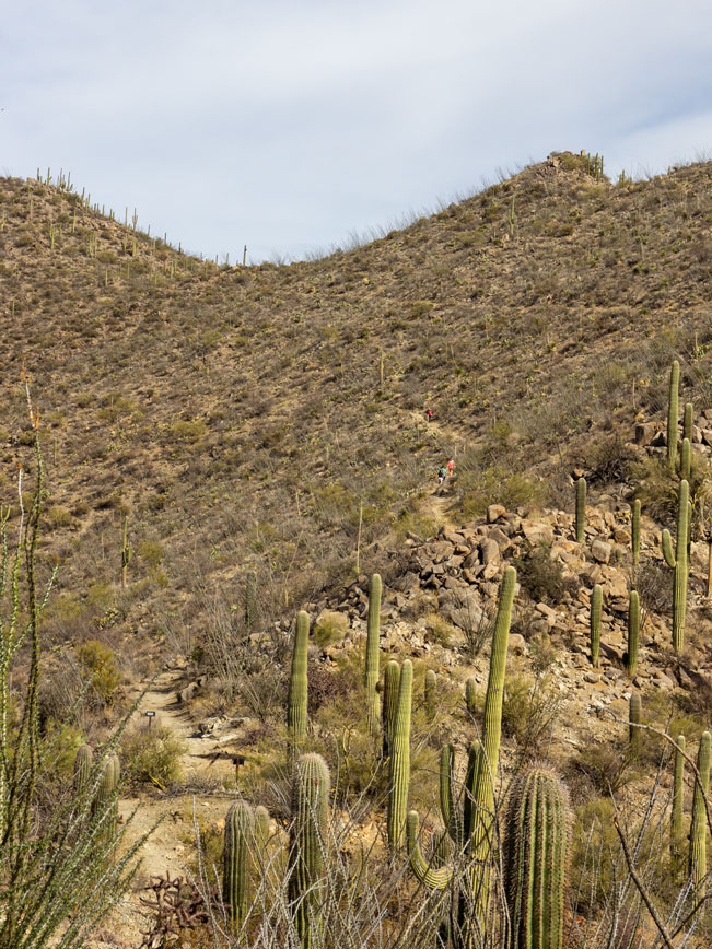 The intersection of the Sendero Esperanza Hiking Trail is clearly marked at the 2.6 mile mark. Ahead, the Hugh Norris Trail continues its ascent up to Wasson Peak. Turn left onto the Sendero Esperanza Trail to continue around the loop.
From this point on, the hike is either downhill or level. The Sendero Esperanza Trail now makes a northward, half-mile descent down the mountain, on a series of long switchbacks. Far-flung views stretch out below.
 The Hugh Norris Big Loop Hike reaches the desert floor again three miles around the loop. Here the Sendero Esperanza trail flattens out and becomes wide and sandy, framed by pretty Saguaro lined hills. After another 0.6-miles, the Dobe Wash Trail veers left off of the Sendero Esperanza Trail. Turn left here to continue around the loop. The Dobe Wash trail curves lazily westward along the base of the park’s rocky foothills.
 Five miles around the loop, the Dobe Wash Trail ends at Hohokam Road. Cross the road to access the Bajada Wash Hiking Trail, which veers left, once again, to complete the last, southern portion of the loop. This lovely trail follows a sandy arroyo, flanked by water carved granite and fields of tall Ocotillo and Saguaro.
 A clearly marked access trail back to the Hugh Norris Trailhead, veers left from the Bajada Wash Trail at 6.5 miles. (While the Bajada Wash Trail continues onwards.) Turn onto the access trail to reach the start of the Hugh Norris Big Loop Hiking Trails at the Hugh Norris Trailhead.
Total Nerdery The Hugh Norris Hiking Trail is named after a respected community leader and police officer for the nearby Thohono O’odham tribe.
Resources Click here to download a trail map.
Directions From the intersection of I-10 and Ina Road (north of Tucson) turn west onto Ina Road. After 2.8 miles, turn left / south at the T-intersection at North Wade Road (which becomes) West Picture Rock Road. Continue for 7.5 miles, then turn left / south onto North Sandario Road. Drive for 3.9 miles to the intersection of North Kinney Road and turn left / east. After a quarter mile, turn left onto Hohokum Road and continue for 0.8 miles to the Trailhead parking lot, on the right side of the road.
2 Responses to Hugh Norris Big Loop Hiking Trails
Very nice article as a travel blogger myself. The Solo Girl Traveler, I admire several travel bloggers for their amazing creativity, talent and sense of adventure
Thanks so much! Love providing information to other hikers.