


★★★☆☆ Moderate / Payson Area
Explore an abandoned railroad tunnel at the end of this short Mogollon Rim Hike. The Railroad Tunnel Hiking Trail works its way down, then around a moderately steep ravine. And leads to a shady stone tunnel which opens onto sweet rim views!
TRAILHEAD: Rim Road 300, east of Strawberry • DIFFICULTY: Moderate (difficult last half mile) • DISTANCE: 1.5 MILES • APPROX. TIME: 0.75-1.25 HOURs • starting elevation: 7,280 • ELEVATION GAIN: -790′ (approx. 56 stories) • APPROX. CALORIES BURNED: 225-225 • BEST TIME OF YEAR: March-Oct. • PETS: yes • KID FRIENDLY: 10 and older • FACILITIES: none • FEES: none
 The Railroad Tunnel’s trailhead sits on the top of the Mogollon Rim, about 12-miles from Rim Road 300’s eastern entrance. From the teeny dirt parking lot, the trail makes a straight shot down the side of a beautiful ravine. Stunning views of the valley spread out below. The pathway is full of loose stones. So be careful with the footing!
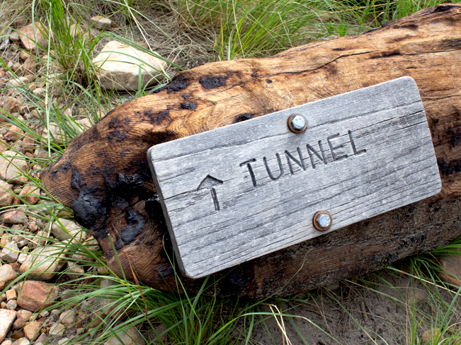 After a one-mile downhill trek, the trail forks at the top of a tight switchback. Turn left to reach the Railroad Tunnel. A sign bolted into a fallen log points the way. (The Colonel Devon Trail continues down to the valley floor to the right.)
 The next half-mile of the Railroad Tunnel Hiking Trail is a steep ascent up a neighboring ravine. The path is rugged, made up of sand and boulders. This is the most challenging section of the hike and a bit of a scramble.
The Railroad Tunnel
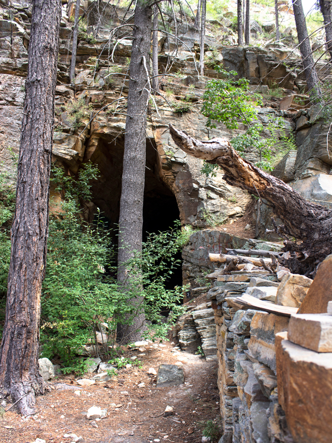 At the top of the hill, the ground levels out and the tunnel comes into view. A tall opening peeks out behind overgrown trees and shrubs. And the remnants of a rustic stone structure sit to one side.
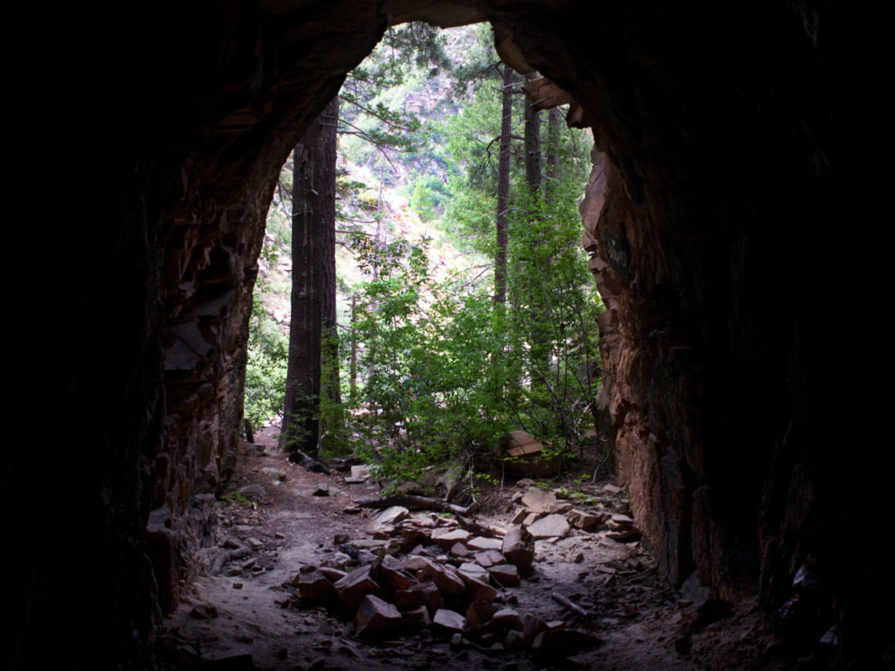
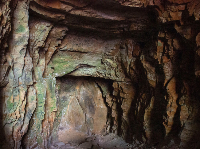 The tunnel is tall and wide and a little over 70′ deep. The floor slants slightly uphill, leading to an abrupt end at a cool stone wall. Unfortunately, the tunnel walls are brightly colored with years of graffiti.
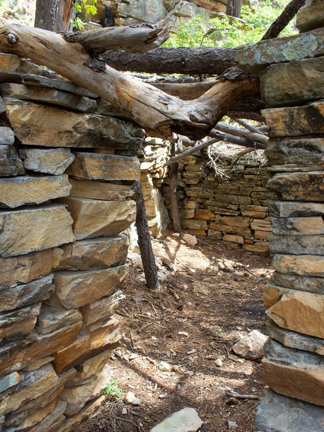 After the hike, it’s nice to hang out in the tunnel’s shade or by the ruins outside. Although the structure is now ceiling-less, its windows open onto incredible rim views.
Total Nerdery
The railroad tunnel is the work of James Eddy, a pioneering businessman of the late 1880’s. His unfinished dream was to build the Arizona Mineral Belt Railroad, in an effort to connect Arizona’s mineral rich south with the cross-country railroads already traversing the north. However, Eddy ran out of funds after only a few months of blasting and had to abandon the project.
Resources Click here to download a trail map
Directions
From Strawberry: From the intersection of AZ 87 and N. Strawberry Drive, take AZ 87 north for 10.2 miles. Turn right / east on Rim Road 300 and continue 12.3 miles to the Railroad Tunnel trailhead, on the right / south side of the road.
From Heber: Turn right / northwest onto Rim Road 300 from its start at AZ 260 (between Heber and Payson). Continue for 43.8 miles to the Railroad Tunnel trailhead, on the left / south side of the road.
Leave a Reply