


★★★★★ Easy / South of Greer
This lush, riverside hike is one of Arizona’s most beautiful! In spring and summer the Thompson Hiking Trail brims with marsh grasses and colorful wildflowers. And the Black River’s chilly, babbling waters provide a welcome respite from Arizona’s lower desert heat.
TRAILHEAD: forest road 116, south of greer • DIFFICULTY: easy • DISTANCE: 3.25 MILES (6.5 miles RT) • APPROX. TIME: 3-4.5 HOURS • Starting elevation: 8,600 • ELEVATION GAIN: 240 (aprox. 17 stories) • APPROX. CALORIES BURNED: 845-975 • BEST TIME OF YEAR: APRIL- SEPT. • PETS: YES • KID FRIENDLY: yes • FACILITIES: NONE • FEES: NONE
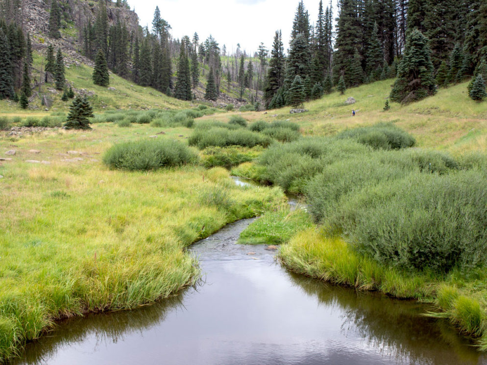
 This part of Arizona could easily be described as outrageously stunning. Even from the teeny 6-car trailhead parking lot, the views of the Black River’s lush green marshes and pine laden hills are Eden-like in their beauty. An old railroad bed parallels the river for the Thompson Hiking Trail’s first quarter-mile. Hint: this is an alternative hiking path if the lower trail is too mucky.
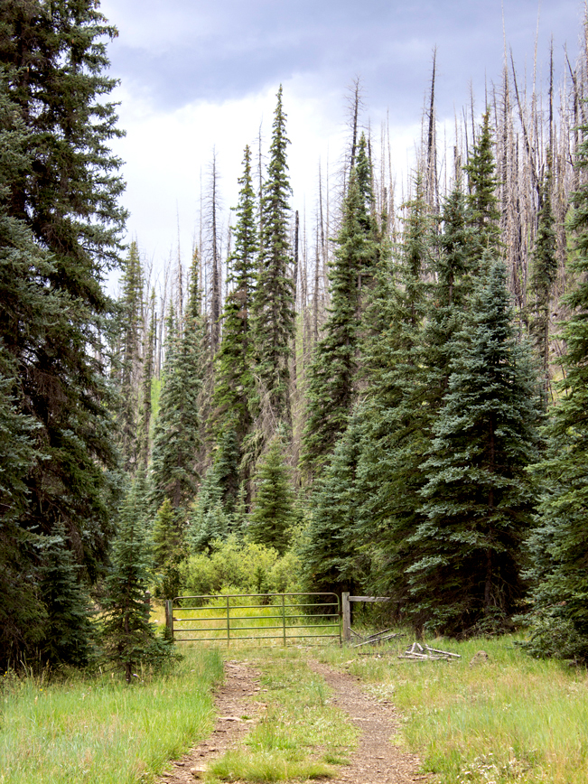
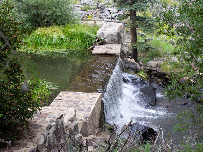 In front of a gate, the trail drops a few feet to the river bank, then continues along its side. A couple fish dams, or gabions, span the river in spots. They serve to keep non-native fish from swimming upstream to help preserve the river’s endangered Apache Trout population.
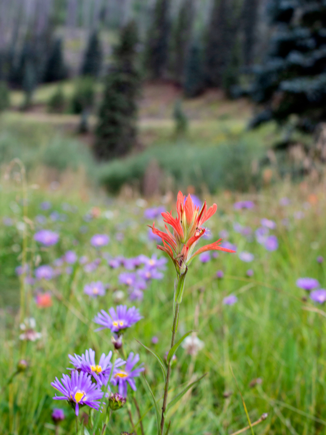 During spring and summer, the banks of the Black River are flush with colorful wildflowers. And every bend in the trail provides yet another breathtaking view.
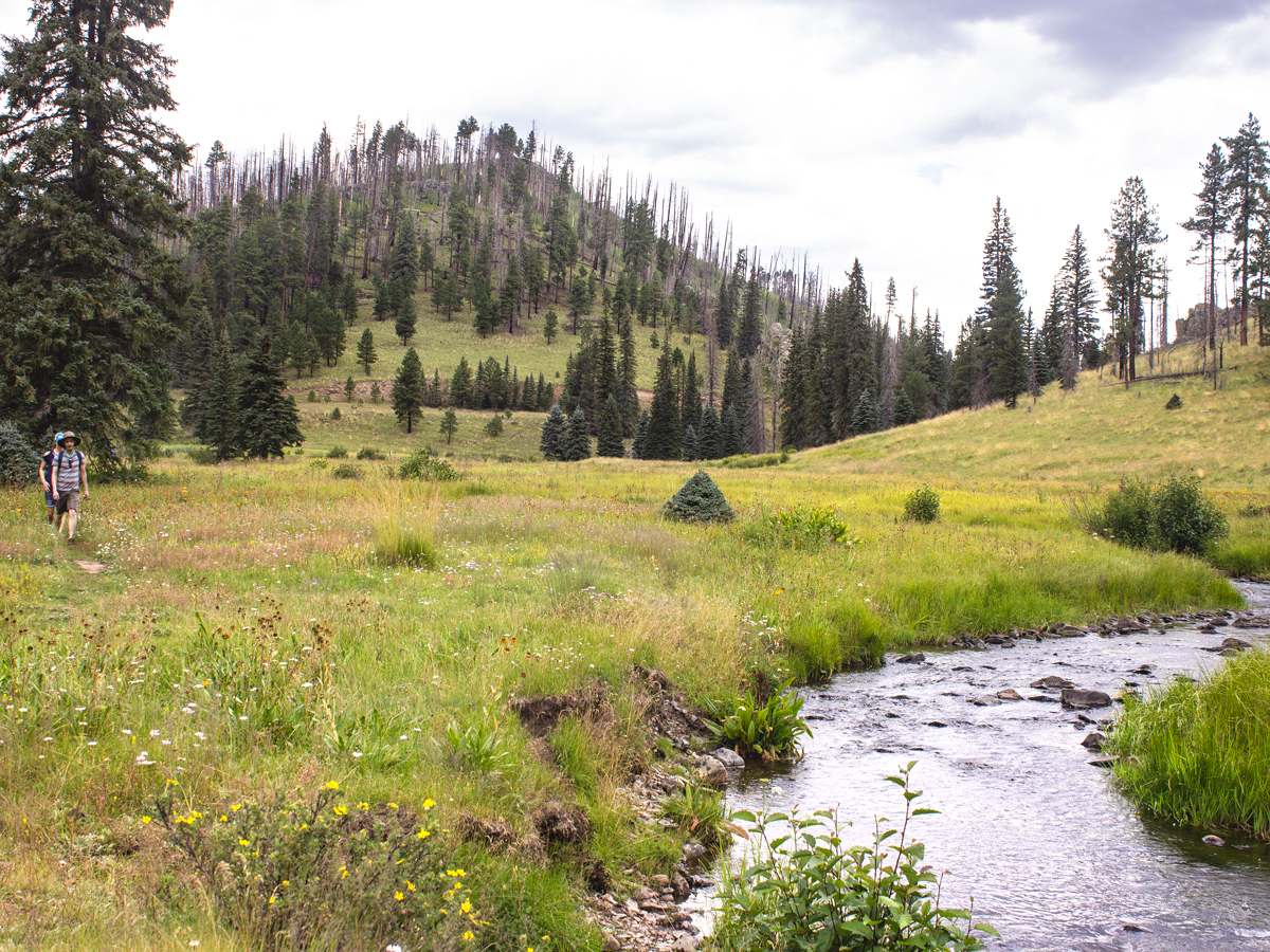 As the Black River winds through the valley, scenic expanses blend river marshes, gently rolling hills and jagged outcroppings. Strands of ashen trees are the ghostly remains of the Wallow Fire that burned through the area in 2011. Along the riverbanks, it’s common to see elk, fox, turkeys and other wildlife.
The Thompson Hiking Trail ends after 3.25 miles, at the juncture of the West Fork Black River Hiking Trail. Turn back here. Or continue another three miles along this trail for a longer out-and-back adventure.
Total Nerdery The Apache Trout is native to Arizona’s White Mountains and is the official State Fish. However, since it’s not too picky about hooking up with introduced non-native Trout, like the flirtatious Cutthroat or flamboyant Rainbow, the Apache Trout has become threatened as a species.
Resources Click here to download a trail map
Directions From the intersection of AZ 260 and AZ 273 (west of Greer) head south on AZ 273 towards Big Lake. Drive 14.1 miles to Forest Road 116. Turn right / south on FR 116 and continue 4 miles to the trailhead.
2 Responses to Thompson Hiking Trail
Nice post
it’s so helpful
Oh good. Hope you enjoy the hike. It’s pretty spectacular.