


★★★★★ Easy / Grand Canyon Area / Southern Utah:
One of the longest, deepest, and most stunning, slot canyons in the world, can be accessed by hiking Wire Pass to Buckskin Gulch. Both trails sit just north of the Arizona border in Vermilion Cliffs National Monument. Wire pass is a short, mostly easy trail, that sports its own small slot canyon. It leads to beyond-words beautiful Buckskin Gulch which, at its southernmost tip, crosses into Arizona.
TRAILHEAD: Horse Rock Valley Road, Utah • DIFFICULTY: EASY (with some challenging water & scrambles further into Buckskin Gulch) • DISTANCE: Wire pass 1.7 miles each way. Buckskin Gulch 11.8 miles each way – from wire pass to its Southernmost point • APPROX. TIME: 2-18 HOURS RT (depending on distance hiked) • ELEVATION GAIN: MINIMAL • BEST TIME OF YEAR: spring and fall • PETS: YES • KID FRIENDLY: yes for wire pass, 10 and up • FACILITIES: Yes, but no water • FEES: $6 per person and pet
 It’s almost impossible to describe the beauty and experience of hiking Buckskin Gulch, one of the longest and deepest slot canyons in the world. With its sky-high walls and 16.6-mile length, it’s only possible to enter this canyon at four points: at the northern and southernmost tips, via Wire Pass and from Middle Trail. Wire Pass is one of the most popular access routes, due to its independent beauty and smaller slot canyon.
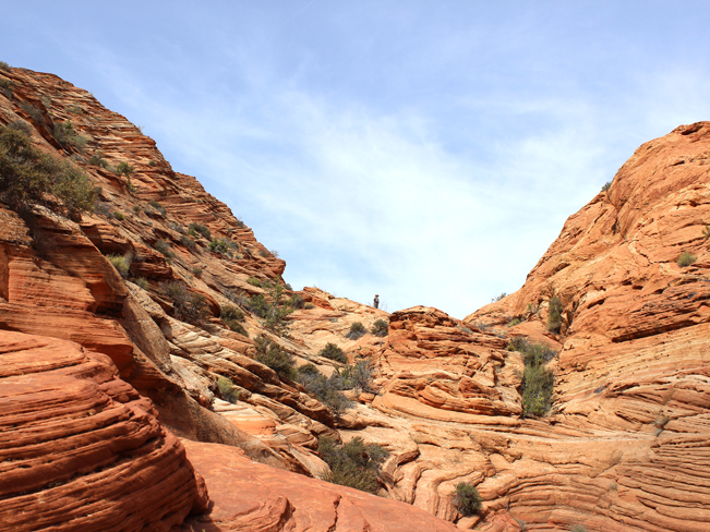
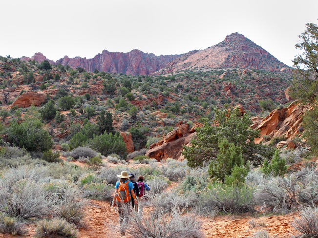 The day passes required for hiking Wire Pass and Buckskin Gulch can be purchased right at the trailhead, off rutted, dirt, Horse Rock Valley Road. Wire Pass Trail starts by winding through pristine scrublands, laced with fragrant Juniper and tucked between wacky red rock formations and tall, distant peaks.
 After meandering along a sandy wash, Wire Pass Trail enters a short, and progressively high-walled slot canyon. A little ways in, a rocky scramble makes its way down a 10′ drop in the canyon floor.
 For those uncomfortable with the scramble, a moderate alternative trail leads over and around this section.
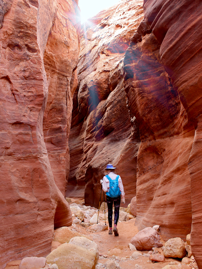
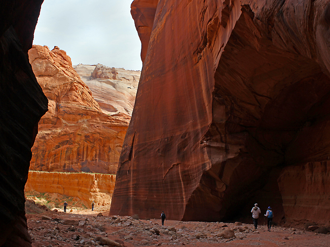 After reentering the slot canyon and continuing a bit further, Wire Pass Trail opens onto a vast, sand and rock divide, flanked by sheer, soaring cliffs. The Wire Pass Hiking Trail ends at this T-intersection with Buckskin Gulch – the confluence of two, sometimes raging, rivers.
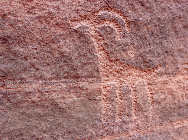 The cliffs here are treasures in-and-of themselves. Ancient Native American petroglyphs line their bases, with delicate carvings of deer, snakes, lizards and mountains. Thousand-year-old social media!
 Turning left, the slot canyon continues for 4.5 miles to it’s northernmost tip at Buckskin Gulch Trailhead (see downloadable map below). Most of this section is wider and more open than the southern portion, which continues right for 11.8 miles to its terminus at the Paria River.
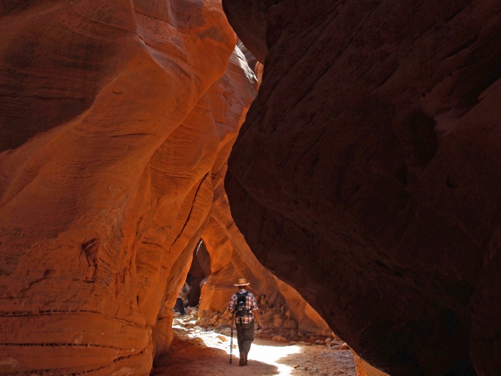
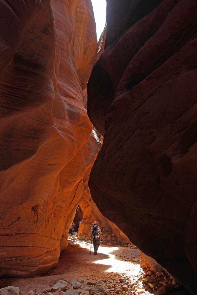
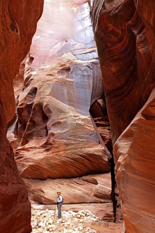
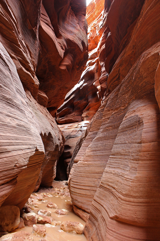 The slot canyon is highly dramatic. Shafts of light cascade onto towering walls, carved into sensually undulating forms by centuries of rushing water. Cool breezes whistle through the passage, and temperatures rise and fall in various sections. Some portions of the canyon are only a few feet across, while others open wide, allowing the sun to kiss the floor. High overhead branches, wedged into crevices, are reminders of the powerfully raging waters here during the monsoons. The canyon floor alternates between soft sand, stones, mud, and ankle to chest high pools of cold water (especially at the Cesspool 6-miles south). Just before it’s end at Paria River, a second drop in the canyon floor, called Rock Jam, requires a challenging scramble.
As with all slot canyons, it can’t be stressed enough that they be hiked ONLY during dry weather! Even a mild rain poses dangers, while storms more than 50 miles away can send 100′-high walls of water through the canyon. Don’t make this hike without first getting a thumbs up on the forecast from the Paria Ranger Station, at (435) 644-1200!
Total Nerdery
The walls of Buckskin Gulch are over 500′ high, at its southern confluence with the Paria River. It’s taken millions of years for these slot canyons to form, being slowly worn away by centuries of water flowing along the same narrow paths.
Resources
Click here to download a map of the trails.
Directions From I-89 (in Page, Arizona) continue northwest for 31 miles, across the Utah Border, to Horse Rock Valley Road. The poorly marked turnoff is on the left side of the road, just past a deeply carved pass through the rocks. Drive 8.5 miles south on Horse Rock Valley Road (high clearance vehicle recommended) to the Wire Pass Trailhead, on the right side of the road.
Horse Rock Valley Road can also be accessed from I-89A in Arizona. Turn west onto I-89A from the intersection with I-89 (south of Page). Continue for 41.6 miles to the right-hand-turnoff for Horse Rock Valley Road and continue north for 21.5 miles to the Wire Pass Trailhead.
2 Responses to Wire Pass to Buckskin Gulch Hiking Trails
Great article. Can I leave a vehicle at the paria river for when we finish the hike?
Susan Jacobson
Thank you Susan. The closest parking to the eastern end of Buckskin Gulch is about 7 miles away, at Whitehouse Trailhead. Most day hikers park at the Wire Pass Trailhead and hike as far into the Gulch as they are comfortable with, before turning around. To experience the full length of the Gulch, many people do a 2-3 day backpack through Buckskin Gulch and down the Paria River to Lees Ferry. Here is a helpful link: https://www.cleverhiker.com/blog/buckskin-gulch-and-paria-canyon-backpacking-guide