


★★★★☆ Difficult / North Rim Grand Canyon
Descend jaw-droppingly beautiful Roaring Springs Canyon to its namesake waterfall & stream. The first five miles of the North Kaibab Hiking Trail provide one of the most awe-inspiring day hikes into the Grand Canyon. The path crosses stunning overlooks, a tunnel blasted through stone and a long narrow ridge. Take the trail all the way to the spring, or less than a mile down to beautiful Coconino Overlook.
TRAILHEAD: AZ 67, Grand Canyon Nat. Park North • DIFFICULTY: difficult • DISTANCE: 4.7 MILES (9.4 miles RT) • APPROX. TIME: 5 – 7 HOURS rt • starting ELEVATION: 8,250 • elevation GAIN: -3,050 (Approx. 218 stories) • APPROX. CALORIES BURNED: 1,600 – 1,785 rt • BEST TIME OF YEAR: april- Oct. • PETS: no • KID FRIENDLY: no • FACILITIES: YES • FEES: $30 per car day use (or $85 annual Parks Pass)
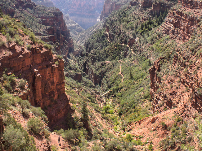 Hiking the first few miles of the North Kaibab Hiking Trail is an amazing way to experience the interior grandeur of the Grand Canyon – without packing overnight gear. North Kaibab is the only maintained trail from the North Rim into the canyon. It descends Roaring Springs Canyon to Bright Angel Canyon. Overnight hikers can continue past Roaring Springs to the Colorado River nine miles further on.
North Kaibab to Coconino Overlook
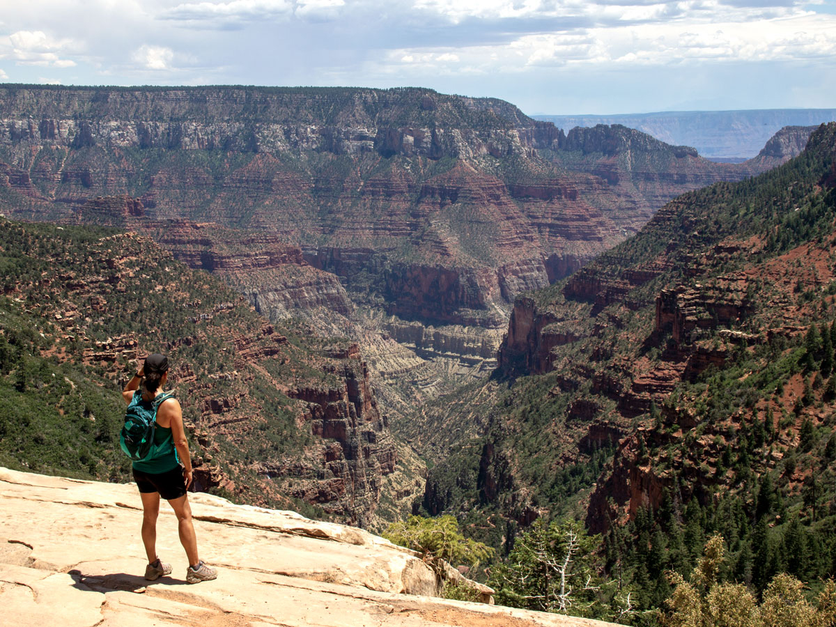 Only 0.75-miles from the top of the North Kaibab Trail, the Coconino Overlook stands atop a massive sandstone cliff. It serves up outstanding views straight down Roaring Springs Canyon, out to Bright Angel Canyon and beyond. The North Kaibab Trail is visible from the overlook, zig-zagging down the canyon. This is a perfect turn-around point for short-distance hikers or families with young kids.
North Kaibab to Supai Tunnel
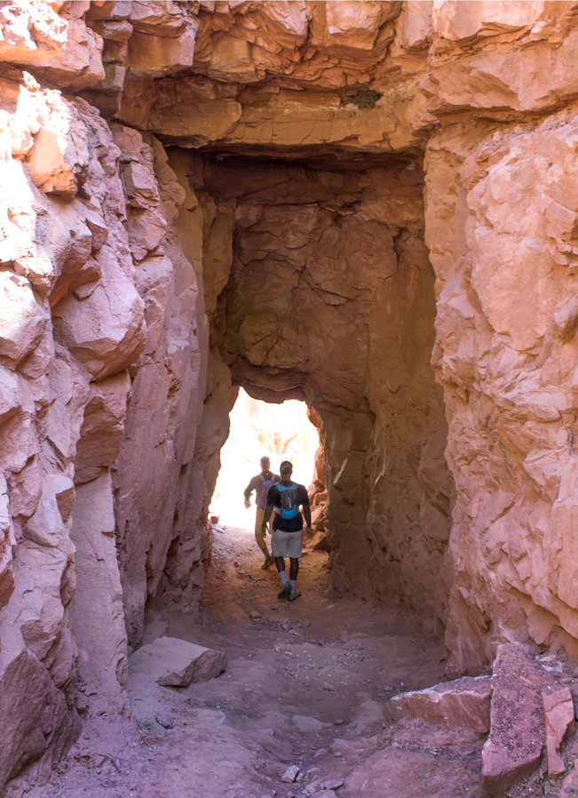 The North Kaibab Hiking Trail reaches Supai Tunnel (and its welcome water station and rest stop) 1.7-miles from the trailhead. This trail leg descends 1,400′, along sometimes treelined, sometime exposed trail. The Supai Tunnel is truly an engineering feat! It was blasted through limestone to allow the trail’s onward journey to the Colorado River.
North Kaibab to Roaring Springs
 Just past Supai Tunnel, a series of tight switchbacks work their way downwards. This short section is very exposed. So be sure to bring plenty of water and sunscreen.
 At the 3.4-mile-mark, the metal Redwall Footbridge crosses from the east side of the canyon to the west. Water rushes below during spring snow melts or after heavy rains. The enormity of the canyon is palpable when crossing this comparatively teeny bridge.
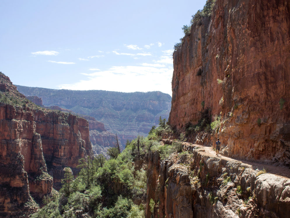
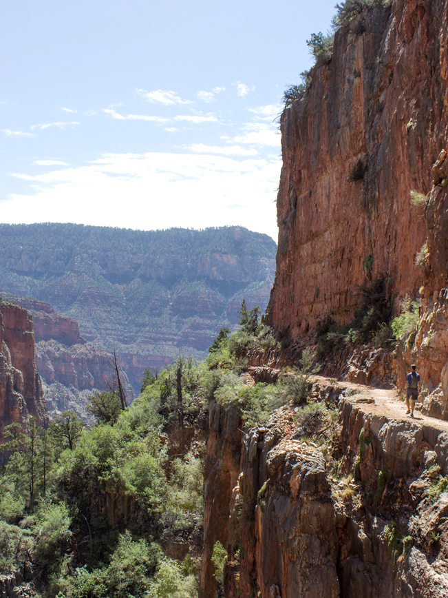 The Kaibab Hiking Trail now traverses an incredibly beautiful, narrow ridge for about half-a-mile on the canyon’s western side. This dizzying trail section was literally blasted out of the limestone cliffs, which soar hundreds of feet both above and below. Expansive views of the canyon’s interior are fantastic throughout this stretch of trail.
 A second set of tight switchbacks press downwards, after traversing the ridge. In the distance, the surprising sight of the Pumphouse, or Bruce Aiken Residence, comes into view. Aiken lived and painted in this home for many years.
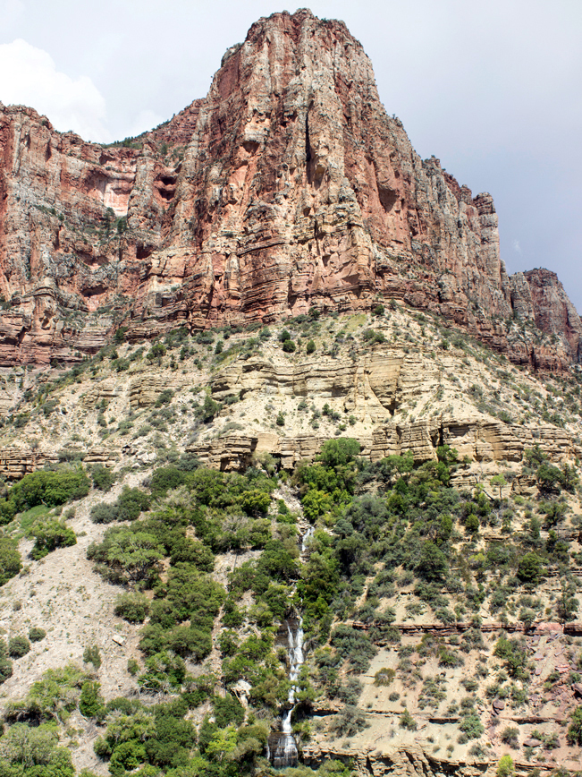 At last the sound and sight of Roaring Springs Waterfall appears, seemingly out of nowhere. This spring rushes directly out of the side of a towering cliff on the far side of the canyon. Its powerful flow is a welcome relief in this dry environment. This fall is actually the source of all water supplied to the Park’s visitors.
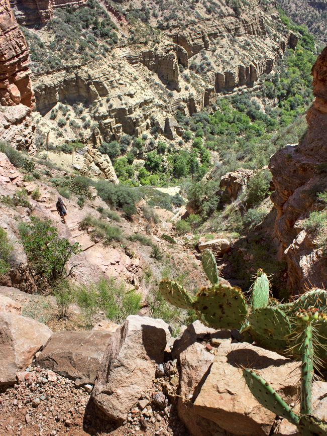
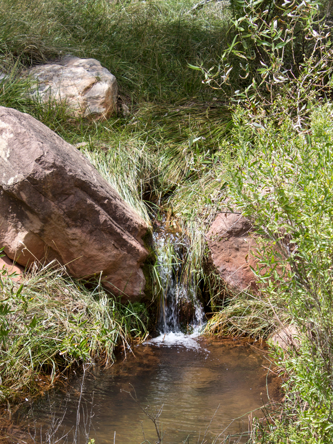 A short side trail makes the descent to Roaring Springs. Here, lush Cottonwoods, moss, ferns and tall grasses embrace the creek. This cool, shady ravine is a wonderful spot to sit, rest and recoup before the 4.7-mile, 3,050′ climb back to the trailhead.
Total Nerdery Of the Park’s three maintained trails into the Grand Canyon, the North Kaibab is the most difficult. Its trailhead is almost 1,000 feet higher than those on the South Rim. The trail descends almost 6,000′ to the Colorado River and is 14 miles each way. Roaring Springs is the farthest recommended point for day hiking.
Resources Click here to download a trail map.
Directions From the intersection of 89A and AZ-67 (in Jacob Lake) take AZ-67 south for 39 miles (past the entry to Grand Canyon National Park) to the North Kaibab Trailhead on the left / east side of the road. The trailhead is located before the road reaches the Visitor Center and Lodge.
Leave a Reply