


★★★★☆ Mostly Easy / Flagstaff Area
This shady trail follows the curvilinear banks of beautiful Schultz Creek, which flows, seasonally, from the top of Dry Lake Hills. In Spring and Summer the path is flush with gorgeous wildflowers, creating a patchwork of green, gold, purple and red.
TRAILHEAD: North Schultz Pass Road, Flagstaff • DIFFICULTY: Mostly easy • DISTANCE: 4.25 Miles (8.5 Miles rt) • APPROX. TIME: 5-6 HOURs • Starting Elevation: 7,198′ • ELEVATION GAIN: 875 FEET (63 STORIES) • APPROX. CALORIES BURNED: 1,105-1,275 • BEST TIME OF YEAR: April-October • PETS: yes • KID FRIENDLY: YES • FACILITIES: None • FEES: none
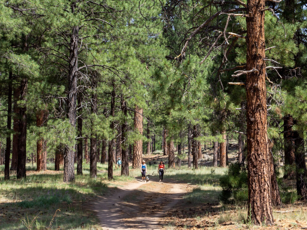
 You’ve got your choice of three trailheads for hiking the Schultz Creek Trail. The first two head gently uphill (from either the large parking area at the Y intersection of North Schultz Pass and East Mount Elden Lookout Roads, or a small pullout about 3/4 mile up Schultz Pass Road). The trail can also be hiked downhill (from the Shultz Tank parking area 4.75 miles up the road). This description kicks off from the Schultz Elden Y trailhead. From the lot, a series of random bike paths fan out to reach a wide level trail. This trail veers left following the base of Dry Lake Hills. Ponderosas and Aspens cast abundant shade.
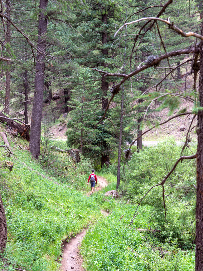 The Schultz Creek Hiking Trail gradually narrows, after passing the second, smaller trailhead. It makes a gentle, windy ascent along the banks of seasonally flowing Schultz Creek. At intervals, lightly-trafficked Schultz Pass Road meanders into view. However, it is hardly noticeable behind the tall Ponderosas and lush undergrowth.
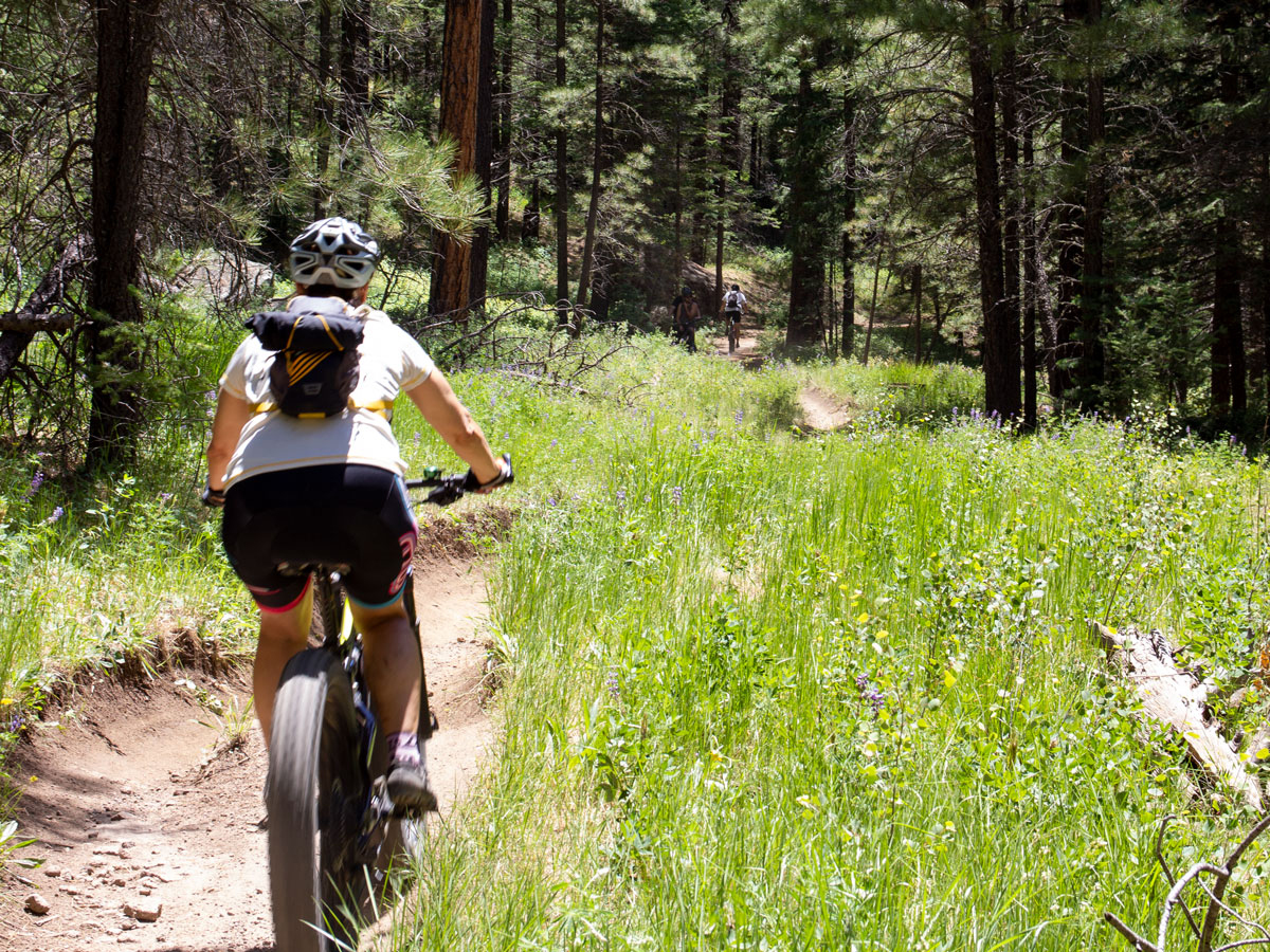 Since this trail is shared with mountain bikers, keep your eyes and ears open around the many blind, curvy corners. And plan to step aside occasionally to let bikers pass.
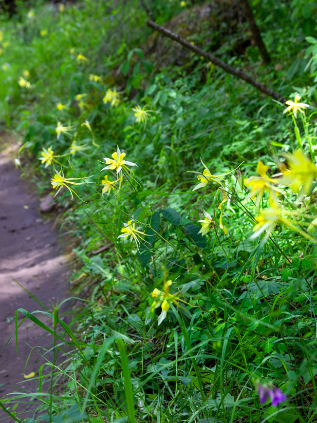 Lush strands of pretty wildflowers line the trail in Spring and Summer. Yellow Columbines, purple Lupines, delicate Queen Anne’s Lace and bright red Indian paintbrush create a patchwork of color. The Schultz Creek Hiking Trail ends at the large Schultz Tank parking area. Turn around here to head back to the start. Or connect with the Sunset, then Brookbank, then Rocky Ridge Trails to form a satisfying 11-mile loop.
Total Nerdery The Beale Wagon Road passed through this area from 1857 to 1883. This trading route ran from Arkansas to California. The Schulz Elden Y intersection area is also the site of Flagstaff’s first reservoir, built in 1898.
Resources Click here to download a trail map
Directions From the intersection of I-180 and North Humphreys Street (in Flagstaff), turn north onto North Humphreys Street and drive 0.60 miles to West Columbus Avenue. Turn left onto West Columbus Avenue (which becomes US-180 West/ North Fort Valley Road) and continue 2.65 miles to North Schultz Pass Road. Turn right onto North Schultz Pass Road and drive 0.5 miles. The large trailhead parking lot is located at the Y intersection of North Schultz Pass and East Mount Elden Lookout Roads. As noted, a smaller parking area is located 0.75 miles further up North Schultz Pass Road. And the Schultz Tank parking area is located 4.75 miles further along this same road.
One Response to Schultz Creek Hiking Trail
Thank you for opening again! I feel blessed. Glorious this day will be