


★★★★★ Easy / Prescott Area
Meander across flower filled meadows and open grassland on this very pretty hike. The Drinking Snake Segment of the Black Canyon Hiking Trail winds through gently undulating hills, expansive ranch land and along the edge of a deep mountain valley. Arizona’s big skies keep company along the way.
TRAILHEAD: Antelope Creek Road, Spring Valley • DIFFICULTY: easy • DISTANCE: 5 Miles (10 miles RT) • APPROX. TIME: 5-6 HOURs • ELEVATION GAIN: 200 FEET RT (14 STORIES) • APPROX. CALORIES BURNED: 1,300-1,500 • BEST TIME OF YEAR: Oct-May • PETS: yes • KID FRIENDLY: yes • FACILITIES: None • FEES: none
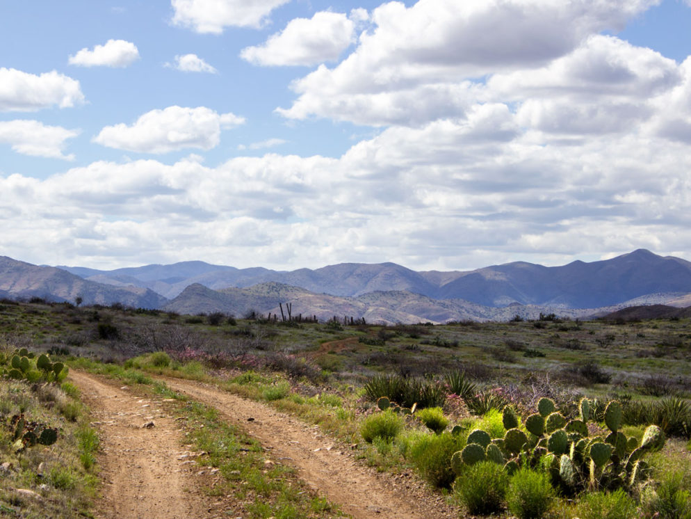
It’s easy to forget how beautiful Arizona’s central grasslands are. The Drinking Snake segment of the Black Canyon Trail brings their splender quickly to life, with a landscape wholly different than that of the lower deserts, high mountains or pine filled rim. This hike heads south from a teeny parking lot on the side of Antelope Creek Road. From the get go, the rolling landscape and open skies create a sense of idyllic tranquility.

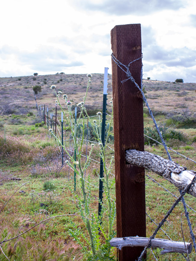
The trail follows Jeep roads for the first half-mile, curving through open ranch land and crossing a cattle gate. The path then veers right at a small trail sign. From here, it moves off into beautifully meandering hills, speckled with Juniper and chapparal. At the 1-mile mark, the trail crosses a shallow wash then starts a mild ascent up the side of a long, lovely valley.
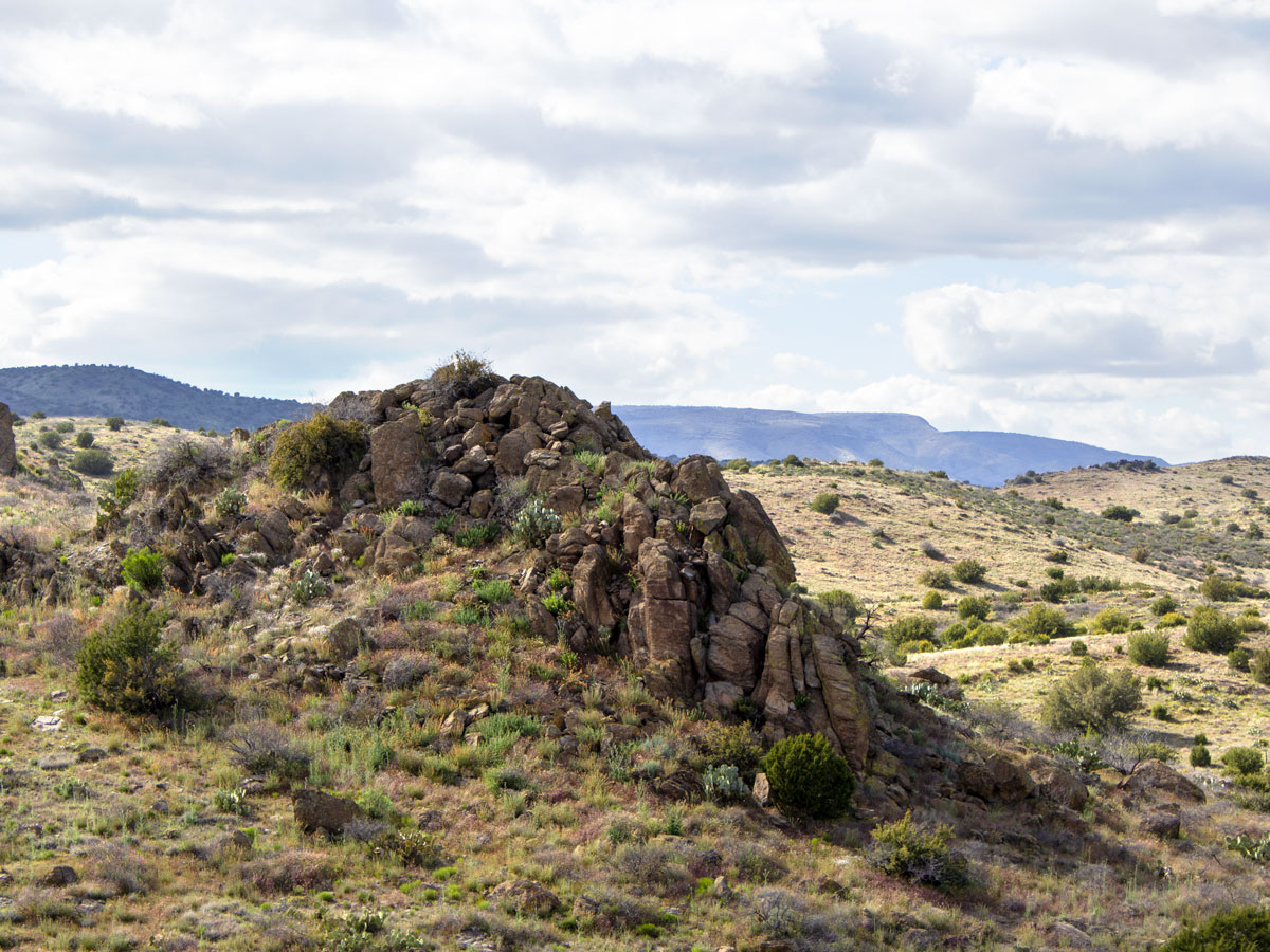
As the trail gently rises, long, westward views are framed by the purple peaks of the Bradshaw and Prescott Mountains. Tall rock outcroppings jut upwards at intervals adding drama to the landscape.
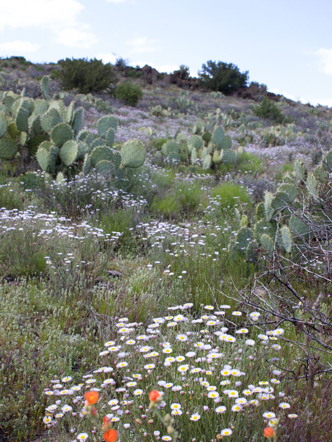
After 2 miles, the Drinking Snake Segment reaches the top this shallow valley. It now veers left, winding southwards. Luscious strands of Thistle, Prickly Pear, Globemallow and Aster line the trail in spring.
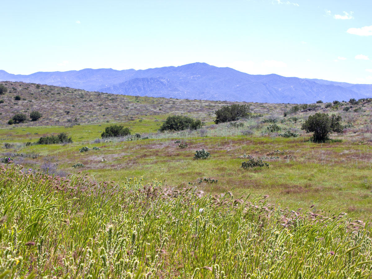
A gentle descent leads to stunningly beautiful, grasslands. These are bright green in spring, swaying picture-perfectly in front of high purple peaks. A chorus of bird and cricket song fills the air. And the flatlands of Aqua Fria National Monument are visible to the southeast.
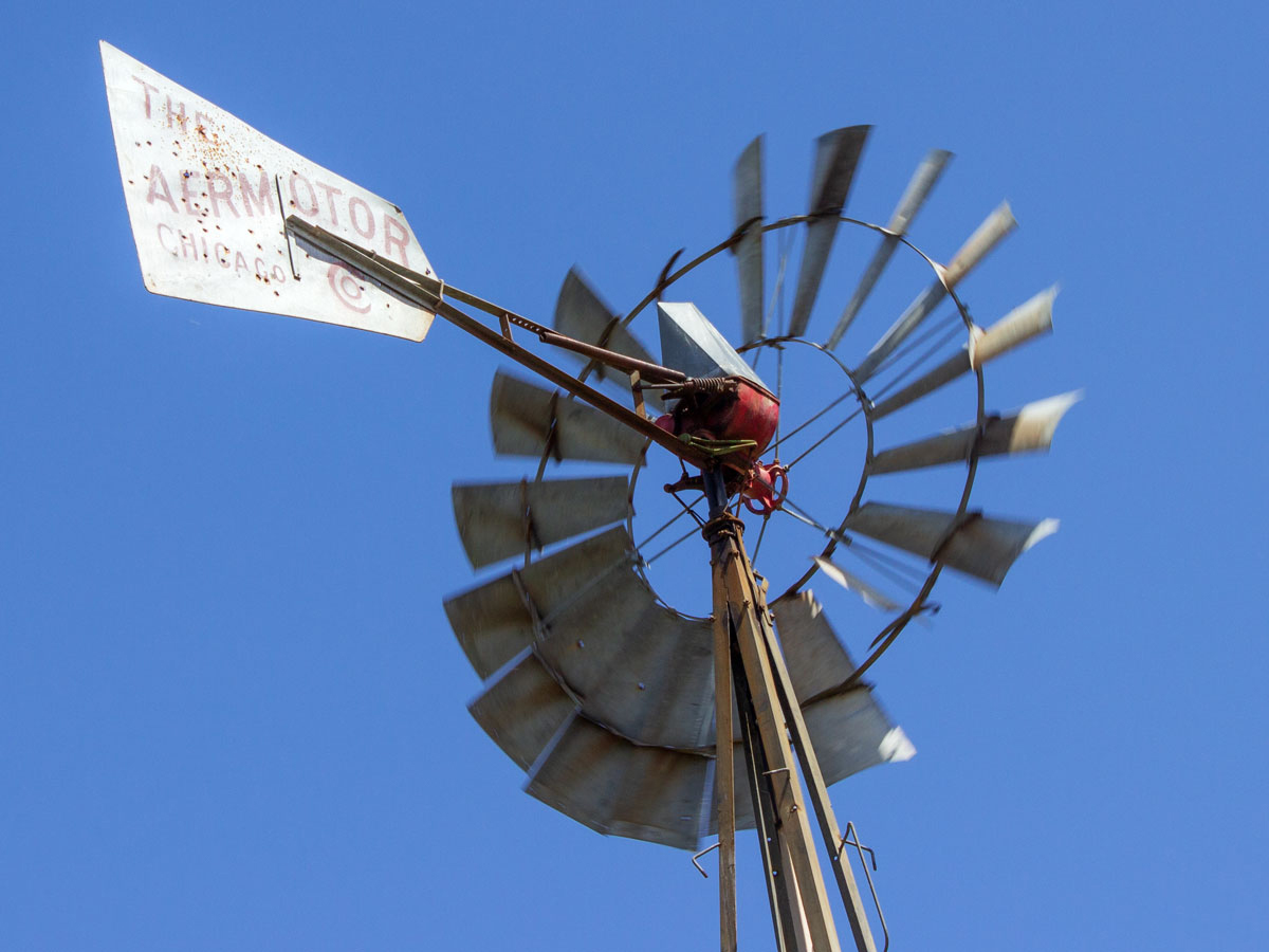
At the 3-mile mark, the trail reaches a T-intersection with a rutted Jeep road. Here, a small windmill spins in the breeze, pumping water into a cattle tank. The hike continues to the right, following this dirt road for the remainder of the hike.

About a quarter mile past the windmill, the land suddenly drops off to the right. Westward views roll out over the cliffs of Dripping Spring, the undulating valleys below and across tall, rugged mountains.
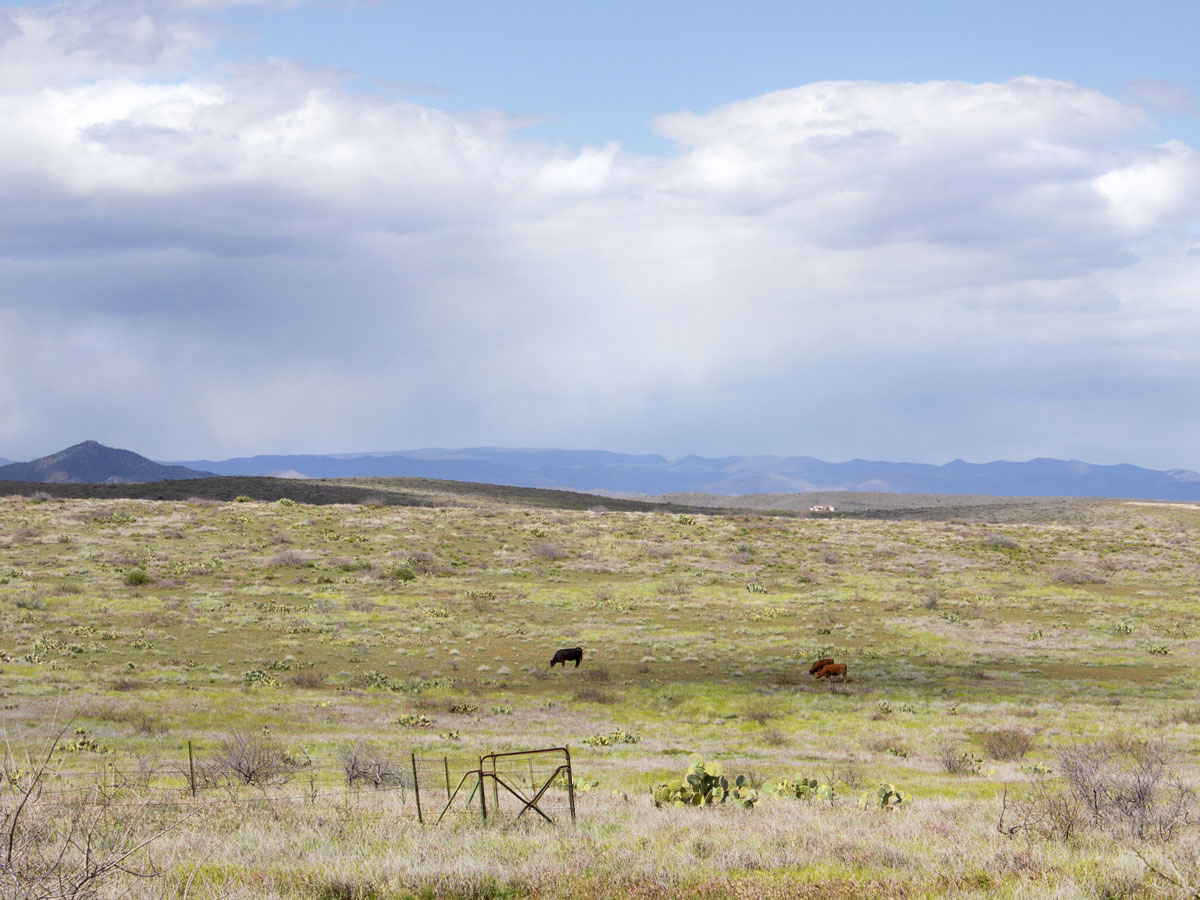
To the left, cattle graze on sun-dappled hills, and endless skies showcase distant weather. The Drinking Snake Trail Segment continues evenly along the Jeep road to its end, at a southern intersection with Antelope Valley Road. Turn around here to head back the way you came. Or cross the road to continue onto the Antelope Valley Section of the Black Canyon Trail.
Total Nerdery The area around Spring Valley and Mayer was originally occupied by the Hohokum and later the Yavapai people. It was called it Wi:kidoʼyoʼ by the Yavapai.
Resources Click here to download a trail map.
Directions From the intersection of I-17 and 69A (in Cordes Junction), turn left / west onto 69A and drive 3.25 miles to South Spring Lane (in Spring Valley). Turn left onto South Spring Lane and continue 0.7 miles to East Spring Valley Access Road (in front of Spring Valley Church). Then turn right and drive 1.25 miles to Antelope Creek Road. Turn right onto Antelope Creek road and continue about a quarter-mile to a small turnout on the left side of the road.
Leave a Reply