


★★★☆☆ Moderate / Phoenix Area
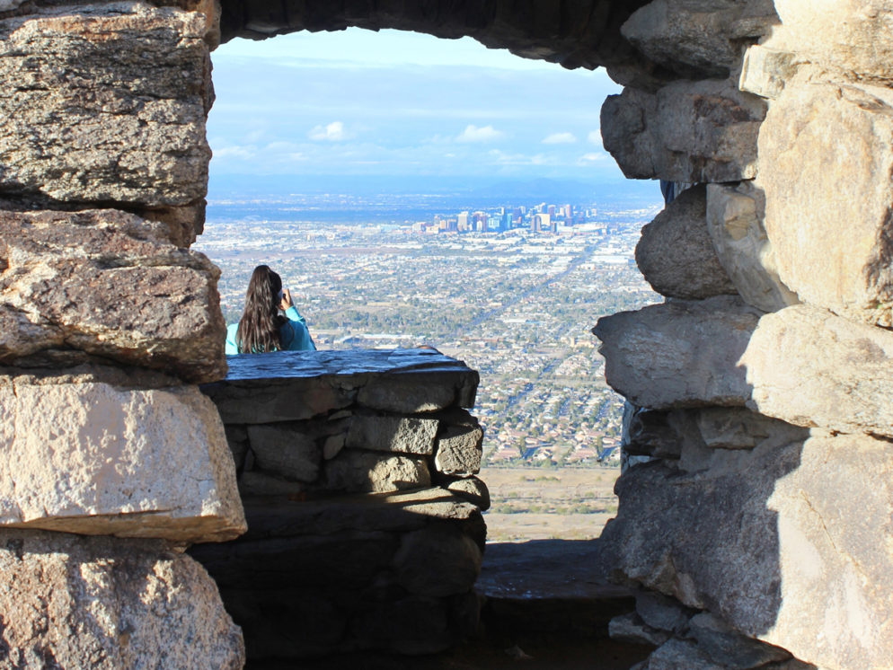
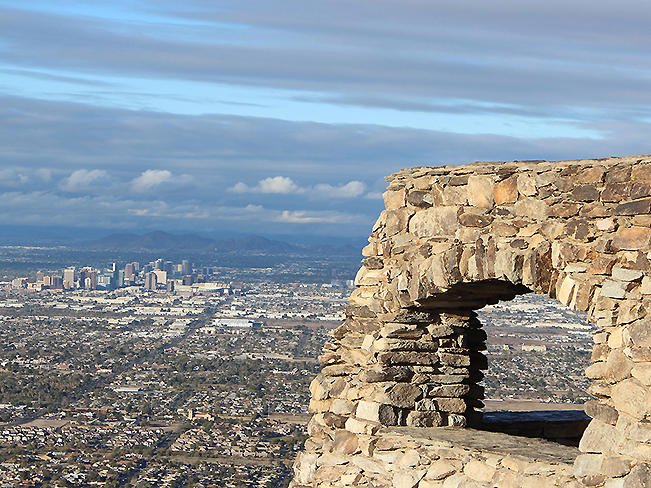
Hands down, the best views of the Phoenix skyline are from the top of the Holbert Hiking trail. Ascending South Mountain’s beautiful rocky slopes, this hike leads to Dobbins lookout. Here arched windows frame “Wizard of Oz” like views.
TRAILHEAD: 10919 S. Central Ave., PhoenIX • DIFFICULTY: MODERATE • DISTANCE: 2.5 MILEs (5 miles RT) • APPROX. TIME: 2.5 – 3.5 HOURS • ELEVATION GAIN: 1,100 FEET (79 STORIES) • APPROX. CALORIES BURNED: 750-850 • BEST TIME OF YEAR: NOV. – MARCH • PETS: YES • KID FRIENDLY: 10 and older • FACILITIES: YES • FEES: NONE
 Even though the Holbert Hiking Trail practically sits on Phoenix’s southern rim, this hike up South Mountain can be surprising in its natural beauty and lack of crowds.
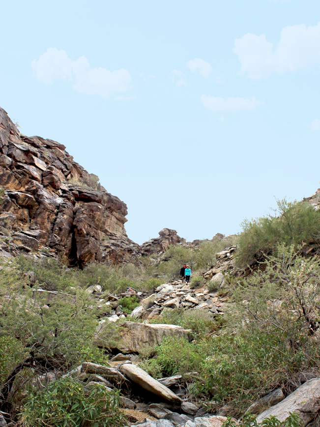
 Facing into the mountain, it’s easy to forget the urban panorama at your back. The Holbert Hiking Trails starts with a gentle 1-mile ramble. It passes a horse hitching area and (not-so-pretty) water tower tucked between hills. From here, the trail begins its ascent, winding up the mountainside.
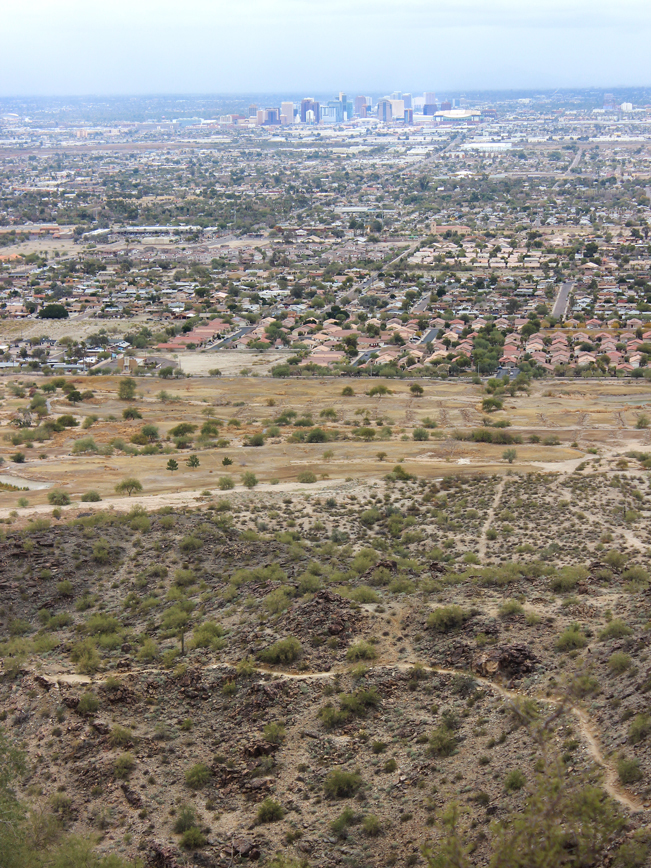
 About halfway up the mountain, a gap between boulders opens onto stunning views of the city. This is an awesome spot to stop for a quick breather!
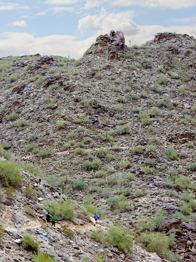
 The next mile ascends along slopes & valleys and between the rocky cliffs of South Mountain. Nearing the mountaintop, a clearly marked access trail leads to Dobbins Lookout.
 From Dobbins Lookout, glimmering views of the Phoenix skyline are truly the best to be had! On weekends, expect big crowds, as the lookout is a favorite driving destination too.
Note: The Holbert Hiking Trail continues another 0.7-miles past the Dobbins Lookout access trail. This distance is not included in figures above. Holbert ends at a T-intersection with the National Trail.
Total Nerdery
Dobbins Lookout was built in 1933 by Roosevelt’s Civilian Conservation Core, which provided work for the Great Depression’s unemployed. The lookout was named after J.C.Dobbins, Chairman of the Phoenix City Planning Commission.
Resources
Click here to download a trail map.
Directions Take Interstate Truck Route I-10 (in South Phoenix) to 16th Street / exit 195A. Turn south on 16th Street and drive 4.4 miles to Dobbins Road. Head right / west onto Dobbins Road and drive 1.4 miles to Central Ave. Turn left / south on Central Ave. and continue for 1.5 miles into the park. Take the first left, after the main gate, to the education center parking lot. The trailhead is across the street.
Leave a Reply