


★★★★☆ Moderate / Wickenburg
Get spoiled with amazingly unspoiled views from Vulture Peak’s high saddle! Located less than an hour northwest of Phoenix, near Wickenburg, Vulture Peak Hiking Trail ascends to a narrow break in the jagged cliffs. Here, endless views of immaculate desert stretch to the horizon.
TRAILHEAD: Vulture Mine Road, Wickenburg • DIFFICULTY: MODERATE • DISTANCE: 2 MILEs (4 miles RT) • APPROX. TIME: 2 – 3 HOURS • ELEVATION GAIN: 940 FEET (67 STORIES) • APPROX. CALORIES BURNED: 600-685 • BEST TIME OF YEAR: OCT. – MARCH • PETS: YES • KID FRIENDLY: no • FACILITIES: YES BUT NO WATER • FEES: NONE
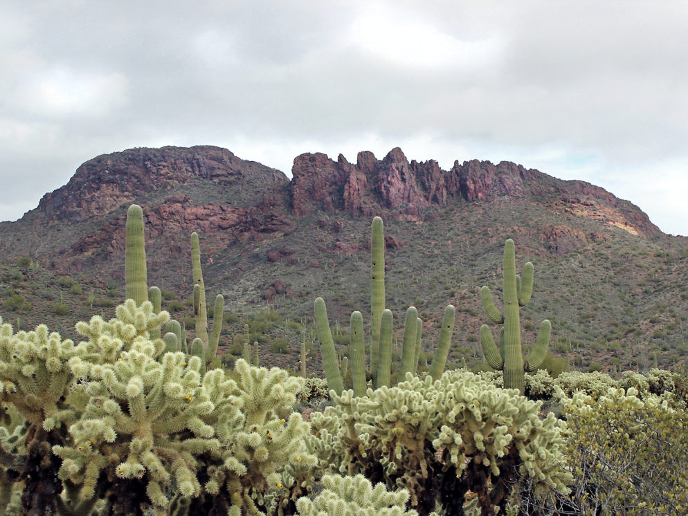
 From the trailhead, it’s easy to ID Vulture Peak’s craggy summit, jutting above the desert floor. The hike kicks off with a gentle, mile-long ramble through pristine desert. It crosses wide arroyos and a primitive 4-wheel drive road, that leads to a second trailhead midway up the mountain.
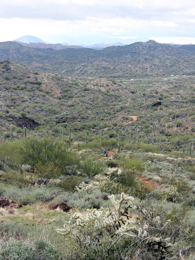
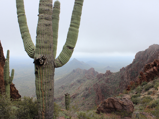
 As the trail ascends towards the saddle, jagged cliffs dominate the horizon.
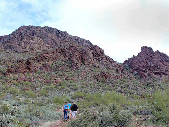
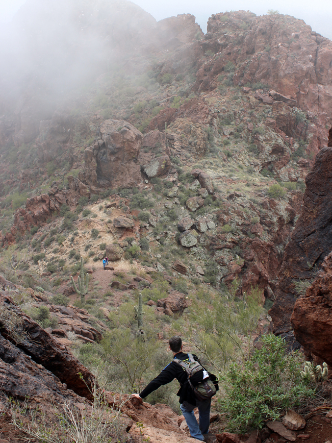
 Switchbacking up the peak, huge boulders provide excellent spots to stop and take in the ever-lengthening views.
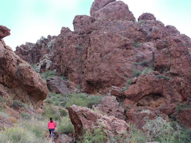 The last quarter mile of Vulture Peak hiking Trail gets progressively steeper. Here it winds between humongous boulders and the bases of rugged cliffs.
 Once at the saddle, epic views of pristine desert stretch out east and west.
 For those who love scrambles, a steep rocky chute climbs 240′ up to the top of the cliffs.
Total Nerdery
Henry Wickenburg discovered gold in the Vulture Mountains in 1863. Both the Vulture mine and ghost town are a couple of miles past the trailhead on Vulture Mine Road.
Resources
Click here to download a trail map.
Directions: From the intersection of I-17 and AZ-74 / Carefree Highway (north of Phoenix) turn west onto AZ-74 and drive for 30 miles to the T-intersection with AZ-60. Turn right / north onto AZ-60 and continue for 10.75 miles to Vulture Mine Road. Turn left / south onto Vulture Mine Road and drive 7 miles to the trailhead for Vulture Peak Hiking Trail and Syndicate Wash. It’s between mile markers 19 and 20, on the left side of the road.
If you’ve got a 4-wheel drive vehicle, a primative dirt road leads to a second trailhead, midway up the mountain.
Leave a Reply