


★★★★★ Moderate / Superstition Mountains
Weavers Needle plays hide and seek on this long, languid, stunningly beautiful loop trail. Three Superstition Mountain hiking trails (Dutchman’s, Black Mesa and Second Water) join together to form an unexpectedly lovely hike. Pretty creek crossings and ethereal area views dot the path. And there is nary a crowd to be found.
TRAILHEAD: First Water Trailhead, Apache Junction • DIFFICULTY: moderate • DISTANCE: 10.41 Mile Loop • APPROX. TIME: 6-7 HOURs • Starting Elevation: 2,280 • ELEVATION GAIN: 1,195′ (85 Stories) • APPROX. CALORIES BURNED: 1,562-1,770 • BEST TIME OF YEAR: September-April • PETS: yes • KID FRIENDLY: no • FACILITIES: None • FEES: None
Part I: Dutchman’s Trail
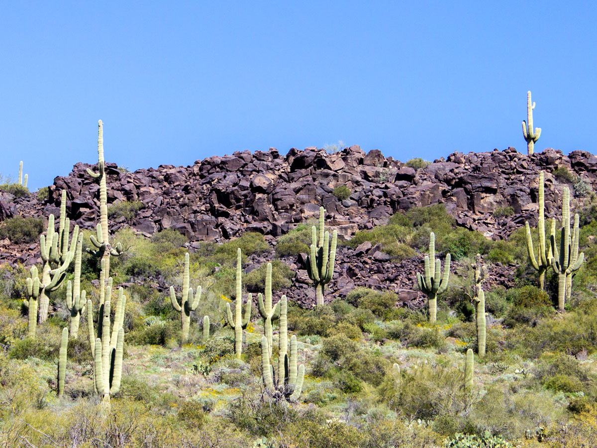
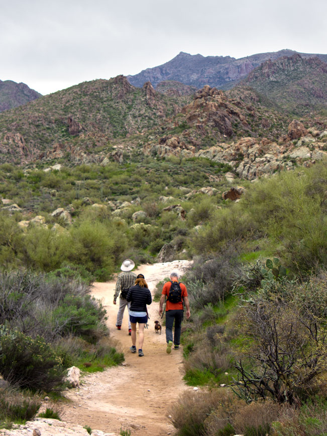 (MILES 0-5) Dutchman’s Hiking Trail heads out from the First Water Trailhead. It starts with a slight downhill on a well defined, sandy path. Pretty, southwestern views of the Superstition Mountain’s ridge line and Flatiron Mesa extend upwards in the distance. The Second Water Hiking Trail veers left at an intersection, 0.3 miles into the hike. Although the Black Mesa Hiking Trail Loop can be hiked in either direction from this juncture, this description continues counter clockwise on Dutchman’s Trail.
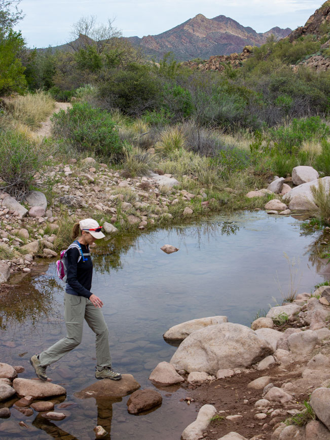 The Dutchman’s Trail follows the banks of shallow First Water Creek. It crisscrosses it multiple times, on ample boulders. The first crossing intersepts the trail 1.5 miles into the hike. With a second crossing shortly thereafter. The height of the water rises and falls, depending on the weather.
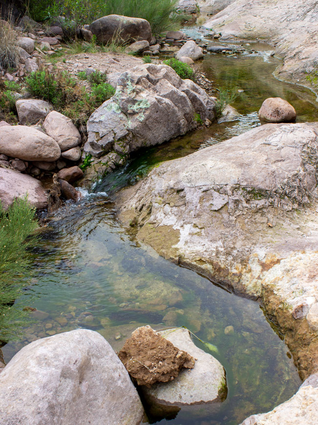 A beautiful creekside area, lined with jagged cliffs, sits alongside the trail about 1.65 miles in. The creek curves gracefully through granite slab, carved by years of rain and current. This is a lovely place to stop for a breather.
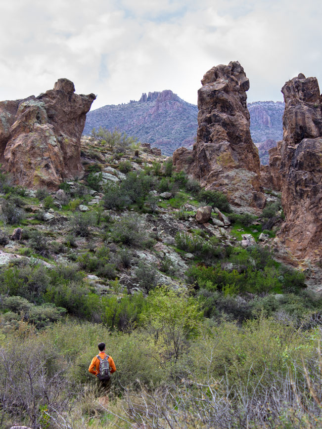 After two miles, Dutchman’s Hiking Trail curves left, moving away from the creek and beginning a moderate climb. High hoodoos poke upwards, framing stunning southward views of the Superstition Mountain’s jagged peaks.
 Beautiful backwards views over the Goldfield Mountains fill the horizon as the trail gains elevation.
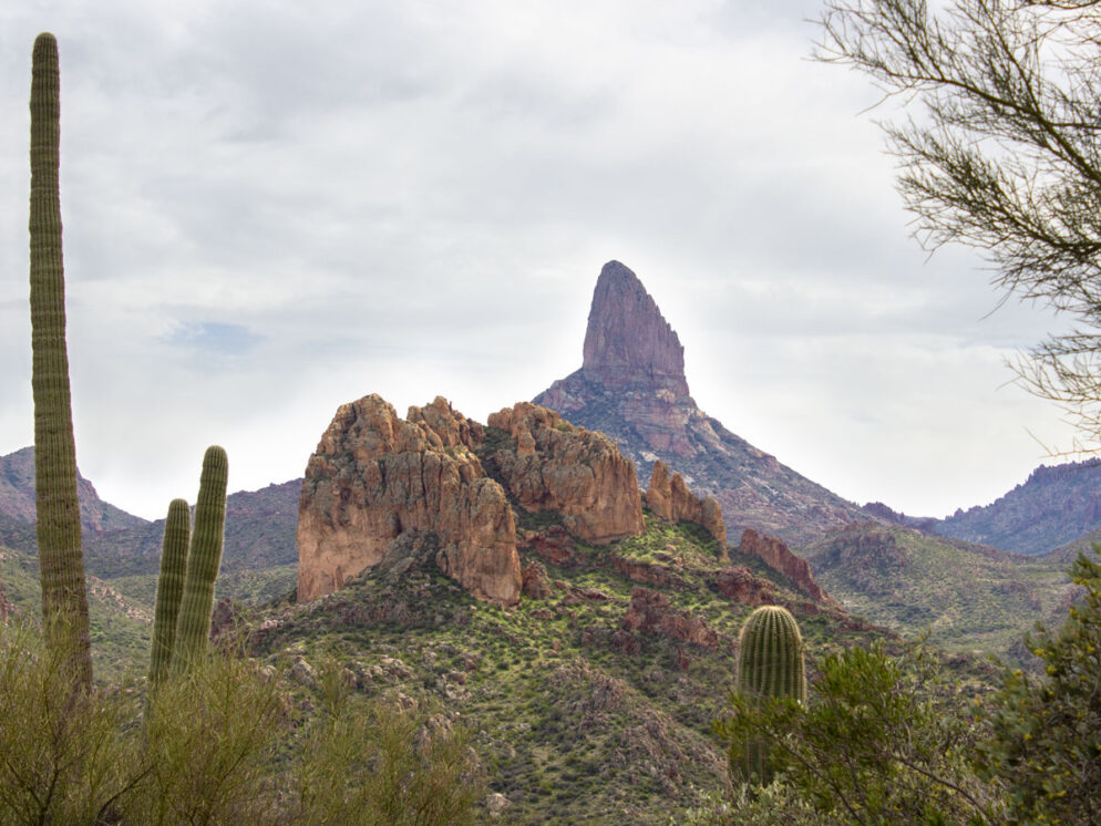
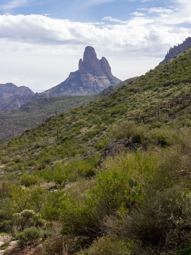 Soaring Weaver’s Needle makes an appearance, peaking out behind the hills, at the top of a rise about 3.25 miles into the hike. From here on out, this monolith plays hide and seek behind the hills.
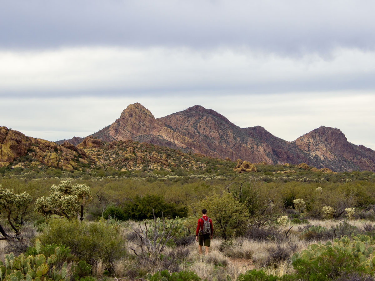
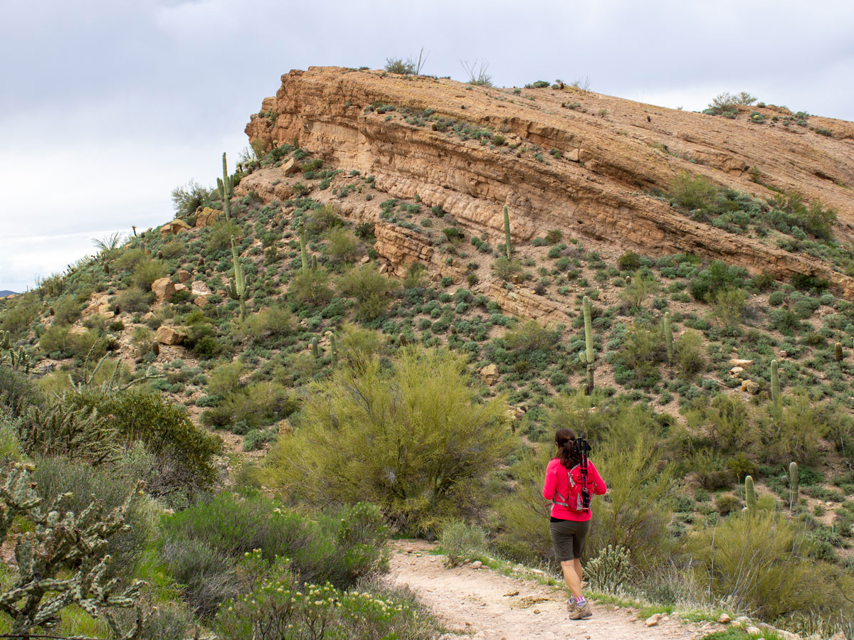
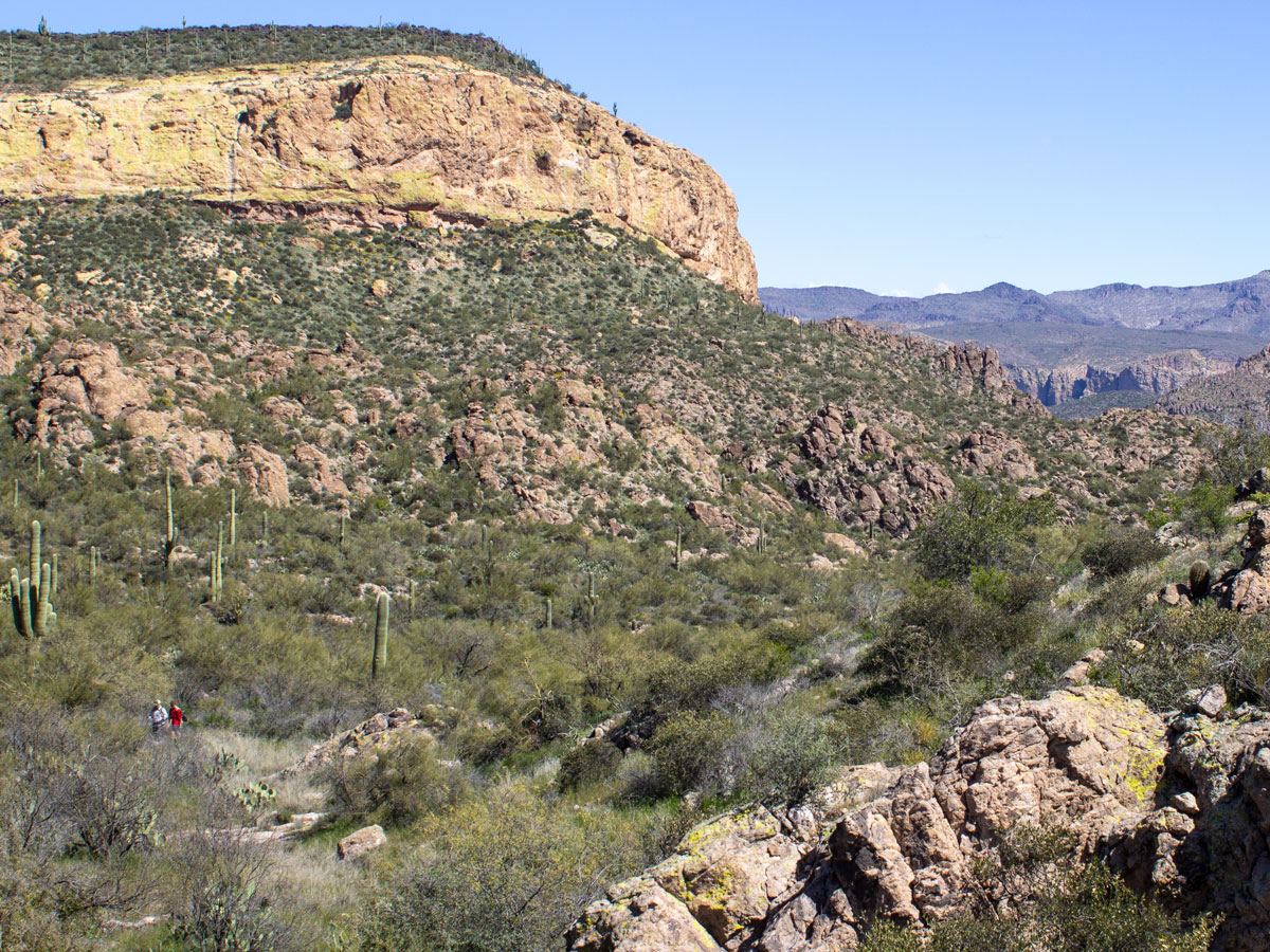 The Dutchman’s Hiking Trail now makes a mild descent, curving left towards O’Grady Canyon. Rugged, yellow cliffs define the landscape as the trail continues downwards for the next 1.75 miles.
 As the trail cuts west through O’Grady Canyon, a second creek intersects the trail at intervals. This creek is often dry in the warmer months. And the area is flanked by dramatic yellow cliffs and wacky rock formations on all sides.
Part II: Black Mesa Trail
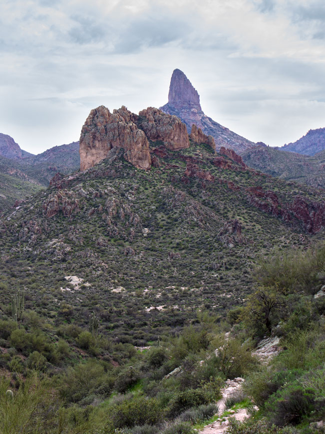 (MILES 5-8) The Black Mesa Hiking Trail veers left at a sign, about 5 miles into the hike. This trail heads north, first crossing a marshy area (flowing in spring or after heavy rains). Then makes a steep, half-mile climb, on a loose rock trail, towards the top of the mesa. This is the most difficult part of the entire loop. The path flattens a little, then ascends a few switchbacks to reach the plateau. Backwards views of Weavers Needle are truly breathtaking.
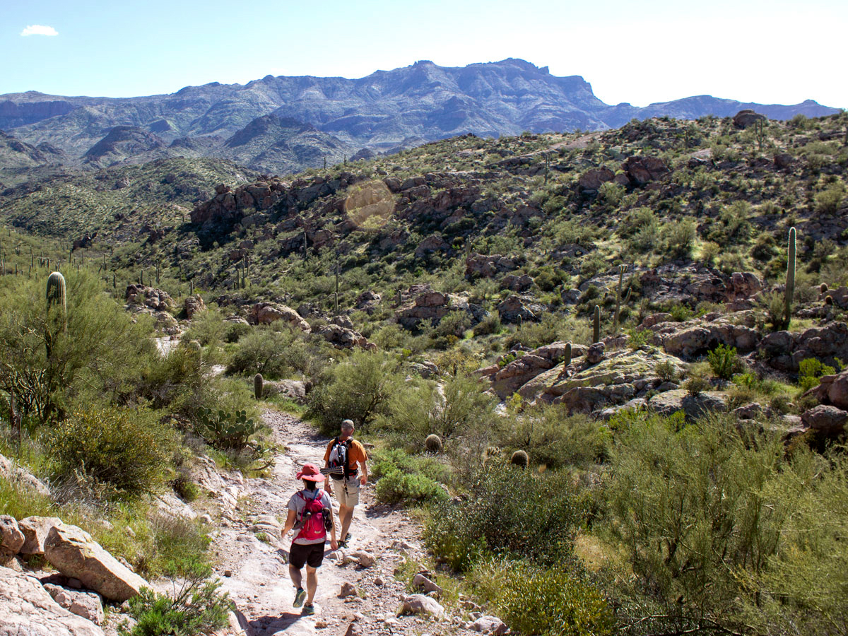
 The next 1.5-miles mostly level as the trail crosses the top of Black Mesa. To the left, beautiful views of the Superstition Mountains frame the horizon. While to the right, a long basalt ridge, guarded by tall Saguaros keeps company.
 At the 7-mile mark, the Black Mesa Trail begins a short, moderate descent back to desert floor. Flatiron Mesa is clearly visible to the left. Here, a wide open expanse leads to stunning northwards views of the Goldfield Mountains. The Black Mesa Hiking Trail ends at T-Intersection with Second Water Trail, at the 8-mile mark. Turn left to complete the loop back to First Water Trailhead.
Part III: Second Water Trail
 (MILES 8-10.41) Turning left, the Second Water Trail continues through the wide, grassy expanse. Then it makes a moderately steep, half-mile descent on a water worn granite pathway. In spring, or after heavy rains, a wash to the right of the trail flows with water. The grade lessens as trail passes through a shallow canyon, hopscotching the sometimes water-filled arroyo.
 The Second Water Trail now makes a moderate ascent up, and then across a long hillside. The valley below is particularly dramatic. A low wash is shaded by twisted yellow cliffs, and tall stone outcroppings. As the path rises above the valley, it levels out again, crossing a wide meadow and stone-filled arroyos. The Second Water Trail ends at Dutchman’s Hiking Trail, at the 9.6 mile mark. Turn right here and continue another 0.3 miles back to trailhead (then 0.5 miles more to overflow parking area if needed).
Total Nerdery Weavers Needle is a 71-story-high, volcanic core – the remains of as eroded mountain. It can be seen from as far away as Cave Creek.
Resources Click here to download a trail map. The Black Mesa Loop is located in the middle left and is made up of trails #104 Dutchman’s, #247 Black Mesa and #236 Second Water.
Directions From the intersection of I-17 and AZ-10 (in Phoenix), take AZ-10 east for 11.9 miles to exit 154/US-60 E. Merge onto US-60 E (towards Mesa/Globe) and continue 24.6 miles to exit 196/AZ-88, Idaho Road. Turn left/east onto AZ-88/Idaho Road and drive 2.2 miles. Merge right onto North Apache Trail. Then continue 5.25 miles to First Water Road / SR78 on the right. Turn onto First Water Road and continue 2.6 miles to the First Water / Dutchman’s Trailhead. NOTE: High Clearance Vehicles are recommended on First Water Road. It is a bumpy dirt road prone to erosion.
4 Responses to Black Mesa Hiking Trail Loop
I hiked this recently. An absolutely beautiful hike with a variety of scenery. Not a difficult hike but seems longer than it actually is. The steep ascent at 5 miles is minimal and short, not difficult at all. Just take a hat, sun screen, and plenty of water. Expect to stop a lot and look around because it really is pretty.
Thanks for the review Arthur! Agree on every point.
You don’t mention the waterfalls
I am not aware of any waterfalls on this particular trail. Please let us know if they do exist.